Not much to report as I am just incrementing my way down the coast en route to my final destination in Mozambique, Maputo National Park, but that will be the focus of my next post after my visit. For now, just to keep my journal continuous, I will give you a quick report on my last two nights. From Inhassaro, just north of Vilanculos shown on the map below, I headed several hours south to Coconut Bay just south of Inhambane shown on the map below, and then on to the seaside village of Macaneta just north of Maputo shown on the map below
Coconut Bay was another huge compound of campsites and cottages set back behind the frontal dunes, so no ocean view from the campsite, but rather a short hike through the dunes to the beach. Fortunately, I was the only guest, so I had the place to myself except the staff. I was originally going to stay a second night, but a huge wedding party was coming in the following day so I bailed. The campsite was rather atypical. As you can see here, you park your camper vehical under a big shed. I suppose most people come to the beach during their summer hot, wet season, and the sheds are probably a way of providing campers shelter from the rain. I suppose that would be nice under rainy conditions, but for me it felt less like camping. Anyways, not my favorite of camping sites, which was another reason to bail after one night:
My campsite at Coconut Bay
The best thing about this place was the Bay itself. As I was the only guest, except for a few local fishmen, I had this amazing beach to myself. Talk about deserted sub-tropical beaches! I even got in a short snorkle behind the natural rock jetty shown in this photo, despite the winds and white-caps everywhere else. It wasn’t the greatest of snorkling locations – some reef fish and a few corals – but it was nice to get in the water regardless:
My snorkle site at Coconut Bay
Also of note for the birders, I had a spotted eagle owl hooting in the tree next to my campsite during the early evening. I managed a poor photo, but I am putting in here for Phil (and you other birders) as proof:
Spotted eagle owl
And sunrise over the Indian Ocean is always a delight:
Sunrise at Coconut Bay
After leaving Coconut Bay, I kept heading south down the coast and randomly ended up in the small oceanside village of Macaneta just north of Maputo, and landed at Pisane Lodge, one of the several oceanside lodges/campgrounds. Nothing special or to my liking at this place – fancy lodge and campround with resstaurant, bar, pool and all the amenities – except that it had a big screen TV and I was in time to watch the US womens soccer defeat Brazil for the gold medal! Funny thing was that Nancy was watching the game with Phil and Mary and we were Whatsapping messages back forth about the game in real time as it was being played – isn’t technology amazing. Here’s my unexciting campsite:
My campsite at Pisane Lodge
Here’s a short 2-minute video of my campsite at Coconut Bay and of the Bay itself; there was nothing worth videoing at Pisane Lodge:
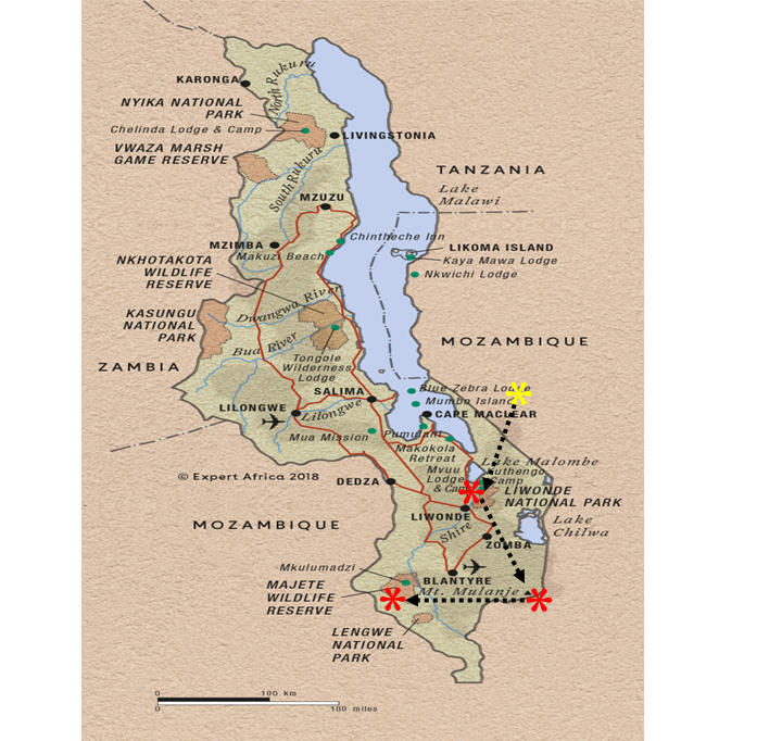
After leaving Gorongosa National Park, I headed south to the coast, stopping en route for a night at Rio de Gorongosa private game reserve and then on to the coast at Inhasarro and then south along the coast to Vilanculos. Note, the map below doesn’t show my actual route, as I had that big detour to Tete after leaving Malawi and then two additional one-night stopovers before getting to Vilanculos, which is shown as the destination in this map, but it suffices to show the basic travel plan within Mozambique.
My first night was spent at a random spot en route to the coast. I had originally planned to drive all the way to the coast but after battling mine-fields on the main north-south national highway(!) for several hours, I decided enough was enough. I know I keep complaining about the roads, but you can’t image just how bad they really are and it’s all I can think about when on these terrible roads. It’s so bad that you simply can’t take your eye off the surface to enjoy the surrounding scenery – not that there was much in this part of the country. In this case, I was driving on a major national highway (N1) that had probably 100 km of potholes distributed intermittantly over 250 km of highway, with holes several inches to two feet deep, and so many of them that it was impossible to drive around them. I had no choice but to come to an almost complete stop and gently drop in and out of them. It was truly driving hell on Earth. SO, what should have taken a couple hours on a decent road surface took 3 times that.
As I was cursing the government for allowing such a disgrace in their national infrastructure, I came upon signs for a lodge/campground that looked promising. So, I abandoned the highway for some much needed R&R. It turns out that this lodge/camp called Rio Gorongosa is a private ranch of 15,000 hectares (soon to double in size) owned by a rich South African who purchased the land from the government (actually, a 99 year lease) back in 2012 to create a game ranch for himself. After purchasing the lease, he then purchased and transported from South Africa 100 African buffalo and some number of greater kudo and sable antelope (can you imagine the cost of that?), and then had the ranch fenced and allowed the populations to grow. He flies to and from the ranch in one of his two helicopters. He will start killing big trophy animals this year and will invite wealthy big game hunters from anywhere to pay him to come and shoot one of these majestic animals. This is classic South African. South Africa is filled with huge private white-owned game farms/ranches all for the purpose of growing big animals for the trophy hunt. Apparently, some of these types have looked to poorer neighboring countries to purchase land for their sport. I can’t abide this practice!
Anyways, I had a nice afternoon sitting by the gentle Gorongosa River and then camped for the night. I had the entire ranch to myself, with only the ranch manager/shef and another staff helper around. It only cost $6 USD. Not a bad stopover all things considered:
My afternoon siesta spot on the Gorongosa RiverMy campsite at Rio Gorongosa
Next morning I headed on to the coast and found on iOverlander a somewhat remote, off-the-beaten-path, beachside lodge/campground called Vista de Bazaruto just south of the village of Inhassoro. This involved several kilometers of driving on sand track behind the frontal dunes (picture below), but I later learned that I could have driven the harder sand on the beach for a much easier and quicker drive.
Sand track through dunes to my campsite at Vista de Bazaruto
Again, as with most of these off-the-beaten path places, I was the only guest. This was a delightful place with beautifully kept grounds and facilities, despite having major damage to the grounds and buildings from the major cyclone that hit here in March. I had a gorgeous beachside setting for the Green Dragon with full outdoor kitchen and toilet facilities, and a nice covered pergola to boot. Here’s what my Green Dragon site looked like:
The I following night I moved 4 hours south down the coast to another delightful beachside campground in the small village of Morrungulo and the lodge of the same name. This lodge and campground was quite different from the previous few. The lodge reception, restaurant, bar, pool, and, yes, minature golf course (although it looked not much used, if ever) sit high up on a hill overlooking the bay and the beachside cottages and campground. The compound is huge, with something on the order of 17 large beachside cottages and numerous smaller bandas and something like 45 campsites, both beachside and behind. Apparently they can get up to 450 guests when every cottage and campsite is full which happens during their summer – 95% are South Africans on holiday. Fortunately, I chose a quite time of year to visit, as there are only a handful of other guests in the entire compound. This place would be a zoo when there are 450 guests running around. I, of course, chose a beachside campsite under dense shade trees, grassy understory and very nice ablutions – including hot showers! This was truly a wonderful campsite setting – Nancy, you would have loved this site! This was also another classic white sand, palm-lined, Mozambiqe beach with almost no one on it. Incredible. Oh ya, and it cost only $5 USD! Even though I had a leftover dinner that needed to be eaten, I splurged and got fish and chips for dinner at the restaurant – I just couldn’t resist! And did I say that after my beach run, dip in the ocean, and hot shower, I sat in my campsite in the shade next to the beach and watched humpback whales courting in the waters just off shore – mainly raising the pectoral fin straight up in the air and then turning and slapping it against the water? I understand that this is a male courtship display, and I could see a big whale doing this over and over near a smaller whale, which was probably a female being courted. These whales come 5,000 km from their feeding grounds in the antarctic to mate (for next year’s births), give birth, and nurse their newborns before making the return trip south.
Here’s a not-too-exciting composite video of my last two campsites, along with a bit of flute playing to make it more interesting. Regarding the latter, I was playing my flute while sitting under the pergola at sunset at the Vista de Bazaruto site and the owners came out and wanted to hear me play and learn something about the native American flute, and he videoed a bit of it to share with his kids. Anyways, he shared with me and I am shamefully passing it on to you in the composite video:
Ok, I’m off further down the coast to another beachsite lodge and campground, and with a little luck a day of snorkling on an off-shore reef. See you there!
After my one-night stand at Mwabvi “Wildlife Reserve” (note, wildlife reserve is in quotes because there wasn’t much of a reserve or wildlife), I headed south to the southern tip of Malawi and across the border into Mozambique. Here’s a map showing my intended route out of Malawi, with an en route stopover somewhere on the way to Gorongosa National Park. But TIA had other plans!
The crossing was very quick and simple as, once again, I was the only one crossing this remote, little used border post. But why so little used, I wondered? The map showed this to be a direct route south across the Zambezi River and on to Gorongosa National Park, my next destination. One of the border post staff that spoke some broken English indicated that I might not be able to drive through, but there seemed to be some conflicting information and advise amongst the border staff, and both my Garmin Navigator and Google Maps showed the direct route and directed me to go that way. After two hours drive on dirt track past small villages I ended up at the Zambezi River, only to find out that indeed there was no longer any bridge for vehicles, just a railway crossing, and the car ferry had broken some time ago and was rusting on the river bank. OK, what to do? There was a route east across the Shire River and then turning south back down to the highway heading on to Gorongosa – Great! No such luck, because This Is Africa (TIA) afterall. The bridge over the Shire was washed away some time ago and that boat ferry was also out of business, with no immediate plans to fix it and resume business. Options? Turn back to Malawi and drive all the way back to Mulanje (the site of my backpack trip) and across the eastern border post, and then make my way south again. Not a terrible option, except I would have to retrace my steps for probably 6 hours or so and cross two borders, one back into Malawi and another back out of Malawi, with each crossing taking some time and costing some money. Not something I could look forward to.
My final option was to drive 300 km on a dirt/gravel track – a major secondary road – west along the Zambezi all the way to the relatively big city of Tete, cross the big river there, and then head back east 250 km to Gorongosa, but on on tarmack after Tete. Just as I was leaving the Zambezi to start the grueling drive to Tete, a young man hailed me and with body language – since he spoke no English, indeed almost no one in the rural parts of Mozambique speak any English – convinced me that his friend had a boat that could ferry me and the Green Dragon across the Zambezi. I loaded him into the Green Dragon and we headed back to the River. It turned out that his “friend” did indeed have a boat, but it was a 20 foot wooden monohull (very much Dhow like) that he wanted to strap planks across the gunnels and have me drive on in a perpendicular orientation to the keel. My front and rear wheels would probably have been either sitting on the gunnels or may have extended beyond the gunnels. Can you picture this? He could, and tried to show me a picture of having done it, but neither he or his 10 buddies hovering around us could show me a picture. Needlesstosay, I opted out of that option and took the long and tortuous two-day drive out to Tete on rough native surface, across the river, and back on intermittantly pothole-ridden tarmack . Big-rig trucks trying to avoid bad potholes or passing other trucks on blind curves almost ran me off the road 3 times. Two days of TIA madness! Aren’t you glad you are enjoying this from a comfortable couch?
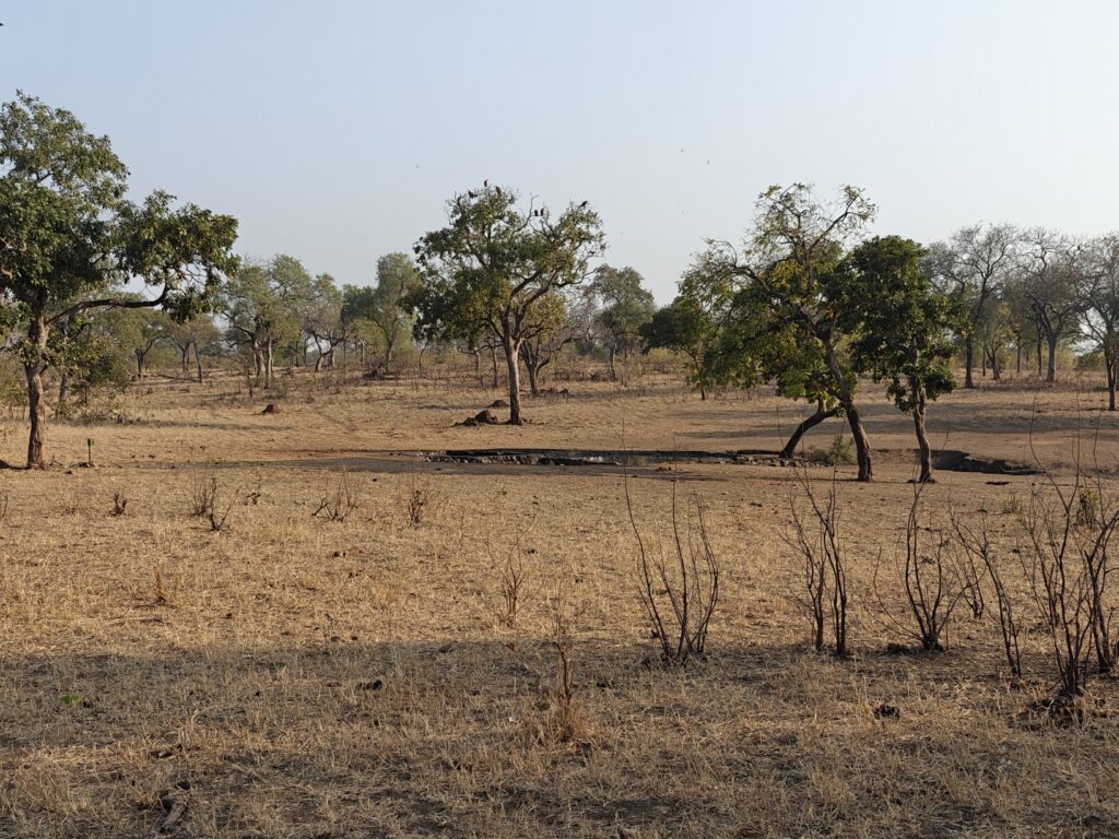
Gorongosa National Park, established as a game reserve in 1920 and later in 1960 declared a national park and covering 1,500 square miles, is located at the southern end of the Great African Rift Valley. The park comprises the valley floor and parts of surrounding plateaus and rivers originating on nearby Mount Gorongosa (6,112 ft) that drain into Lake Urema – a large lake in the middle of the Park, and includes a mixture of woodlands, savannahs and extensive floodplain grasslands. The Park doesn’t have the appearance and the feel of the rift valley settings in Kenya and Tanzania, as there are no dramatic escarpments to be seen, at least from the part of the Park I visited. Here are a few shots of the landscape as seen on my walking and driving safaris. Note, Gorongosa NP doesn’t allow self-drive safaris yet for a variety of reasons, mostly due to the aggressive elephants that haven’t habituated to humans yet after many years of persecution during the civil war (but this is changing with each new generation of elephants), so I had to go on guided safaris with other visitors (one birding walk, one morning drive and two afternoon drives).
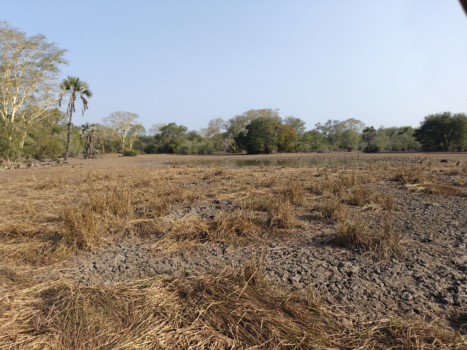
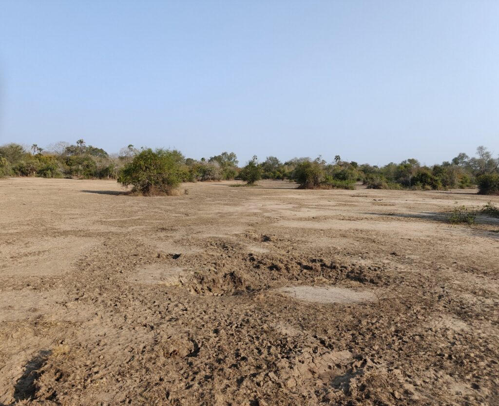
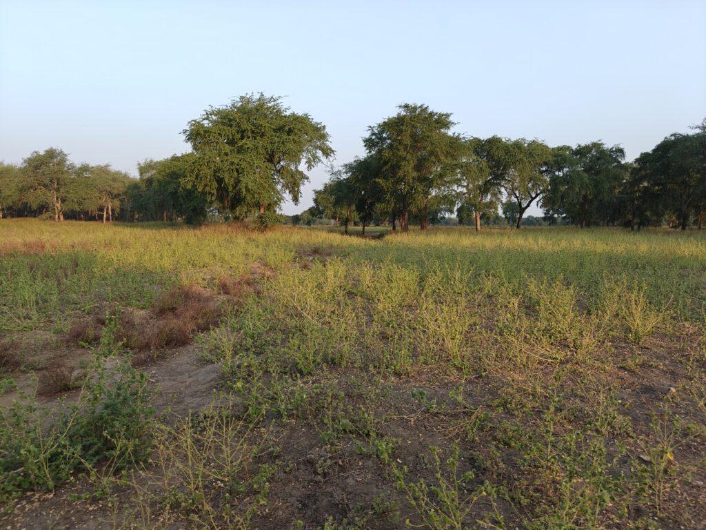
Seasonal pan (water hole)Seasonal pan (now dry)Floodplain palm forestFloodplain savannahFloodplain grasslands (and waterbuck)
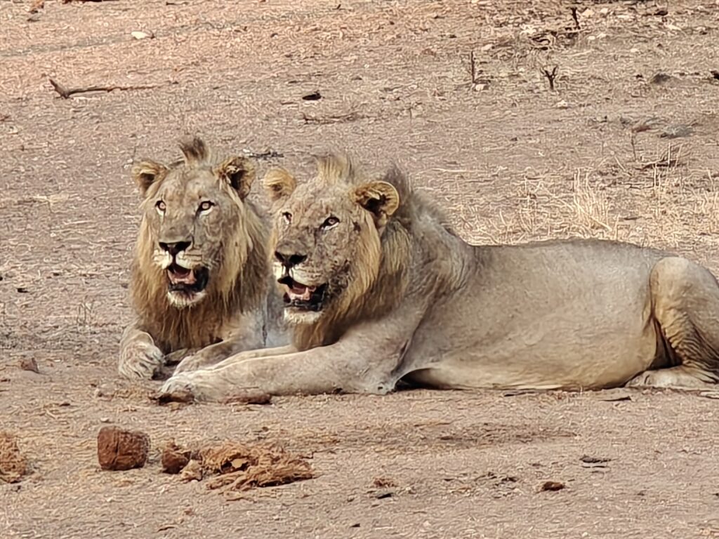
Gorongosa National Park is yet another story of a southeast African Park that lost an estimated 95% of its large wildlife due to rampant poaching and the bloody civil war (1977-1992). After the civil war, the authorities recognized the opportunity for ecotourism based on wildlife conservation and started concerted efforts to restore the wildlife and ecology of the Park, very similar to what we saw in Malawi at Liwonde and Majete. Progress was slow at first, This Is Africa after all, but in 2008, the Government of Mozambique and the US-based Carr Foundation formed the “Gorongosa Project”, a 20-year Public-Private Partnership for the joint management of the Park and for human development in the communities near the Park, and they began a rehabilitation and reintroduction program to bring back many of the large mammal species that were lost. Of particular note has been the successful reintroduction of wild dogs (or African wolves as they are called here) in 2018 (now a population of 200 or so and enough that they are now supplying dogs for reintroductions to other Parks and Reserves), and in just the past few years they successfully reintroduced leopards (although still only a half dozen or so animals and rarely seen). The cheetah reintroduction has thus far failed. Of the 4 animals released, one died trying to kill a waterbuck, 2 others were poached for their skins and the lone surviving individual just disappeared. Hopefully they will try again becuase the habitat is certainly there for these cats. Time will tell, but along with the recovering lion population, it looks promising for the large cats and other predators since the populations of antelope species have rebounded providing the essential food source for these top predators.
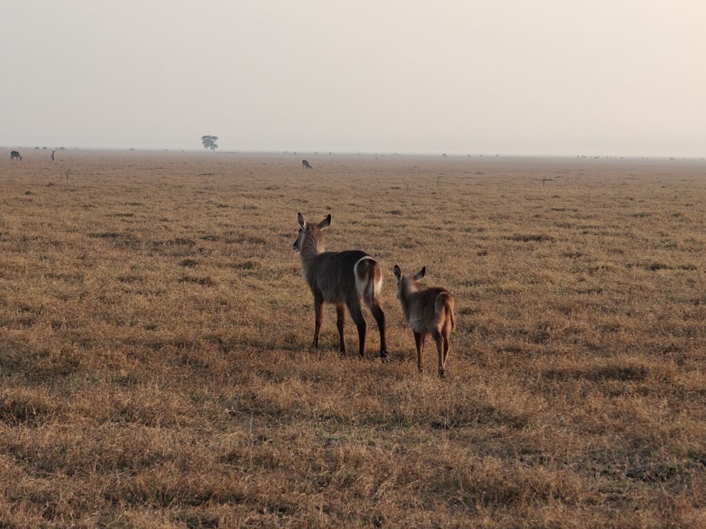
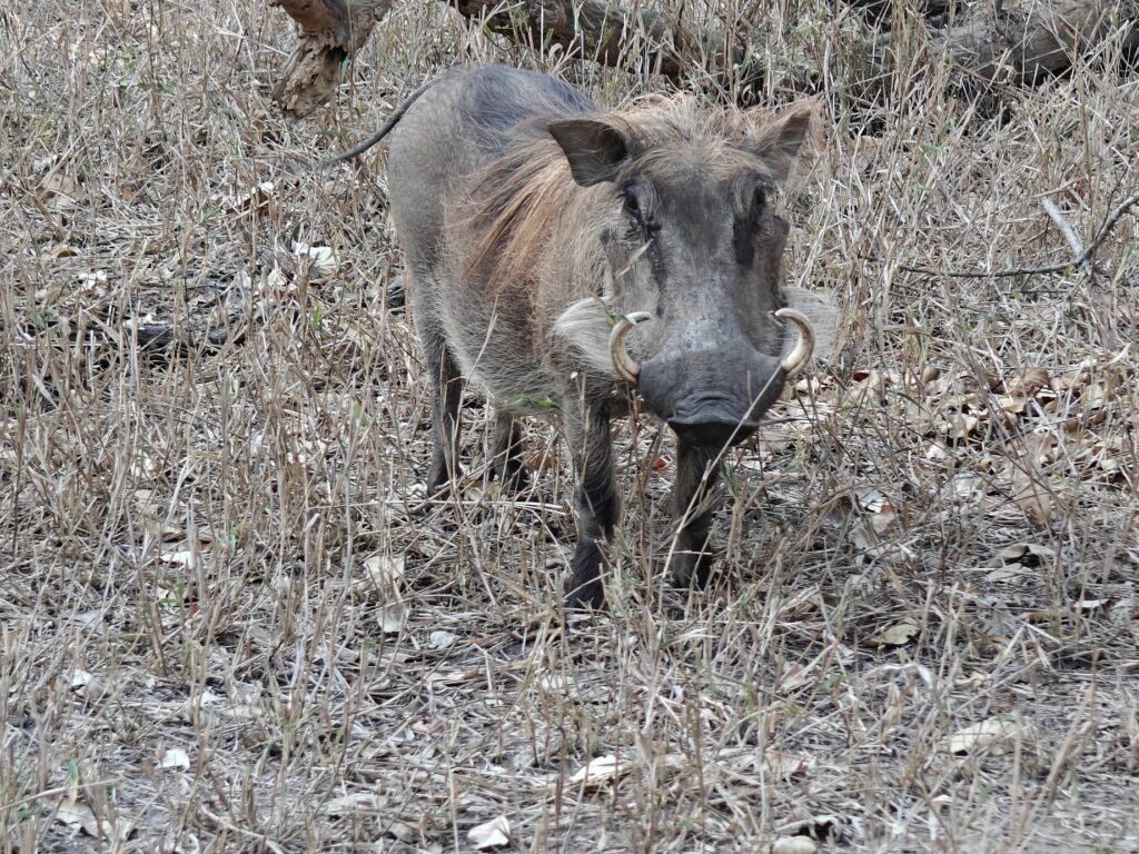
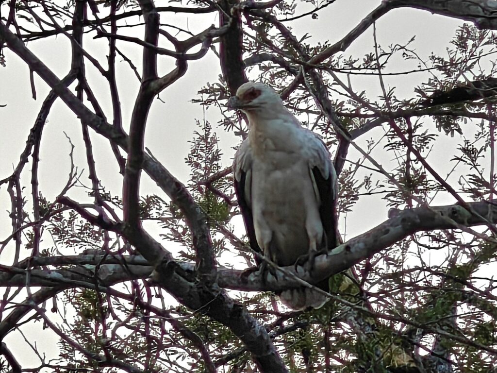
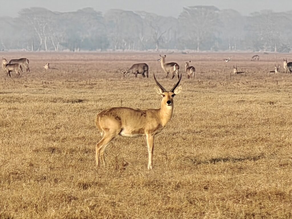
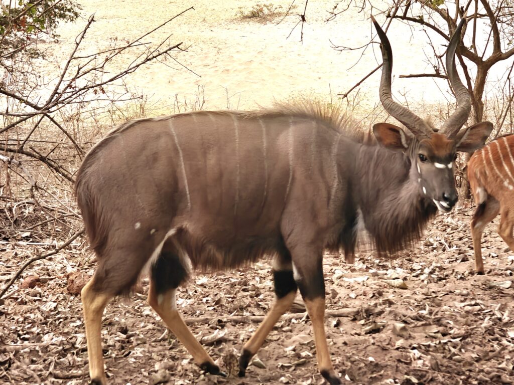
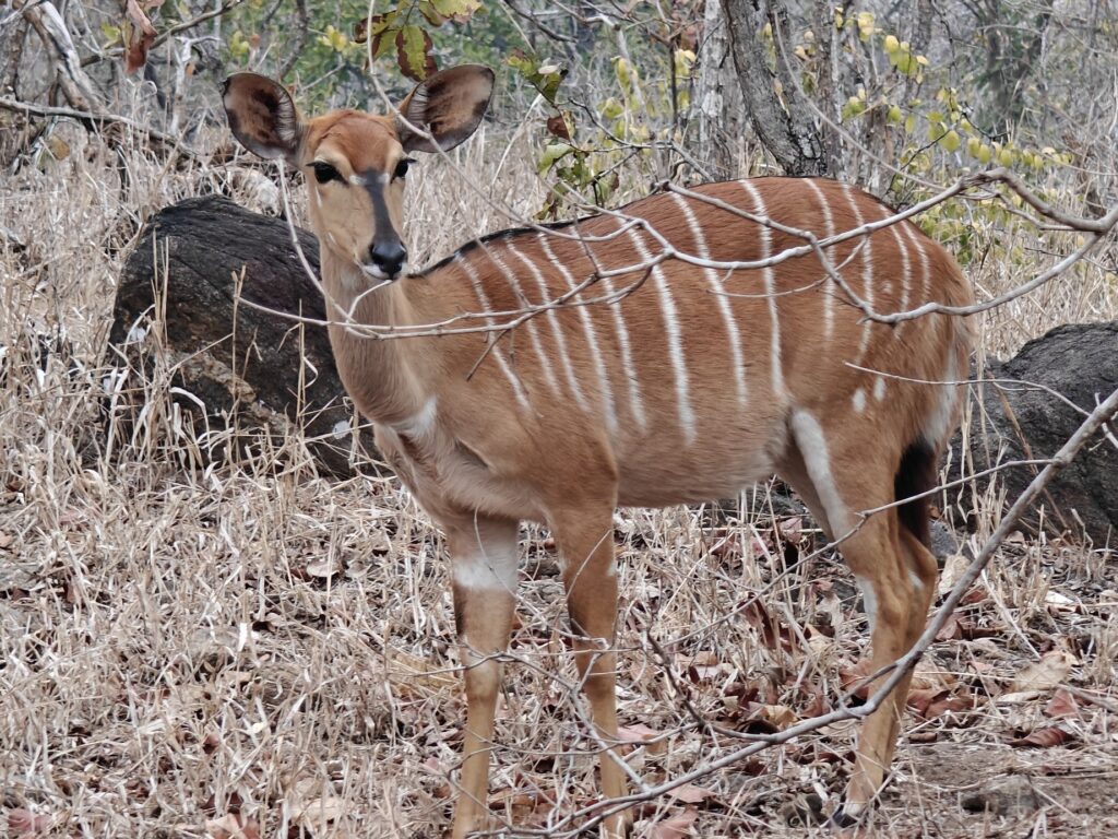
Here are a few shots of some of the wildlife I observed, but I wasn’t able to capture the massive (i.e., many thousands) numbers of waterbuck I observed in the woodland savannahs and floodplain grasslands.
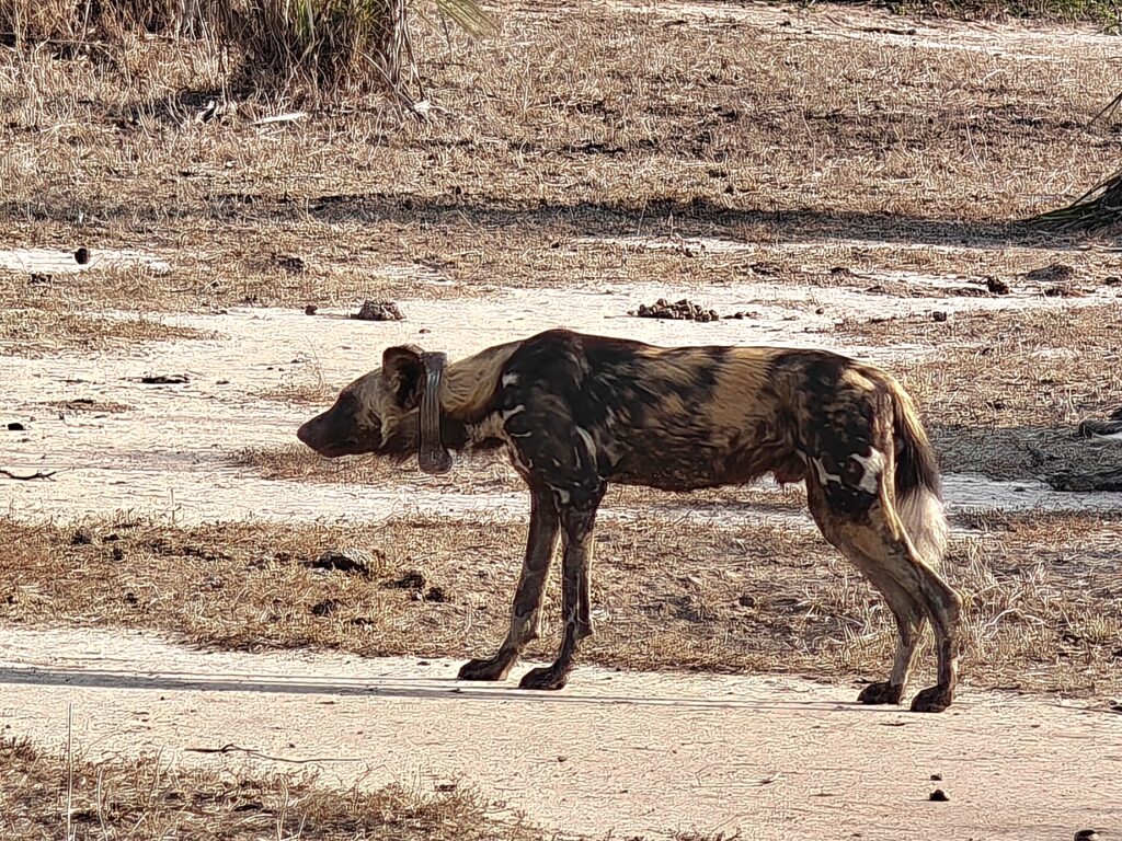
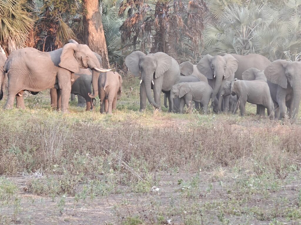
The ubiquitous warthogPalm-nut vulture (for Phil)Common reedbuck (male)Oribi (male)Wild dog (note GPS collar)Elephants (matriarchal unit)
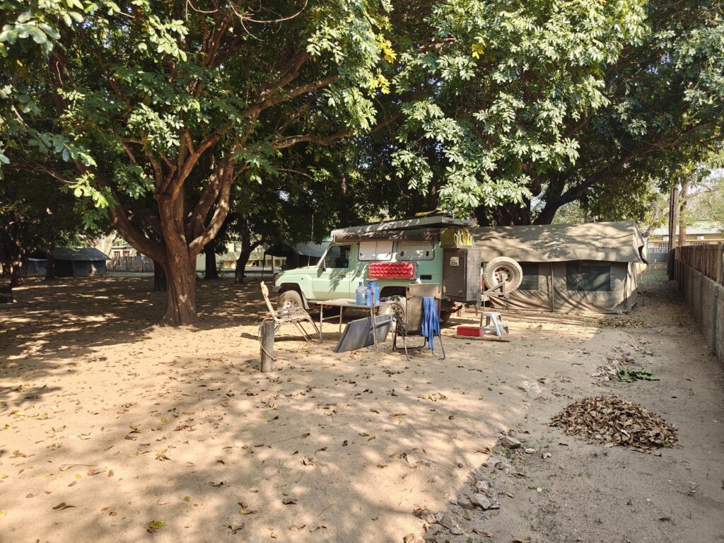
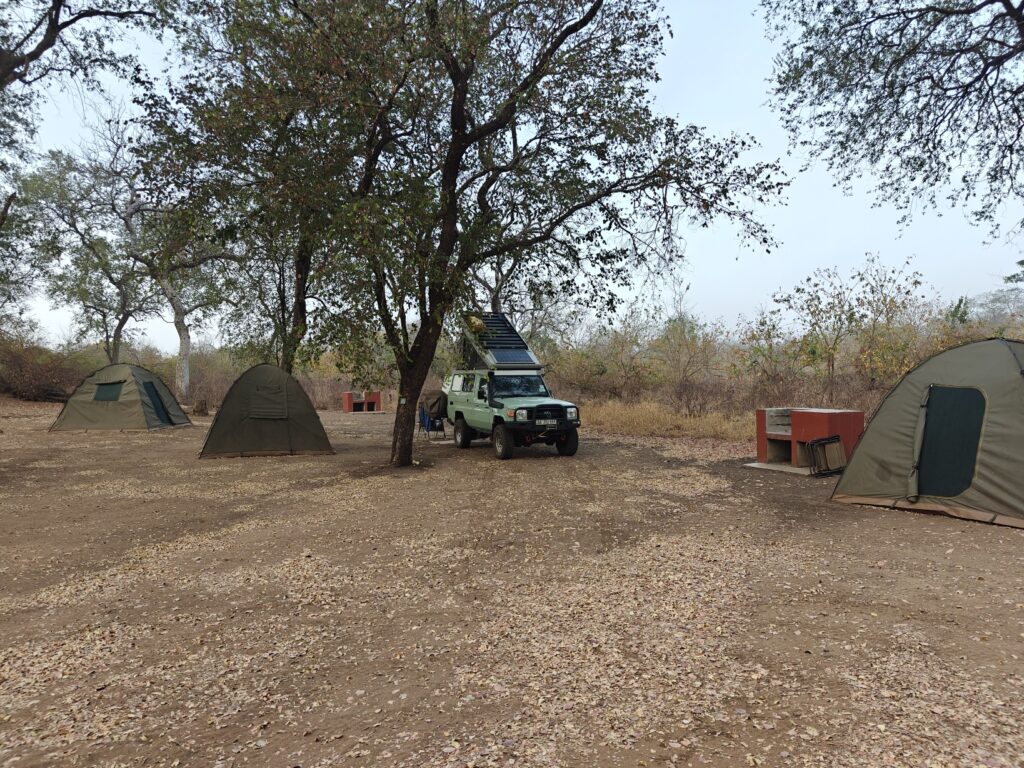
I camped at the main lodge and campsite in the Park called Chitengo. The setting was very Kruger-like. Chitengo is essentially a city comprised of a conference center, airstrip, dozens of bungalows and many dozens of tents of different luxuries, pool, restaurant, activities center, and a sprawling staff housing compound. The campground was an enclosed area with dozens of platform tents. I parked the Green Dragon in one of a few sites for vehicles between the tents. Note, there were aalmost no private vehicles here as most people either fly in or get picked up at the nearby town. The most, if not only, redeeming feature of the campground was the dense canopy of shade trees – and they did have a hot shower too. Not my kind of camping but I had no other choice. Here’s a photo of my campsite:
My Gorongosa (Chitengo) campsite
Here’s my composite video of my visit to Gorongosa National Park:
Although I am re-entering the country of Mozambique for the second time on my African overland journey, the first entry was a brief pass-through the northwestern corner en route to Malawi, so I delayed my welcome overview to this second and longer visit. Again, as with the other countries I have visited, it is worth sharing a few factoids about this country to put things in better context and to educate myself (and you, if needed) a little about this corner of the world. Here is what I learned from my research.
As you can see in the map above, Mozambique is bordered by the Indian Ocean to the east, Tanzania to the north, Malawi and Zambia to the northwest, Zimbabwe to the west, and Eswatini and South Africa to the southwest between the latitudes 11-27 degrees south, which in terms of distance from the equator is the southern hemisphere equivalent to most of central America in the northern hemisphere.
Roughly 3 times the size of Colorado, New Mexico, and Utah combined.
Roughly 34 million people, compared to ~332 million in the U.S..
Portuguese is the official languages, but only about half the people speak it; the remainder speak a variety more than 40 tribal languages.
Government is described as a unitary dominant-party semi-presidential republic under an authoritarian government, with both a president and prime minister appointed by the president, an elected legislative assembly, and a judiciary, so in many ways similar to the US form of government, but with more power invested in the president – unless Trump gets elected and has his way!
Currency is the Metical.
Major exports include aluminum, coal (in the form of briquettes), coke, and natural gas (particularly liquid nitrogen gas).
Like most of the region, it was occupied by humans for probably 10,000 years until it was “colonized” by the Bantu people in the 5th century from west Africa. The Kingdom of Mutapa Empire or “Wene we Mutapa” (Shona) was a medieval kingdom (approx. 1450-1629) which stretched between the Zambezi and Limpopo rivers of what is now the modern states of Zimbabwe and Mozambique. Its founders were culturally and politically related to the Shona kingdom of Great Zimbabwe. The empire was mostly peaceful and built their wealth through trade. Imports included such luxury goods as silk, ceramics and glassware. Exports included cotton cloth, gold, copper, salt and silver. Trade was centrally regulated, with weights and measures controlled by the court. The Mutapa also regulated “the volume of local produce on the international market” to maintain “a favorable balance of trade.” Because the Mutapa had access to gold, they were able to buy livestock and luxury goods like beads. They mostly traded with the Portuguese, who had a growing presence on the coasts of Africa. To protect their trade network and growing economy, the Mutapa relied on a well-trained military force to maintain the security of the empire.
Suffered the sad, but typical, European colonization history. The Portuguese were the first Europeans to explore and colonize Mozambique between 1500-1700. After that, the Portuguese continued to rule, but their rule was continually challenged by the Arabs, mostly from Oman, through the mid-twentieth century. Eventually, the native people rebelled against the Portuguese in a sporadic war that eventually, by 1975, ousted the Portuguese and left control of the country in the hands of a communist regime supported by Russia and China. Soon after, however, between 1975-1992 a prolonged bloody civil war ensued between the communists in rule and the capitalist reform party, resulting in over a million people killed. The civil war ended in 1993 and a democratic government was created that has remained in place to the present. Like most East African countries, it should be noted that Mozambique was heavily involved in the East African slave trade under the rule of the Portuguese and Arabs. Although slavery was legally abolished in Mozambique at the end of the 19th century, the chartered Portuguese companies enacted a forced labor policy and supplied cheap—often forced—African labor to the mines and plantations of the nearby British colonies and South Africa.
Remains one of the poorest and under-developed countries in Arica.
In 2013, the last rhinos in Mozambique were killed by poachers making them extinct in the country. Additionally, Mozambican poachers regularly cross into Kruger National Park in South Africa to kill rhinos.
Roughly half the population is under 15 years in age. Bodes well as a potential work force but without better education it means dire poverty in the future.
Bearing the brunt of unprecedentedly fierce cyclones in recent years. Climate scientists are not in doubt that the warming climate played a significant part in creating these mega-storms which the Mozambicans had never ever experienced before. In 2019, torrential rains and flash floods caught many people by surprise and more than 1,000 people died as a consequence. Mozambique will bear the brunt of the climactic changes that come with global warming. The sad truth is that the people who have contributed the least to the climate crisis are the ones who will suffer the most from it.
Fossil fuels have now been discovered off the northern coast of Mozambique and big oil companies are now scrambling to secure rights to extract gas (LNG, liquid natural gas) there to make a pretty penny. The projects are still in the exploration phase, but already thousands of people are being forcibly relocated. Important habitats like the Quirimbas National Park, a UNESCO biosphere reserve that includes areas of pristine coral reefs, mangroves, and seagrass beds are under severe threat. Ironically, extracting gas from these deposits to help the economy will also serve to accelerate and exacerbate the climate change crisis that is so adversely affecting them.
Has ~30% of its total land area devoted to national parks, reserves and wildlife management areas. This is truly impressive and hopefully the wildlife populations and ecology of these areas can be recovered and sustained after being decimated by is the countries long civil war. But at the same time, don’t let this impressive figure impress you too much, because we saw at Mwabivi, some of the Reserves are little more than a line on the map. If this 30% was all managed like Majete and Mwonde, then this would indeed be impressive and bode well for the future of wildlife in this corner of Africa.
My last stop in Malawi, the Mwabvi Wildlife Reserve, established in 1953 and expanded in 1975, and covering an area of 52 square miles, is Malawi’s smallest national Park or Reserve, and its least visited – it turns out for good reason.
Mwabvi is located at the southern tip of Malawi bordering Mozambique. Like most of the other Parks and Reserves in Malawi, this one too is managed through a cooperative arrangement between the Malawian government and a private nonprofit trust called Project African Wilderness (PAW), which was formed to protect and restore the Mwabvi Wildlife Reserve. I suspect that Mwabvi was established originally because it was the last natural home to the black rhino in Malawi. However, as with the rest of the country, both wildlife and woodland have been heavily poached over the years, and thus there are few animals left today. Black rhino were hunted out many years ago and there has been no effort to reintroduce them given the management status of the Reserve (see below). As far as I can tell, and what little information I could glean from the Reserve entrance gate ranger (the only Reserve staff person I saw), there are only a few species of antelope left, such as kudu and duiker, but I saw none during my brief stay.
The reserve is situated in the Shire River valley, but it does not abut or straddle the River like Liwonde and Majete, so there is no riverside floodplain or riparian habitat. Instead, Mwabvi straddles a seasonal tributary (now dry). They claim that this Reserve has a wide variety of habitats, but all I could see was unbroken woodlands and the dry riverbed. Perhaps the most notable feature of the landscape is the occasional sandstone outcroppings that provide some relief. Here are a few photos of the relatively uninteresting landscape:
Mwabvi woodlandMore Mwabvi woodlandSandstone outcrop at MwabviDry riverbed at Mwabvi
The story of Mwabvi is a sad one. Unlike African Parks, which manages Liwonde and Majete and has done an amazing job of recovering the wildlife populations and improving the infrastructure and facilities, PAW, as far as I can tell, has done absolutely nothing to protect and restore this Reserve. There is no obvious investment in infrastructure or facilities and, so far as I can tell, they have done nothing to protect and recover the wildlife populations. Consequently, there is almost no wildlife to speak of, and as a result, no one visits this Reserve. It appears as though the Reserve is simply a common area for the locals to rummage wood, grass and poach the occasional antelope for meat. It’s a shame, because given the location in the Shire River valley and the woodland habitat, this Reserve could be as successful as Majete with the right investment and management. Fortunately, I only had to pay $13 USD for the one-night stand.
I camped at the public campsite (Migudu) in the Reserve. This was the one redeeming feature of the Reserve. There are just 5 sites, but each are private and nestled up against some minor sandstone outcrops with both shade trees and – surprisingly – a water tap at each site. Amazing! There is no toilet, which is shocking, and it looks as if no one, including the Reserve staff (if there is any) has visited the campground for some time. Nevertheless, the campsite suited me just fine for my brief stay. Moreover, there were two very short trails leaving from the campground, one to a viewpoint and one to the dry riverbed. Note, I had planned on staying 3 nights in the Reserve, thinking there would be more to see, but after arriving and doing a little reconnaissance, I decided to bail after the first night and give myself more time elsewhere. Here’s my campsite:
I took a short video of my campsite and one from the viewpoint to share for those followers that just see my videos and don’t actually read the blog. Here it is:
After my grueling, but extraordinarily rewarding, trek on Mount Mulanje, I headed west to Majete Wildlife Reserve:
The reserve, established in 1955 and covering 270 square miles, was African Parks’ (the nonprofit organization managing many Parks throughout Africa) first mandate, signed with the government of Malawi in 2003. Prior to this, Majete was an unknown reserve where almost all its wildlife had been hunted out – only a few antelope remained. Just 12 scouts were employed, and not one tourist had visited the park in three years. African Parks immediately began creating the necessary infrastructure and establishing a collaborative relationship with local communities. In 2003, they reintroduced black rhino, followed by elephant in 2006, lion in 2012, giraffe in 2018, cheetah in 2019, and wild dogs in 2021. The Majete law enforcement team maintains the remarkable track record of not having lost a single rhino or elephant to poaching since their respective reintroductions. Thanks to these introductions, along with effective park protection measures, wildlife numbers increased significantly and by 2016, Majete was able to supply wildlife to other parks in Malawi.
I am told that Majete now provides hundreds of jobs and supports thousands of community members with education, health and socio-economic opportunities. Apparently, the communities around Majete number more than 140,000 people who, before 2003, received almost no benefit from the reserve, except the occasional poacher’s meat. Today, however, Majete’s community engagement programs have apparently reduced the incidence of malaria, helped thousands of children attend school, and supported critical enterprise development, cementing the value of the reserve within the community. Like Liwonde National Park, Majete offers some hope for the future of African wildlife. I was very impressed with the state of the Reserve. The major roads were in great shape and the facilities, such as the campground and the observation hides, were in excellent condition.
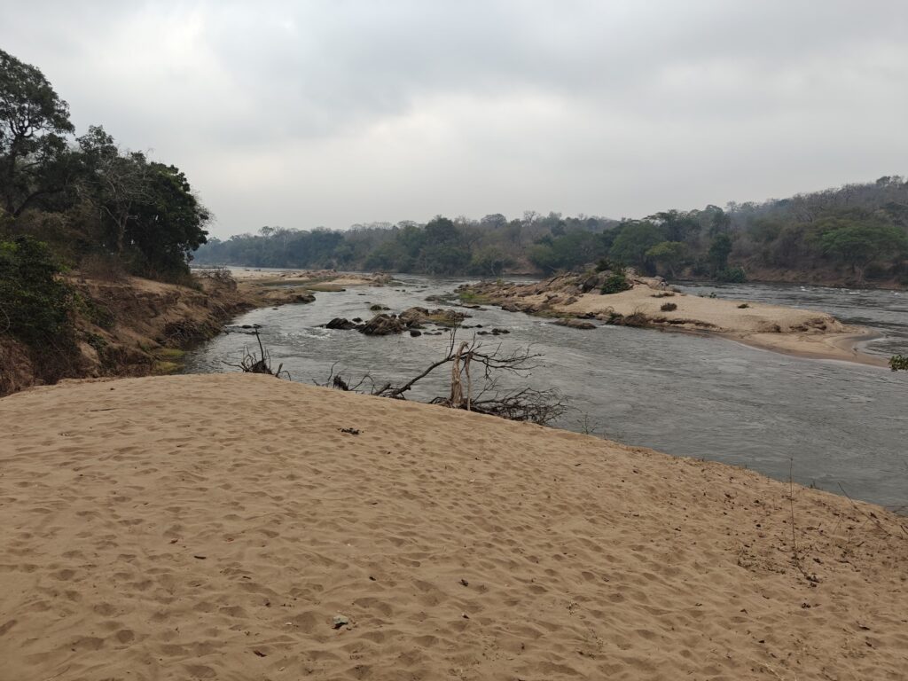
Like Liwonde National Park, Majete straddles the Shire River, Malawi’s largest river and the only river outlet of Lake Malawi, which drains into the mighty Zambezi River. The landscape is primarily woodlands and some riparian vegetation along the Shire River. Here, the Shire is a fast-moving series of rapids with lots of in-channel boulders and islands, and virtually no floodplain to speak of – quite a contrast from Liwonde where everything centered around the extensive floodplain, as shown here:
Shire River in Majete Wildlife Reserve
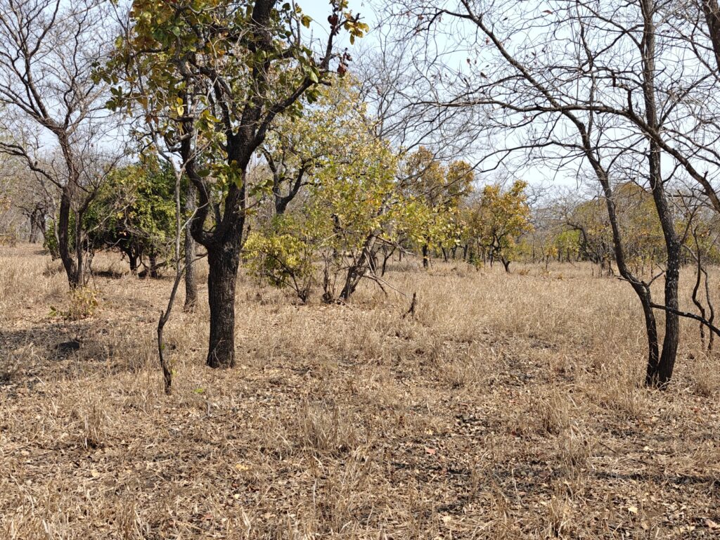
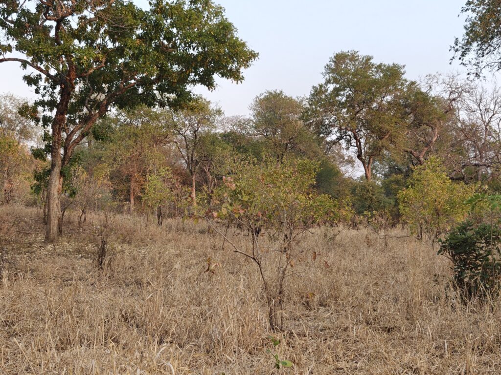
In Majete, it is all upland, hilly woodland bisected by lots of seasonal riverbeds – all dry during my visit, as shown in these photos:
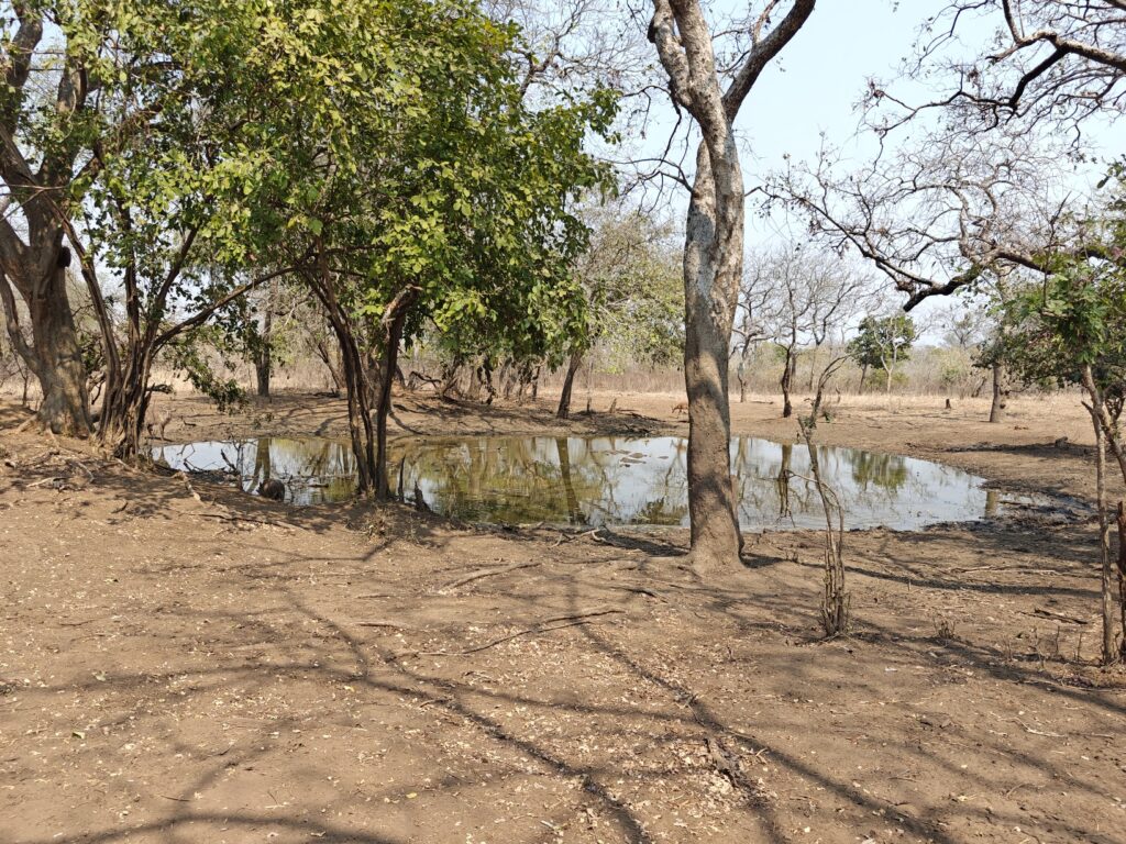
Because it was mostly woodland, it was rathger difficult to see lots of wildlife driving around, but I could sit at one of the waterholes, a couple of which have observation hides on platforms – and let the wildlife come to me. Indeed, Majete is mostly a Park of woodlands and waterholes. I spent about half of my time simply sitting at the waterholes:
Majete waterholeMajete waterhole
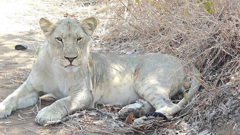
I ended up seeing quite a bit of wildlife, mostly at the waterholes. Some of my observations where from one of the waterholes with an elevated hide, and at times I had to share the hide with a number of other visitors (as you will hear if you watch the video below), while others where from a waterhole without a hide that I had all to myself. In fact, I took a drive into the interior of the Reserve to one of the waterholes, where I sat for 2-3 hours and filmed a variety of wildlife (see the video if your interested), and I saw no other people the entire morning, including the drive to and from. Apparently, just about everyone goes to the two waterholes with hides, and that is where the safari guides take their clients. SO, going to the interior was awesome. Not only did I see lots of wildlife at the waterhole, as seen in the video below, but on my return drive I ran into a pride of lions and spent some intimate time with a young male – see the video for the experience. Here are a few wildlife shots to wet the appetite:
I camped at the Game Capture Community Campsite in Majete. The first night I share the campground with two other parties; the second night with just another couple, and on the third night the South Africans arrived. In case you don’t remember from last year, South Africans – white ones that is – do love to camp, but they almost always travel in big conveys with lots of people and set up huge elaborate camps, often times with big lights and the works. They sometimes send advance parties to secure the site(s) and get the compound started, as was the case on my third night. Fortunately, the bulk of the convey arrived after I left so it was bearable. It’s actually quite annoying for someone like me that cherrishes the serenity of nature.
The campsite was actually pretty nice. I had a corner and shade trees, and there was a fully-equipped indoor kitchen, covered dinning area, and, most importantly, hot showers with great water pressure! I took advantage of the kitchen to cook a big pot of curried pasta with potatoes, onions, green beens, peas, carrots and tomatoes, and some of the homemade cheese that Nancy and I bought at Mambo ViewPoint in Tanzania – declicous! I will be eating it for 4 days I suspect. Here’s the campsite:
My campsite in Majete Wildlife Reserve
On my second night I heard a male lion roaring just outside the campground during the early morning hours, and I subsequently learned and saw that he had killed a waterbuck at the waterhold right next to the campground. I only saw the remnant carcass after he and the scavengers (including side-stripped jackals, spotted hyena, vultures, and even the warthogs) had their turn at it. See the video for the gorey detail.
Here’s my composite video. Sorry, but it’s rather long since I had lots of wildlife observations, so it’s only for the most dedicated followers. There’s extensive footage of lions from two different observations, one shared with a crowd of other visitors and one private viewing. There’s also footage of Nyala, zebra, elephant, buffalo, eland, ground hornbills, and even some warthog thrown in for good measure:
After leaving Liwonde National Park I headed southeast to the Mulanje Massif, also known as Mount Mulanje, which is a large inselberg or monadnock (i.e., isolated mountain rising up from the surrounding plains) in southeastern Malawi. Mount Mulanje actually contains several peaks, not just one, and is more akin to an isolated mountain range. I climbed Sapitwa Peak, the highest point on the massif at 9,849 feet, which is the highest point in Malawi.
Here’s what the Mulanje Massif looked like as I approached it – a bit intimidating realizing that I was goint to ascend to the top of that beast and beyond to the hidden peaks (note the tea farms on the lower slopes):
The Mulanje MassifThe Mulanje Massif
Mount Mulanje is essentially a huge mound of granite formed by subsurface magma bubling up to form one giant massive, along with several places where the magma broke through to form the distinct peaks. I was extremely relieved to find out that the entire massive was granite, which forms a really nice surface for traction, otherwise I would not have been able to ascend the steep slabs of rock or safely hop from boulder to boulder along the ridge to the summit of Sapitwa. My route took me up the main valley shown in this photo:
The Mulanje Massif (my route went up that valley in the middle)
Prior to the trek, I camped near the trail head outside the village of Likhubula while I got myself organized for a two-night backpacking trip into the high country. Day one involved passing by some beautiful waterfalls on the way up to a high mountain basin and then over two passes before descending to a mountain hut at the base of Sepitwa Peak – a total climb of 5,000-6,000 feet over 7 hours. Needlesstosay, I wasn’t in the greatest shape for such a climb after having been mostly on my butt for the past two months, so I suffered a bit – mostly because I let myself get dehydrated. I had a great night stay in the hut, enjoying the company of Aiter and Natalya from the Basque Region of Spain, and then did the grueling 2,000 foot slog up a 45 degree slope on bare rock slabs followed by boulder hopping, squeezing through rock tunnels and eventually making it hand over hand to the summit. The weather was perfect for the hike and the views were stunning – except for the dense smog from all the wood burning both from brush fires on the Massif as well as every household in the region burning wood for cooking and heat. We descended the peak, did a litte R&R at the hut – sorely needed after the 5.5 hour summit excursion – and then trekked for another 3 hours back over the same 2 passes we climbed getting to the first hut and then on to the head of another basin, where a delightful hut awaited my tired feet and legs – not to mention the cold pool in the stream next to the hut. Had another great night with my spannish friends, and we were even entertained by our guides with music and dance. Next day, I did the gruelling descent from the massif. I will include a few slides of the mountain landscape and the huts here, but see the video if you want to see the progression of my trek and hear me give a few side notes about the landscape:
oplus_3145728Mount Mulanje trekFirst night hutMount Mulanje trek approaching the summit of SepitwaSummit of Sepitwa PeakSecond night hut
Here’s a video following the progression of my trek in case you want to see a bit more of the trek and here my commentary:
After leaving Songea in southcentral Tanzania, I headed 300 km south across a very remote border crossing into Mozambique. The crossing took perhaps 15 minutes top and $11 USD, and I was the only one crossing. Apparently, they don’t get many overlanders at that remote post. The 300-km long track was all native surface and extremely slow going given all the bumps and holes and stream crossings, etc., so it took me about 11 hours – argh! The first 100 km in Mozambique was through a Game Reserve – which is basically just a large patch of ground that native people mostly didn’t want to settle and where rich people, mostly from South Africa and the U.S., pay a lot of money to shoot big things. The second 100 km was through almost continuous villages and heavily used land – the only cash crops being charcoal and maize, so far as I could tell. I spent the night in the relatively large town of Lichinga at another iOverlander site that turned out not to be a campsite afterall, but the owner let me stay anyways, and then drove a few more hours southwest to cross into Malawi, where the border crossing took perhaps 1.5 hours and cost $70 USD – there is just no consistency in border crossings. All the border crossings in Africa have been easy, but some take a lot longer and cost a lot more.
My first destination in southern Malawi was Liwonde National Park, established in 1973 and covering 212 square miles, which has a sad history like most the natural areas in Malawi (and elsewhere in this part of Africa), but also has been an inspiring example of what can be done to recover the ecology of an area if there is the will and the means to do so. Liwonde has been the site of some significant wildlife translocations and reintroductions, transforming it into a sanctuary for Malawi’s wildlife. When African Parks assumed management of Liwonde, in partnership with the Department of National Parks and Wildlife (DNPW) in 2015, the park was riddled with tens of thousands of wire snares – more snares existed than large animals – and it had some of the highest human-wildlife conflict levels in the region and almost no wildlife. But since then, Liwonde has established one of the most effective conservation law enforcement measures and training in southern Africa, integrated advanced technology to protect and monitor wildlife, removed more than 40,000 wire snares, and orchestrated a number of historic animal reintroductions. The Park was entirely fenced to reduce the potential for poaching and to reduce human-wildlife conflicts, and all evidence that I saw suggests that it has been very successful. Moreover, the Park has collaborated and cooperated with some 31 local communities neighboring the Park to accomplish their mission.
The Park straddles the Shire River, which drains Lake Mwombe, which is connected to Lake Malawi (Nyassa) by a short stretch of river. Lake Malawi is one of the largest Rift Valley lakes. The Park is evenly split between bottomland floodplain and upland woodlands, with a few tall hills thrown in for diversity. I spent most of my time in the floodplain where most of the wildlife is concentrated. The floodplain is a mosaic of openings and Mopane woodland, but much of the floodplain is now under water. Like all the Rift Valley lakes, water levels have been rising over the past several years. The unusually high rainfill this year (recall the massive flooding in Kenya, Tanzania and elsewhere, which cause the loss of ~2,000 people in Malawi) has exacerbated the lake level rise and the consequence is that much of the floodplain is now under a few feet of water. What used to be extensive floodplain grasslands (providing food for the grazing animals) is now water. Most of the remaining dry surface is either bare ground or grass stubble, as the extensive and huge termite mounds, some of them truly ancient, keep the ground almost completely free of vegetation. Termites in this ecosystem are truly a keystone species as their mounds serve as habitat islands for a variety of plant species, including several tree species that seemed to be found only on these mounds, because the plains are seasonally flooded or at least very wet, making it unsuitable for a lot of plant species. These mounds also provide I homes for a wide range of species, including most notably mongoose. Moreover, their role in decomposition of plant matter and nutrient cycling is immense. Termites are truly amazing! Here are a few shots of the varied environments in the floodplain:
Floodplain Mopane woodlandFloodplain baobab (not bare ground)Floodplain with tree island on termite moundsFlooplain adjacent to Shire RiverFlooded flooplain of the Shire River with Palm tree islands
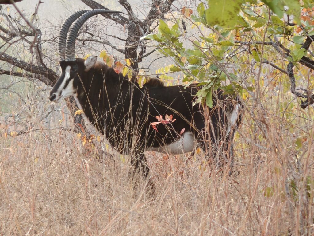
It was quite evident that African Parks has really turned this Park around and made it into a true wildlife sanctuary. On my drives I saw hundreds, if not thousands, of waterbuck and impala, hundreds of greater kudus and warthogs, a couple harems of sable antelope, a smattering of bushbuck, several elephant family units, and lots of waterbirds. Clearly, African Parks is doing something right in only 9 years. Here’s a few shots of some of the wildlife:
Arican woolly-necked storkPod of hippos chillen outEurasian hoopoeWaterbuck (male) – Liwonde’s most ubiquitous antelopeThe shy bushbuck (male)Sable antelope (males)
In 2017, African Parks began re-establishing Liwonde’s predator population by bringing back cheetah, which had been absent from the park for a century. This was followed in 2018 by a founder population of lion, and wild dog in 2021. The lion population now contains 3 large prides. Unfortunately, I only saw one lion on my drives, but wasn’t able to get any decent photos or videos. Apparently there are many cheetah now (they told me, but I forget the number) and on my second morning drive I came across one of the GPS-collared individuals. He/she was almost 100 meters off the road lying at the base of a big tree in a sunny patch, and then at one point it got up to stretch and look around and then suddenly got startled by something and bolted away into the woods beyond. I had probably 10-15 minutes with this beautiful animal. I wish I could have watched it for longer, but I’ll take what I can get when it comes to cheetah (and leopard) See the video, which is not great given the distance, but here’s a photo taken through my spotting scope:
Cheetah (note GPS collar)
Tragically, the established wild dog pack was all killed when some low-life poisoned a water hole within the Park. This year, they reintroduced another 7 dogs and one wildlife trust volunteer I talked to said they saw a pregnant female a few days earlier, so that means they the population is reproducing. In 2019, 17 black rhino were relocated from South Africa to Liwonde in one of the largest international black rhino translocations in history, and I believe the population has doubled since then, so you can bet I was on the look-out for rhino. In fact, on my afternoon boat ride we spotted a single black rhino on the edge of the flooded plains, but it was too far away to photograph.
One of the reasons I decided to visit southern Malawi was to see this recovery effort in action and to support the effort through my visitor fees. I think if there is any hope for the long-term sustainability of wildlife populations in eastern and southern Africa, it is going to take efforts like this.
One of the innovative strategies implemented here to reduce human-elephant conflicts prior to the electric fencing of the entire Park was to encourage local farmers abutting the Park to plant red hot chiles to create a sort of deterrent fence. The “Spicy Farmers” project has harvested nine tons of chillies, which has also resulted in a decrease in human-elephant conflict thanks to the ‘chilli elephant barrier’ created by the project. Unfortunately, I didn’t see any evidence of the “chilli fence” now that the Park has a contiguous electric fence, but it is a cool idea similar to the beehive fence I talked about and showed last year.
I camped in Liwonde Safari Camp located just inside the Park fence. I was suppose to camp in the campground at this lodge by prior arrangement but before I arrived a few other parties showed up unexpectedly according to the owner, so they set me up on the other side of the compound in a wonderfully private setting overlooking a large wetland and a tributary of the Shire River – and with shade trees to boot. Within an hour of setting up camp, I had 4 handsome waterbuck bulls, 2 big warthogs, 1 delicate bushbuck, and one bull elephant on the penninsula across from my campsite (see video for footage of all but the elephant who was too far away) and a pied kingfisher (Mary!). And on the following day, a hippo showed up grazing during the middle of the day. Here’s a photo of my campsite:
My campsite at Liwonde Safari Camp
Here’s a composite video of my visit to Liwonde National Park:
First, ordinarily I would welcome you to Mozambique, as that is the country I entered next after leaving Tanzania, but since I just spent a day and a half driving through the northwestern region en route to Malawi, I will delay the introduction to Mozambique until I re-enter for an extended period after leaving Malawi.
However, I will post this composite video of my drive through the northwestern region of Mozambique between the Tanzanian border and the Mozambique town of Lichinga, where I stayed for a night before going on to Malawi. Note, this video is solely footage taken from the driver’s seat as I drove along 200 km of dirt track and through small villages in Mozambique, so if that is not what interests you, do skip the video:
I am entering the country of Malawi for the first time on my African overland journey, so it is worth sharing a few factoids about this country to put things in better context and to educate myself (and you, if needed) a little about this corner of the world. Here is what I learned from my research.
As you can see in the map above, Malawi is a land-locked country bordered by Tanzania to the north, Mozambique to the east and south, and Zambia to the west and located between the latitudes 9-18 degrees south, which in terms of distance from the equator is the southern hemisphere equivalent to most of central America in the northern hemisphere.
Rough the same size as Pennsylvania.
Roughly 20 million people, compared to ~332 million in the U.S..
English is the official language, but Chechewa is the national language spoken by more than half the population. And there are numerous other tribal languages spoken as well.
Government is described as a unitary presidential republic with a structure much like the United States, except with a functioning senate in the legislature.
Currency is the Kwacha, although US dollars are accepted in many places.
Major exports include tobacco, gold, tea, ground nuts, and dried legumes.
Like most of the region, it was occupied by humans for probably 10,000 years until it was “colonized” by the Bantu people in the 5th century from west Africa. Between 1600 and the end of the 19th century the Portuguese exerted a strong influence over the native peoples in the area and promoted the slave trade. In 1891, the area was taken over by the British as the British Central African Protectorate, and it was renamed as Nyasaland in 1907. In 1953, it became a protectorate within the semi-independent Federation of Rhodesia and Nyasaland. The Federation was dissolved in 1963. In 1964, the protectorate was ended: Nyasaland became an independent country as a Commonwealth realm under Prime Minister Hastings Banda, and was renamed Malawi. Two years later, Banda became president by converting the country into a one-party presidential republic. Declared President for life in 1971, Malawi’s next few decades of independence were characterized by Banda’s highly repressive dictatorship. Following the introduction of a multiparty system in 1993, Banda was defeated in the 1994 general election. Today, Malawi has a democratic, multi-party republic headed by an elected president and has continued to experience peaceful transitions of power.
Malawi is the fourth poorest country in Africa and over 40% of the population live on less than $1 a day. Sadly, it has one of the highest rates of Aids orphans in Africa
Lake Malawi (also called Lake Nyassa) is 350 miles long from its northern to its southern tip, making it the ninth largest lake in the world, and the third largest and second deepest in Africa (eclipsed by Lakes Victoria and Tanganyika). It is, according to UNESCO, home to more species of fish than any other lake on the planet, including some 700 types of cichlid – the little, colorful, finned creatures which flicker and flutter in its shallows.
Has ~23% of its total land area devoted to national parks, reserves and wildlife management areas. This is truly impressive given the undeveloped and poor state of the country, but the wildlife populations were decimated throughout the entire country until relatively recently when reintroduction and recovery efforts were taken.
After leaving my little gem of a campsite at Kilwa, after being delayed by my primary car battery failure, I made my way south to the southern most point on the coast of Tanzania:
My destination was the Mnazi Bay-Ruvuma Estuary Marine Park and the Msambiti Penninsula. The road was a pothole nightmare once again, but I wont sour this post with more whinning about that. The Park, established in 2000, encompasses a narrow sliver of coastline along the southern coast bordering Mozambique. The area covers 251 square miles, of which one-third is on land. The marine environment within the park is exceptionally diverse and includes mangroves, rocky and sandy shoreline, mudflats, salt pans, fringing coral reefs, lagoonal patch reef, seagrass beds, three islands and numerous small rocky islets.
Interestingly, close to 3,000 or 30,000 people (depending on the source) live within the “Park”, depending mainly on marine resources for their livelihoods; the park includes in its boundaries 11 villages and 8 sub-villages. There are few opportunities for development, hence poverty is rife. This has created an over dependence on marine resources and the persistent use of destructive fishing methods. Indeed, between the ubiquitous human development on the penninsula and the unconstrained fishing that I observed, there really isn’t any “Park” to this Park other than a name on the map and an opportunity to extract money from non-resident tourists like me. This is another pet peave of mine: Parks that don’t really protect the environment from human uses and yet charge an arm and a leg for non-residents to access. This Park is a classic example of this. To make matters worse, natural gas was discovered in Mnazi Bay in 1982, and wells were brought into operation in 2006. Gas from the wells all over the penninsula within the Park is now piped to the mainland within the Park where there is a big gas processing plant. If I had known it was going to be this un-Parklike, I probably would not have made the extra drive to get down there.
On a positve note, I camped in another delightful beachside location at a private lodge and it cost only $8 USD. I had the place to myself except for a nice German family with two young children and a grandpa that stayed in one of the cottages. Unfortunately, as with my previous campsite, I didn’t have a lot of time to enjoy the site other than an evening, as I was off early morning to go on a whale-watching boat ride with the German famil – despite the fact that they were christian missionaries. You will have to watch the video to see my campsite, as I forgot to take a picture. The target of the whale watching trip was humpback whales, which come to these nearshore waters beginning this time of year to give birth before heading back south to colder waters for feeding. Apparently, the whales had been seen recently were almost certain to see them – according to Park staff and boat captian ???? – but we saw none after about 2 hours of looking. We did see some spinner dolphins but I suppose the highlight was the gorgeous sunrise:
Whale watching with cute German familySunrise off the Msambiti PenninsulaSunrise off the Msambiti Penninsula
My purpose on the Penninsula was actually not whale watching – that was unexpected – but rather snorkling on the nearshore coral reefs. After the boat trip I spent a couple hours snorkling on beautiful coral heads just off the beach. Unfortunately I don’t have underwater pictures to share as I don’t have an underwater camera, but the reef was in moderately healthy condition (patchy) but there were lots and lots of colorful fish and the water was shallow and clear so visibility was great. Needlesstosay, I had the entire reef and beech to myself. Here’s the beach where I snorkled in the waters just offshore:
oplus_3145728
I was planning on spending two nights on the Penninsula but then realized that my drive the following day would have been 10-12 hours. No way could I handle that with the often stressful driving, so I left the Penninsual and headed west towards my destination, Songea, before then turning south to enter western Mozambique. After driving several hours I stopped before sunset at a “wild” campsite identified on my trusty iOverlander app. It was a rock quarry next to a rocky hilltop right off the highway. Looked good, so I started to set up when a local showed up on the rock above. I later learned that the locals come to this high point in the evening to make their cell phone calls as the reception is good there. Before long there was probablly 8 men looking down on me from the rocks. OK, probably not the safest and wisest place to spend the night since technically I was tresspassing. Fortunately, the first man there was a secondary school biology teacher at the community-based school in the tiny village of Lumesule just over the hill and we got to talking and he invited me to spend the night at the school grounds. So, I packed up and we headed to his school.
I met several of the other teachers and staff and was surrounded by hundreds of young boarding students for a while before a couple of the teachers walked me into the village center to show me around. Not much to the village center other than one small fruit stand selling only banana’s, and a pool table for the young, mostly jobless, 20-year old men to spend their evenings. In 2-3 hours of discussion, I learned a lot about the community-based school, local, national and international politics and economic challenges, and of course football (i.e., soccer). The English teacher, who barely spoke English, tried to get me to stay through the weekend to talk to the students in proper English, but I simply couldn’t comply given my plans ahead.
Overall, the school is a sad and depressing situation, and it would be easy to want to help out financially and otherwise, but then you realize that there is a school just like this one every several kilometers down the road and it feels hopeless. In this case, for this tiny village, there are 300 students, half of whom board, and 17 teachers. The students have to help with all the capital improvements and facility maintenance on top of their “studies”. They even have to carry water by buckets up from the nearby river to meet their water needs. Most of the parents don’t support sending their kids to secondary education but fear government repercussions if they don’t, so they do, and the kids treat learning and using English as a form of punishment, so nearly all of them lose all English skills once they leave school – as was demonstrated in our visit to the village. Worse, only about 10 out of 300 kids will go on to any form of higher education because the parents and community largely don’t realize the benefits of doing so. So 90% of them are stuck in the same poverty-striken life of their parents with no aspirations to change that. It’s heartbreaking because the kids simply don’t know any better and they are getting no incentives or encouragement to improve themselves and their livelihoods through higher education. Instead, 100% of them (I learned) simply fall back on their religious beliefs (75% muslim, 25% christian) to justify their lot in life. Religion as an escape goat to justify suffering in this life is one of the great lies of religion in my opinion.
Here’s an early morning photo of my site before the students got up as I left early in the morning:
My campsite on the secondary school grounds at Lumesule
Here’s a composite video with a clip of my Msambiti campsite, snorkling site and the school grounds at Lumesule: