After leaving Daan Vijoen Wildlife Reserve outside of Windhoek, we headed west and camped for a night in the Namib-Naukluft National Park en route to Walvis Bay on the coast:
Ordinarily I might not post a blog entry for a one-night stand en route to a destination, but our campsite was so awesome that I decided to. We camped at a remote and exclusive desert campsite called Rock Arch in the Namib-Naukluft National Park about 30 km on a 4×4 track off the main route to Swakopmund on the coast (n.orth of Walvis Bay). This was desert camping at its finest, and Ki was especially at home and delighted being the old desert rat that she is, owing to her days researching pronghorn antelope in southern Arizona.
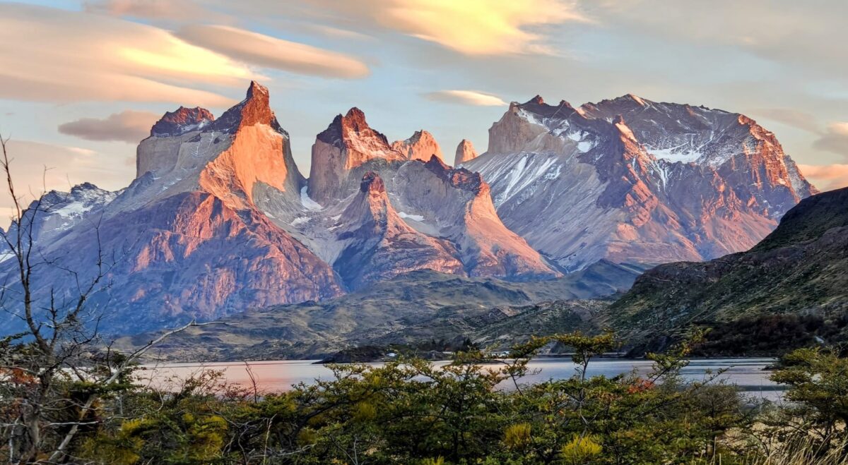
The Namib-Naukluft National Park is located in western Namibia and ecompasses over 19,000 square miles of the Namib desert, which is purportedly the oldest desert on Earth. The Namib extends from the Atlantic Ocean east to the Great Escarpment that runs down and around the southern part of Africa, mostly in South Africa. You may recall from last year my visit to the Drakensberg escarpment on the northeast coast of South Africa. The Drakensberg is part of the same Great Escarpment that wraps around South Africa. The Namib is a true desert, with an average of only 4 inches of precipitation per year, which comes in the form of coastal fog that warms and falls as rain. More on the spectacular dunes in the Namib in a subsequent post.
The Namib-Naukluft Park is one of the largest wildlife parks in all of Africa. The orgins of the Park date to 1907, but there have been several substantial additions over time. The Park now runs 370 miles north to south along the coast and, thanks to an addition in 1979, it includes 1,000 miles of Atlantic Ocean coastal waters as a marine reserve. This is a really big Park; we have nothing in the States to compare in terms of size.
Ok, back to my original justification for this post – a one-night stand to a surprisingly awesome desert campsite. Our campsite was remote, private and desert camping at its finest. Our site was perched on the top of a rocky outcrop (or kopje, or koppie) perhaps only 50 feet above the plains, but enough to afford us spectacular views of the surrounding desert. There was a grotto to sit under for shade with seating and a really nice loo below the koppie. I will let the photos do the rest of the talking.
Driving into the Namib desertQuiver tree in the Namib desert near our Rock Arch campsiteSociable weaver nestHeading to Rock Arch campsiteOur hilltop Rock Arch campsiteOur Rock Arch campsiteSteve and Ki’s rigOur Rock Arch campsiteOur Rock Arch campsite looking through the archOur drop-toilet loo below our Rock Arch campsiteKevin in the grottoNancy holding up the archNancy in the grottoKi in the grottoNancy, Ki and Steve in the grottoSunset through the arch at our Rock Arch campsiteSunrise from our Rock Arch campsite
Off to Walvis Bay and a trip to Sandwich Bay. See you there!
After leaving Waterberg Plateau National Park, we ccompleted our big loop through northwest Namibia by heading back to Windhoek to meet up with Steve and Ki, resupply, and head out on the next leg of our journey.
En route to Windheok we spent a night at a wonderful campsite in a private game reserve called Omatozu located 100 km or so north of Windhoek, and then headed on to Windhoek to meet up Steve and Ki, shop in a fully-stocked supermarket, and then on to the Daan Viljoen Game Reserve just outside of Windhoek for a couple of nights R&R and some leg stretching.
Before we get to the good stuff, let’s do a little TIA drama! Hopefully you remember that TIA refers to “This Is Africa” and all the simple things that can go wrong or become challenges that would otherwise not be in the States. Well, here’s a good one for your entertainment. After meeting up with Steve and Ki (see below) and stocking up on food and drink, we stopped at the Shell fuel station to top off our tanks before heading into the remote portions of Namibia. As usual, I hopped out of my driver’s seat and told the attendant to fill up my Sub tank (that’s my secondary tank in the rear) with diesel, and then I went into the station to look for something. When I came back out to the car and looked at the pump and the guy pumping the fuel, my heart stopped beating – literally – as I saw that he was pumping petrol (gasoline) into my diesel fuel tank! This was a DISASTER in the making. Contaminating diesel fuel with any amout of petrol can destroy an engine. Fortunately, someone or something was shinning down on me because I did not turn the key in the ignition before I noticed what was happening and yelled STOP, and thus none of the contaminated fuel got into the fuel lines or engine, which would have been a serious problem. Anyways, we – actually the station manager – called an expert experienced with this problem for emergency help. He came and drained and flushed the Sub tank, and then we test drove the Green Dragon and he guaranteed all was well – but only because I had not turned the ignition key to the On position, which would have pulled fuel into the fuel pump to prime it. After 2.5 hours and just a little bit of stress, we were on our way. BTW, this was a great way to welcome back Steve and Ki to TIA.
Push the Green Dragon away from the pumps to drain and flush the tankDraining the contaminated fuel from the Sub tank
We spent two nights just outside of Windhoek at the tiny Daan Viljoen Game Reserve, named after the South African administrator of South West Africa (when South Africa governed the territory of what is now Namibia). This National Park, established in 1962, encompasses only 15 square miles of hills and valleys west of Windhoek. The vegetation is mostly short Acacia and Mopane woodland and the Park hosts several of the classic wildlife species, but no lions or elephants. We had a delightful campsite and so far as we knew shared the entire Park with only one other party – a German family that didn’t stray too far from the WiFi.
We had a wonderful 10 km morning hike and another 3 km evening hike, giving our legs some much needed exercise (see pics below), but the most noteworthy event of our stay was the raid on our campsite by a large male baboon. We were setting up camp the first night and getting prepped to make dinner. We had car doors open and stoves and other gear on the tables, as we were all busy getting stuff from the vehicles to set up camp, when a huge male baboon came around the corner and we saw him get into the driver’s side of the Green Dragon. At which time we all yelled and I darted to the Dragon causing him to abandon the front seat – while I quickly wondered what he was trying to steal from the front seat. Anyways, he immediately ran around to the back of the Dragon, climbed in and grabbed a bag of beautful seeded rolls that Nancy was really looking forward to eating – since good bread is almost impossible to find in this country. I raced to the back of the Dragon at the same time as he and yelled and lunged at him while he came out of the Dragon, at which time he turned and aggressively lunged back at me – bread rolls in his mouth – with a growl and with his HUGE fangs bristling white and looking quite menacing – and my heart stopped for a second time in the same evening. Fortunately, he realized that he had his prize and turned and very confidently strode away knowing that he was the boss of this one-on-one confrontation. There is no question that he would easily take me down in a fight if he wanted to. Fortunately, his brain is relatively smaller than mine – I think – and thus he didn’t realize his superiority.
Knowing he had hit the jackpot with us during his first raid, our baboon “friend” returned in the morning by stealth, as we were now on constant look-out for him, and tried a rear ambush from the other side of our camp. He darted in from behind the ablution block, but Nancy yelled out and I grabbed my new slingshot – thank you Nathan for that xmass present – and at the sight of the slingshot he took off. Phew! This guy was bold and aggressive and certainly poses a safety risk for the Park’s visitors. Subsequently, the Park staff revealed that they will have to remove (i.e., shoot) this baboon. Sad fate for an animal just trying to get food in the easiest way possible, like we all do.
Here’s a few pics of our campsite, with first night drinks with Steve and Ki, and our hikes:
Welcome to Daan Viljoen Game ReserveFirst night drinks with Steve and KiFirst night drinks with Steve and KiNancy, Steve and Ki with the wildebeest in the backgroundHiking in Daan ViljoenHiking in Daan ViljoenHiking in Daan Viljoen
OK, hope you enjoyed the TIA anecdotes, because now we are off to the desert and the coast. See you there!
OK, the Etosha post was indeed rather long – but it was afterall 4 days in the crown jewel Park of Namibia – so I will make this one short. After leaving the Onguma Reserve and Etosha, we headed south towards Windhoek to meet up with Steve and Ki, who will join us for the remainder of this year’s journey. We made a brief one-night stand stop in Waterberg Plateau National Park, primarily because it was conveniently located halfway to Windhoek, but also because it provided an opportunity to stretch our hiking legs
Waterberg Plateau is, as the name suggest, a large sandstone plateau a few hundred kilometers north of Windhoek rising roughly 800 feet above the vast plains of the Kalahari of eastern Namibia. The Park, encompassing 156 square miles, was declared a reserve in 1972. It is largely inaccessible; hence, in the early 1970s several of Namibia’s endangered species were translocated there to protect them from poaching, and it worked! The Park now supplies other Namibian parks with rare species, including the rare black rhino.
The Park is rather picturesque from the southern side where a several hundred foot escarpment rises from the plains along a roughly 100 km stretch to reach the top of the plateau. When the sun hits the red rocks as sunrise and sunset, especially with the multi-colored lichens on the rocks, it is truly a beautiful sight to behold.
The Plateau still hosted a small tribe of the San (Bushman) as recently as the 1960s, but they are all gone now. The site is also somewhat famous, at least in German history books, as the place where the Ovaherero people lost their last and greatest battle against the German colonial forces at the beginning of the 20th century. Native survivors fled to neighboring British Bechuanaland (now Botswana), but an estimated nearly two-thirds of the Ovaherero population lost their lives during this period – yikes!
Here’s a few pictures from our brief visit that involved a few hour hike up to the top of the escarpment:
Waterberg Plateau escarpmentNancy scrambling up the Waterberg Plateau escarpmentWaterberg Plateau escarpment from the topRosy-faced lovebirdKevin scale’s a termite moundNancy chooses not to scale the termite moundNancy hiking with the Aloe treesDik-did, the smallest antelope in AfricaThe delicately beautiful dik-dik
Here’s a short 2 min video showing the escarpment from the top and some close encounter footage with a pair of dik-diks, Africa’s smallest antelope:
We left the Kunene River and the border post town of Ruacana and headed back south a few hundred kilometers to the western entrance to Etosha National Park.
Our journey through Etosha involved a west-to-east route through the Park, entering through the western gate and exiting through the eastern Gate, with 3 nights at campgrounds inside the Park and 1 night at a campsite in the Onguma Conservancy on the eastern side of the Park.
Etosha NP is the crown jewl of the Namibian Park system, and really the only Park in Namibia with the full complement of wildlife species, including all the big ones. The Park is one of the largest national parks in Africa, encompassing 8,600 square miles – that’s pretty big! It started as a game reserve like most Parks in Africa, with a focus on supplying big game for the white hunters, proclaimed in 1907 by the governor of German South West Africa, which you may recall was ruling Namibia before the South Africans took it over at the start of World War 1. At the time of its establishment, the game reserve was several times larger than the current Park and extended west all the way to the Atlantic ocean and north all the way to the Angola border. Subsequently, the South African government declared it a national park in 1967 and over time was progressively reduced in size to its current extent, primarily to honor the land rights of the native people in the region.
The Park is named after the enormous Etosha pan, which is almost entirely within the park and encompasses an area of 1,840 sq mi and constituting 23% of the total area of the Park. You may recall that these pans form in low-lying areas that flood during the rainy season and subsequently dry out, and in the process concentrate salts on the surface, often producing a white salty crust and generally preventing vegetation growth due to the high salinity. Etosha pan has vast expanses of salty clay soil interspersed with salt-loving grassland. Surprisingly, you can find lots of springbok out on these salt pans, along with zebra and wildebeest in the grassy areas. Here’s a few pics of the pan and fringing sweet lime-loving grasslands on the fringe of the Pan:
Etosha pan panoramaEdge of Etosha PanSweet grasslands on the fringe of Etosha PanEtosha pan sweet grasslandsEtosha pan fringeEtosha pan fringe sweet grasslands with plains zebra
The 77% of the Park that is NOT the Pan is very flat, with only a few hills in the far west of the Park and a couple of isolated hills (or koppies) in the south, and mostly covered with short mopane woodland interspersed with shrubby acacia thornveld – not the stuff you want to do a walkabout in. Truth be told, much of the Park is rather monotonous landscape with very few animals to see in most of it; we probably spent 90% of our time driving through homogenous vegetation without seeing anything or much. But then there are hotspots where the animal life is concentrated and in large numbers and it makes all the driving worth it. Here’s a few shots of the grassy/shrubby openings in the otherwise monotonous mopane woodland (which you have seen enough of):
A patch of grass/shrubland amidst the extensive mopane woodlandA patch of rass/shrubland amidst the extensive mopane woodland
The Park is home to all the classic savannah species of southern Africa, but is most noteworthy for its population of the endangered black rhino. Unfortanately, despite the Park’s anti-poaching efforts, as recently as 2022, 46 were killed inside the Park. The Park is simply too big to effectively patrol and the Park’s boundary fence is too easily thwarted by the poachers. At this rate of poaching, I’m not sure how long the Park will have black rhinos.
Our first night was spent at the Olifantrus camp in the western section of the Park. While the campground was unexpectedly rather devoid of any redeeming character or views of the surrounding landscape, it did have a waterhole just outside the campground with an elevated blind or hide that offered up close and personal observations of elephants and other creatures. Here’s what happens to the 1/2 inch think plexiglass hide viewing window at ground level when an elephant head bangs it, probably trying to take out one of the many annoying French or German tourists:
Our drive eastward through the western section of the Park, after leaving Olifantrus, was mostly rather uneventful except for a couple of very special wildlife encounters: one with a pair of bat-eared foxes on the road in front of us and another with a honey badger digging out ground squirrels and eating them, but you’ll have to watch the composite video to see these observations as I was too busy tring to video to take pictures.
Our next campsite was called Okaukuejo, located in the central portion of the Park and serving as the administrative headquarters for the Park and overall hub for all tourist activity. This was a campsite from Hell, truly! 50 or more sites crowded together without any separation, partitions or shade to speak of, and crowded, dirty, shared ablutions. Here’s a picture of our campsite way before it got crowded later in the day:
Okaukuejo campsite
This was one of my least favorite campsites in all of my African travels, in part because of the aweful campsite but also because of the hundreds of annoying European tourists, or to be more specific, French and German tourists. Do you sense a bit of tourist bias on my part? If so, you are right on, as we have encountered lots of rather discourteous French and German tourists on our wildlife drives and at the waterholes. The only highlight of this portion of the trip and our stay at this campsite was the waterhole, which they light up at night for viewing the nocturnal creatures. We were fortunate to watch a black rhino come to the waterhall after dark, despite the loud Frogs and Germans chattting away when the “Silence Please” signs are all over the place at the waterhold viewing area. Here’s a few shots of the waterhold at sunset and the endangered black rhino, and there is a little video footage as well:
Okaukuejo waterhold at sunsetBlack rhino at Okaukuejo waterholeZooming in on black rhinoZooming in even closer on black rhino
Our third night was spent at the Halali campite in the east-central section of the Park. Another campsite NOT to recommend for the same reasons as before, but somewhat more tolerable than the previous one. More importantly, there was a rather nice waterhole with night lighting and we managed to watch two black rhinos along with several spotted hyenas at this hole. See the composite video for some footage.
Our last night was spent just outside the eastern boundary of the Park in the adjoining Onguma Conservancy. Fortunately, we had a delightful campsite with all the trimmings, as shown here:
Onguma Conservancy campsite
Overall, we saw lots of critters during our visit to Etosha, but also spent a lot of time driving too, and on some pretty crappy corrogated roads which produced not just a few cuss words out of my mouth, much to Nancy’s irritation. Not much else to say abou the Park, so I will end this post with: 1) a link to the composite video that has some cool footage of the honey badger along with some night footage of the black rhinos and lots of miscellaneous stuff, 2) a few “From the Wildside” pics, and 3) a gallery of some highlight wildlife photos that didn’t make it into the story above.
“Sorry, we are not serving baboons today at this restaurant”“Banana pancakes in the bush anyone? It’s brunch time at Etosha Pan”“Phil, margarita on the dock, Namibian style – overlanding doesn’t always mean roughing it!”“Mom, do we really have to be nice and pose for the French and German tourists?”“That will be one Namibian dollar for the photo, please”“Sis, do you mind if I rest my head on you for a bit, these tourist photos are wearing me out”“John, it’s a good thing you made me do yoga this morning or I would never be able to get down far enough for a drink”“In the eye of the elephant. I see you, the real you!”
Photo Gallery:
White-crowned shrikeParadise whydahKori bustard (heaviest flighted bird in Africa)White rhino (dehorned)Black-faced impala (endemic race restricted to nortwest Namibia)Classic waterhold scene (elephant approaching, springbok, black-backed jackal, and more)Black-backed jackalWhite-quilled bustardPale chanting goshawkSpringbokGiraffeAfrican elephant (bulls)(Red) hartebeest(Blue) wildebeest
Regretfully, we left the Palmwag Concession and our delightful Elephant Song campsite and private lion encounter to head all the way north within Namibia, first for a one-night stand at the Kaoko Mopane lodge and campsite outside of Opuwo (the commercial and population center of Kaokoland, with a population of around 12k), then on to Epupa Falls on the Kunene River and Angola border, and finally east upriver to a campsite just short of the border post town of Ruacana.
Not much to report on Opuwo other than to say it was a nice place to resupply with food and fuel – actually, the only place – before heading up to the Kunene River on the Angola border. We found a decent lodge and campground for the night, but the only thing worth reporting was the clever use of recycled materials in the lodge, restaurant, and gardens. Here’s one example of what to do with your vehicle when it has died of old age:
Recycling at its best, or worst?
We left Opuwo and drove north through more mountains, valleys and plains covered with, you guessed it, Mopane woodland, the ubiquitous tree of this region, and almost no people. We continue to be in awe of how extensive the Mopane woodlands are that seem to stretch across mountains and valleys for endless distances. On the human population side, I suppose it is not too surprising that there appear to be almost no humans throughout most of this vast landscape given the aridity and minimal productivity of these lands. Every so often, we will come across a cluster of a few to a dozen huts and natives living a subsistence lifestyle, mostly by raising goats and/or cattles, but otherwise the landscape is rather void of humans. Here’s a few pics to give you a taste:
Kaokoland drivingMopane woodlandEndless mopane woodlandMore mopane woodland (and overgrazing by the local villagers)Typical Kaokoland “village” (and, yes, families live in those tiny dome-shaped huts)
After 4 hours or so of driving, we eventually made it to our destination at Epupa Falls on the Kunene River and Angola border. The Falls were spectacular in many ways, but most notably by the way in which the water flowed through more than 30 paths/channels and then over falls and cascades into the gorge below. The Falls may not be the largest in terms of water volume, width, or height of the drop, but they certainly are in the running for having the most character. Pictures, of course, don’t quite capture the quality of the Falls, but here’s a few anyways to give you an idea of the marvel we beheld:
Nancy at the main falls at Epupa FallsLargest falls at Epupa FallsEpupa Falls continuedEpupa Falls panorama
But to really see the breadth and character of the Falls, you need to watch this 2 minute video, which better captures, but only partially, the magnificenc of the Falls:
We spent two nights at Epupa Falls. Our campsite was right next to the river and just above the Falls, close to the spray and such that we heard the constant sound of the Falls, which made for nice backing music for my native American flute. Our site was not very rustic, as we were situated right next to the lodge owner’s house and close to the restaurant bar, but the proximity to the Falls compensated, as did the sublime sunsets and some of the campsite visitors. Check it out:
Our Epupa Falls campsiteSunset from our campsite at Epupa FallsMale Namibian rock agama in our campsiteAnother male Namibian rock agama in our campsiteWater monitor passing by in front of our campsiteFemale Namibian rock agama in our campsite, and trying to evade the horny maleCrocodile in the river above our campsite wondering how we would taste
We did a four hour morning nature walk with a local guide along a beautiful stretch of the river upstream from our campsite.
One of the many side channels of the Kunene RiverBraided channels of the Kunene River
We saw lots of birds, including a couple of new species for me, but what was most interesting to us was some of the insights we gained into the local Himba culture. Our guide was half Portuguese, half Himba, reflecting the cultural reality that political boundaries, including international ones such as the one along the Kunene River, don’t mean that much to the locals living a subsistence lifestyle.
Our local Portuguese – Himba guide
We met a few local women and their children out foraging for Makalani palm tree seeds along the river floodplain and a deeper appreciation for the immensely difficult life they lead just trying to stay fed. Despite these hardships, though, the babies still look beautiful:
Local Himba woman and babyTrying to pry open a Makalani Palm seed to get at the flesh on the without breaking a tooth
One of the more interesting factoids about the local Himba culture is their fondness for Palm wine. Why should we be surprised? All human cultures throughout time have found a way to produce alcoholic beverages. In this case, they tap the palm tree and drain the sweet sap, often killing the tree after the first tapping but at other times after several taps, and then add some Mopane tree bark as a fermenting agent and let it ferment for some unspecified amount of time. The palm trees are actually protected by law, but that does little good in the remote regions of the country, and thus we saw lots to tapped and dying or dead palms. Here’s a tree with a series of taps:
Tapped Makalani Palm tree
Our last night on the Kunene River was spent about 150 km upriver from Epupa Falls near the border town of Ruacana. The drive involved lots of ups and down, across dry washes and past numerous clusters of huts, mostly along the Kunene River floodplain, where the natives herded goats and cattle and grew maize. It was a great drive except for the fact that every child under about 15, when they heard our engine coming, ran out to the roadside to beg for handouts. Some of them had no clothes on. Heartbreaking to see all these kids so desperate for handouts and to have to pass them by because you quickly realize that it is impossible to stop for all the kids or you wouldn’t get very far – argh!. This kaoland region is apparently the poorest section of the country and the first-hand evidence surely supports that.
Driving the hills above the Kunene RiverDriving along the Kunene River
We did a one-night stand at a somewhat random campsite called Tjonkuvy Otjiruwo (try to say that one fast) overlooking the Kunene River just below the big Ruacana hydroelectric dam. Nothing to write home about, but I am going to do so anyways, other than to say we had the campground to ourselves and would have enjoyed it more if it weren’t for the troublesome Mopane flies – think black flies that like to get in your eyes, ears and nose.
oplus_3145728
Next stop, southward en route to Etosha National Park and some real wildlife observations! See you there.
We left Twyfelfontein and headed farther north into the heart of Kaokoland, inhabited primarily by the Himba people, to Ongongo Waterfalls located about 25 km south of the town of Sesfontein.
We spent a night south of Sesfontein at Ongongo Waterfalls and their community-run campsite just below the falls – we needed to be near water after so many days in the desert! The waterfall creates a marvelous swimming pool below the falls, albeit enhanced by a stone dam. We were the first campers to arrive at the campsite, which ended up being full at night, so we took advantage of the privacy and took a nice refreshing swim in the pool before others arrived. Good thing Nancy remembered to bring her bathing suit, although I suppose we could have done without!? Here’s a few pics of the pool, our campsite along the stream and the canyon above the pool:
Ongongo Waterfalls campsiteOngongo Waterfalls and swimming poolRock hyrax watching us swim in the poolHiking above Ongongo WaterfallsHiking above Ongongo Waterfalls
After leaving Ongongo Waterfalls, we headed into Sesfontein for a resupply of cookies and wine – the two essentials – did a quick stop at the historic Fort Sesfontein, built by the Germans in 1896 while under their colonial control to serve primarily as an outpost to control rinderpest (cattle disease) and poaching, but later converted into a military base and then ultimately abandoned in 1914 at the outset of World War 1. Now it is a lodge and tourist attraction:
Fort Sesfontein
We drove an hour into the desert to the Palmwag Concession, which is a wildlife reserve, carved out of a few adjoining community Conservancies, dedicated to conserving the desert ecosystem and, most notably, desert elephants and black rhinos. They purport to be the largest wildlife concession and so forth, but we have heard that claim before, and to have the largest wild population of black rhino, but we have heard that claim before as well. Regardless of whether any of this is true or not, it is an expansive desert mountain landscape that does support a wide variety of desert wildlife, including the aforementioned, as well as lion, leopard, mountain zebra, giraffe and various antelope.
We had a delightful campsite called Elephant Song Campsite perched up on a bench above the Hoanib River (dry river bed this time of year, but with scattered pools) and valley floor. Unfortunately, we did not hear the elephant’s song, as the local matriarchal herd was at the time of our visit apparently about 25 km down river, having passed through our area a few days before. We learned, in contrast to savannah elephants, which are quite numerous in places (despite overall population having been drastically reduced over the past century), there are very few desert elephants left. Note, desert and savannah elephants are all one species but have some different adaptions, both physical and behavioral, for the different environments they live in. We read that there may be as few as only 150 left, distributed among 5 matriarchal herds across the 5 major river basins in northwestern Namibia. Had we known in advance that they were so endangered, we might have scheduled more time to seek them out. Indeed, most of the tourism (i.e., lodges and safaris) in this region seem to be focused on finding and observing desert elephants.
Here’s a few pics of our drive into the campsite along the Hoanib River, our Elephant song campsite and valley viewed from the top of the escarpment above the site (from our morning hike to the top), as well as the view from my lounge chair at the campsite during midday siesta.
Hoanib River valleyHoanib River valley from peak above our campsiteHoanib River valley and Green Dragon in Elephant Song campsite from Peak above campsiteDriving up the Hoanib River bedNancy on peak above Noabib River valley and our Elephant Song campsiteHoanib River valley from peak above our Elephant Song campsiteKevin’s favorite – view from Elephant Song campsite during siestaNancy’s favorite – view from outdoor shower at Elephant Song campsite
Aside from the stellar scenery and peaceful desert environment, the most exciting activity came from an evening drive we took just a few kilometers upriver from our campsite to find a lone male lion that was reported to have killed an ostrich the night before and was likely still gorging and resting in the same location. Here’s what we found:
His majesty
Here’s a short video of that close and intimate encounter:
We left our Elephant Song campsite and head farther north to the town of Opuwa en route to Epupa Falls and the Kenene River on the Angola border. Not much to report on for this leg of the journey other than to say that on our drive to Opuwa from Sesfontein we only passed one vehicle in three hours – that’s some lonely road! In addition, despite my expectations, this part of Kaokoland is virtually uninhabited. All we saw in three hours of driving was mountains and valleys covered in Mopane (dominant tree) woodlands, and perhaps a few stick and mud huts and their associated goat herds.
From the Wildside:
“I could swear we are being watched”“Damn tourists, always making us move from our resting spot during the hottest part of the day”“In search of lion up the dry Huanib River bed; I guess I better deflate my tires or set up camp right here!” “If I had a penny for every goat seen I would be a rich man!”
We left Brandberg and the White Lady campsite and headed farther north, still within Damaraland, to Twyfelfontein, a UNESCO World Heritage Site renowned for its extensive collection of ancient rock engravings.
You will be surprised to hear – not really – that we opted to take the track less travelled route from our White Lady campground to Twyfelfontein. It was only 65 km as the crow flies, but of course much longer on the winding desert tracks. Indeed, it took us most of the day to traverse the landscape, mainly in second gear 4×4. This was truly a lonely desert drive that took us across numerous washes, over hills, across almost endless plains, through miles of moderately deep sand, and through a few different conservancies. We saw no one the entire day except for the remote gate attendants at one of the conservancies and a couple of rhino rangers deep within that conservancy.
The log at the gate indicated that only one vehicle every 4-5 days drives the route we took, and this was confirmed by the very lonely gate attendants. Can you imagine, attending a gate way out in the boonies that sees only one vehicle every 4 or 5 days, with only a tent and no other amenities to help pass the time?
Kevin entertaining the lonely gate attendants with a little small talk
Here are a few pics to give you a sense of the landscape we traversed. I should note that the Green Dragon was in her element and loving every minute of the drive – as were we. One interesting thing to note in a few of the pics is the relatively lush grass in the plains. This is an unusual occurrence due to the high rainfall and flooding the region experienced this past February, which produced an amazing flush of grass in what would otherwise be in most years barren ground. We did manage to see a couple herds of springbok and a few scattered ostriches, both species well adapted to the dry desert conditions, and a few other cool desert critters (see pics below).
Desert traverseDesert traverseDesert traverse on sandy tracksDesert traverseDesert wildlife: Double-banded courserDesert wildlife: Namibian rock agama
Interestingly, the conservancies we drove through are part of a network of conservancies (Red Mountain Joint Management Area) that boasts to be the largest in Africa – not sure if this is true, but it’s impressive nonetheless. The central conservancy we drove through, called Burnt Mountain, also boasts one of the densest concenrations of black rhino in Africa, which was shocking to me since the vegetation was so sparse. We looked hard, but saw none.
The Twyfelfontein UNESCO site we visited boasts over 2,500 San (Bushman) petroglyphs, some estimated to be over 6,000 years old, making it one of Africa’s largest and most significant concentrations of rock art; hence, deserving of the UNESCO status. Here’s a few shots of the site and petroglyphs, which are remarkably well preserved given their exposure to the elements (i.e. not in caves and under overhangs like they are in the American Southwest). Note, this site is all petroglyphs (engravings), whereas the White Lady site at Brandberg and the Bushman’s Paradise site at Spitzkoppe were all pictographs (paintings). Not sure why some sites are one versus the other, but there appear to be a lot more sites with pictographs, for what its worth.
Kevin, the “student” getting a lecture on the San Bushman engravings.Twyfelfontein petroglyph siteTwyfelfontein petroglyphs: what animals and half human and animal creatures do you see?Twyfelfontein petroglyphs: how many horns does that giraffe have?Twyfelfontein petroglyphs: is that a herd of hartebeest?
At Twyfelfontein, we camped a couple nights at a nearby rather upscale campground called Mowani. Our site was quite deluxe by our standards, with all the amenities, including Nancy’s favorite feature, along with a hot outdoor shower, a loo with a view. We also had a couplel of fun campsite visitors. Check it out:
Our Mowani campsiteNancy’s loo with a view at our Mowani campsiteSunset afterglow on the mesa with a full moon above from our Mowani campsiteOne of the many species of hornbills: Monteiro’s hornbillBlack-fronted bulbul
From our campsite, we did a couple of short day hikes. One was a cross-country (i.e., off-trail) hike around a mesa that involved some rock scrambling as well as some casual meandering up and down a couple of valleys – we felt like San Bushman, but with more cloths! Here’s some pics:
Mowani cross-country hikeKevin “San Bushman” McGarigal on Mowani cross-country hikeNancy “San Bushwoman” on Mowani cross-country hikeMowani cross-country hikeDesert succulent on Mowani cross-country hikeMowani cross-country hikeSheppard’s tree (or at least that’s what one person called it)
From the Wildside:
“Break-down in this landscape and this could be your fate!”“Desert watermelon anyone?”
After our brief but pleasant visit to Spitzkoppe, we headed northwest for a few hours along some more lonely gravel roads to the Brandberg Massif:
The Brandberg Massif is a giant granitic intrusion (which is typically created by magma that boils up from below but doesn’t emerge to flow as lava on the surface) that forms a dome-shaped massif, with a smattering of basalitc rocks (which form from lava flowing on the surface). It originated during the Early Cretaceous period about 130 million years ago during the rifting that led to the opening of the South Atlantic Ocean. Here’s a satellite image (borrowed from the internet) to give you the full impression of what this dome-shaped massif jutting up from the surrounding plains looks like – pretty cool hey:
Here are a few more pictures of the Brandberg and surrounding plains. Note the Green Dragon on the plains below in one of the pics, where it is thoroughy enjoying driving the sand tracks across the plains.
Brandberg MountainsBrandberg MountainsPlains and rock outcrops around BrandbergOstrich family on the plains around BrandbergGreen Dragon on the plains around Brandberg
Like the Spitzkoppe, the Brandberg is a spiritual site of great significance to the San (Bushman) tribes. The most famous rock art is known as “The White Lady” located on a rock face with other rock art under a small rock overhang at the foot of the mountain. The White Lady, after it’s initial naming, was later determined to actually be a male shamen. Some of the monochromatic drawings in the panel are dated to more than 5,000 years old, while the polychromatic (i.e., multi-colored) drawings date to around 2,000 years old. There is even a penguin painting on the panel suggesting there was some trans-continental communication (nearest penguins are in southern South Africa) even during these early times. We have seen a lot of rock art panels, both here and in the American Southwest, and I must say this is one of the most impressive set of pictographs that I have ever seen. The ravine it is located in contains more than 1,000 rock shelters, as well as more than 45,000 rock paintings (although we have read and heard variations of from 20,000 to 100,000 paintings) – clearly, this was a very important place for the San! Of course, we did the 2.5 km trek up the valley to the White Lady rock art panel. Here’s some pics:
Valley of the White Lady paintingThis Armored Cricket tried to stop of us from visiting the White Lady.The White “Lady” himself (the White Lady was latter determined to be a male shamen)Rock art at the White Lady panelRock art at the White Lady panelRock art at the White Lady panel
We camped in the Brandberg Nature Reserve at the White Lady Lodge and Campsite. Our site was situated under a huge acacia tree on a sandy floodplain. We had lots of avian visitors to the trees around us, which provided some good midday entertainment:
Brandberg White Lady Lodge campsite
From the Wildside:
What does this rock look like?
Next stop, a UNESCO World Heritage Site – you guessed it, because of the ancient rock art. See you there!
With Nancy by my side at last (see photo proof below), the two of us did NOT spend a comfortable night in Bella’s mini house near the Windhoak airport to give Nancy a comfortable bed to recover in after the long overseas flight BECAUSE her flight to Cape Town was delayed in Washington DC and she missed her evening flight to Windhoek. SO, I enjoyed – and I really did enjoy – Bella’s mini house alone – Argh!
After collecting Nancy from the airport in Windhoek, we left for a 3-week journey through the northwestern section of Namibia, traveling through Damaraland and Naokoland up to the Angola border. In stark contrast to southwestern Namibia, which you will recall was virtually uninhabited except for a few scattered small settlements, Damaraland, and to a lesser extent Naokoland, is supposedly where the bulk of the human population lives, although we have yet to see many people or inhabited landscape other than along the main highway north of Windhoek. Despite the relative density of development in this region, there are some remote and wild places that we targeted on this part of our Namibian journey. Our first stop after leaving Windhoek was the Spitzkoppe Mountains:
The Spitzkoppe (German for “pointed dome”; also referred to as the “Matterhorn of Namibia”) is a group of bald granite peaks or inselbergs (isolated mountains or outcrops, or what we might call “monadnocks”) located in the Namib desert. The granite is more than 130 million years old and the highest outcrop rises 5,669 ft above sea level and 2,200 ft above the floor of the flat surrounding desert below.
The Spitzkoppe from a distanceThe Spitzkoppe
Aside from the stunning geology, the Spitzkoppe is renowned for its many examples of ancient San (Bushman) rock art. Another fun fact: photographs of the Spitzkoppe Mountains were used as backgrounds for the movie 2001: A Space Odyssey in the “Dawn of Man” sequences. We did a short hike to a rock art panel that involved a chain-assisted climb of a couple of hundred of feet up a steep rock incline. Here’s pics of the climb and the cave with the rock art:
The chain-assisted climb to the San (Bushman) rock art caveSan (Bushman) rock art caveSan (Bushman) rock art caveNancy’s Vanna White impersonation pointing to some San (Bushman) rock artSan (Bushman) rock art
We camped for two nights at the base of the Spitzkoppe in one of the nicely private campsites nestled up against the rocks, and had one surprising campsite visitor, as seen below:
Our Spitzkoppe campsiteOur Spitzkoppe campsiteSurprising campsite visitors (gold star if you guess what they are?)
Unfortunately, despite my plans, we didn’t get the opportunity to do much hiking because it was all guided technical rock climbing, which was beyond our capabilities. So we simply enjoyed the landscape and the really fine camping weather. We had fun naming some of the rock features, such as this one:
The “four sisters” (Laura, Nancy, Rebecca, and Kathy), as we dubbed them
We did manage to pick up several new bird species though, which was nice. OK< we are off to the Brandberg Massif for more rocks and rock art. See you there!
This post is not my typical post because it has almost nothing to do with overlanding Africa – well not entirely nothing, I guess, since it is about a reality of this overlanding trip. Instead, it is a short post dedicated entirely to Laura! Why Laura, I will tell you.
Nancy’s flight to Cape Town was delayed and she missed the flight to Windhoek, or at least that is my expectation as of right now while I write this post. In any event, she is almost certainly going to miss staying in this really incredible mini house. Bella’s mini house is close to the Windhoek airport and I booked this place so that Nancy would have a comfortable bed and accommodation to recover from the long journey. Well, that’s not happening it seems.
When I arrived at Bella’s mini house and did a quick reconnaissance I immediately thought of you, Laura, and how this place was made for you. Laura, I know you would just be happy beyond belief staying here. Indeed, it’s almost worth a plane trip for you just to experience this place!
This place is a few kilometers into the bush with nothing and nobody around or in sight. There is a mini house and a separate mini-mini house – Laura, this is analogous to our (your) hobby house apartment at our home in Colorado. I will mainly let the pictures do the talking, but let me briefly say that this place is immaculate and meticulously aranged and has every conceivable ammenity, including covered verandas, outdoor bathing tub and loo, swings and recliners of all sorts, braai cook area, campfire seating area, stone walks to and from everything, and views out over the bush and a small reservoir. The frig and freezer are stocked with all sorts of foods and drinks too. There’s even a strong WiFi. Check it out:
The mini houseLoft bed above kitchenKitchen and work benchCouch and reading areaVerandaMini mini houseMini mini verandaView of reservoire from mini mini verandaOutdoor bath and lounge (and hidden loo)