Nothing to report here other than to say that I returned to Lusaka en route to Luangwa National Parks and spent 3 nights at Pioneer Camp, the same place I stayed previously and reported on, getting some R&R. The main reason for delaying in Lusaka for 3 nights instead of 1 was to wait for the delivery of my Carnet de Passage (CDF). A Carnet is essentially like a visa for the vehicle and allows you to “import” your vehicle into certain countries without paying a huge bond feeb that is something like 80-90% of the vehicle’s value – yikes! On my trip, Kenya is the only pain-in-the-you-know-what country that requires a Carnet. Unfortunately, a Carnet involves putting a substantial amount of money on deposit with South Africa Automobile Association, which I will get back (or at least most of it) when I return the vehicle back to South Africa. The problem has been the total incompetence of the person in charge of Carnets at SAAA. I have been trying to get the damn thing for 3 months and at last arranged to have it shipped to Lusaka. It arrived today, at last, and I am once again on my way with papers in hand to eventually get into Kenya.
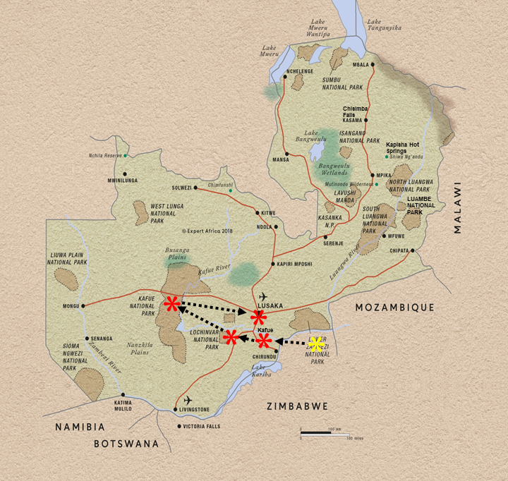
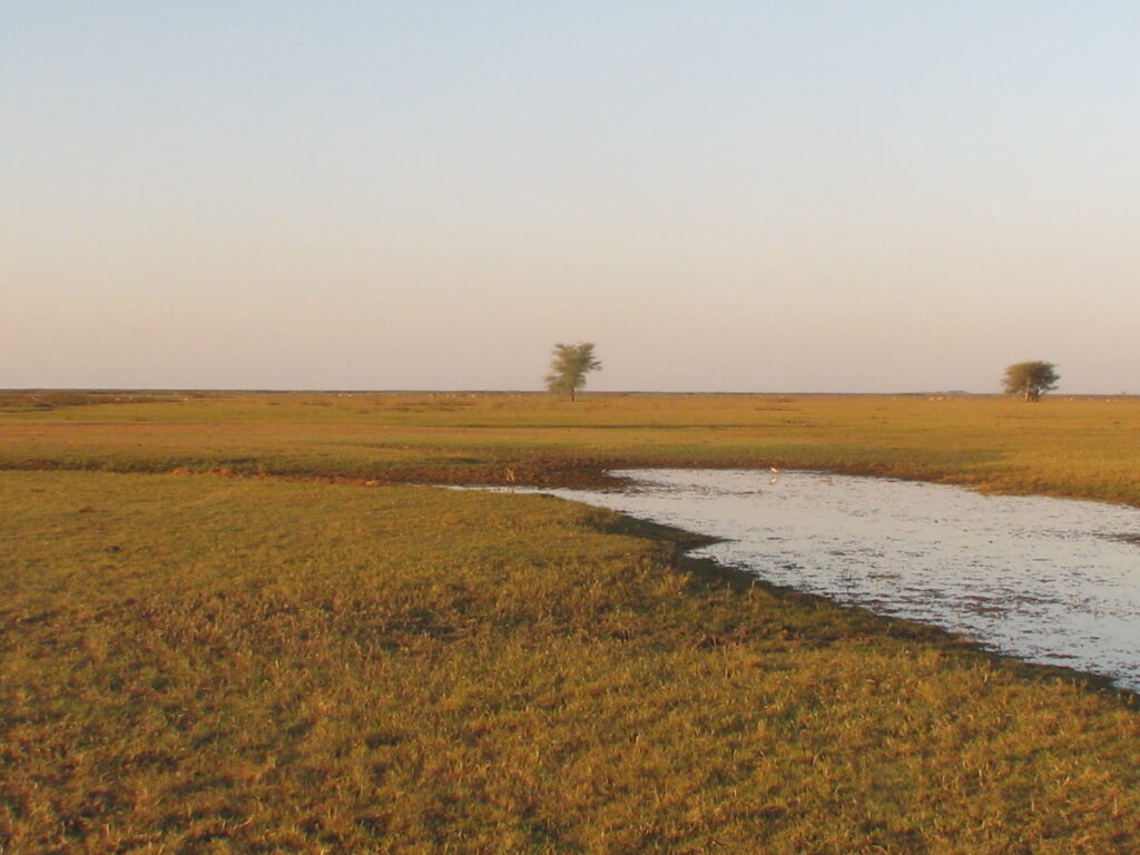
After leaving Lochinvar a day earlier than planned, my next stop was Kafue National Park, located in western Zambia and the largest park in the country. Kafue NP (8,649 sq. mi.), established in 1950, covers a massive area in western Zambia and is centered on the Kafue River, running north to south through the park. Most of the park is covered in miombo woodlands (which I introduced in a previous post from South Africa), which are open semi-deciduous forests of trees adapted to periodic wildfires, but there are scattered open grasslands throughout the park as well, mostly in the form of what they referred to in the local language as “dambo”. Much like elsewhere, these dambos are low-lying areas that over the course of the year collect too much water to support woody vegetation, so instead become grasslands that vary from wet to dry depending on the season, and may even form pools of water at times. Here’s a tilted shot (no, I wasn’t drinking and driving) of a dambo:
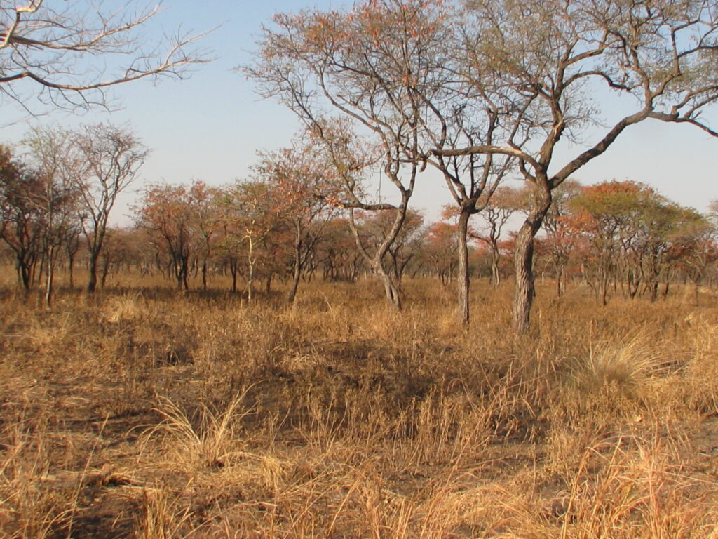
Overall, the miombo woodlands here support relatively dense vegetative cover, which makes wildlife viewing somewhat challenging. I also found interesting that, as I understand it and the empirical evidence supports this, the land managers here attempt to burn every acre every year. I can only assume that this is done to keep the woodland understory relative open for human movement (e.g., so they don’t step on hidden poisonous snakes) and to rejuvenate the grasses and forbs for the grazing animals. Can you imagine such a burn policy in the states? I don’t think so! It is hard enough for land managers in the states on public lands to get approval to burn a tiny, almost insignificant, percentage of the forest and woodlands each year, and the consequence is steadily increasing understory fuel loads and ever increasing occurrence of high severity wildfires. I think we could learn something from the Africans in this regard. Note, because of the frequent burning, these woodlands burn at low intensity and thus low severity, with almost nary a woody stem except the very smallest killed (for better or worse). Here are a few photos of the landscape before and after burning:
Kafue Miombo woodland prior to burningKafue Miombo woodland after burningKafue dambo after burning (note all the small termite mounds)
Like certain other Parks I have visited, both in Zambia and Zimbabwe, this Park has a long history of intensive wildlife poaching, both for ivory and for meat. Consequently, populations of the larger game animals such as elephant, rhino and most of the antelope species along with their attendant large predators (e.g., lions, leopards, etc.) have been dramatically reduced, or even extirpated in the case of the rhino. Fortunately, steps have been taken recently to restore wildlife populations through aggressive anti-poaching operations and the turning over of management of the Park to Parks Africa, the same organization, you may recall, that took over management of Matusadona National Park in Zimbabwe. It is too early to see the results of the change in management, but hopefully in 20-50 years there will be a thriving wildlife community. The owner of KaingU Safari Lodge said that she has already seen changes in the numbers of some species and, importantly, in their behavior towards humans. However, I suspect they have a long way to go, as long-lived species such as elephants have a very long memory, and pass on that history to their offspring. So, I think it is going to take some time before this Park is going to support ideal wildlife viewing. I saw very little wildlife while in the Park and surrounds, other than birds, and thus certainly could not recommend it to anyone seeking a great African wildlife experience. I did see a new primate species, the Yellow Baboon (looks and behaves just like the Chacma Baboon to the south but with a fur coat that is generally more yellow – dah), and a new antelope species, the Puku (a mid-sized antelope associated with wetlands), a new subspecies of the Waterbuck called the Defassa Waterbuck, and a Warthog with the biggest tusks I have ever seen. See the photo gallery below for pictures.
My first campsite was actually outside the Park on the opposite side of the Kafue river at KaingU Safari Lodge, which is across the river from the southern section of the Park. In the video below I show a hilltop view of the Kafue River valley and discuss my campsite and the river, so I will not show pictures here:
One of the most rewarding things I did while camping at KaingU Safari Lodge is take a guided inflatable canoe trip down a section of the Kafue River in front of the Lodge and my campsite. This was a beautiful section of the river flowing through volcanic rocks. The video below is an unnarrated audio-video of my 2-hour canoe trip condensed into 4 1/2 minutes. If you are so inclined, sit back and relax and imagine you are in the boat. Here we go:
I also took a delightful guided morning birding walk with another one of the Lodge guides and picked up another dozen or so new bird species. Here’s a picture of my very knowlegeable guide, who has been guiding people for 23 years in various Parks in Zambia.
My KaingU Safari Lodge birding guide
For my last 2 nights in Kafue National Park I moved north to Mayukuyuku Bush Camp, also located on the Kafue River but in the northern section of the Park. Nothing too remarkable about this site other than it was also situated on scenic section of the river, so I spent my siestas sitting on the river bank under a shade tree enjoying the view and the animals, and spent some time conversing with fellow campers. Specifically, I met and spent quite a bit of time talking to a very nice younger German couple that have spent 1 month every year for the past 12 years backpacking around various places in sub-Saharan Africa. They travel on foot and use public transportation. Brave soles to be sure, and they have had nothing but positive experiences in their 12 years of journeying, with one exception in Gabon. I also met a party of Namibians who have rental cottages on the beach in Namibia for us to rent at wholesale rates whenever we go to Namibia. Here’s a shot of my campsite and sunrise:
Mayukuyuku campsiteKafue River sunrise from my Mayukuyuku campsiteTypical section of the Kafue River (upriver of my Mayukuyuku campsite)
Perhaps the biggest observation of note regarding this Park is the prevalence of tsetse flies. These are nasty biting flies about the size of a deer fly that seem to be attracted to motion and the color blue. Consequently, driving through the uplands attracts these flies by the dozens, and they harrass you constantly by flying into your face, eyes, ears, etc.. More importantly, if you let these guys settle on you for more than a few seconds, they bite with something akin to a poke with a red-hot needle. Needless-to-say, wildlife drives with open windows become a bit challenging and uncomfortable. You end up spending as much time battling the flies as you do watching for wildlife. Fortunately, they seem mostly attracted to motion, so if you stop moving they eventually go away – which doesn’t help too much on a wildlife “drive”. Also, they don’t seem attracted to the riparian environment along the river, so my campsite was relatively free from attack. It’s a good thing too, or I probably would have packed up camp and moved on. Another fortunate thing is that here in the Kafue they apparently don’t carry the parasite for the disease trypanosomiasis (a.k.a. “sleeping sickness”). The last reported case was something like 60 years ago. That’s a good thing or else no one would want to visit this place, including me. Oh ya, they also don’t like the cool weather, so there is a respite at night and early morning. Note, I tested out this theory on my morning guided walk, which was from 7-10 am and we didn’t encounter any flies until after 9.
I’m off back to Lusaka for a day or two and then on to the famous South and North Luangwa National Parks – let’s hope they are tsetse free!
My first destination park in Zambia was the relatively unknown and rarely visited Lochinvar National Park, located southwest of the capital Lusaka and situated on the southern edge of the Kafue Flats, a wide floodplain of the Kafue River. Lochinvar NP (165 sq. mi.), established in 1972, is centered on the river floodplains and the shallow Chunga Lagoon which fluctuates considerably in size with variations in river levels, but the Park also includes extensive marshes, grasslands and wooded uplands as you move south from the river. Kafue Flats is the exceptional ecological feature – much like the Okavango Delta in Botswana – that extends along the river for more than 100 km and is up to 50 km wide in places. The Flats include numerous braided channels of the river along with pools of all sizes, sloughs and extensive abutting marshland and grassy plains that vary from partially flooded to dry in response to the wet/dry annual cycle. Here are a few shots of the ecological gradient from the Kufue flats immediately abutting the marshland to the upland woodlands:
Kafue Flats on edge of marshKafue Flats getting drierLochinvar higher and drier
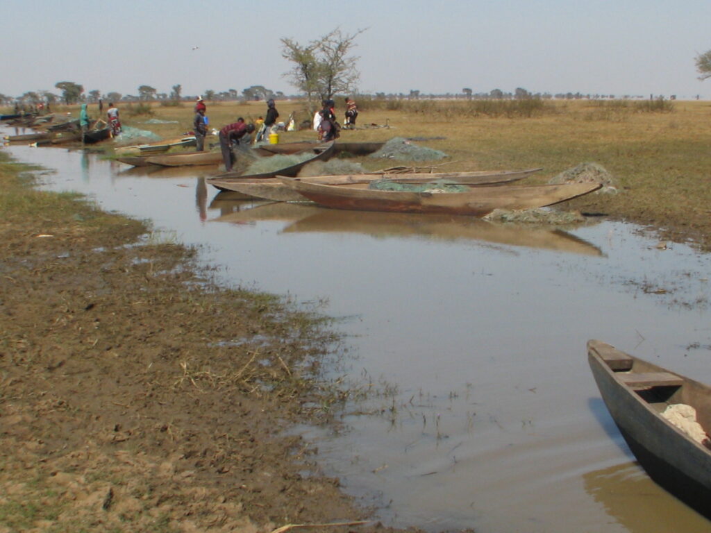
One unappealing aspect of this National Park, at least for my tastes, is that they allow certain commercial resource extraction activities, including a large open-pit gypsum mine in the middle of the Park with heavy hauling trucks going in and out all day and a local commerical fishery by communities located both inside and outside the Park, a boat harbor for the latter shown here:
Mulindu fishing camp harbor inside Lochinvar National Park
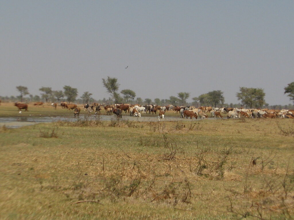
In addition, cattle from the adjacent lands are allowed to forage and access water within the Park, and since the community lands outside the Park are limited in both resources, the cattle make significant use of the Park. To me, it is a bit tragic that a national park has to be used in this way, even though I understand that without these compromises they probably would not have been able to create the Park in the first place, so I guess it is better than not having a Park, but then again I’m not sure in this case what it really means to be a “Park”. It didn’t feel much like a National Park as I passed huge trucks hauling out gypsum and ran into cattle herds on several occasions, including waking up to a herd of several hundred cattle approaching my campsite. Here is the view from my campsite – not what I hope for in a national park:
Cattle on Kafue Flats inside Lochinvar National Park
On the flip side, I took advantage of the local fishermen and had one of them take me out into the marsh and lagoon in his boat, as I show in my video below, so I guess I shouldn’t complain too much.
Lochinvar NP is particularly well known for the large herds of Kafue lechwe, an antelope species endemic to the Kafue flats (i.e., it is found here and nowhere else) that reaches numbers in the many thousands. Everywhere I looked on the flats I saw herds of Kafue lechwe.
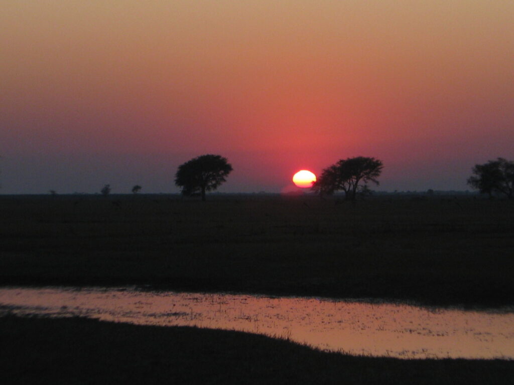
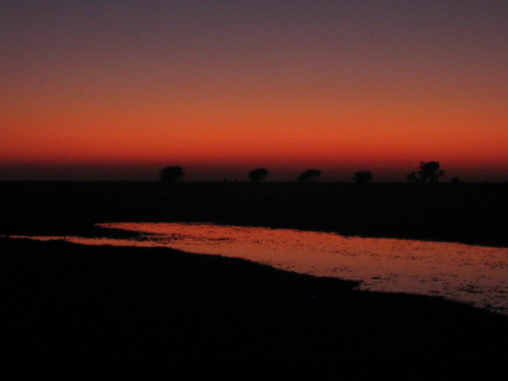
My campsite was what is referred to as a “bush camp” or “wild camp”, which means it was just a spot that I chose for my campsite but without any facilities at all. I simply drove as far as I could out on Kafue Flats until I hit wet grassland and marsh and stopped next to a tree and slough, set up my campsite (i.e., opened the rooftop of the Green Dragon) and sat back to enjoy the amazing sunset, as shown here:
Campsite on edge of Kafue Flats in Lochinvar National ParkSunset over the Kafue Flats in Lochinvar National ParkSunset over the Kafue Flats in Lochinvar National Park (no image enhancement)
Unbeknownst to me, it turned out that the fishermen from one of the local villages located inside the Park used this area to launch their boats from a small channel about a 100 meters away. After setting up my campsite I walked over and talked to one of them and arranged for a boating trip into the marsh the following day. Here’s a composite video of my excursion out on to Kafue Flats in a very small and unstable wooden canoe – if you are so inclined, sit back and enjoy the canoe ride with me:
After my morning canoe ride I decided to change campsites for a change of scenery. I drove to the other side of the Park to the edge of Chundu pool, which is the enormous pool – lake, really – we boated out to, as seen in the video above. However, the one site with a very limited view of the open water was strewn with trash from the local fishermen that use the spot as a harbor. I decided it was too unpleasant and there were no other camping options since it was too long a drive to get back to my previous campsite, so I left the Park.
Overall, while Kafue Flats was exceptional in many ways and my canoe ride was quite memorable, the Park had little else to offer. There was very little wildlife to see, other than the lechwe and the wetland birds – which were great – and there were zero facilities for campers. I saw a couple of baboons and vervet monkeys and I heard a spotted hyena and that’s about it. In retrospect, I’m not sure it was worth the long drive to get here on rough dirt and gravel roads for a single night and a 3 hour canoe trip. Oh well, live and learn.
I opted to drive halfway to my next destination, Kafue National Park, to save me a very long drive the next day, and “wild camped” along the way. My iOverlander app directed me to a “flat spot behind a tree”, which was sort of true, but also put me on some private property with an undetermined owner or owners, so I went to the first house enountered off the road at that point and asked for permission. The person didn’t speak or understand a word of English so I had to use sign language to indicate my request. I felt like Merriweather Lewis communicating with the native Americans on his journey across western North America in 1803. Ultimately, I think I got permission, so I gave the person 50 kwacha, or the equivalent of $2.50 USD, which doesn’t sound like a lot but is in fact a lot here, and went to my chosen flat spot behind the tree. Later, after dark, a couple of other women with a small child showed up and tried to communicate in their native language. I determined that they too wanted some kwacha, so I ended up given them each 50 kwacha and the child a box of crayons and drawing booklet and they went away happy. No other visitors after that, thank goodness.
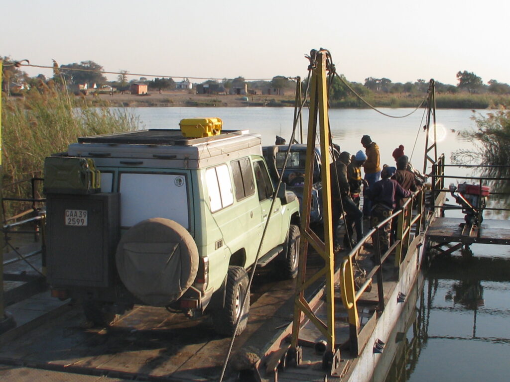
Next morning, I continued on my way and had an interesting pontoon ferry crossing of the Kafue River, as shown here:
Pontoon ferry crossing the Kafue River
Eventually, after driving some distance on mostly pretty decent gravel roads and one sketchy dirt track leading to my final destination, I made it to KaingU Safari Lodge and my campsite. More on that in the next post. Cheers.
Nancy and I said goodbye to Mana Pools National Park and Zimbabwe with sadness since we really loved our visit to the country and its wonderful Parks and people. Our first stop was the border post with Zambia at Chirundu. Fortunately, we engaged a helper and there was almost no one else in the queue so the process went relatively quickly; i.e., 1.5 hours. However, the process to get through this one-stop border post (i.e., leave Zimbabwe and enter Zambia) was the most convoluted and complex process imaginable, and one that we would never have been able to navigate ourselves. In and out of several offices, back and forth between customs and who knows what other offices, stamping this and that, paying this and that, and all done in a whirlwind frenzy. At one point they didn’t want to let us leave Zimbabwe because we didn’t have a police authorized and notorized declaration form stating the vehicle was not stolen. After about 20 minutes of pleading my case they relented and stamped me through that step of the process, but it was touch and go for a minute and I wasn’t sure if they were just trying to get me to pay a bribe or not so I just kept on pleading my case until they agreed. Apparently, this is the worse border crossing in all of southern Africa – who would have known.
After the “crossing” we stopped at Chita Lodge just outside the town/city of Kafue about 1 hour south of Lusaka. The Lodge offered camping on the Kafue River front and seemed like it would be a sweet spot to rest up before Nancy’s departure from Luska. Well, turned out my research on this place wasn’t too accurate and informative. What could have been a really sweet place turned out to be a wild and raucous hang out for the local affluent 20-30 year olds and the ablutions were crap (i.e., no hot water, no water at all in the morning, dirty and smelly). Partying went on until 11:00 pm. Needlesstosay, we didn’t get the nice nights sleep we desired. I’m very sorry I subjected Nancy to this on her last night. Argh!
It was a very sad goodbye to Nancy in Lusaka as she departed Africa and headed home to Colorado. She is my ultimate and perfect travel companion and made everything more special. I’m very sad to see her go. But, the journey must continue.
I ended up finding a very sweet lodge and campground just outside Lusaka for the night (Pioneer Lodge) and had the entire place to myself. Beautiful setting, hot clean showers and ablutions, attractive open air dinning and lounge area, and gardens, and all for $12 USD! Laundry service, dinner (butternut squash soup), and a hand-made tote bag (for carrying stuff) all for $35 USD. Nice deal!
After a few shopping chores in Lusaka, I am off to the relatively remote and poorly visited Lochinvar National Park for a couple nights. Don’t know what kind of wifi service I will have, so I’ll be back online with the next episode when I can. Cheers.
Our 4th country on this overland trip is Zambia, and once again, it is worth sharing a few factoids about this country to put things in better context and to educate myself (and you, if needed) a little about this corner of the world.
As you can see in the map above, Zambia is a land-locked country bordering Namibia, Angola, Democratic Republic of the Congo, Tanzania, Malawi and Mozambique (and it touches Botswana too) located between the latitudes 8-18 degrees south, which in terms of distance from the equator is the southern hemisphere equivalent to, say, Columbia and Venezuela in the northern hemisphere.
Roughly the same size as Texas.
Roughly 20 million people, compared to ~332 million in the U.S..
7 official languages, including Bemba, Nyanja, Lozi, Tonga, Luvale, Lunda, and Kaonde, the latter three being languages of North-Western Province. English is the official language of government and is used for education, commerce, and law.
Government is a democratic republic, which includes independent executive, legislative and judicial branches with a structure similar to the US, except that the legislature is unicameral and thus contains only a single national assembly. Since 1991 it has become a stable multi-party democracy.
Official currency is the Kwacha, but many tourist places (e.g., hotels, lodges, etc.) accept US Dollars.
The major export is copper in various forms, comprising roughly 75% of all exports, and a wide range of less important items include gold and other minerals, tobacco and, you guessed it, diamonds, similar to Zimbabwe.
It is unclear what percentage of the population self-identifies as indigenous, but there some 73 self-recognized tribes.
Zambia’s European colonization history is very similar to Zimbabwe’s. The indigenous Khoisan hunter-gatherers began to be displaced by Bantu peoples some two thousand years ago, and the influx of various Bantu peoples continued through the 19th century. The Portuguese were the first Europeans to sway influence over the region during the 16th and 17th centuries but never assumed any real colonial control over what was then the Mutapa Kingdom. Eventually, the British arrived in 1855 in the form of English explorer David Livingstone, who encountered the spectacular Mosi-O-Tunya falls on the Zambezi River, and called them ‘Victoria Falls’. Subsequently, in the 1880s and 1890s, British companies, specifically the British South Africa Company, began mineral extraction and eventually consolidated the territory into what they called “Northern Rhodesia”, which became a British protectorate in 1924 when the company charter expired. Northern Rhodesia was forced into a federation with Southern Rhodesia (today’s Zimbabwe) and Nyasaland (today’s Malawi) in 1953, but this sparked protests and independence movements, particularly in Northern Rhodesia. The federation was dissolved at the end of 1963 and independence activist Kenneth Kaunda became the president of the new independent Republic of Zambia in 1964.
Did you know that Zambia has termite hills the size of a house – awesome!
Did you know that more than 70 languages are spoken in Zambia – wow!
Nshima is a traditional Zambian dish made by pouring maize (corn) flour into hot water, and it is eaten pretty much every day and with everything, but only with your hands if you want to fit in with the locals – no cutlery please!
Has ~41% of its total land area devoted to national parks, reserves and wildlife management areas – amazing accomplishment and the highest in all of Africa!
As I leave behind Zimbabwe, once again it is time to reflect on observations of the country from behind the wheel. Here are some of my reflections:
#1. The African Runaround. In fairness to this great country, this observation is not really restricted to Zimbabwe, as I observed the same runarounds in Botswana and South Africa. The “runaround” refers to my attempts to purchase almost any item other than food, although I even had some runarounds when it came to finding food stores as well, in which I get directed to one store only to find out that it doesn’t carry the item, redirected to another store, which also dosesn’t carry the item. It’s like this. You go to a store that based on its name and categorization online should stock a particular item, say a jerry can. You get to the store and find out they don’t have it and they direct you to another store. You drive to that store only to find out that they also don’t have the item, but they direct you to yet another store, and so on. Here’s a symbolic representation of the scenario I am describing: A -> B -> C -> D -> A. The surprising and super frustrating thing is that the store clerks don’t seem to have any idea of what the other stores in their locality ,and by the way in the same retail category (e.g., outdoor supplies), actually offer and so you get this circuitous runaround and spend an unbelievable amount of time tracking down where to buy a simple item.
#2. Potholes Forever. I have ranted about this before, but I owe it to anyone reading this blog to repeat and enhance my rant here because the issue has risen to new heights in Zimbabwe. In South Africa, as I pointed out before, they at least have the courtesy to alert you with a sign to the fact that there is an upcoming mine field and that they plan to do nothing about it other than post a warning sign of your doom if you don’t slow down. In Zimbabwe, however, they don’t bother to alert you since you can pretty much expect all secondary roads to be massively potholed. Because of this reality, much of the driving on secondary, supposedly asphalt, roads is with one tire on the edge of the irregular-edged asphalt and the other on the sand/gravel verge (side), meaning that you are perpetually tilted away from the center of the road. On the positive side, it does provide a subtle core workout for the body. Regardless, it is quite clear that road infrastructure planning, management and implementation involves getting some one-time flush of funds to asphalt a road, and to cover as many miles as possible, do so with a single 1-inch layer of asphalt, and then hope it holds up until the next adminstration. Clearly, road maintenance is not on anyone’s radar, other than for the few primary highways, which are in decent shape, save a few exceptions.
#3. Twistin and Turnin the Road Away. One of the realities of driving on “game” drives in the Parks is that you have to go slow, not just so that you can spot wildlife, but because the roads/tracks are so damn twisty. Well, I have studied this issue quite a bit and have concluded that the snake-like twisted course of many Park roads results from complete negligence. To be specific, if a tree falls down across the road or partially into the road, instead of the Park staff ocassionally driving the roads and cutting away the fallen trees, which would take minimal effort in almost all cases, instead, they let drivers make a new track around the debris until it becomes the main track. Over time the road takes on a twisty, turning course simply because no one ever clears a fallen tree from the track. Let me be clear, I don’t mind the twisty nature of the tracks as it feels more “wild”, but I can’t believe that the Park wants all these new tracks being formed. I can’t help but attribute the result to indifference and/or laziness on the part of the Park and staff, which leads me to my next rant. Here are a couple of examples:
A typical fallen tree turned into a new twist in the roadA typical wash out in which the track simply goes into the gully and around the probem
#4. To Staff or Not to Staff? I have commented repeatedly in this blog about the deplorable condition of the Park roads and facilities infrastructure in many of the Parks (but there some excellent exceptions, as noted), and I would normally excuse this because of understaffing and underfunding. However, I have learned through cryptic inquiries that understaffing is NOT the problem, although underfunding may be. In fact, most of the Parks we have visited have a shockingly large staff. For example, in Matusadona National Park we learned that they have 200 people working there, all stationed at the administrative headquarters. In Chizarira National Park we saw a few dozen or more Park personnel at the admin center every time we went by to use the WiFi. In all cases, however, we almost never encountered Park staff out and about in the Park actually working. The one exception was in Mana Pools where there was a crew of 20 workers rebuilding a washed out concrete bridge over a small waterway. Instead, I really hate to say it, but we often saw Park staff just sitting around doing nothing. With the numerous Park staff on hand and with a little work effort and ethic, they could do so much to improve the conditions for tourists in the Parks – if they wanted to. A simple thing like fixing the signage would go a long way. There are so many road intersection signs that have fallen apart or have illegible print on them that without a GPS it would be all too easy to get lost. It many cases it would literally take a few minutes with a can of paint to improve the signage. I really don’t understand the apparent lack of work ethic in the Parks, but perhaps for the workers it is simply a paid job and not a passion, so they don’t do anything unless directed to. I’m sorry to be so critical, but I can’t abide laziness when there is work needed to be done.
#5. The Ultimate Carwash. In the states, we pay a premium for a machine car wash that basically doesn’t do crap but wet the vehicle and make it shine in a few exposed places. However, in Zimbabwe we treated ourselves to car washes in a couple different towns and boy-oh-boy what a washing they do. For anywhere from 10-20 dollars, you get 1-3 laborers working on your vehicle for up to an hour. Power wash, followed by hand scrubbing with detergent, followed by another wash, another hand scrubbing, another power wash, and then a hand drying. And we are talking in and out of every nook and cranny on the top, sides, and underneath the vehicle. Oh, and did I mention that they also degrease and hand clean the engine under the hood and polish the wheels! And, for a couple of bucks more they vacum, hand wash and shine the inside of the vehicle. I’m telling you, this is the delux in car washes. It’s almost worth shipping your vehicle over to this country just to get a car wash!
#6. Happy, despite all things. Like all the African people we have seen and met, the Zibabweans are happy, friendly people. Most enthusiastically wave as you pass by and anyone you meet and talk to is super friendly and welcoming; this, despite the deplorable working and living conditions for the vast majority of the people, especially those living in the rural areas. We learned from conversion with one worker at a lodge/camp that the standard pay for a low-level worker – grounds keeper in this case – is $5 USD/day and supervisors can make up to $20/day. Based on the high cost of food in this country, these are barely living wages – just enough to feed oneself and small family, forget about buying a house or going on vacation. Most of the workers we met had a spouse and 3 or more kids, so how they can get by on these wages is a mystery to me. I suspect in the rural villages things are much worse, as there is essentially no paid labor positions. We learned that in most households the head of the family (males in most cases), and in some cases both spouses, leave their village and home for work in an urban center or perhaps a job with the government (e.g., in a Park) for months at a time and only return home periodically. The kids stay home with their grandparents and go to the local public school. The typical scenario seems to be work away from home for 3 months and then return home for 1 month. Note, every worker we met was excited about the upcoming presidential election to be held on August 23 and adamant about a change in administration. They are tired of the corruption, the empty promises, and failure of the government to actually do things to help the average citizen. All voiced deep concern and frustration over the declining economic conditions in the country. Despite all this, they all smile and are happy to meet you and seem generally happy people. SO, go to Zimbabwe, spend some money, and meet some of these nice, happy people.
#7. To Give Or Not To Give? Given the deplorable living conditions I described above, it is no wonder that children in the villages almost universally beg for food, treats, money, or whatever when you pass them by. My heart weeps every time I see young children run out from their mud and thatched, little rondavel hut to the roadside and reach out with their tiny hands and beg for food or treats as I pass them by. However, to stop and give each child something is simply not possible, as it would take a truckload of gifts to satisfy all the children encountered. With my limited supply of gifts for children, namely pencils and crayons, how do I choose when to stop and when to pass them by. It’s the same dilemma I faced with the roadside produce stands. How do I decide which child gets a gift? When a raft load of kids rush out from a village it’s a nobrainer, as I don’t have enough to satisfy them all, so I sheepishly pass them by and wave – which is not the response they are after. I am embarrassed and guilt-ridden waving at these children when they are reaching out begging, but what else can I do? So I delay and delay handing out gifts until I see the most desparate, needy child that is either alone or with just a few siblings. But then I face another dilemma. Is it fair to give a child a pencil or crayon without also giving them some paper to write or draw on? Unfortunately, I did not come prepared with paper to give out, so my pencils and crayons remain on my dash taunting me every time I pass by a begging child. However, I just purchased some small writing/drawing booklets and am now prepared to start handing out pencils/crayons and paper. But I still face the dilemma of choosing the recipients of my meager gifts. Perhaps instead I should pick a small village and find the primary school master and give all the pencils/crayons and paper to the school. But then I would probably feel equally or more embarrassed to deliver so few items to a school when I have the means to do so much more, and they know it. If anyone has some good advice on how to resolve this dilemma, please share?
#8. Glorious Parks. Whatever you might say about Zimbabwe, one thing is for certain, they have magnificant Parks. Moreover, each Park has a unique character and distinctive features. Zambezi has the might river front, Hwange has the amazing water holes, Chizarira has the spectacular escarpment, Matusadona has the beautiful lakeside, and Mana Pools has the phenomenal Zambezi River floodplain and pools. The wildlife is incredible and the terrain is highly varied with lots of mountains, plains and rivers to keep your interest. All this combined with friendly people makes this a wonderful place to visit.
After resupplying in the town of Kariba, we headed to the most famous park in Zimbabwe, Mana Pools National Park, located on the lower Zambezi River on the border with Zambia and its Lower Zambezi River National Park. Here, the floodplain turns into a broad expanse of lakes and sloughs after each rainy season, and as the lakes and sloughs gradually dry up and recede during the dry season large animals flock to the shores and few permanent pools in search of water, making Mana Pools one of Africa’s most renowned game-viewing regions. Mana Pools NP (2,612 sq. mi.), declared as a national Park in 1975, was inscribed as a UNESCO World Heritage Site in 1984 based on its pure wilderness and beauty. Mana means ‘four’ in Shona, in reference to the four large permanent pools formed by the meanderings of the middle Zambezi.
We booked an exclusive campsite in Mana Pools called Nkupe, which is the most remote of the exclusive sites and beautifully situated on the banks of the Zambezi River, with expansive views over the river and floodplain and across the river to the Zambian escarpment (note, we shifted our actual campsite location within the site between nights, so the photos below may look like we are at different sites, but we are not). Here are a few shots of our campsite and the state-of-the-art pit toilet:
The most spectacular aspect of our campsite, in addition to the incredible morning and evening hippo and bird serenade (through in a few hyena’s to boot), was the sunrises and sunsets, especially the later. Here are few shots that don’t do justice to the sublime scene:
Mana Pools Zambezi sunset from Nkupe campsite (with campfire)Mana Pools Zambezi sunset from Nkupe campsiteMana Pools Zambezi sunset from Nkupe campsite with elephants
In addition to the sublime setting, we also ate like royalty thanks to Nancy’s ingenious cooking with the supplies on hand. I added very little to the cuisine other than some yeasted bread made in the Dutch oven, as seen here (note, I failed to take a picture of my Dutch oven bread at Mana Pools, so the photo below is from a similar effort at Chizarira):
Dutch oven yeasted bread (not bad, hey?)
In addition to the river and floodplain, the Park consists of extensive areas of mopane woodland (which you are now all too familiar with) and bushveld on the relatively flat valley floor, interspersed with patches of dry forest growing on outlying remnants of Kalahari sand. However, the floodplain area along the river, in which our campsite is located, is the most unique and interesting part of the landscape. This unique setting extends in from the river several kilometers and consists of a series of abandoned river channels (from the days before the regulated flow of the river from upstream dams) interspersed with old islands and pans. The riparian woodlands in this floodplain area support a diversity of tree species, but one gr\oup of trees known as “albida” have an interesting “reverse cycle” in which they lose their leaves during the rainy season and are in full leaf and fruit during the winter and spring dry season, providing desirable food for many animals during the hottest, driest times of the year. The riparian floodplain woodlands during this time of year looks like a muncipal Park, as the huge trees are spaced out and the understory is almost completely cleared of leafy shrubs, leaving only closely cropped grass and bare ground. Later in the dry season around September-October all the remaining grass and stubble will be consumed by the abundant termite colonies, leaving only bare ground under the spacious canopy trees, only to be flushed with new lush new growth as soon as the rains begin in November. Here are some photos of the landscape:
Mana Pools Zambezi River floodplainMana Pools Zambezi River floodplainMana Pools Zambezi River floodplain sloughMana Pools Zambezi River floodplain and one of the permanent pools (with hippo)Mana Pools Zambezi River floodplain and the Mana River
The open Park-like setting of the riparian floodplains makes for ideal wildlife walks, so Nancy and I took advantage of a credit we had on our account due to overpaying the Park fees online, and went on an early-morning guided walk with a “ranger”. The day begin with a partial pride of 7 lions on the hunt (and a couple of spotted hyenas close behind) crossing the track in front of us in full hunting formation. One half-hearted attempt at an impala was quickly given up and then we lost them to the riverfront, so we went on to meet our ranger guide. As you will see in the video below, our guided walk began quietly with a hippo emerging from a pool full of crocodiles and wading birds (mostly yellow-billed storks), but soon evolved into an exciting wild dog hunt. We spotted 6 wild dogs on the hunt (we were told that the remainder of the pack must have been back at the den taking care of the newbord pups) and were able to stay with them for about 45 minutes while they moved through the open understory, made an attempt at an impala (but gave up quickly), rested, resumed the hunt, and then rested again. After some time, we concluded that they could be resting for a long time so we abandoned them to visit one of the “mana” pools before returning to camp. The video below of the wild dogs sort of sucks, in part because we kept our distance so as to not interfere with the hunt, but at least it will give Mook something to drool over as he was keen to see wild dogs on our visit to Botswana where we were unsuccessful. Sorry Mook! Here’s a photo of Nancy and our guide:
OK, that wraps it up for Zimbabwe. Next stop Zambia and Nancy’s sad departure.
Photo Gallery:
Hippos outnumber people here, probably by several-fold, but I failed to get any photos so you’ll have to take my word for it. Instead, here are a few other photos I think capture some magical moments:.
One of the radio collared elephant bulls feeding on invasive in one of the Mana Pools10 Bullseye butts to stare at (waterbuck)Mana Pool reflectionsDance of the Baobabs
Into the unknown no longer! After leaving Chizarira and the amazing cliff-top camping on the edge of the Zambezi River valley escarpment and the Mucheni River gorge, we decided to go to the other extreme and spend time on the shores of Lake Kariba in Matusadona National Park, which just so happened to be more or less on the way to our next destination Park, Mana Pools National Park.
Our original plan was to backtrack west past Binga to the port town Mlibizi at the western end of Lake Kariba, spend a couple of nights R&R, and then catch the 22-hour long overnight ferry to the eastern end of the Lake to the town of Kariba. However, we were unable to book a spot on the ferry because of vehicle height limitations (i.e., the 3 slots for vehicles exceeding 2 meters in height were already reserved), so we instead kept on driving east from Chizarira on the so-called “back road”, which was reported to be a long and tortuous drive on a terrible road. However, much to our surprise and delight, the road was in pretty good shape, with only a few minor rough spots. Moreover, for 7 hours of driving we only saw 4 other vehicles, 3 of which were trucks hauling goods, and these were all near the beginning of the day’s drive. Thus, for probably 6 hours or so we saw no other vehicles, even though there were a fair number of pedestrians from the local villages scattered along the way. We had one river to ford en route, since the bridge was long since washed out. We had a small audience during our crossing, probably because they had rarely seen other vehicles on this road, let alone someone ford the river. Turned out the river bottom was solid sand and the Green Dragon cruised across as if it was an insult to the vehicle’s ego. Here’s a photo of the crossing point:
River crossing on way to Matusadona National Park
We detoured off the main through road (which ends on the main highway that leads to Mana Pools and elsewhere) to go to Matusadona National Park on the shores of Lake Kariba. The Park is the first in Zimbabwe to fall under the African Parks mandate, which is a partnership between the National Parks of the resident country (Zimparks in this case) and this NGO. African Parks has helped “rescue” several Parks throughout Africa. Essentially, at the request of the resident government, African Parks comes in an takes over management of the Park and dramatically improves pretty much everything from road infrastructure to tourism facilities, such as first-class campsite accommodations, and the general administration of the Park. African Parks took over management of Matusadona in 2019 with a 20-year agreement and the improvements are already obvious to us.
Proclaimed a National Park in 1975, Matusadona (1,470 km2) was once a conservation stronghold for African elephant and black rhino, and a sought-after tourism destination. But over the years, financial resources slowly diminished and poor management impacted the parks’ wildlife. Limited road networks and manpower left some areas entirely unpatrolled resulting in rampant poaching which virtually eliminated the black rhino population and severely reduced the elephant population. As with Chizarira, the widlife populations are just now starting to recover. As an example, a recent survey counted over 2,100 hippos along the Park’s lakeshore, up from a mere 250 in the 1980’s.
This remote and rugged Park gets its name from the rolling Matusadona hills that form part of its water-rich landscape. The Park is flanked by Lake Kariba to the north, the peaks of the Matusadona hills to the south, and two perennial rivers, the Ume and the Sanyati, to the east and west. Driving here, we passed down through the Matusadona hills on a very windy road that coursed up and down across countless streambeds, most of which were dry this time of year. Much of the mountainous inland portion of the Park is dominated by mopane woodland, but the hills descend to flatland near the shores of the lake with mixed woodland species. One of the iconic features of the Lake is the kilometer-wide “drowned forest” comprised of the trees that died when the lake was filled but still remain today, even after more than 50 years, as standing dead trees or snags. Here are a couple photos of the Park:
Matusadona HillsThe “drowned forest” on the shores of Lake Kariba
For Nancy and I, the highlight of the Park was the spectacular public campsite situated out on a peninsular with huge shade trees, modern ablution facilities (including hot showers!), uninterrupted views of sunrise and sunset across the Lake, hippos serenading us all evening and morning, and much more. Here are a few photos:
Matusadona campsiteMatusadona campsiteMatusadona campsiteMatusadona campsiteMatusadona campsite at sunsetMatusadona sunset from campsite
A perpetual breeze off the lake combined with perfect temperatures kept the environment most comfortable. We felt little need to abandon our serene campsite setting for drives on the Park’s few roads, so we spent an afternoon and all of one full day relaxing and enjoying the spectacular setting, and adding several new bird species to the list. Of course, the evenings were spent around a campfire, with countless stars in the sky, Venus so bright that it was reflecting off the surface of the lake, and a little musical entertainment by yours truly. Here is a short snippet of my evening campfire serenade to Matusadona and Lake Kariba:
Instead of another long and slow drive to another unknown stop en route to Mana Pools, we opted to spend the money on a barge ferry that was returning to Kariba after delivering supplies to the Park and had room to accommodate a vehicle. Six hours of dusty driving or 6 hours relaxing on the barge while birding and brunching? The choice was a no-brainer. Here’s a 6-minute video of our Lake Kariba barge/ferry journey:
After our ferry journey, we ended up staying in a campground just outside of Kariba within a strange lakeside association that is a combination of residential homes, rental chalets, restaurant/bar and this campground. Rather than search for a more secluded setting, we opted to settle here for the night and take advantage of the restaurant, To our surprise, we had a very large hippo grazing on the grasses in our campground after we returned from the restaurant, and prior to dinner there were zebras grazing in between the buildings – strange place or should I say strange animals.
We are off to Mana Pools National Park. See you there!
After a brief safari respite on the shores of Lake Kariba, we headed to the remote and rarely visited Chizarira National Park, located in northern Zimbabwe south of Lake Kariba. Chizarira NP (770 sq. mi.), established in 1975, is the 3rd largest national park in Zimbabwe and is situated on the Zambezi escarpment, which falls steeply some 2,000 feet to the Zambezi River valley floor and offers magnificent views towards Lake Kariba, 25 miles to the north. Rivers such as the Mucheni and Lwizikululu have cut almost sheer gorges in the escarpment, making for some spectacular scenery, as you will see if you watch the video below.
The landscape in this Park is dramatically different from that of Hwange. The landscape here is craggy near the escarpment, intensely incised by spectacular gorges and awesome gulches, with lush vegetation found in the impenetrable valleys because of natural springs. Grading south away from the escarpment are hills and valleys puncuated with drainages constituting the headwaters of the rivers that cut through the escarpment. Here are some photos showing the varied landscape:
Mucheni River gorgeChizarira gorgeChizarira landscapeChizarira landscapeChizarira landscapeChizarira landscape
As you may have noticed in the photos above, owing to the Park’s history, the landscape is rather heavily forested today, albeit with mostly young trees. Specifically, it appears that prior to independence in 1980 much of the Park was burned regularly with high severity fires (perhaps for many hundreds of years by the natives), and this was especially true during the war of independence between 1965-1980. Consequently, while miambo woodland dominated land cover near the escarpment, it quickly gave way to a mosaic of mopane woodland and open grassland savannah. Indeed, much of the Park was open grassland savannah. After independence there was almost no management of the Park and thus very little prescribed burning took place. Consequently, much of what was open grassland regenerated to dense woodland, which dominates the landscape today. Recently, the Park resumed burning with an aggressive acreage target every year, but they are burning with too low an intensity so that at best only a couple percent of the small woody stems are getting killed. Unless they start burning at much higher severity they will never recover the open grassland savannah they presumably want. Of course, one must ask whether they should seek to create an environment – open grassland savannah – that is not what nature wants to create. Nature wants this to be a rather dense woodland I think. Ah, the challenges of managing a landscape with such a complex ecological and anthropogenic history in the current socio-political context. I’m glad I am sort of retired! Here are some photos of the post-burn landscape:
Chizarira NP is arguably Zimbabwe’s most remote wilderness area. Unfortunately, the remoteness and low visitation of this Park, including the lack of lodges and safari operators, has meant increased risk from poachers in recent years and many wildlife populations have seriously suffered as a consequence. Accordingly, we saw very little wildlife on the few accessible drives in the Park. A partnership betweent the Park and an NGO called National Parks Rescue has mostly put a stop on the poaching, so they say, but it has only been 5 years since the anti-poaching effort began so the wildlife populations have not yet recovered, so most of the big game species are sparse and hard to find.
There are very few roads in the Park and most of them have apparently not been maintained since they were built, and thus they are essentially no longer drivable. Consequently, we had to content ourselves with driving the few accessible roads, which occupied us for the first couple of days. One of the so-called accessible roads even challenged the Green Dragon a little – but only a little! I actually had to put the troopie in 4×4 low for the first time to cross a gulch. Another so-called drivable road along the escarpment to a spectacular veiwpoint was just barely drivable, with numerous bolders strewn across the “track” and downed logs, some of which we had to remove to pass, as depicted in these photos:
Crossing a gulch in Chizarira (steep entry into and out of gulch not visible here)Clearing logs from one of the so-called accessible roads in ChizariraOne of the so-called accessible roads in Chizarira (do you see a road?)One of the so-called accessible roads in Chizarira (do you see a road?)
Nevertheless, the remoteness and low visitation are the very things that attracted us to this Park. In fact, on our first day and night in the Park, we were the only visitors! Yes, that right, we had 770 sq. miles of Park entirely to ourselves for a day, except for the Park staff of course (of which there were quite a few for some unknown reason given the lack of facilities and tourism). On day two another self-drive party arrived, so it started to get crowded. Needless-to-say, on our drives through the Park we saw nobody, except for a 3-person team of researchers studying lion and elephant in the Park. Of course, most visitors with any sanity would not have tried to drive a couple of the roads we drove, so perhaps it is no surprise that we didn’t run into the one or two other visitors to the Park.
Our campsite was called Mucheni View and was situated right on the edge of the escarpment at the mouth of the Mucheni River gorge. The video below will do the talking I hope, but just let me say that Nancy said that this was in her top 3 favorite campsites of all time – that’s saying something! Unbelievable view, no bugs, perfect temperatures day and night, nice facilities (i.e., ablutions, gazebo, brai, water) – what more can you ask for?
Chizarira Mucheni View campsiteChizarira Mucheni View campsiteNancy enjoying the view from our Mucheni View campsite
One of the greatest things about our campsite in Chizarira was the night sky. We are talking seriously dark sky as there is literally no light pollution for hundreds of miles and the arid climate this time of year makes for superb night sky viewing. The Milky Way never was more visible and spectacular in its display. Here is a nice photo Nancy captured of just after sunset with our campfire in the foreground and the escarpment in the background:
Here is a short composite video of our campsite and the escarpment:
OK, we are on to an unknown destination, as we have 3 days and nights to kill before going on to Mana Pools National Park, where we have reservations. Into the unknown we go! We’ll see you on the other side, hopefully!
Photo Gallery:
Just a really beautiful tree in ChizariraChizarira escarpment looking eastLilac-breasted rollerBaobab and CandelabraWaterbuck
After leaving Hwange National Park, we headed to the town of Binga on the shore of Lake Kariba for a little relaxation by the lake and resupply before heading to our next national park (sorry, no map for this one). Lake Kariba is the world’s largest artificial lake and reservoir by volume. Lake Kariba lies along the border between Zambia and Zimbabwe. It was filled between 1958 and 1963 following the completion of the Kariba Dam at its northeastern end, flooding the Kariba Gorge on the Zambezi River. The lake runs 129 miles long and averages 25 miles wide. A number of fish species have been introduced to the lake, notably the sardine-like kapenta (transported from Lake Tanganyika), which now supports a thriving commercial fishery. Kapenta, in turn, now support a thriving game fishery, particularly tigerfish, which was among the indigenous species of the Zambezi river system.
We had a nice stay in Binga at the Masumu River Lodge. Contrary to my pre-trip internet research, it turned out that the lodge no longer accommodates self-contained campers, like us, but we talked the manager into letting us camp on site anyways – since there was nobody else at the lodge. The lodge is situated on a prominent rocky headland protruding out into one of the bays of Lake Kariba in a spectacular setting. The restaurant/bar/lounge area is built into the rocks of the headland with beautiful matching stonework. Nancy and I took advantage of the outdoor lounge area both days during our stay, especially since we had the place to ourselves. We also treated ourself to a local fish (freshly caught from the lake) fish-and-chips dinner – which was private as we were the only guests. Correct that, we actually had abundant guests the entire time, but they were of the rock hyrax kind, as shown below. Our campsite was situated down the hill a few hundred feet from the restaurant/bar/lounge in a nice shaddy lawn area and next to one of the chalets that we were able to use for ablutions. Here are a few photos of our stay:
Our Binga Masumu River Lodge campsiteBinga Masumu River Lodge verandaRock hyrax attendant (one of many- at Binga Masumu River LodgeSunset on the veranda at Binga Masumu River Lodge Sunset at Binga Masumu River Lodge
Otherwise, there is not much to report about our brief stay in Binga. We made the trip into town from the lodge and got the Green Dragon washed, stocked up on some food, mostly produce, supplies, refueled and visited a local women’s collaborative craft shop, where Nancy purchased a couple of baskets made by the local women. Here is a photo of a woman weaving what will become a table.
Basket weaver at Binga Women’s Craft Center
I hate to end on a bad note, but in fairness to the spirit of this travel blog, I must report that the road to Binga from the main highway between Victoria Falls and Bulawayo was deplorable for much of the way. It was ostensibly tarmak, but in reality only the center 8 feet of the roadway had some asphalt on it, albeit with more potholes than asphalt, and the verges (sides) where rough sand and gravel, much of which was corregated. Needless-to-say, it was not a very pleasant drive. What I can’t comprehend is why they would lay, at most, a 1-inch thick layer of asphalt and expect it to last more than a few years, and then walk away from the road without any attempt at maintenance. I guess money, or the lack of it, and politics are the likely reasons. As the manager of the Binga lodge put it: there’s the 1st world, the 3rd world (what happened to the 2nd world?), and then there’s Zimbabwe – the “lost” world. Here’s proof of my rant:
The “beautuiful” road to Binga
OK, we are off to the remote and rugged Chizarira National Park. See you there.