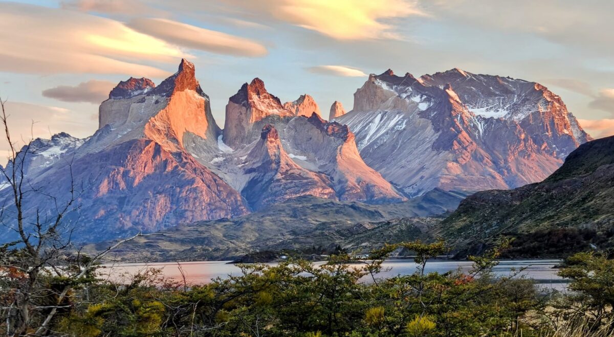
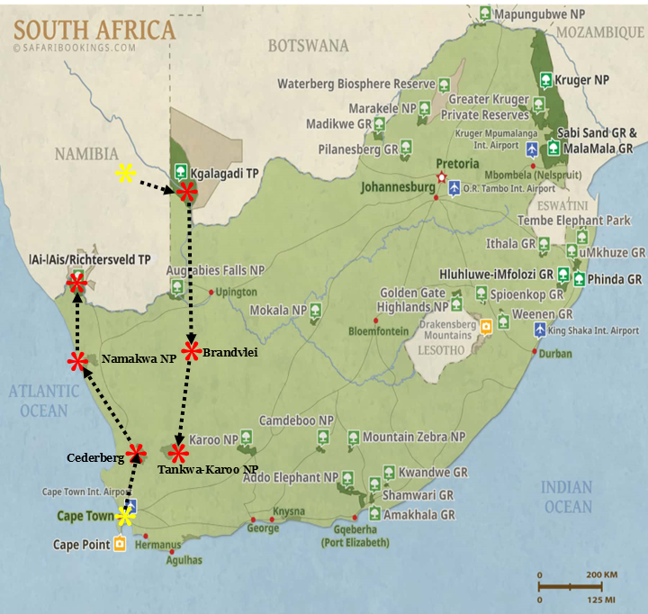
After leaving the spectacular Tankwa Karoo, we head south to Cape Town and Table Mountain National Park.
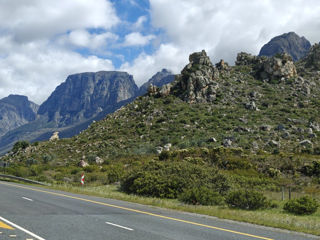
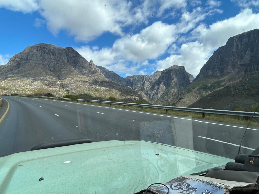
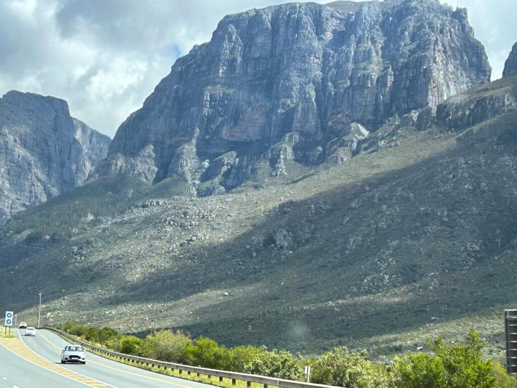
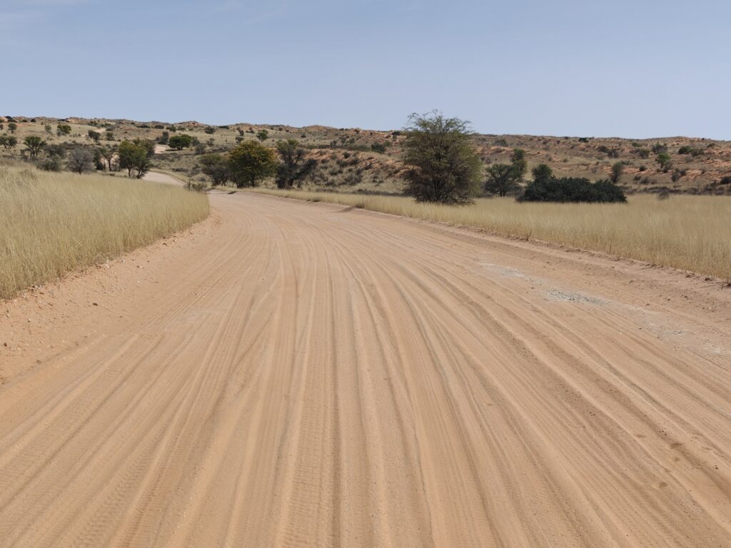
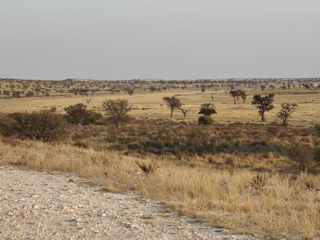
Leaving Tankwa Karoo basin we travelled down through the Cape Fold Mountains, which are a series of mountain ranges that run along the southern and western coastlines of the Western Cape Province in South Africa and south and west of the Great Escarpment that rings all of southern Africa. The Roggeveld escarpment in the Tankwa is part of that Great Escarpment. Anyways, driving through the Cape Fold Mountains was truly spectacular. Steep, rocky mountains with lush valley bottoms reminiscent of places like Yosemite and Zion, or perhaps the Swiss Alps – just amazing rugged mountains. Here’s a few pictures but they don’t do justice to the visally striking landscape:
Driving through the Cape Fold MountainsDriving through the Cape Fold MountainsDriving through the Cape Fold Mountains
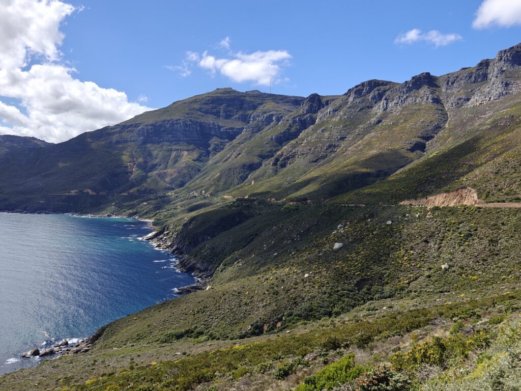
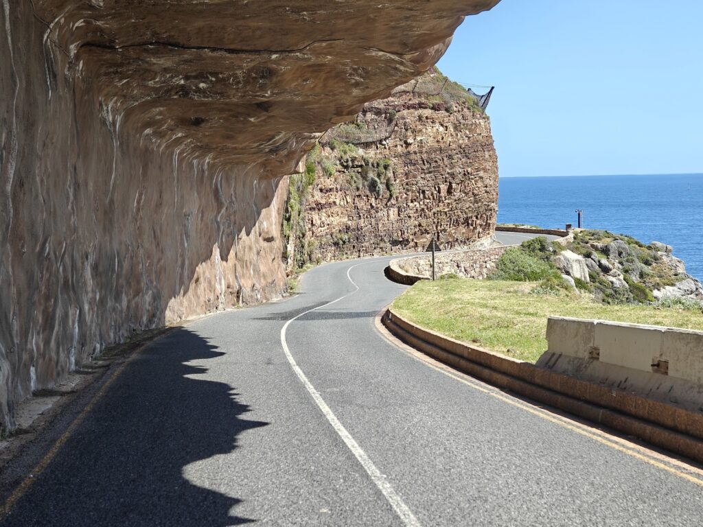
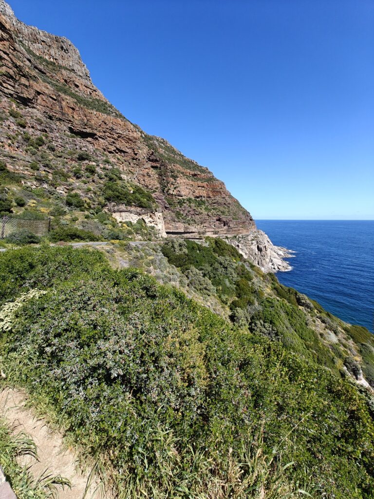
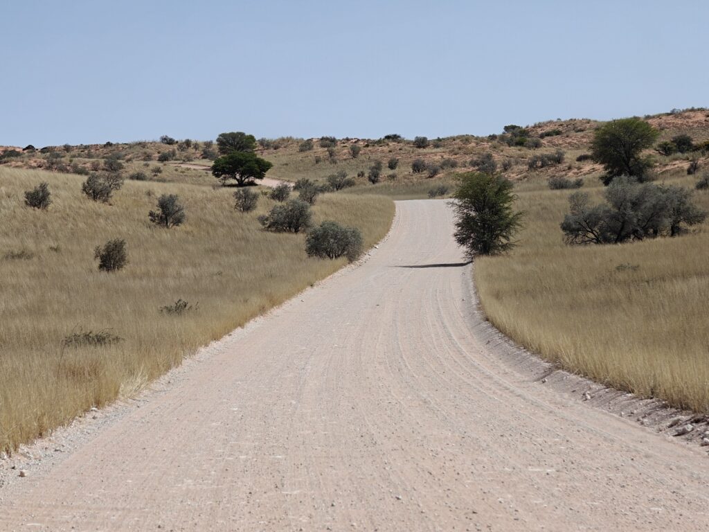
We traversed the busy highways and streets of Cape Town and made our way out to Table Mountain en route to Cape Point – this is the penninsular jutting out from the coastline at Cape Town, which sits at the neck. We took the western shore route that traverses the steep mountainside along the coast and past stunning seaside communities in the small bays and inlets. However, the most stunning part of the drive is kown as Chapman’s Peak drive, and this portion of the road hugs the cliff face and is even carved into the overhanging cliff in places. Here’s a few photos of this incredible drive:
Driving out to Cape PointChapman’s Peak drive out to Cape PointChapman’s Peak drive out to Cape Point
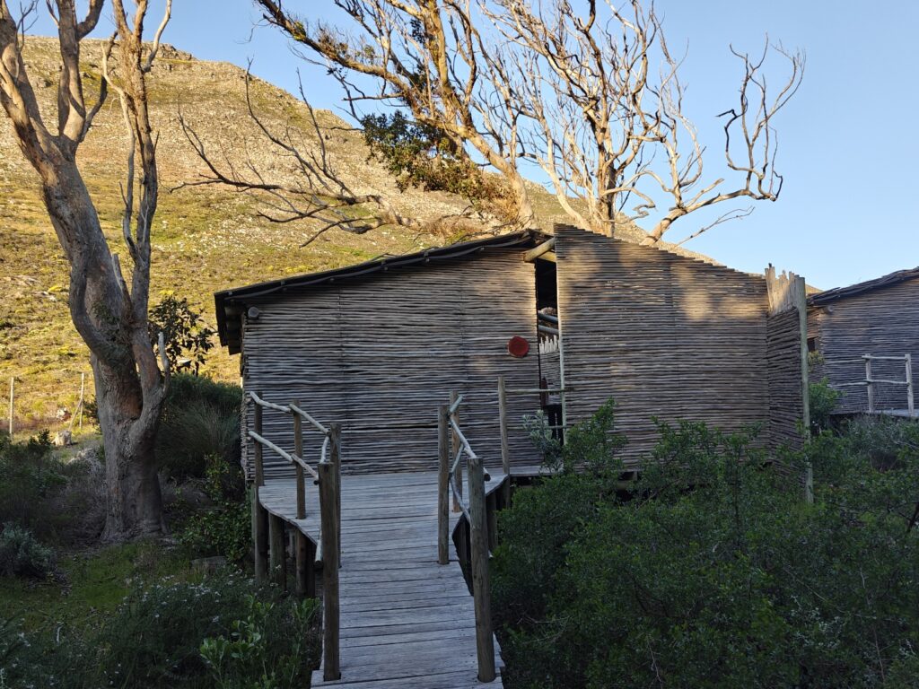
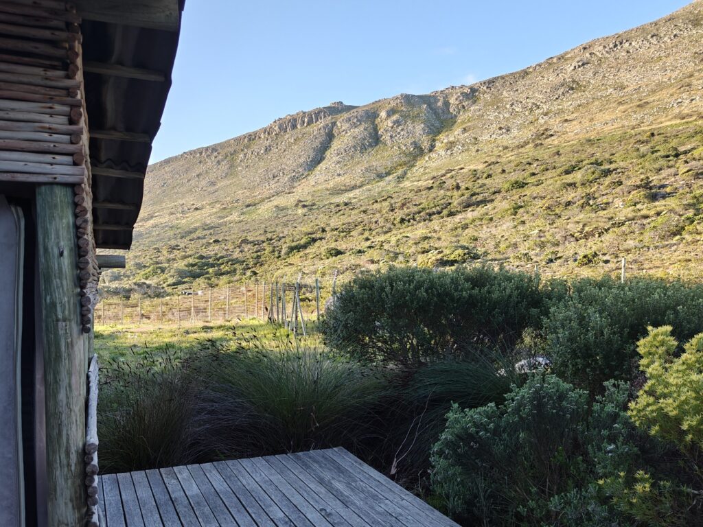
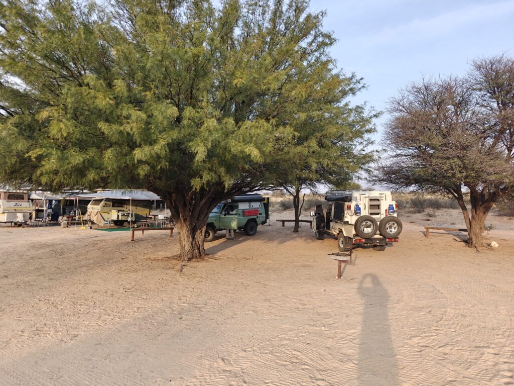
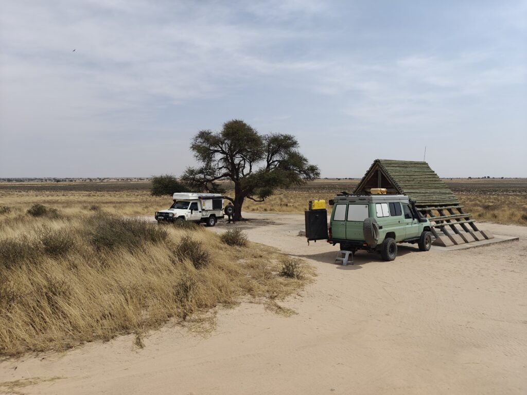
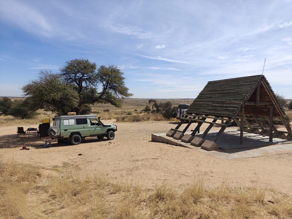
We stayed three nights at one of the Park sites called Smitswinckle (Smits for short), which is a platform tented camp situated at the head of Table Mountain. Smits is a small tented camp with only 6 tents. Each tent comes with two beds, toilet and shower, and there is a share boma (kitchen with seating). Pretty sweet digs while we explored Cape Point for two full days. The camp is nested in a large grove of trees, which functions as a forest oasis for birds in the middle of the fynbos vegetation of the Cape. Here’s a few shots:
Smits platform tentView from our Smits platform tentSmits boma
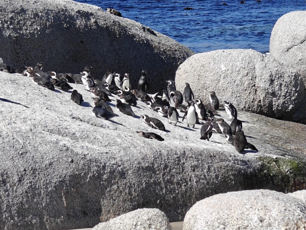
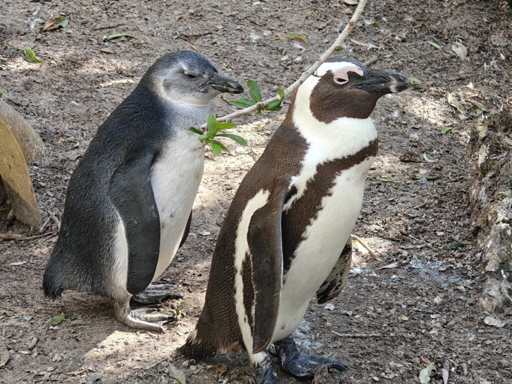
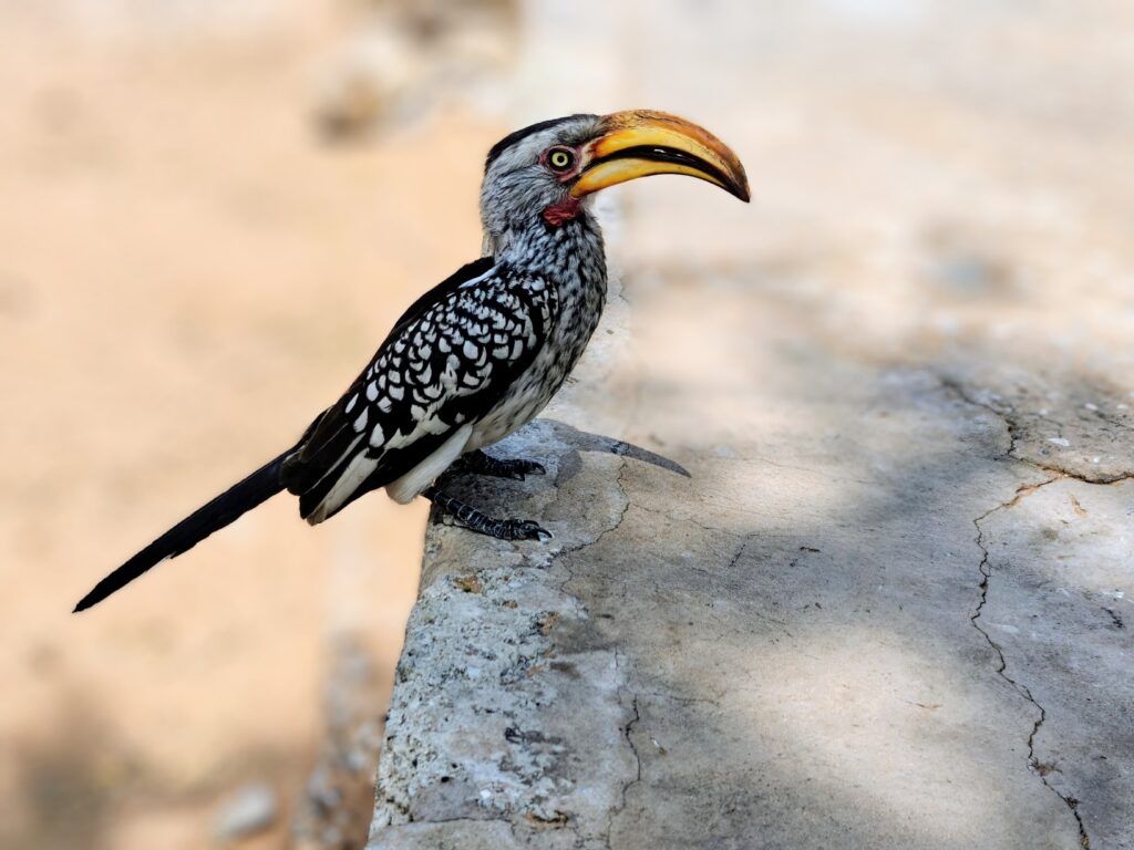
En route to Smits, we did the obligatory stop off at Boulder’s Beach to see the African Penguins – cool as usual:
African penguins at Boulder’s BeachMomma and babyblue young African Penguin at Boulder’s Beach
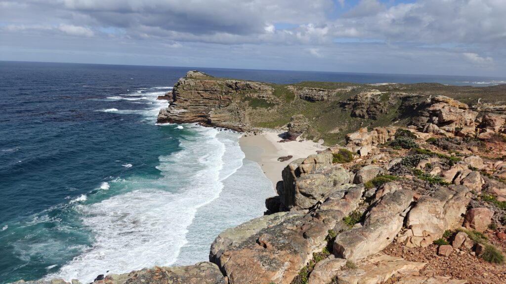
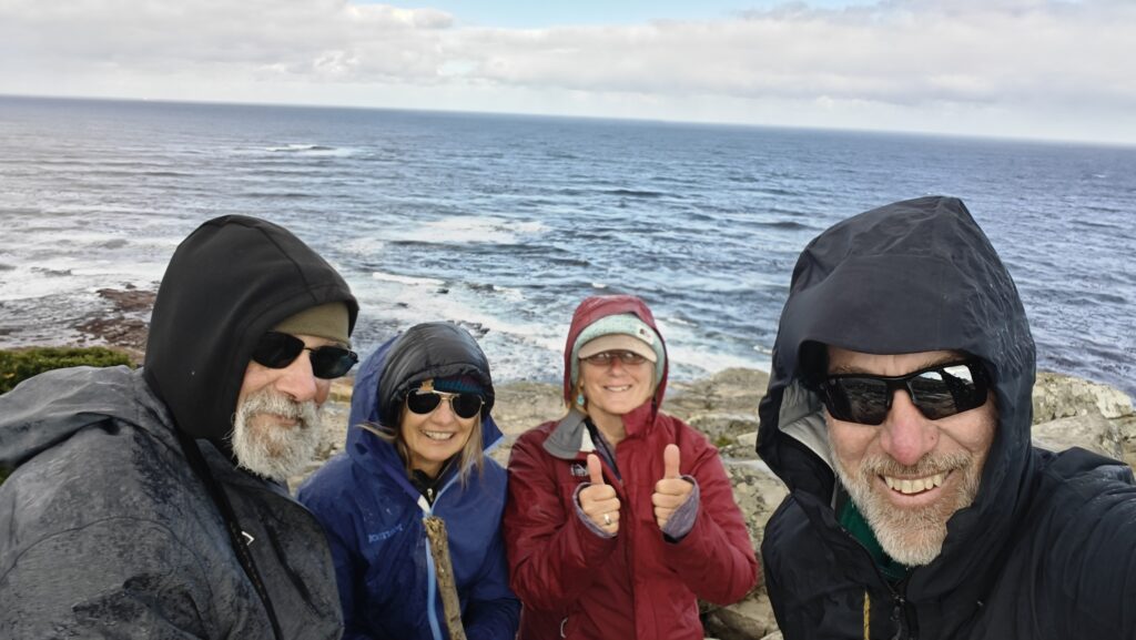
We had some amazing hikes at Cape Point. The Spring wildflowers of the coastal fynbos were in their full glory and the steep cliffs and rugged coastline were as stunning as ever. We all made it out to the Cape of Good Hope at the tip of Cape Point amidst the wind the occasional band of showers:
Cape of Good HopeThe gang on the Cape of Good Hope (not cold, just windy)
I have been out to Cape Point several times now – and each time I am awed by the beauty of the place – but this is the first time I have visited during the peak of Spring wildflowers in the coastal fynbos, which was phenomenal. Once again, I took too many photos to include in this post, so I am giving you a slideshow again. Note the colorful flowers of the fynbos in Spring, the surprising critters, and the amazing oceanside cliffs. Unfortunately, my slideshow maker can’t handle photos in both landscape and portrait mode, so the portrait photos are all cut off on the top and bottom, but you’ll still get the jist of it:
Sadly our visit to the KTP had to come to an end, so we headed south to visit the Tankwa-Karoo National Park (hereafter, simply Tankwa) en route to Cape Town and the final leg of this year’s journey:
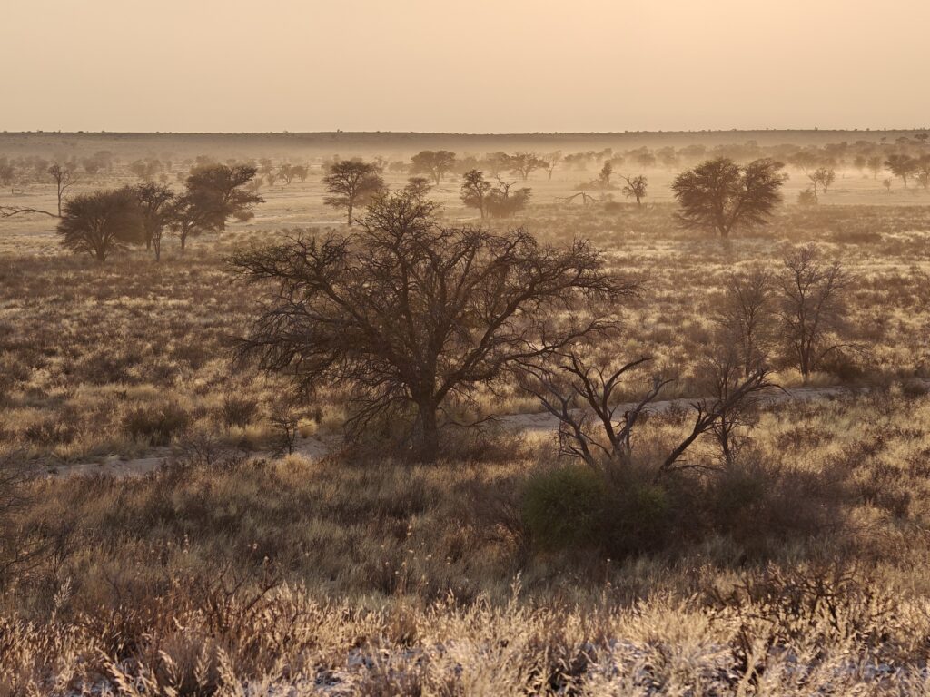
First, let me provide a little natural and cultural history context for this post. The Tankwa is one of several South Africa parks dedicated to conserving the expansive Karoo ecosystem. You may recall from previous posts during the first year of my African overland journey that the Karoo is a special place in Africa – and the world for that matter. It is an expansive semi-desert ecosystem encompassing more than 150,000 square miles of land in South Africa, spanning much of the Northern, Eastern and Western Cape Provinces. The Karoo is surprisingly diverse and is ecologically divided into several sections, each with its own characteristic flora and fauna.
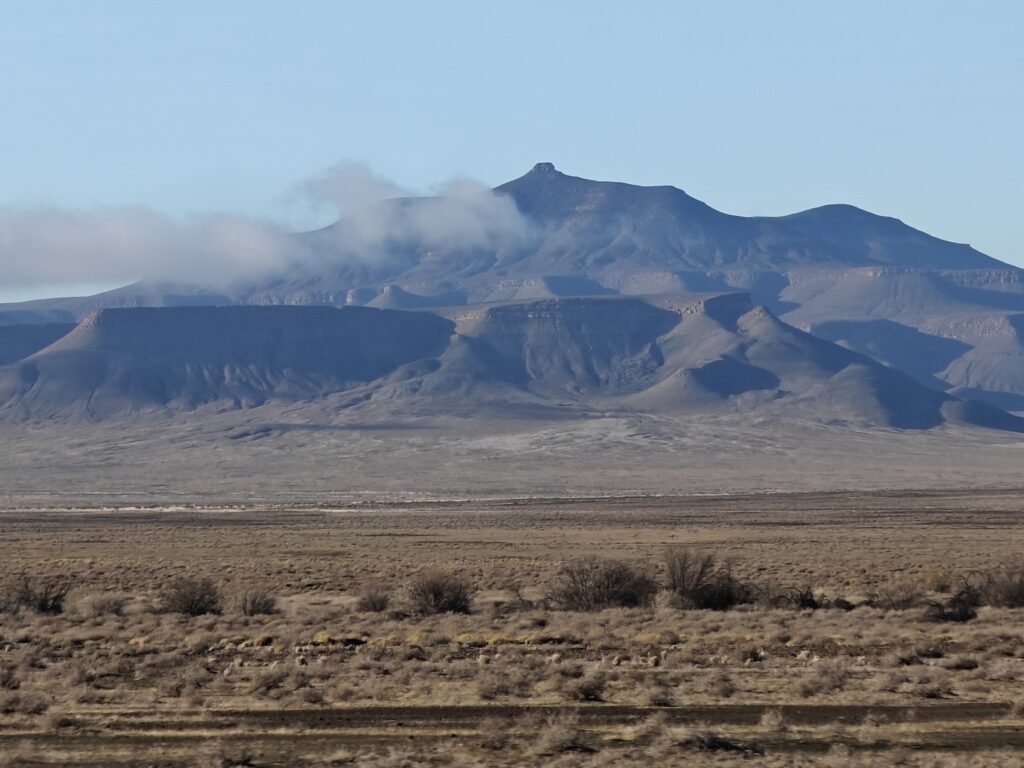
The Tankwa is just a small piece of the Karoo in what is referred to as the Succulant Karoo – semi-desert comprised of many different succulant plant species, and one of the world’s designated biodiversity hotspots. The Tankwa was formally established in 1986 by consolodating 9 abandoned farmsteads and has grown steadily over the years by purchasing additional farmsteads. It currently stands at roughly 400,000 acres. The Park encompasses the northern portion of the Tankwa Karoo basin and bordering Roggeveld escarpment, with the basin floor lying at roughly 1600 feet elevation and the escarpment rising more than 3,000 above to an elevation of almost 5,000 feet. Consequently, there is a pronounced environmental gradient as you move from the basin floor to the top of the escarpment, and this strongly shaped much of the historical human land use (see below).
Tankwa basin rising towards the Roggeveld escarpmentTankwa Karoo basin
You may recall from previous posts that the San (Bushman) were the original human inhabitants in southern Africa and probably occupied the region for well over 100,000-150,000 years, and had a predominantly hunter-gatherer nomadic lifestyle. Roughly 2,000 years ago, as part of the Bantu-speaking migration out of northwestern Africa that expanded south and east, the Khoi moved into the region of the Tankwa. The Khoi were primarily herder-pastoralists and were larger and more aggressive than the San. Consequently, the San slowly were killed off or displaced from the Tankwa (and elsewhere) and survived only in remote and harsh areas too inhospitable and unsuitable for the herder-pastoralist lifestyle of the Khoi. But the San left behind their knowledge of how to survive in the Karoo and their rock art, which we have seen elsewhere. Today, sadly the San are almost gone and the few that survive live mostly pitiful lives.
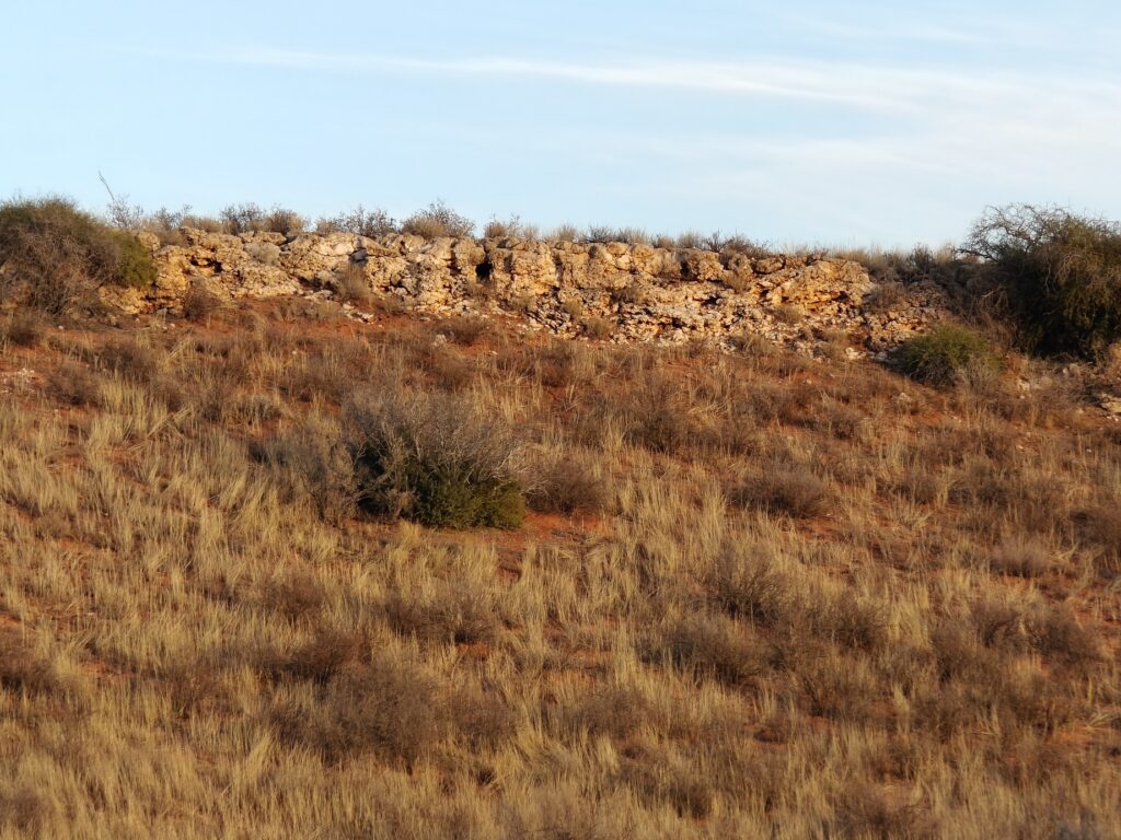
The Dutch were the first European colonists to occupy South Africa and established Cape Town in the mid 1600’s. During the 1700’s, the Dutch expanded north from the Cape colony into the Karoo, including the Tankwa. These trekboers or voortreckers, as they were sometimes called, trying to elude the heavy-handed colonial government of the Cape, killed off or displaced most of the Khoi, or otherwise enslaved or incorporated them as labourers. The trekboer established huge farmsteads in the Tankwa, centered largely around where they could find or tap water, and mostly tried to eke out a living by raising sheep and goats. They would move the livestock down into the Tankwa basin during the cooler, moister winter months and then move them up on to the Roggeveld escarpment during the hotter, driver summer months. Ultimately, the Brittish would take over the Cape Colony and extend its reach throughout all of South Africa. The Anglo-Boer war of 1899-1902 even touched the remote Tankwa and resulted in some famous battles. Eventually the environment of the Tankwa proved too harsh even for small livestock farming and most of the farmsteads were gradually abandoned. Today, there are still scattered ocupied farmsteads, but they mostly eke out their living by a multitude of enterprises, including tourism – farmstalls along the roads into and out of the Tankwa are a common sight.
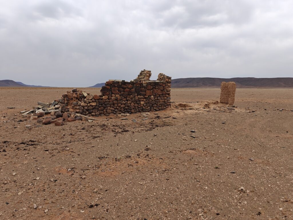
This history of land use is important for a couple of reasons. First, nearly all the large mammals were hunted out by the settlers for subsistence. After the Park was established, they began a campaign to reintroduce some of the species, including springbok, gemsbok, kudu, hartebeest, eland and even ostrich. Many of these species are now thriving in the Tankwa once again – and we ended up seeing all of these species here. The Tankwa even hosted lion and rhino in the days of the San and Khoi, but they were quickly extirpated by the Dutch settlers. Second, several of the old farmsteads left behind buildings that still dot the landscape today as historical landmarks, and some have even been restored for use as cottages that can be booked.
Farmstead ruin in Tankwa basin
Today, the Tankwa is in a stage of ecological recovery both in terms of flora and fauna. One day, they even hope to reintroduce the large predators, but for now the caracal (mid-size cat) is probably the largest predator.
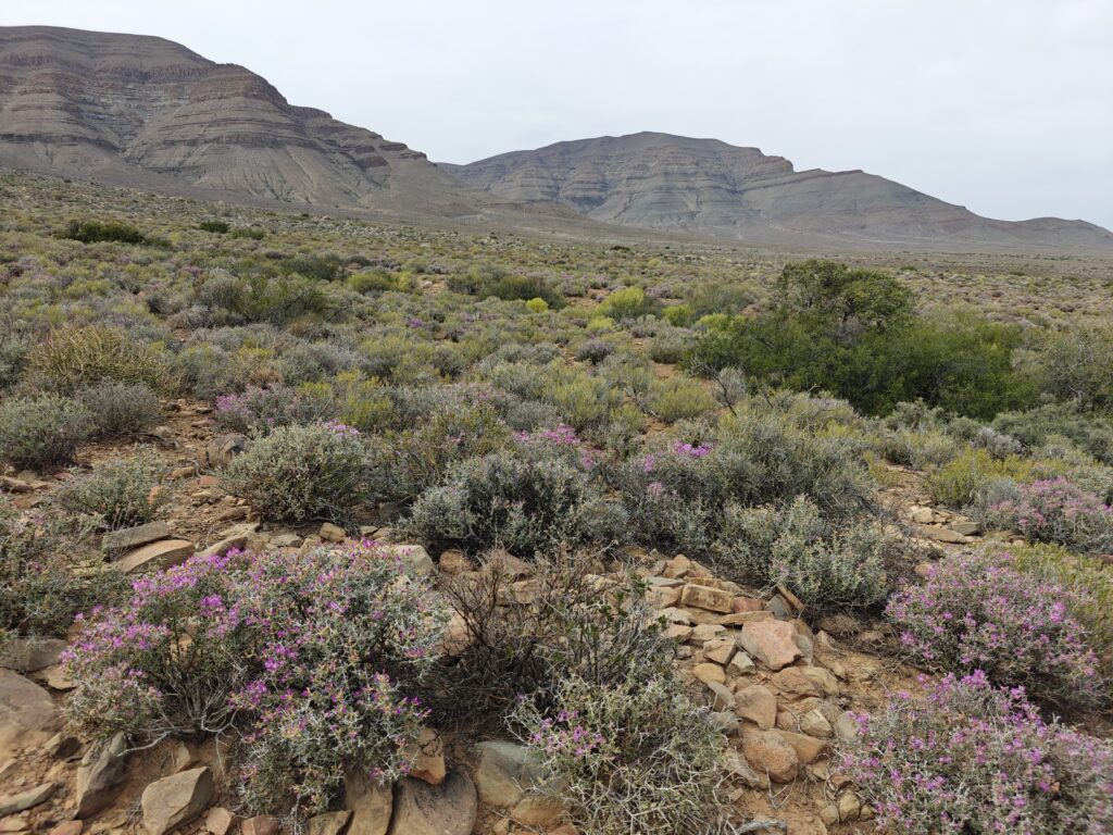
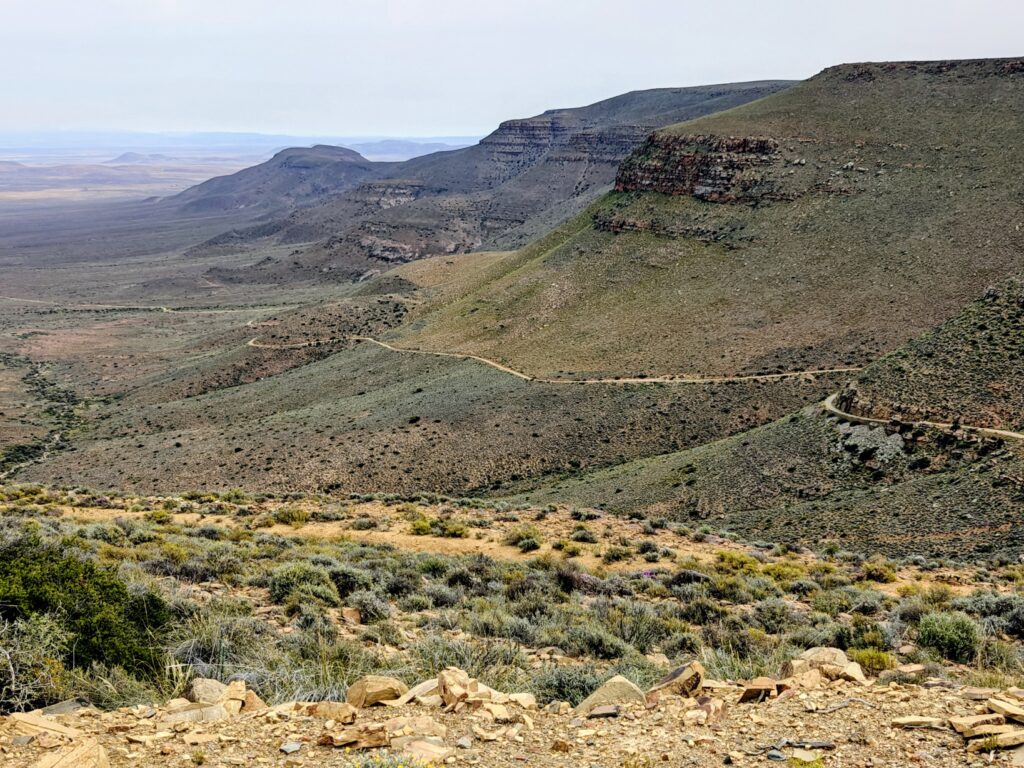
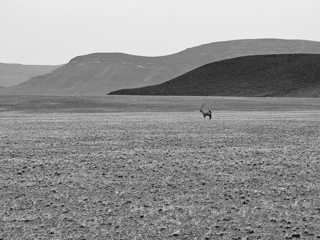
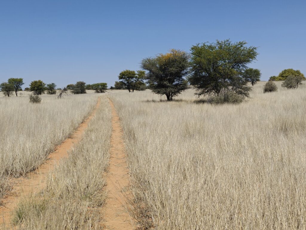
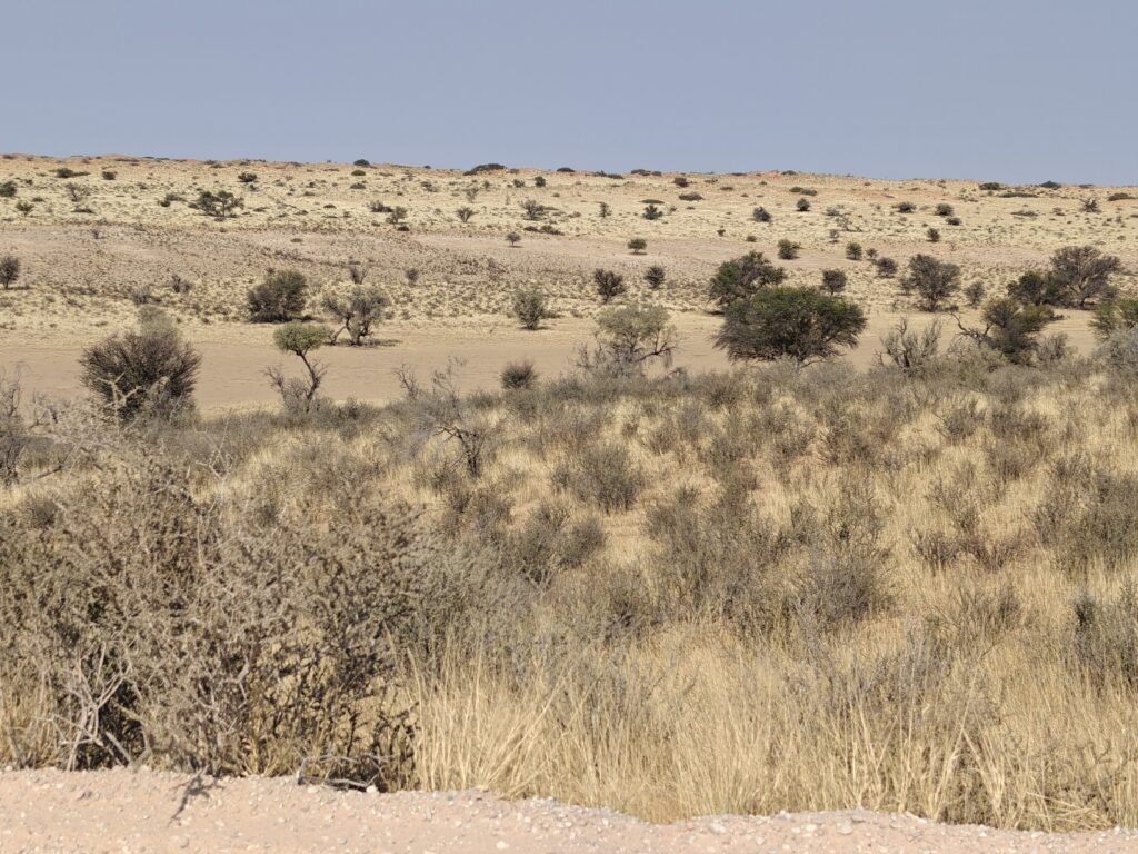
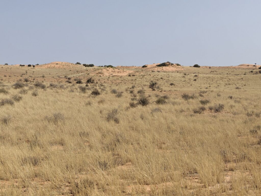
The Tankwa was strikingly beautiful to us. We especially loved the juxtaposition of the open basin floor and the Roggeveld escarpment, with rather lush riparian vegetation along the intermittent drainages. Entering the Tankwa from the north involved descending off the escarpment via the Gannaga Pass. Here’s what they say about the Pass road: “45 bends, curves and corners – including 4 hairpins and 3 more corners sharper than 90 degrees.” Here’s a picture from one of the bends near the top looking down over the lower section, but the hairpin swictchbacks and tight bends can’t be seen from this vantage point – what a great way to get introduced to the Tankwa!
Lower section of the Gannaga Pass road
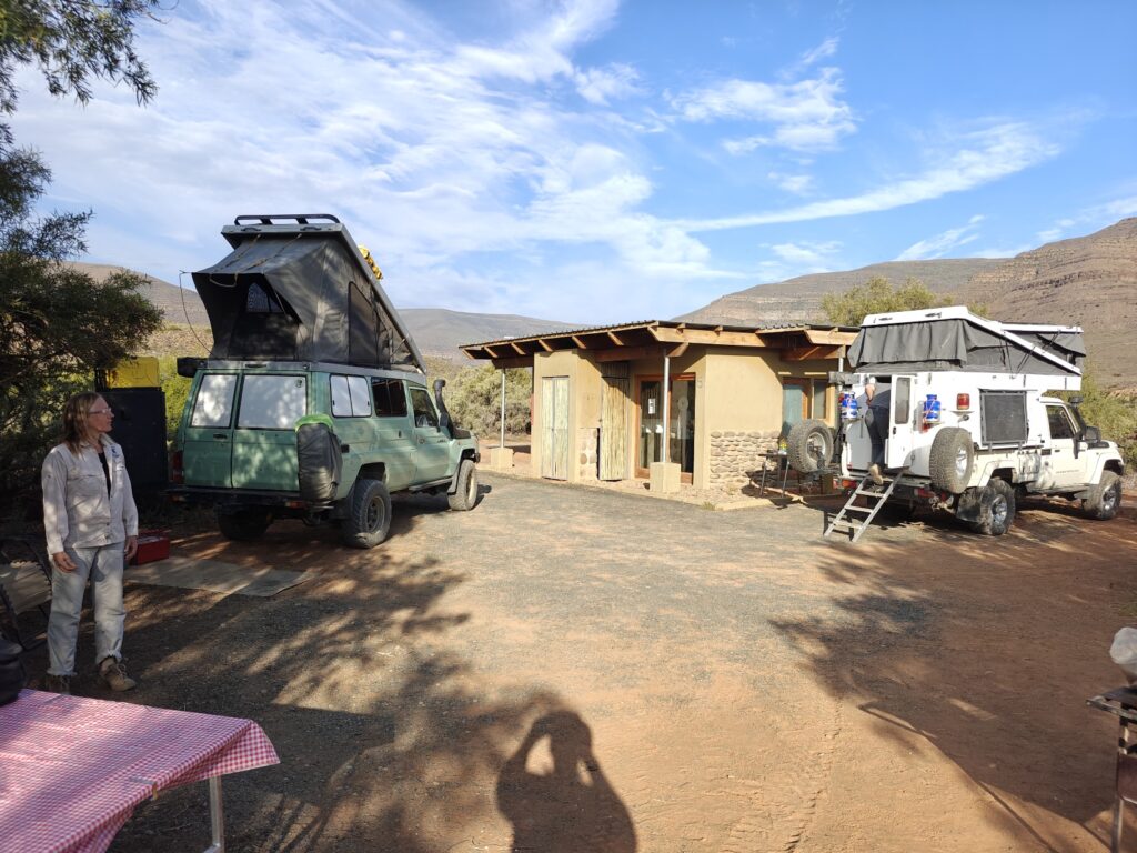
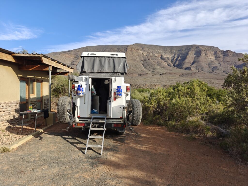
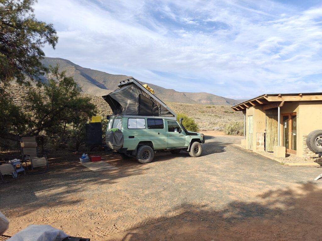
We camped for two nights at a delightful campsite called Perdekloof near the head of one of the scenic canyons, with great shade and ablutions to boot:
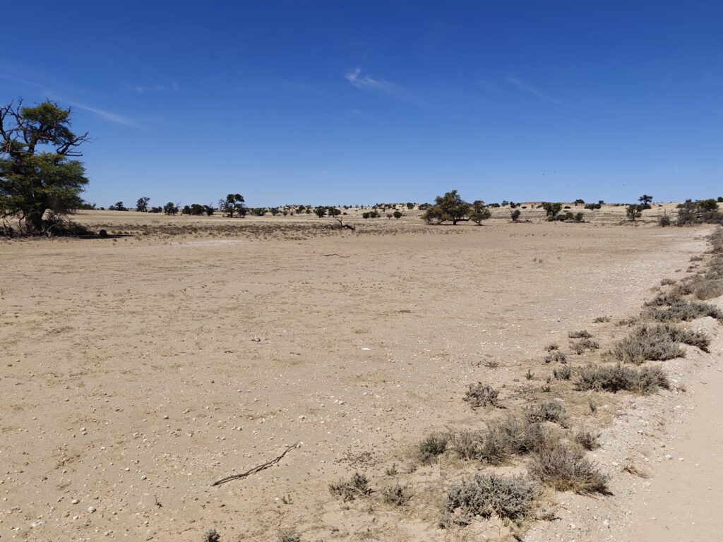
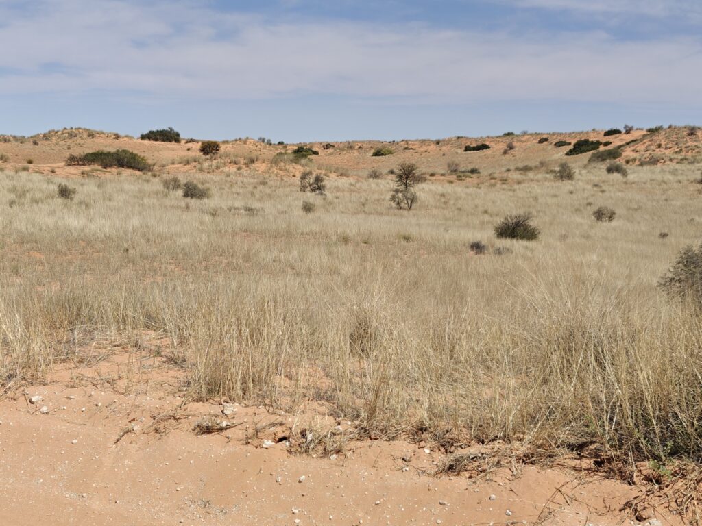
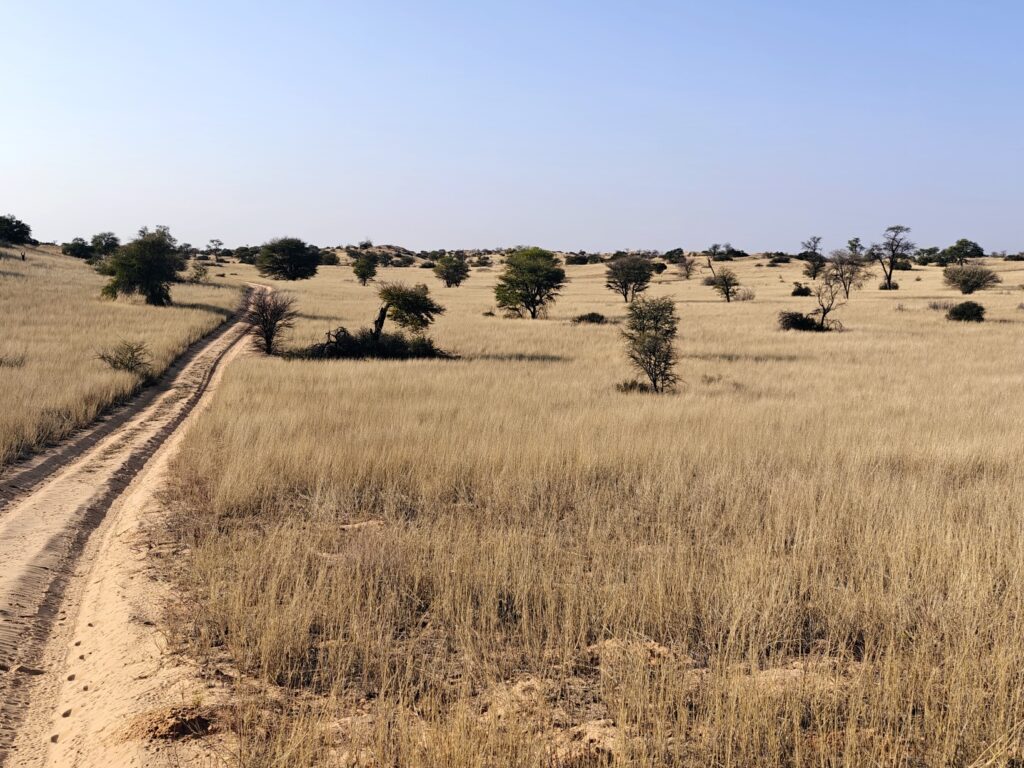
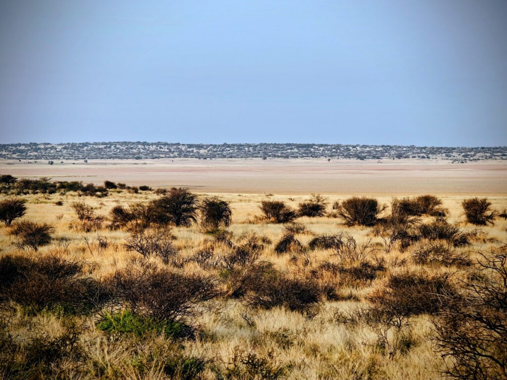
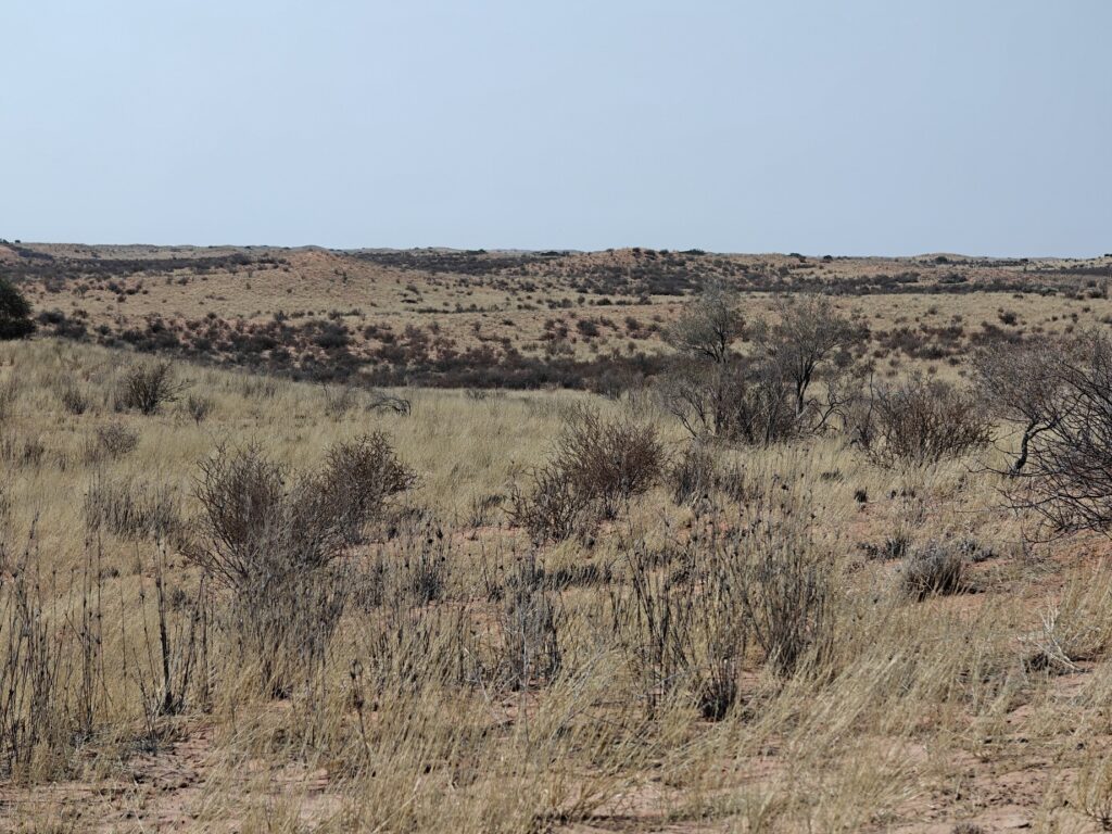
Nancy and I took a drive up one of the canyons and encountered lush and diverse riparian vegetation and some of the large but elusive antelope such as Kudu and Red Hartebeest. We also did a loop through some of the desert basin floor which produced one of my favorite photos of the entire trip – Ansel Adams worthy?:
Tankwa basin
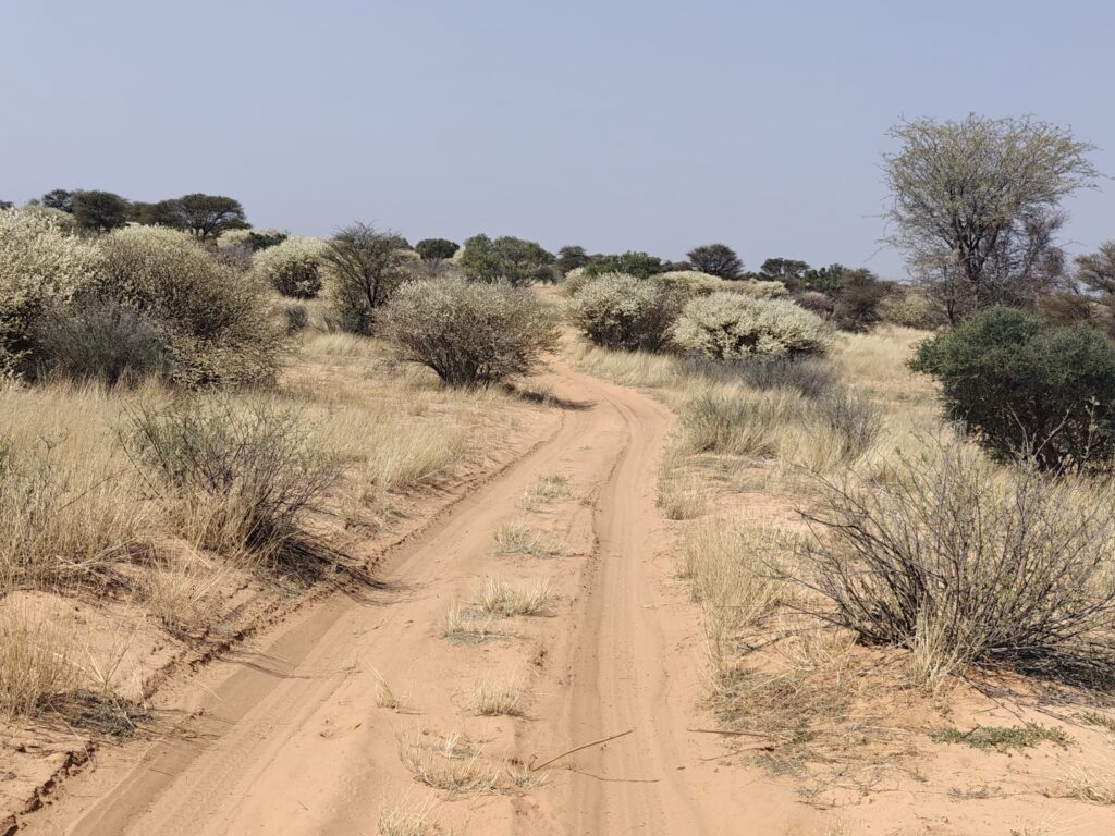
I took a lot of pictures, as the landscape was so striking, and rather than pick a handful to show you here, I created a slide show of our entire journey through the Tankwa. Take note of the diverse succulant vegetation, early Spring flowers, old farmstead ruins, and the stark beauty of desert mountain landscapes. Hope you enjoy it as much as we did:
They say that “all good things must come to an end”, so regrettably this will be my final post for our KTP visit – argh! Our last three nights in the KTP after our epic venture into the Botswana wilderness area were spent back on the Nossob Riverbed:
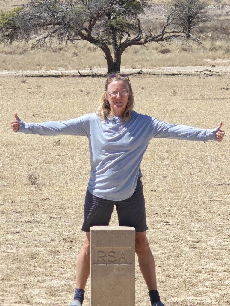
We finished the epic wilderness trip to the Botswana side of the Park with a memorable crossing of the international border with South Africa, but without a border post or fence!
Botswana – South Africa border post in the middle of the Nossob riverbed
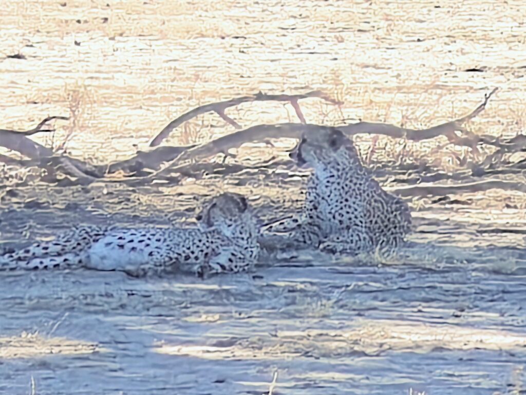
Our first night back on the Nossob was spent in a cabin – yes, a cabin – back at the Nossob restcamp (#10 on the map). The best part of staying here was actually leaving the next morning and heading downriver, eventually getting all the way to the southern most part of the Park and the Twee Rivieren restcamp, and en route watching a pair of adult male cheetah brothers in the riverbed lounging and then scent-marking a big acacia tree, before lumbering off and up the dune hill on the opposite of the riverbed from us, only to dissappear as soon as they plopped down in the comfort of the soft sand and cushy grass. Here’s proof of sighting (but also see the video for coverage):
Cheetah brothers morning after a presumed kill
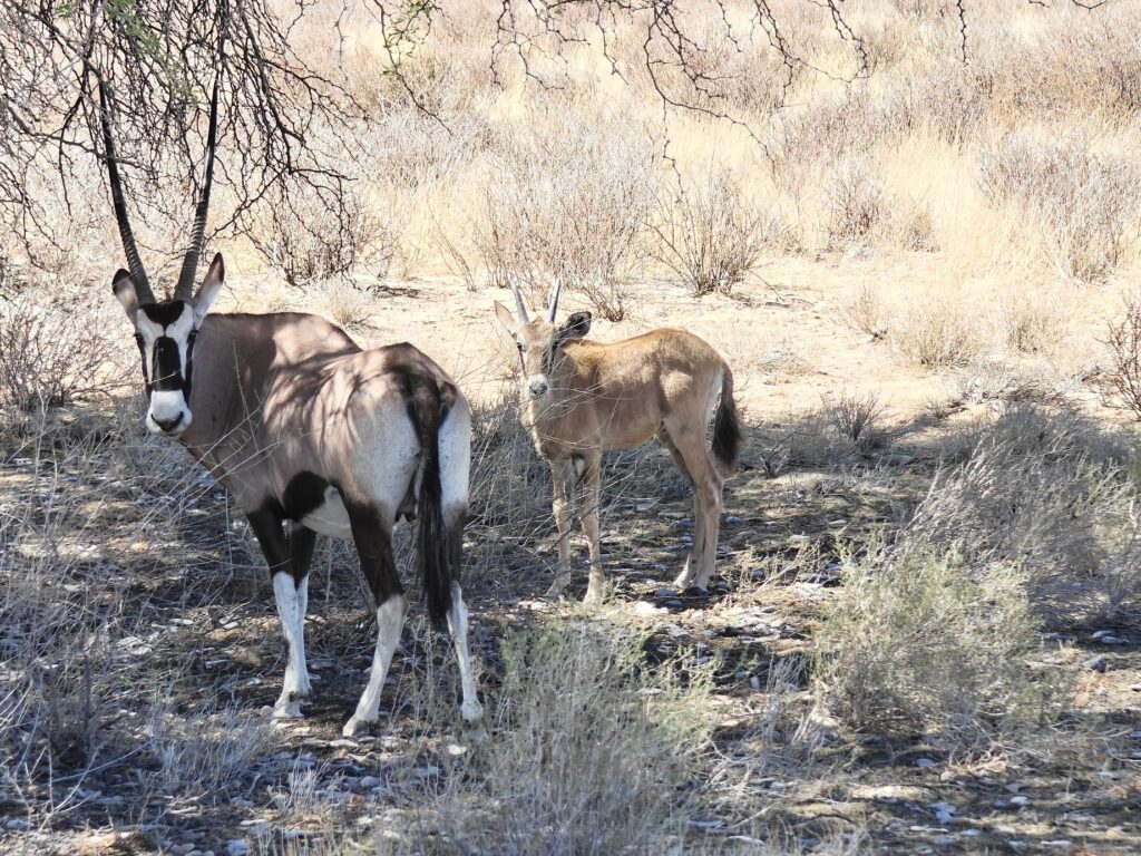
Another “fun” sighting was of a Gemsbok with a very young calf, which we only rarely saw on this trip, and of a Springbok right after she gave birth (and looked like she might also give birth to a twin, but it didn’t happen before we left), but you’ll have to watch the video to see this encounter.
Gemsbok with young calf
The Lower Nossob was similar to the Upper Nossob in many respects, i.e., a fossilized dry riverbed bordered by partially vegetated dunes, but the woody vegetation, specifically, the trees, became increasingly sparse as we drove south, giving way to grass and sparse woody shrub covered dunes. We found the entire drive down the riverbed delightful. Here’s a few pics:
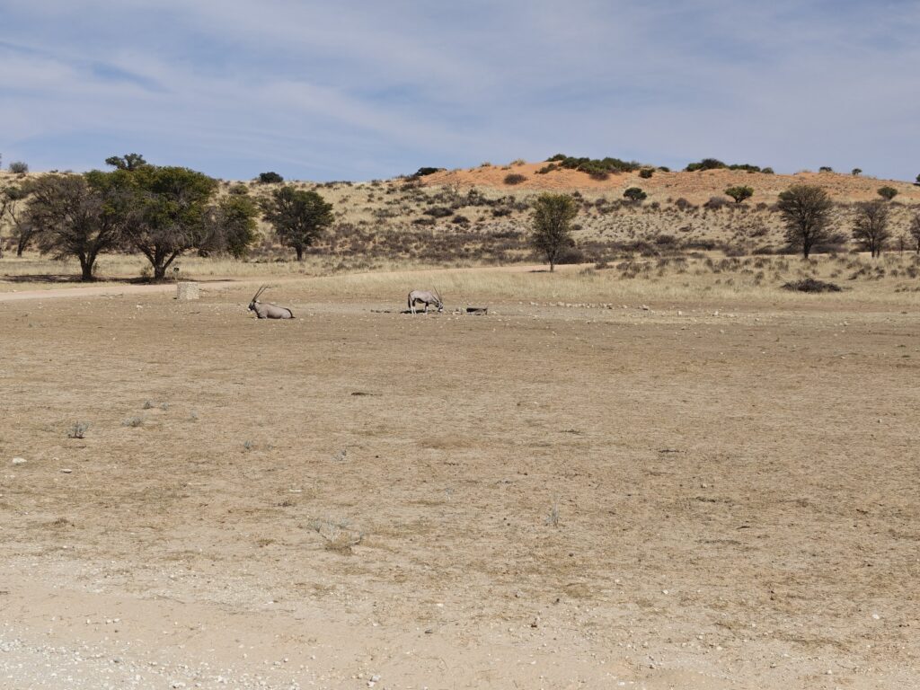
Lower Nossob riverbedCalcrete (calcium carbonate) outcrops bordering the Lower Nossob riverbedLower Nossob riverbedLower Nossob riverbed with Gemsbok at a waterhole
We also did a little drive into the dunes between the two major riverbeds, the Nossob and Auob, and were mesmerized somewhat by the stark beauty of the rolling dunes, with the white sands in the valleys and the red sands on the hilltops, and the luxurious grass covering much of the dunes. Here’s a few pics:
Driving through the Khalahari dunesDriving through the Khalahari dunesKhalahari dunes
We did a few wildlife drives up and down the lower Nossob while we were camped at Twee Riverien and found the wildlife surprisingly exceptionally unafraid of our vehicles. Consequently, we were able to get very close to quite a few of the critters, which was a real treat. Some of these close encounters are in the pictures and video below, but a couple of other sightings are worth distinguishing.
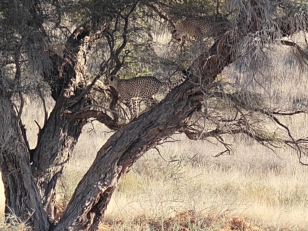
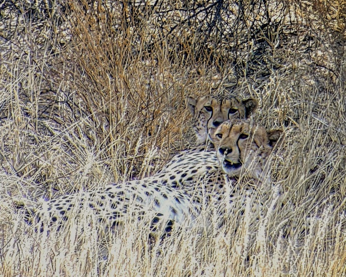
First, we saw yet another pair of adult male cheetahs (a “coalition” as they refer to these groups of 2 or 3 males, usually brothers, but not always) climbing up a big Acacia tree to scent mark with their urine and feces, presumably to get their scent as high as possible to encourage the greatest dissemination of their scent, both for territorial purposes, but also to attract females in heat. Not the greatest picture, given the distance, but trust me it was glorious watching them through the binoculars:
Cheetah brothers scent marking in a tree
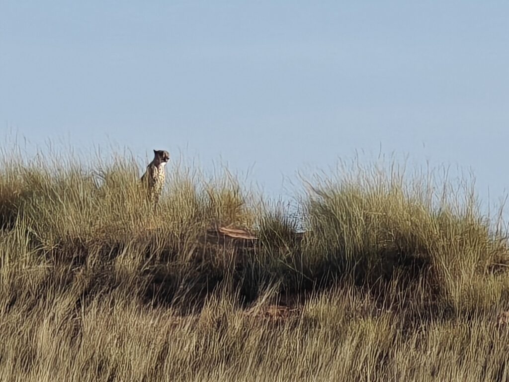
Nancy also captured this classic cheetah scene at a distance, after the two males left the scent tree and headed up into the dunes. The picture is way too grainy, but the scene is epic and thus worth showing. There is nothing that captures the essence of wild Africa, at least to me, as a cheetah on a hill surveying the landscape:
Male cheetah surving his territory
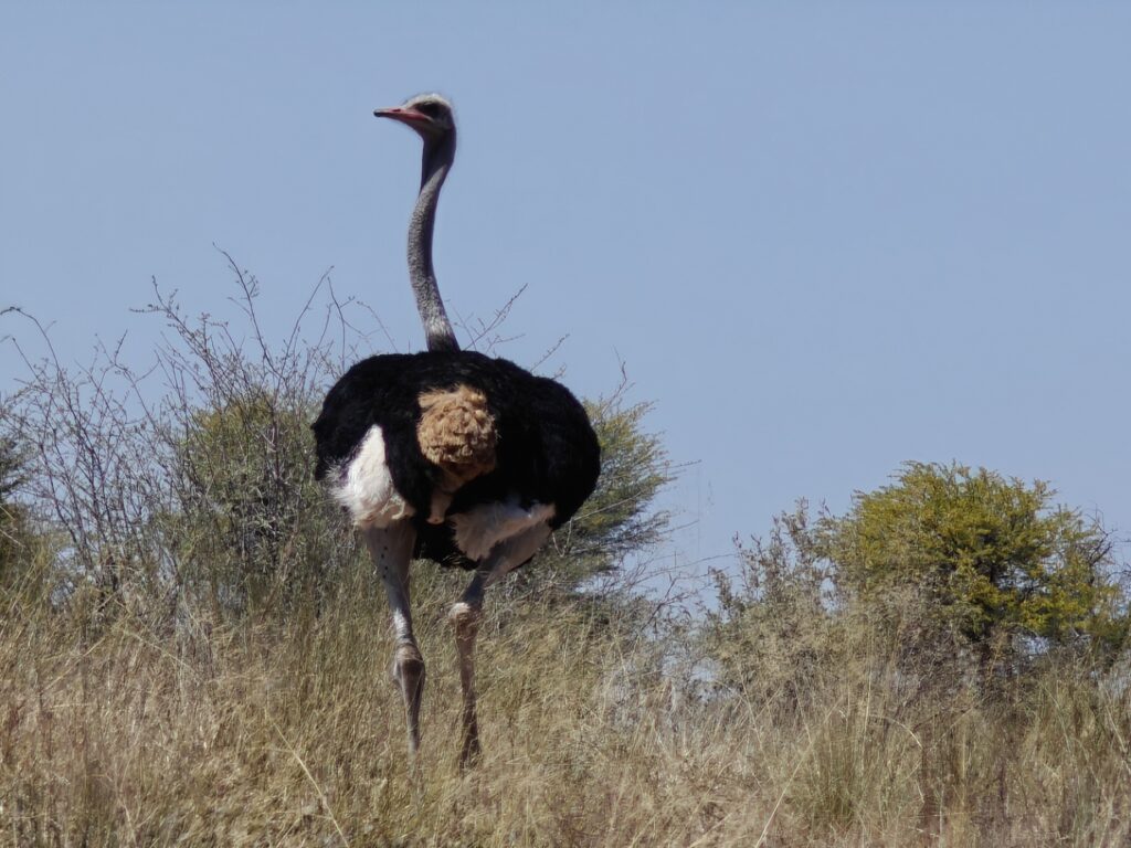
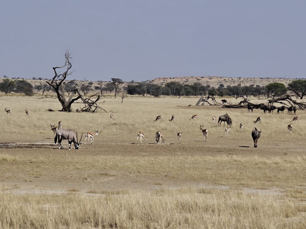
The second wildlife encounter was with 2 lionesses and a very little cub coming to a water hole, but I failed to take any still pictures as I was too focused on taking video, so you’ll have to watch the vidoe to see that. At this point in our KTP journey you might be wondering about how we were able to have all these cat sightings. We had repeated lion, cheetah and wild cat sightings (unfortunately no leopard or caracal), which lived up to the reputation of the KTP being a great place to see the big cats. Other folks we met had equally stunning encounters with all of these species, including leopard. Surprisingly, even in this semi-desert, there are lots of animals that thrive in this environment. Gemsbok, steenbok, springbok and ostrich in particular, but also a few less common species such as the mighty Eland and spectacular Kudu. All of these are ideal prey species for the big cats, so they too are in abundance here. It truly is a magical place to come watch this predator-prey dynamic.
Here are some other pictures to enjoy:
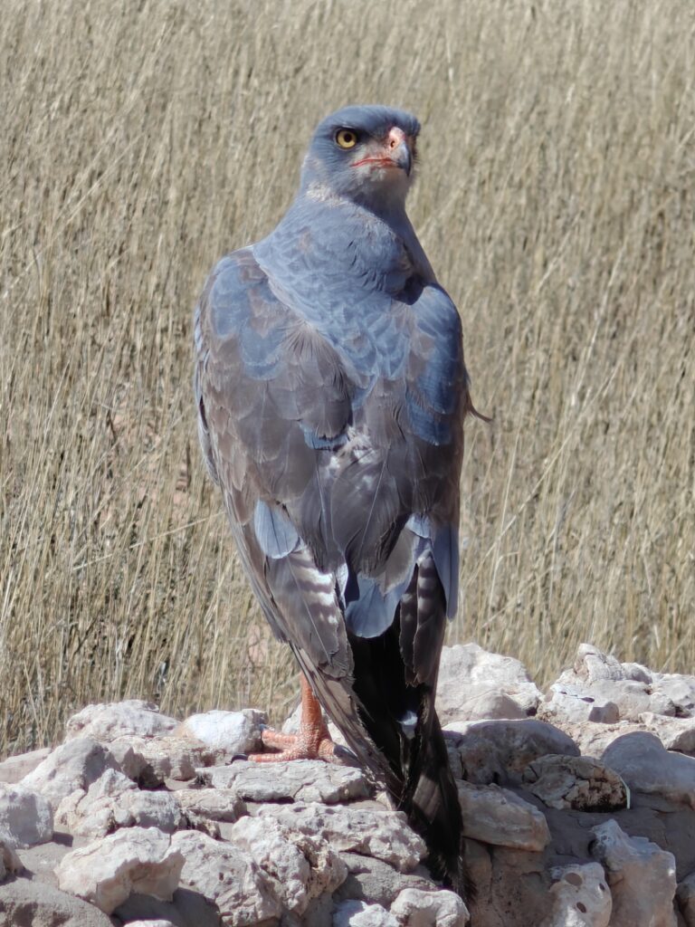
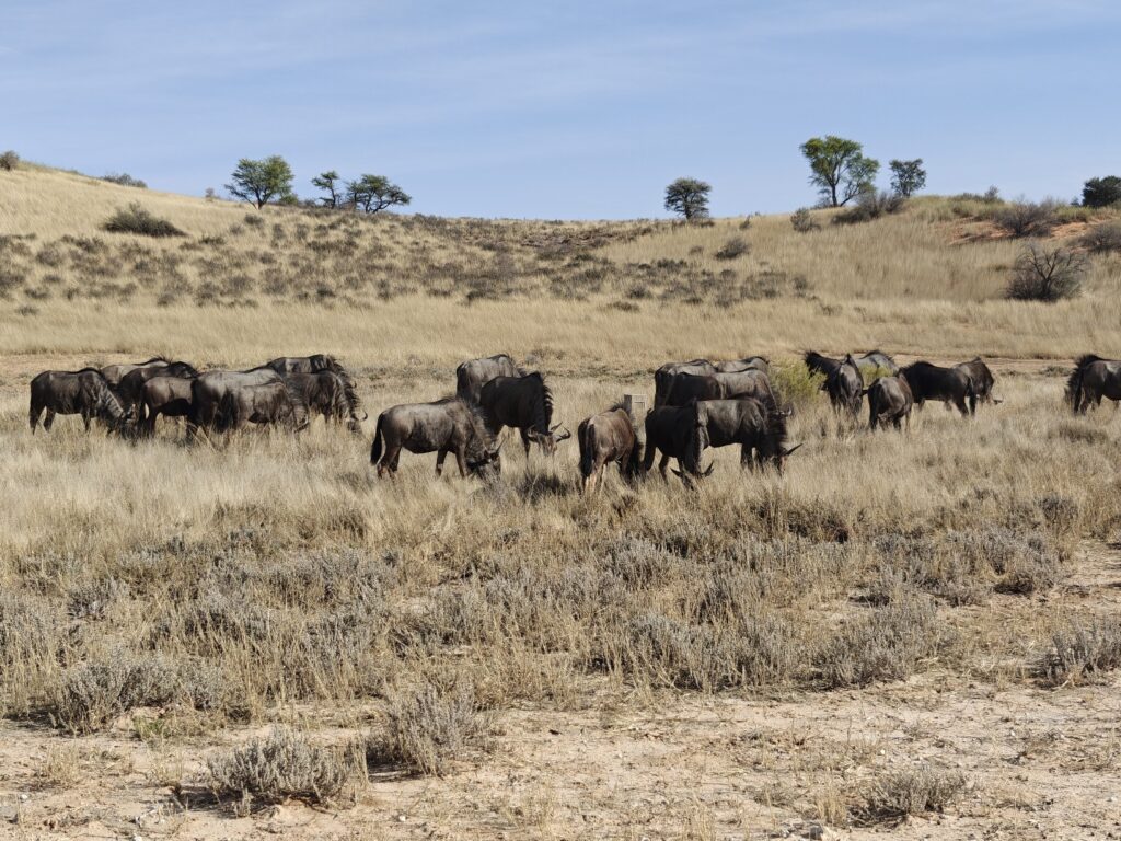
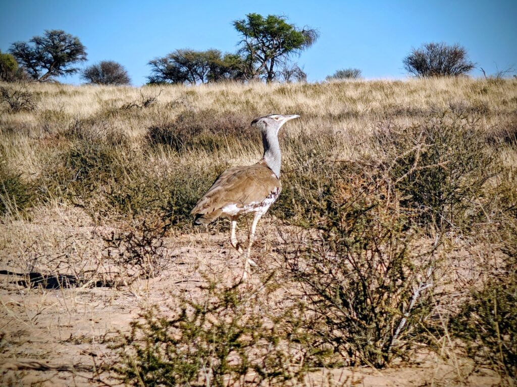
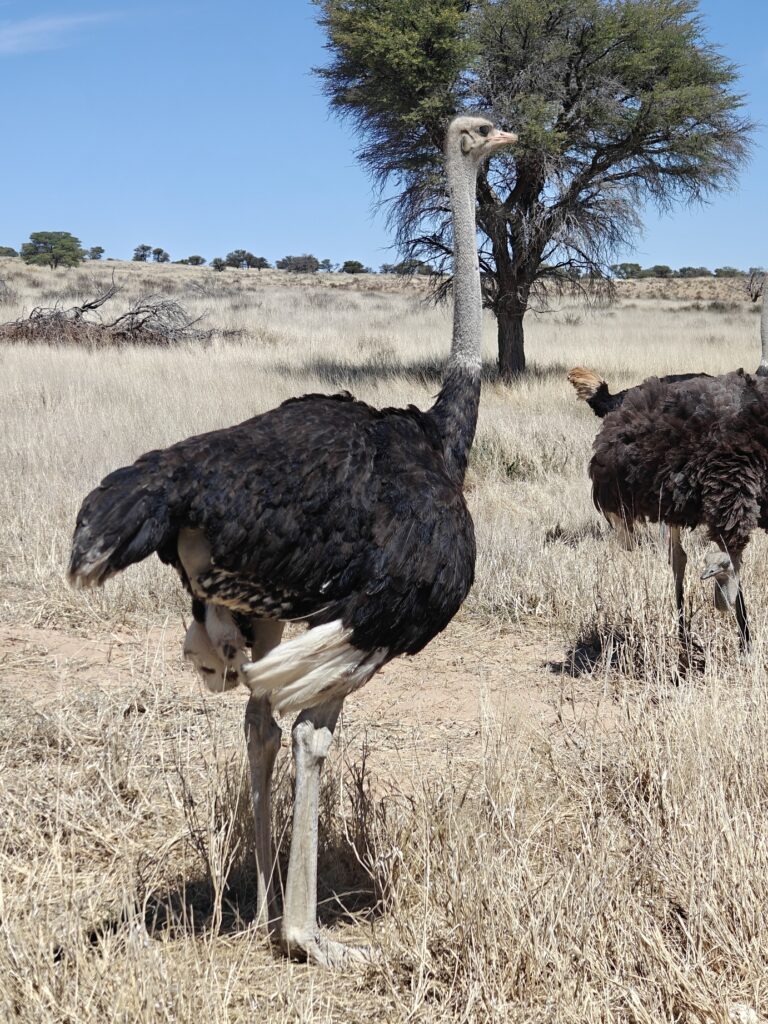
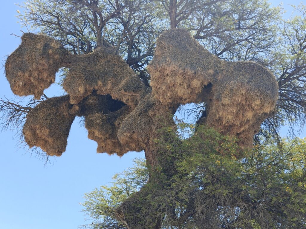
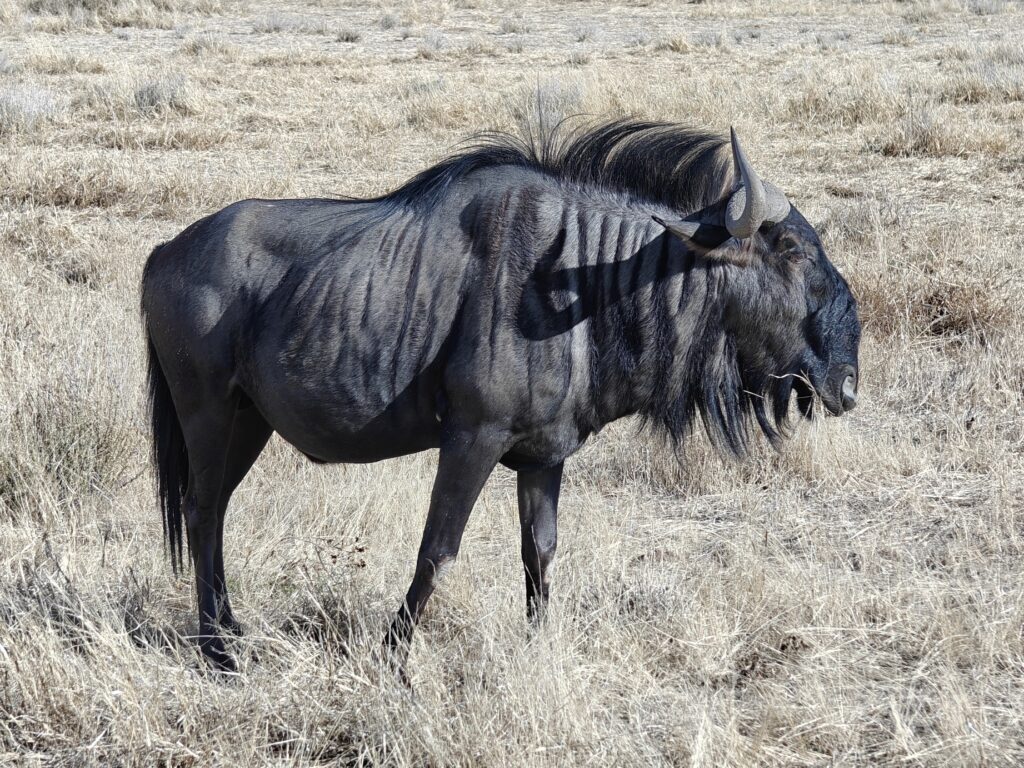
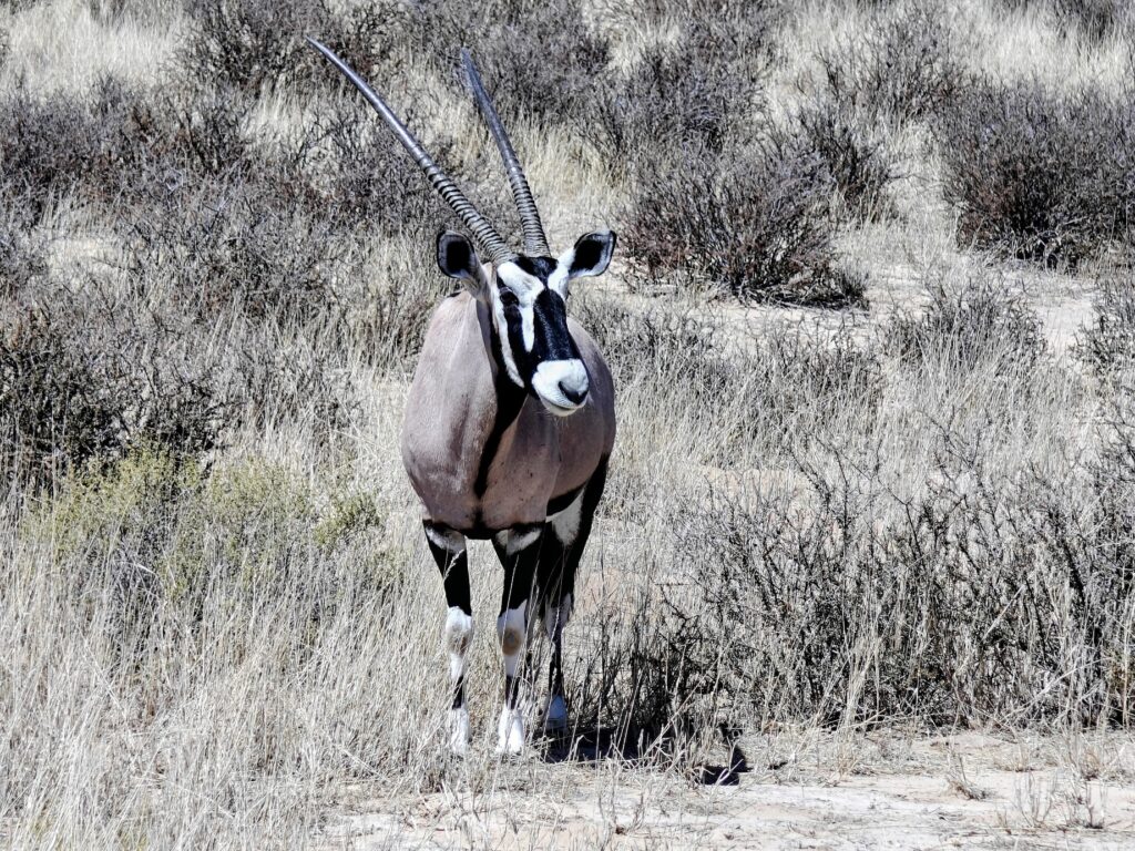
Sub-adult pale chanting goshawkWildebeest grazing in lower Nossob riverbedKhori bustard (heaviest flighted bird in Africa)Male ostrichSociable weaver colonyMuch maligned for its suppose ugly face, the blue wildebeestGemsbok (#1 prey species of lion in the KTP)
Here’s a composite video of our Lower Nossob visit, including 2 different cheetah encounters and 1 lion encounter, plus a couple of other fun encounters:
OK, not much else report here on this 4th KTP post, so I will mercifully let you go until my next post on our visit to the Tankwa-Karoo National Park in the Great Karoo Desert. See you there!
NOTE: Due to the a-hole spammers around the world that are innundating my incoming comments box with useless meaningless comments and unwanted advertisements, I am forced to close post commenting to all except logged-in subscribers. So, that means if you are a subscriber and want to send me a comment, you will have to log in first. If you forget your password, you can request a password change and then log in. Alternatively, if that doesn’t work or is too much trouble, you can just send me an email direct (kmcgee@umass.edu). Sorry for the inconvenience – I wish all spammers could be located and thrown in jail for good!
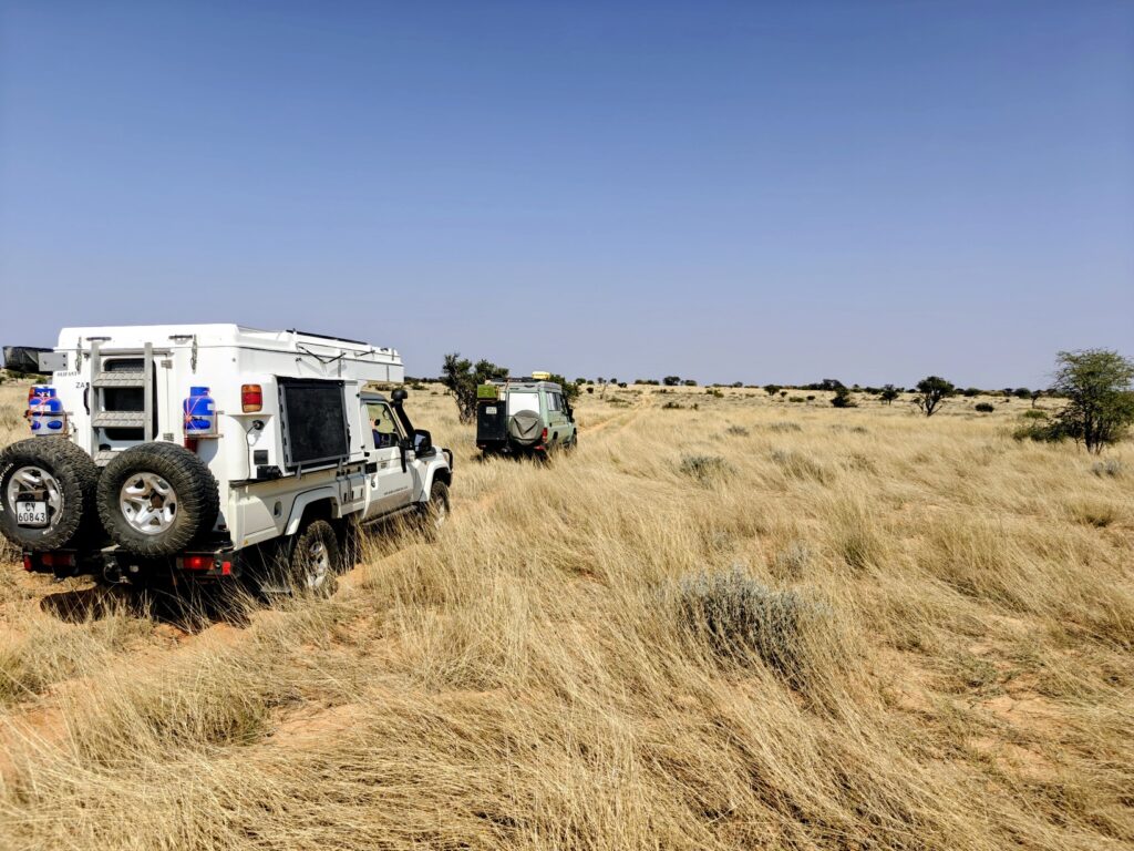
Now for the fun stuff! We survived and thoroughy enjoyed our 8-night jaunt into the Botswana side of the KTP, much of which is vast wilderness – and I mean true wilderness, not just the ones on paper. The map below shows the overall route (from #4 to 5-9 and back to 10):
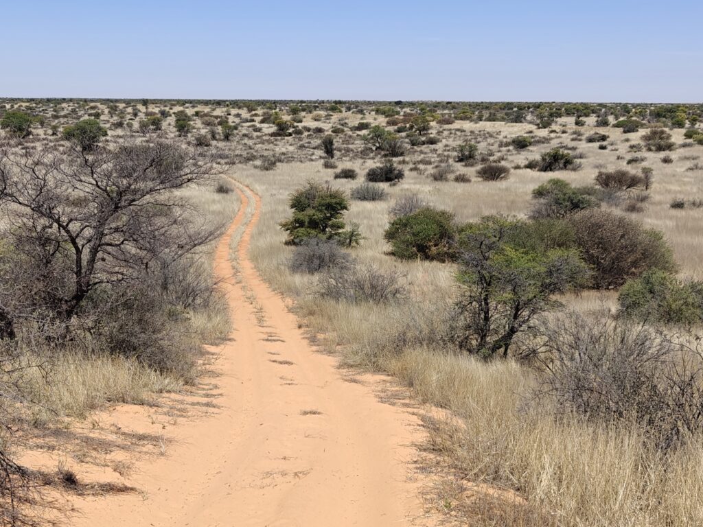
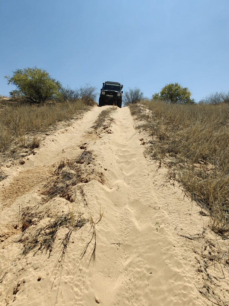
We left from the Nossob restcamp (#4), after a luxury overnight stay in one of the riverside cabins you might recall, and did a very long 8+ hour overland drive across the Khalahari to the far eastern area of the KTP in Botswana. This was no ordinary drive. The track was all sand, sometimes deep, and traversed up and down numerous rolling dunes. On occasion, we had to down-shift to first gear and grind our way up and over steep-sided, soft-sanded dunes, but most of the time we drove in Hi-4 wheel drive in second gear – pretty slow going to be sure. The worst of it was the bumps and humps and moguls that kept us and the vehicle bouncing up and down and rocking side to side, sometimes uncontrollably. Fortunately, these difficult stretches were usually short-lived and we worked our way through them relentlessly until we eventually reached our first destination campsite at one of the large salt-clay pans in the eastern part of the Park. Here’s a whole series of photos showing the landscape and the drive to and from our sites in the Botswana side of the KTP:
OK, did that series of photos seem a bit repetitive and, dare I say, monotonous? Well, the Khalahari is in fact rather monotonous in both terrain and vegetation, as the photos suggest, and for some it would be agonizing to drive more than a few hours across this semi-desert. But for others, like we four in our party, the terrain and vegetation was strikingly beautiful and intimately variable – but it’s not for everyone.
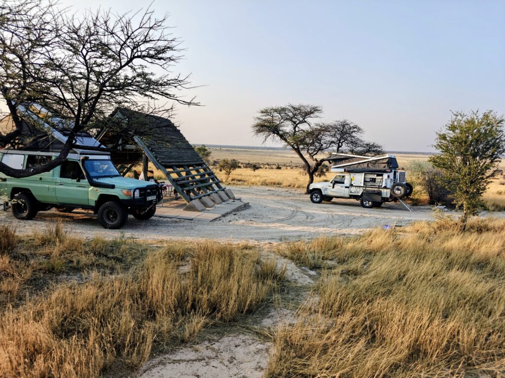
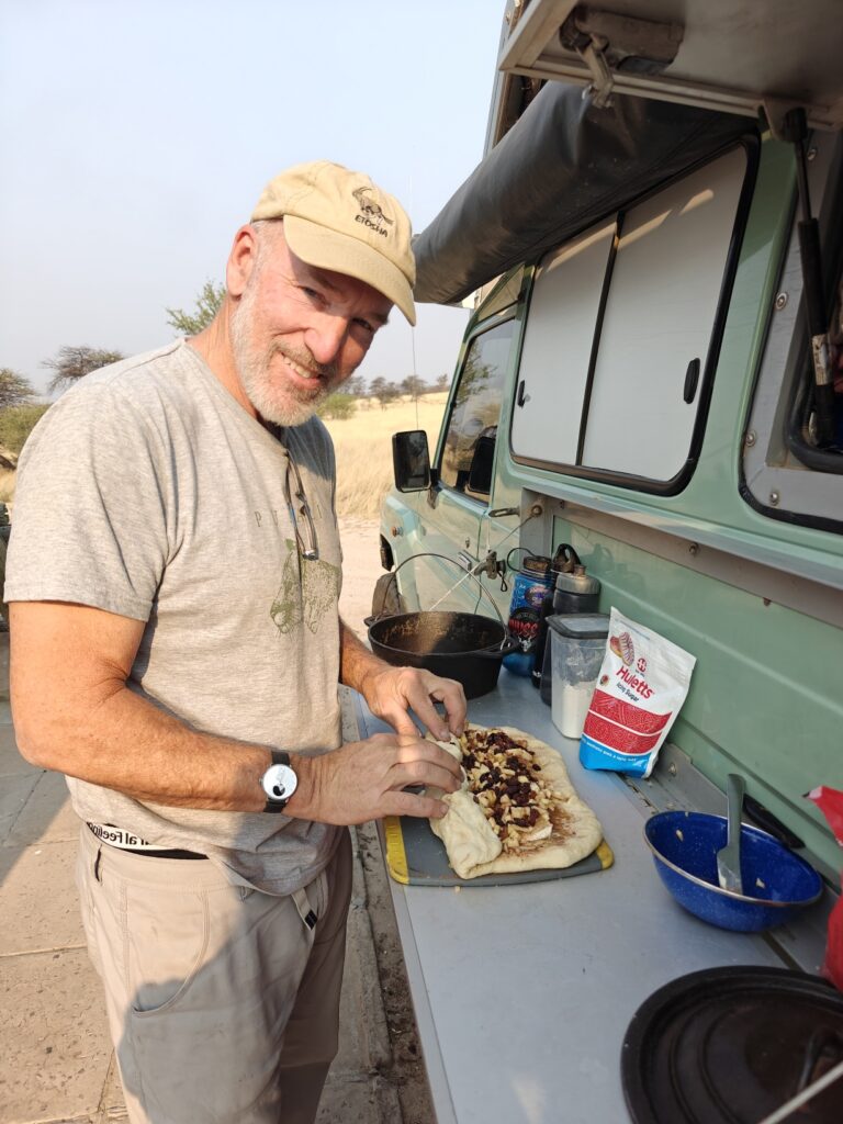
Our first campsite was located on the hillside above a large salt-clay pan called Bosobogolo (#5 on map). It was a delightful site overlooking the vast pan and afforded us a great chance to recover from the long overland drive. We spent the next full day in camp just enjoying the site and the views, watching animals come and go from the dry, mostly grassy, pan. I also took advantage of the down time to make – you might have guessed it if you know me well enough – cream cheese-apple-raisin filled yeasted cinnamon rolls. That’s right, no skimping on good food when car camping in the bush! Here are some pics:
Bosobogolo pan from our campsiteBosobogolo campsiteMaking cinnamon rollsCutting firewood from the canopy of this acacia treeBosobogolo campsite and campfire
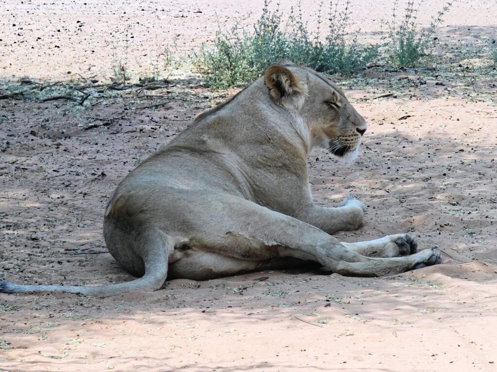
Our second campsite was located right next to another huge pan called Mbua (shortened for convenience, and because none of us could actually pronounce the full name of the pan)(#6 on map). We had great views and great sightings of wildlife on and around the, once again, dry and partly grassy pan. The wind coming off the pan was troubling at first (see video below), but it eventually calmed down and the site became quite pleasant. The most exciting thing that happened at this site was a night-time visit by lions in our campsite. Around midnight, 3 lionesses came into camp, lapped up all the water in the bowl we had placed out for any and all critters, and then proceeded to stroll through our camp past our chairs and tables and directly beneath our vehicles, sniffing each item in turn, including the back door of the Green Dragon, and then moved off. We ran into one of these ladies the following day:
Lioness
Later that night, a large male lion showed up, hot on the trail of the gals, and proceeded to roar directly beside our vehicle multiple times. The sound was deafening – the reverberations were so powerful that they sent shivers through our bodies. He lingered on the edge of our site, roaring periodically, for about an hour and then moved off in pursuite of the females – probably hoping they would make a kill so that he could steal a free meal, as is customary for the Pride leader.
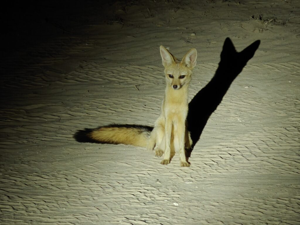
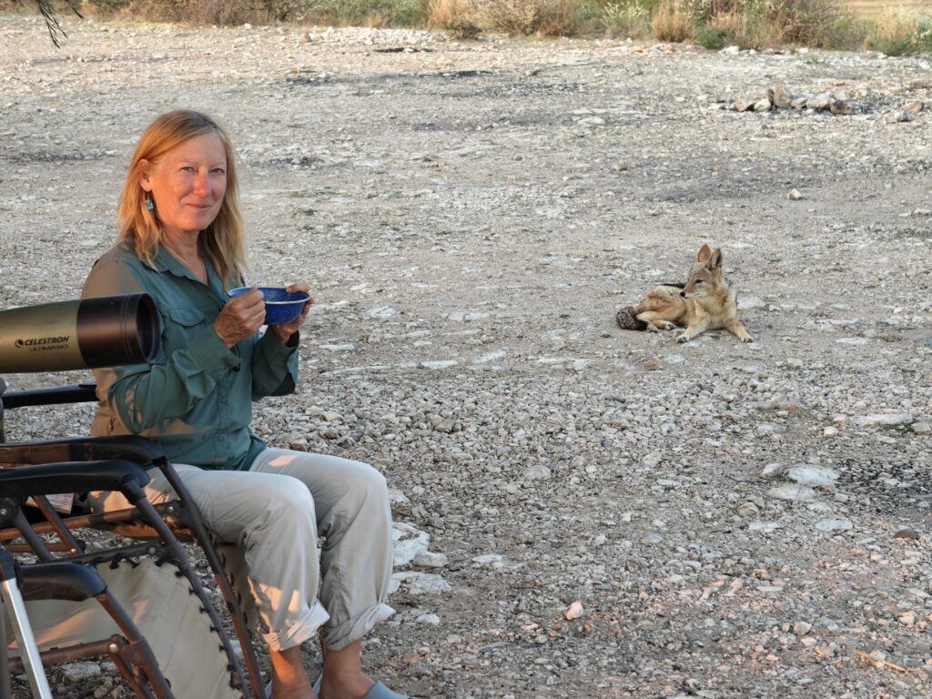
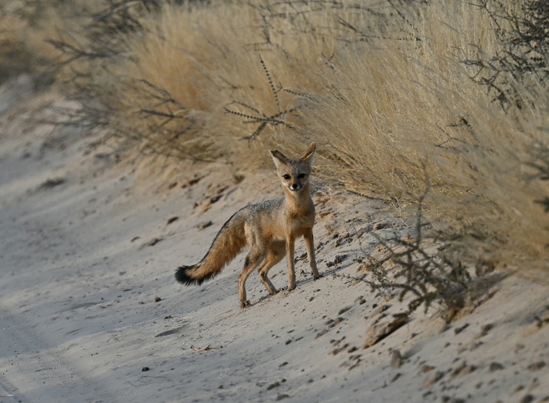
The other awesome campsite visitor the following night was the elusive Cape Fox, a truly beautiful creature that had eluded me for 3 years. She scantered through our site, pausing here and there for our photos as if she new she was the star of the show and worth everyone’s admiration. Here’s a few pictures from this site.
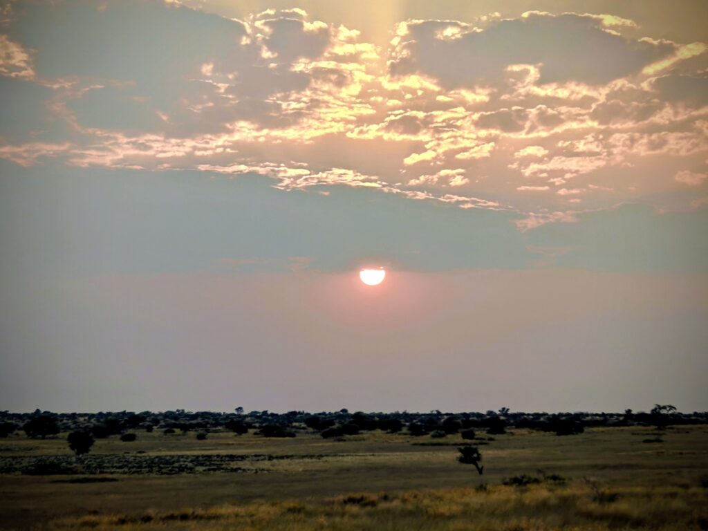
Mbua panMbua panMbua pan campsiteMbua sunriseCape fox visitor to our Mbua campsite
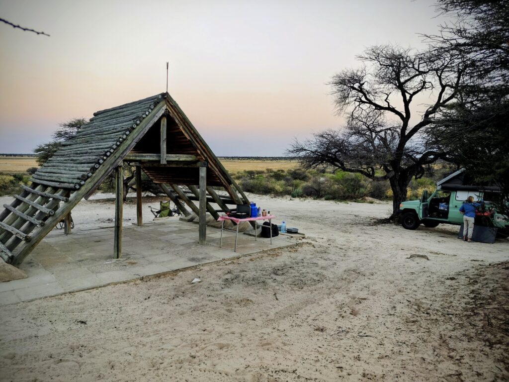
Next, we moved to another pan called Mpaya (again, shortened for convenience)(#7 on map). We had a wonderful site located on a penninsular with great views of the entire pan, including the only maintained and functioning water hole in this part of the KTP. Nothing too dramatic to report on from this site other than to say we had some very nice local drives and some fun campsite visitors. Here’s a few pics:
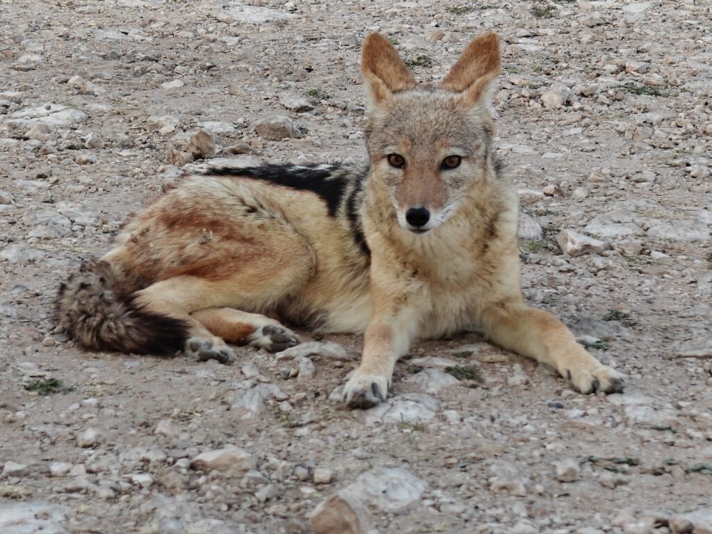
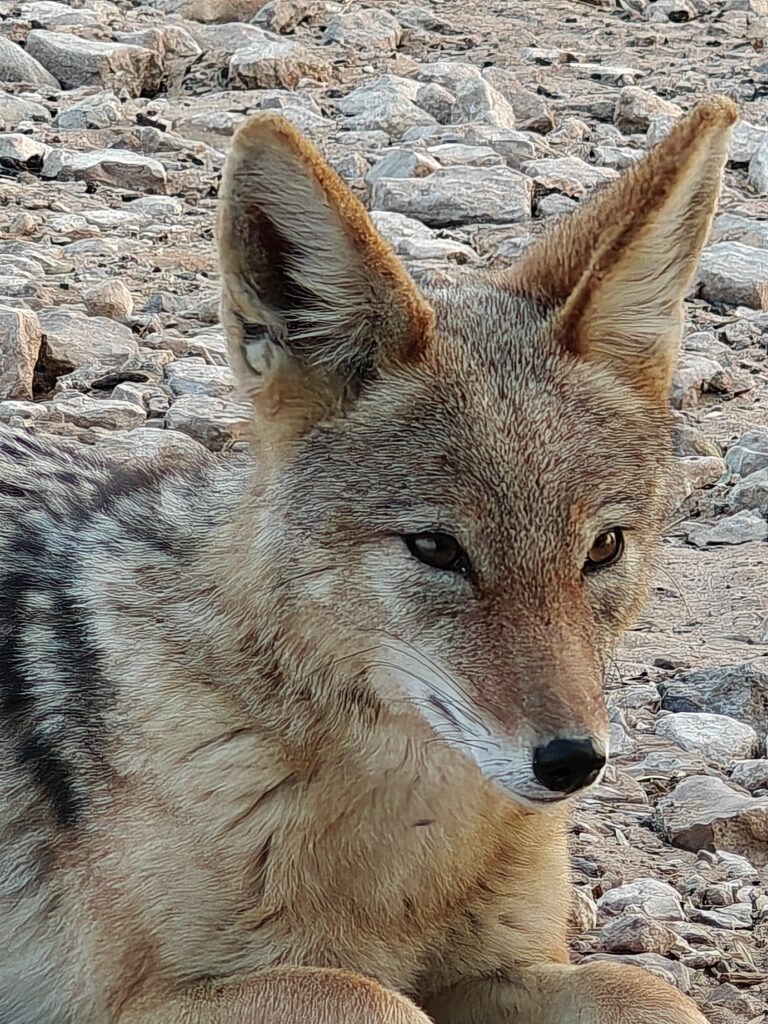
Mpya pan from our campsiteMpya pan (Lefika) campsiteMpya (Lefika) campsiteMpya pan waterholeMpya pan sunrise from our campsiteMpya (Lefika) campsite visitor (black-backed jackal)Mpya (Lefika) campsite visitor (black-back jackal)Mpya (Lefika) campsite visitor (black-backed jackal)
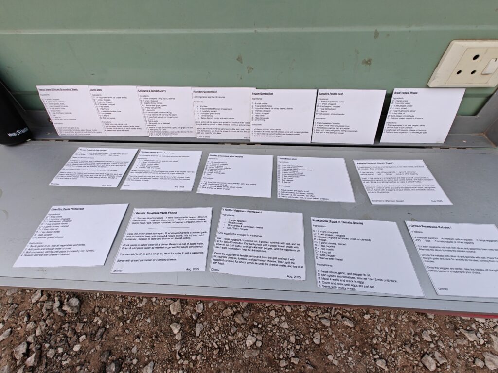
I should bring to your attention, if I haven’t already, that we eat pretty darn good on these overland trips, even when we are deep in the wilderness. Nancy does a phenomenal job of planning and preparing dinners, and we enjoy the fruits of her labor, but I need to mention another player on this stage. Steve, the consumate scientist, brought his planning and organizational skills with him to Africa. Here’s a photo of our “bush menu” courtesy of Steve. Note, this photo depicts just some of the “bush recipe” cards that he made up prior to the trip, and each night that he and Ki were responsible for dinner, they carefully scrutinized their menu options and picked one for the occasion:
Steve’s bush menu recipes
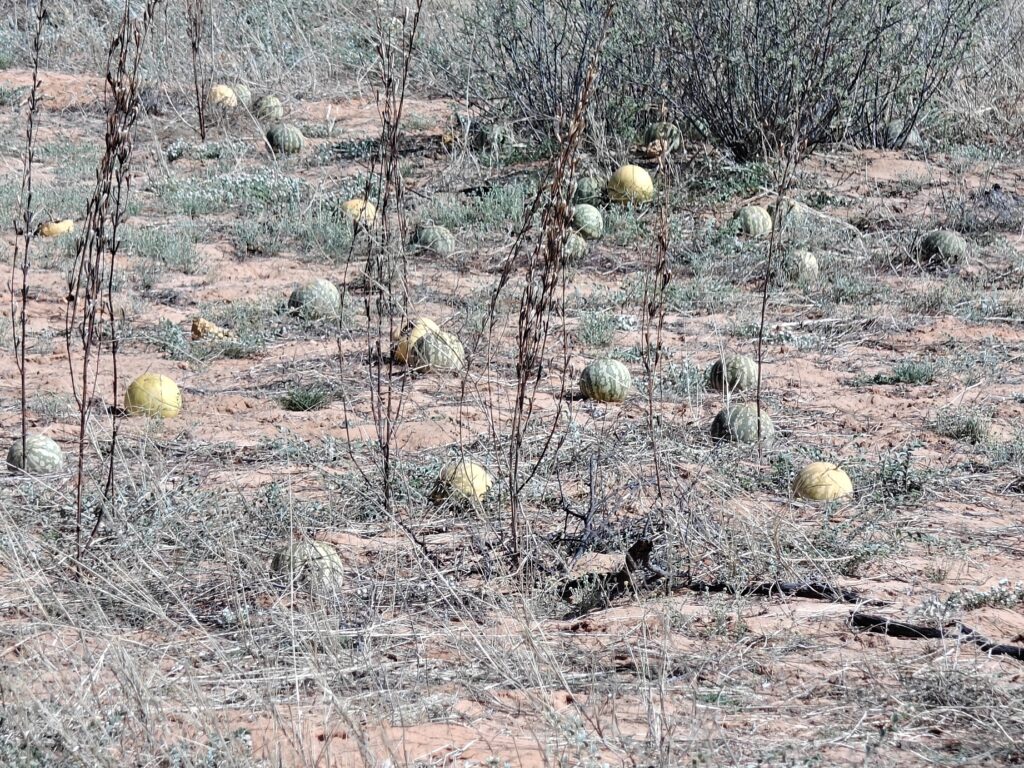
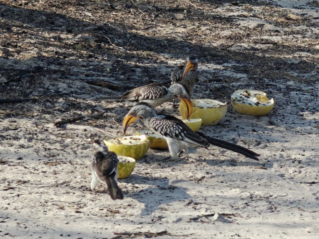
Next, we moved to a smaller pan called Khiding (#8 on map) in order to be close to our wilderness 4×4 drive back to Nossob starting the following day. Again, we had some fun campsite visitors, one of which we encouraged by chopping open some Tsamma melons (which are a critical desert food and water source for many of the animals during the dry season), and did I already say that the night skies were truly spectacular – never have we had better views of the Milky Way galaxy!
Khiding campsiteTsamma melon patchYellow-billed hornbill eating tsamma melons we laid out in our campsiteYellow-billed hornbill campsite visitorUnidentified skink campsite visitor
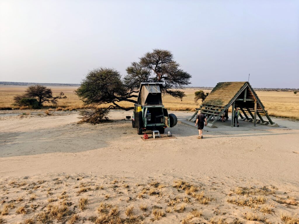
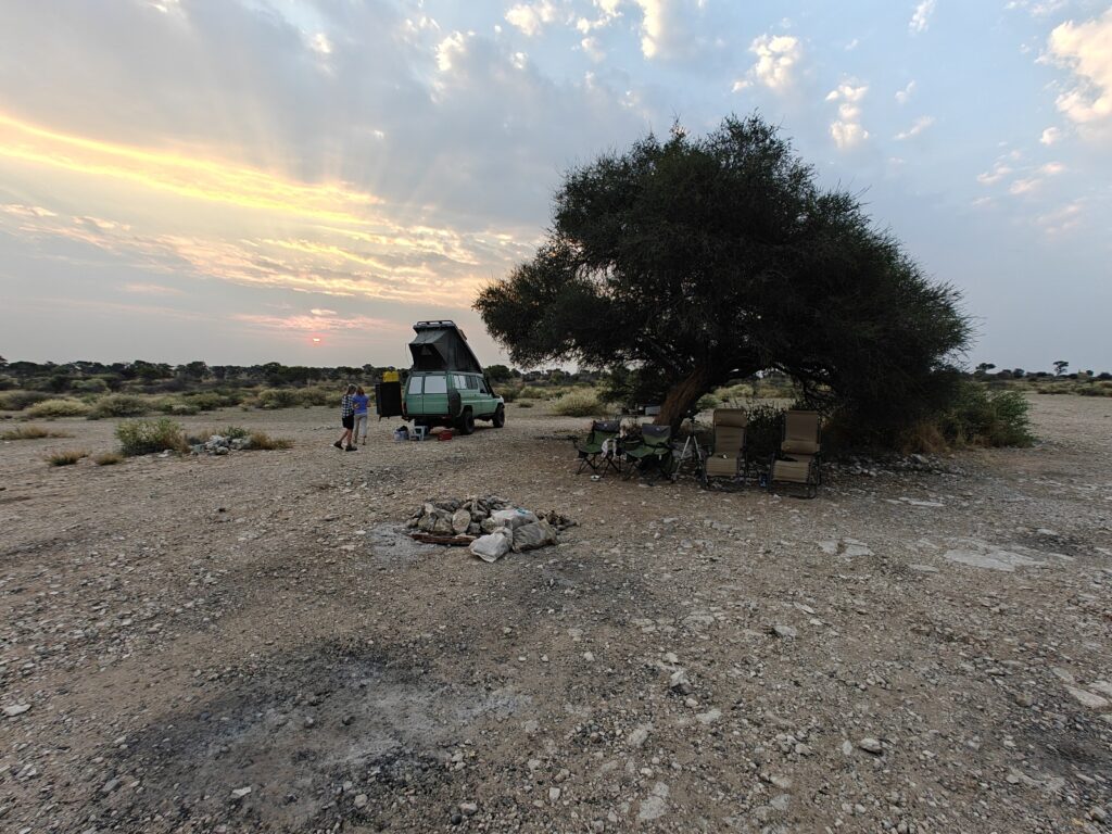
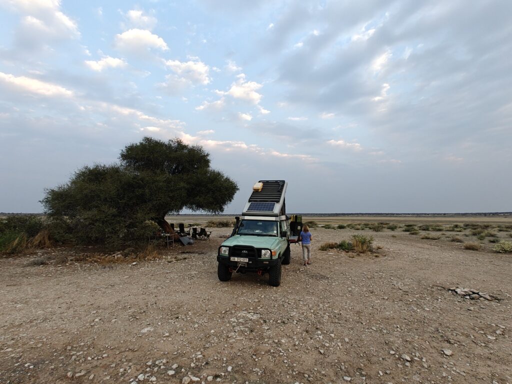
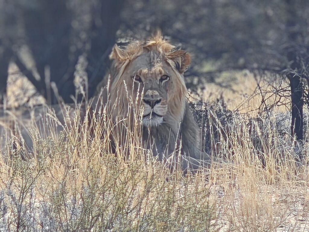
Finally, we started our permit-only, 1 party per day entry, overnight wilderness 4×4 route back to Nossob, with an overnight stay at a mid-size salt-clay pan called Mosomane, which was entirely a mineral salt-clay pan without any vegetation at all (#9 on map). The Gemsbok loved this pan as it provided essential mineral salts for them, and with Gemsbok comes desert lions! En route to this pan and campsite we encountered a lion pride in the dunes, including two adult golden-maned males (probably brothers and co-leaders of this pride), at least 3 lionesses with 2-3 very small cubs. We did a little off-road driving to get closer to the pride – the stuff that our Toyota Land Cruisers were built for – but they were extremely skiddish and kept moving away from our approach, clearly very weary of our machines and protective of the little cubs.
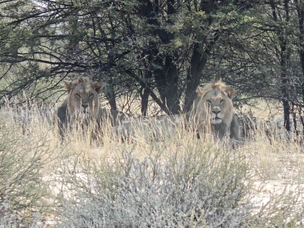
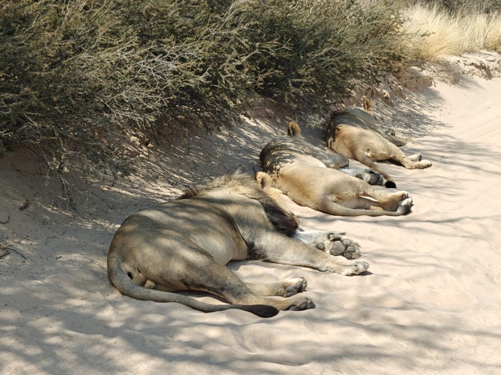
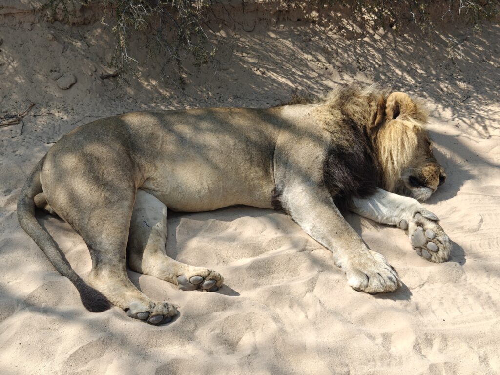
But this was not the end of the excitement. As we arrived at our wilderness campsite – no ammenities, just an empty space beneath a large umbrella acacia tree next to the pan – we noticed two adult male lions in our site, undoubtedly enjoying the shade of the large acacia treee and the soft sand beneath. As we approached, they willingly relinquished the site to us and slowly moved up under the bushes on the hillside above our campsite to find another patch of shade. They seemed quite content to remain in their shady patch while we cautiously established our camp about 100 feet away, but all the time keeping at least one eye on the brothers – nicked named the “nick brothers” by Ki because of the notched ears. They remained in their shady patch all afternoon, doing all the usual lion stuff during the heat of the day; in other, lying belly up and only occasionally rolling over or getting up to shift position and resume snoozing, but all the time keeping an eye on us as well, since neither of use were quite sure what the other might do. We spent the entire afternoon close behind our vehicles, which we arranged in a protective wall-like fashion between us and the lions – which of course wouldn’t have actually protected us if the lions wanted to get to us, but gave us a false sense of security nonetheless. We were hoping to follow the brothers on an evening hunt and were prepared to do so, even after dark, but the hunt never materialized. Instead, just after dark, they snuck off away from the campsite without us noticing. Later that night we heard them roaring from a long way off. Here’s a few pics:
Lion in our Mosomane campsiteLion brothers in our Mosomane campsite
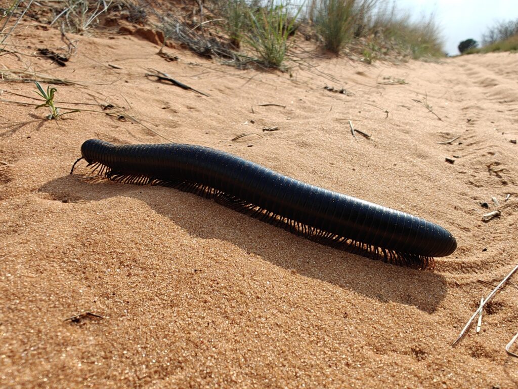
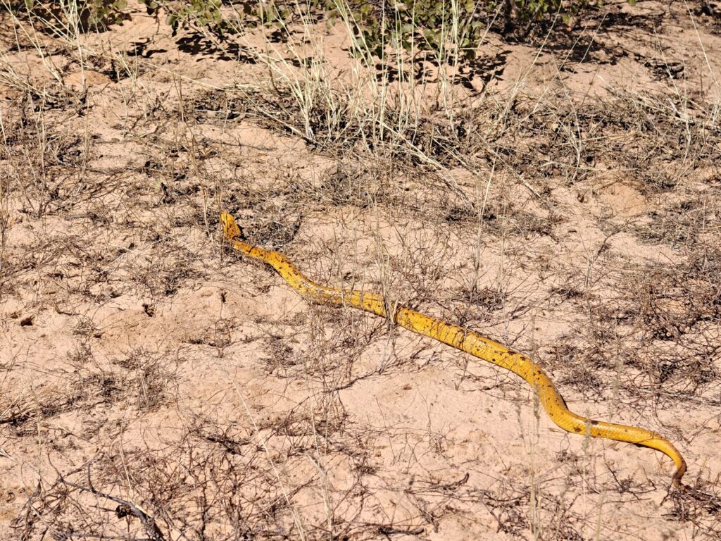
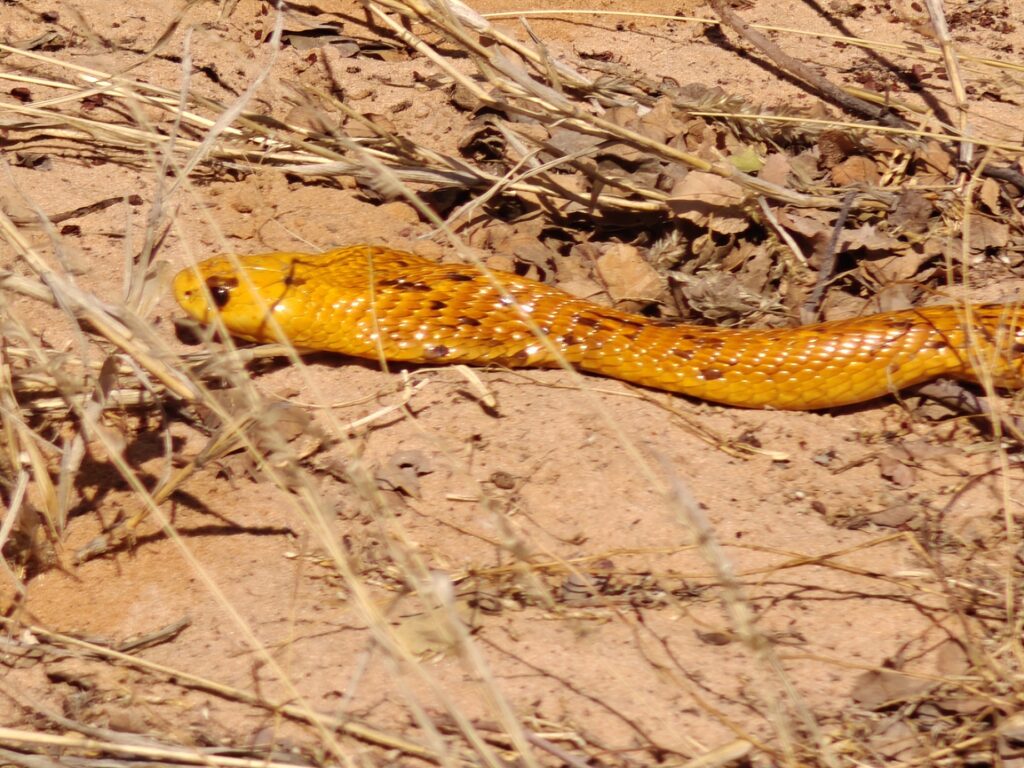
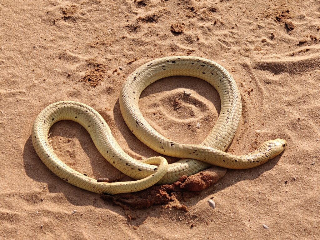
Our last day in the Botswana side of the KTP had us driving 100 km back across the dune savannah to the Nossob riverbed and restcamp. It was an awesome wilderness track that we had entirely to ourselves. We passed by more small pans and over countless numbers of dunes before reaching the Nossob in pretty good shape. The track was one of the most enjoyable tracks I have driven on in Africa, except for perhaps the last 10-15 km, which was very bumpy. We crossed lots of soft sand dunes and on at least one occasion I had to make multiple attempts to get the Green Dragon up and over the hill. En route we saw lots of the 3 characteristic large animals of the Khalahari: Gemsbok (oryx), Springbok, and Ostrich. We also had some exciting sightings of some less comom species, such as the Eland (Africa’s largest antelope) and the beautiful but deadly Cape Cobra, and let’s not leave out the small but really cool Khalahari giant millepede. Here’s a few pics:
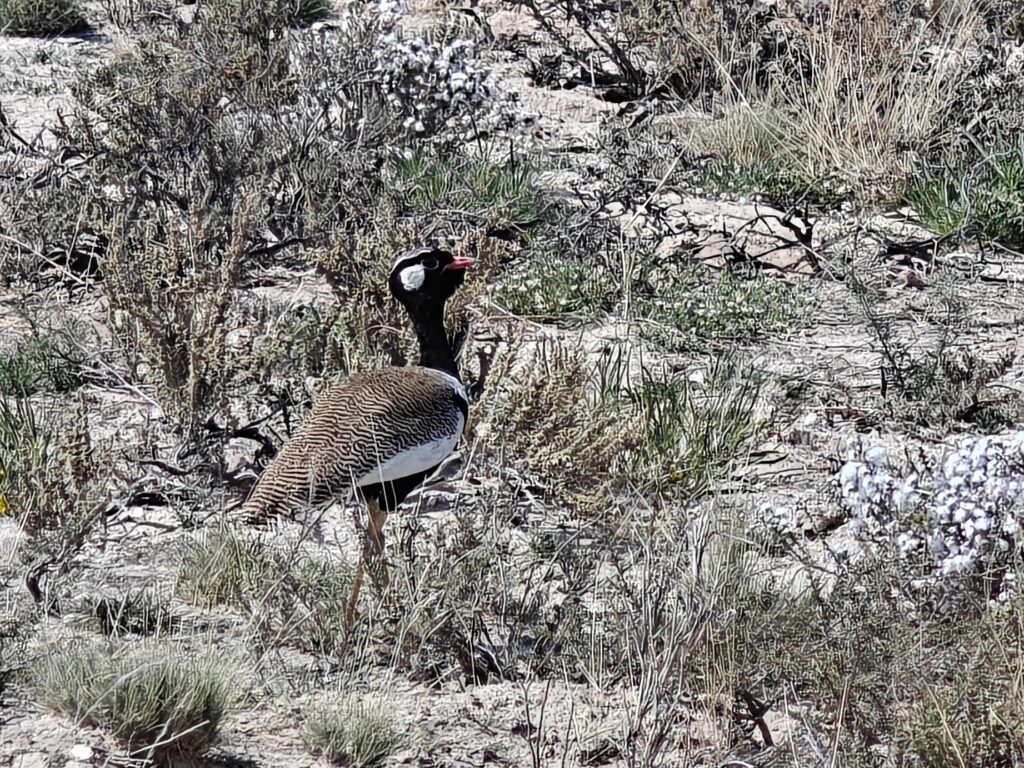
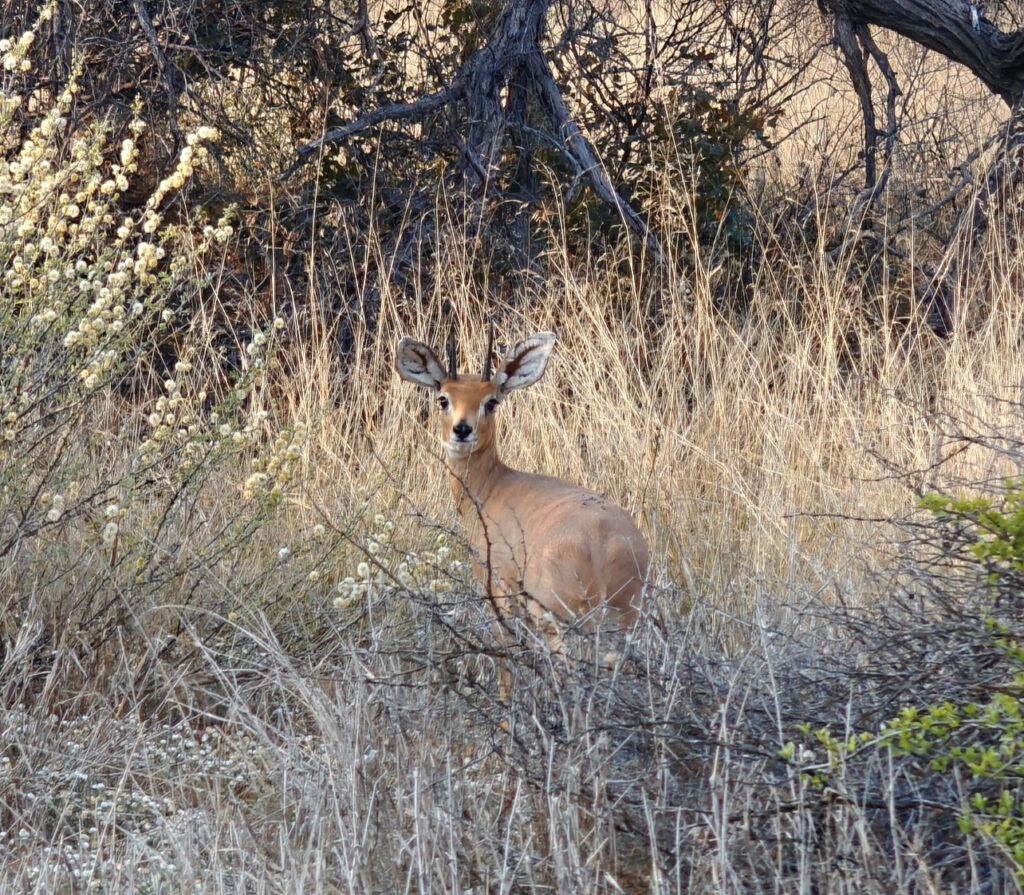
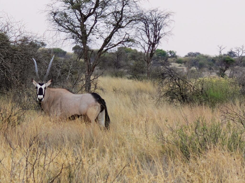
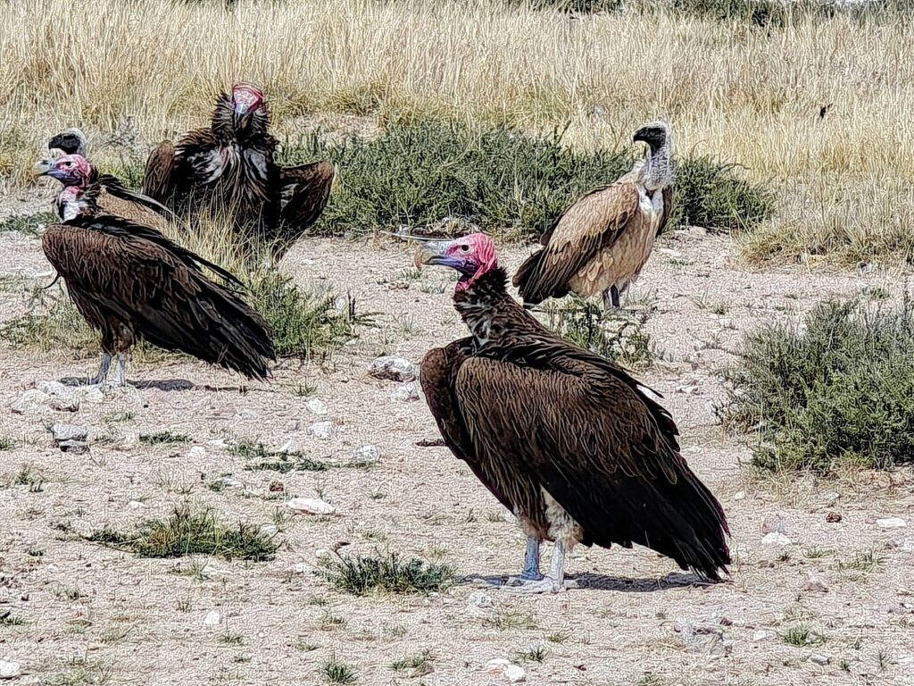
Khalahari giant millepedeCape cobra at full length (~5 feet)Cape cobra head shotWhite-guilled bustard (Southern black khoran)Ostrich (male)Steenbok (dwarf antelope and most common antelope in the KTP)Gemsbok (oryx)(the most common large antelope of the KTP)Lappet-faced vulture (and white-back vulture behind)
Lastly, here’s a short composite video of our KTP Botswana visit, with footage of our lion brothers that we shared our wilderness campsite with. Enjoy:
Ok, we are spending a night in a cabin – yes, that’s right, another treat for the gals – before heading down the Nossob to our last campsite in the KTP. See you there!
NOTE: It will be a minimum of 9 days, possibly more, before my next post, as we are heading into the real wilderness of the KTP, so please don’t worry, all is great!
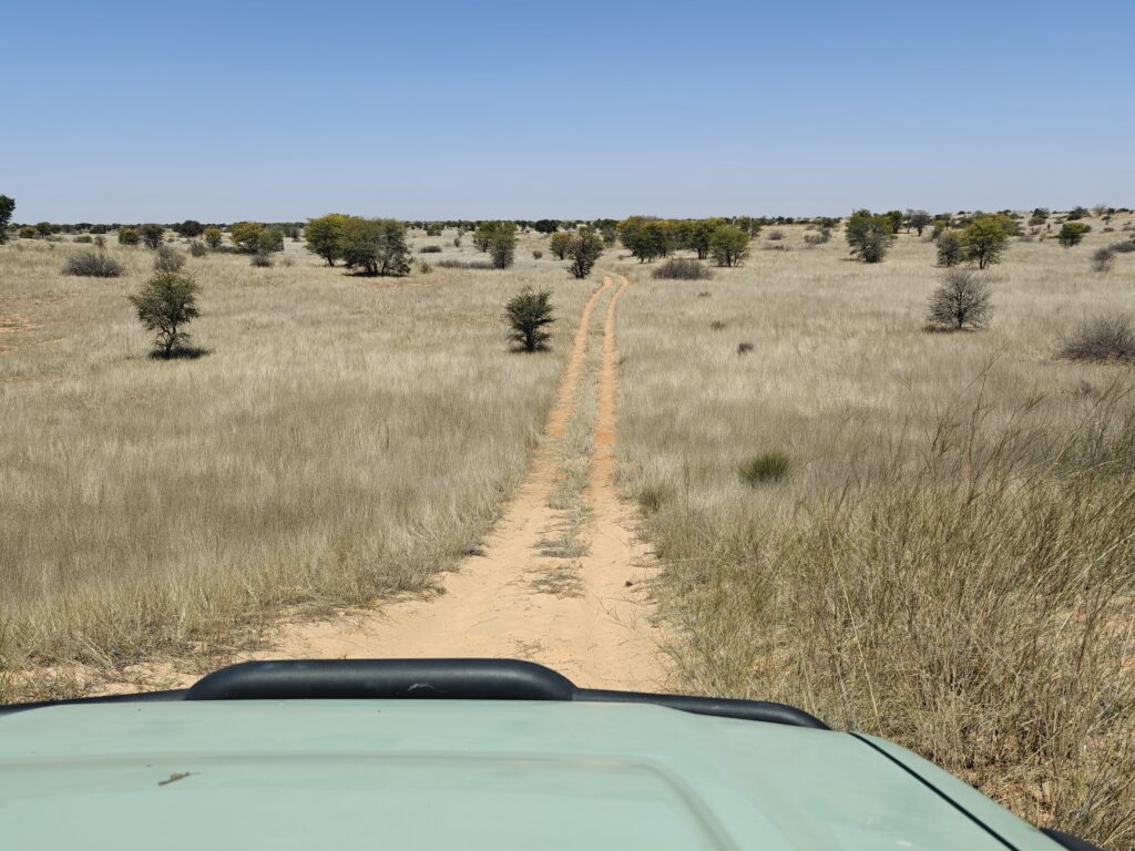
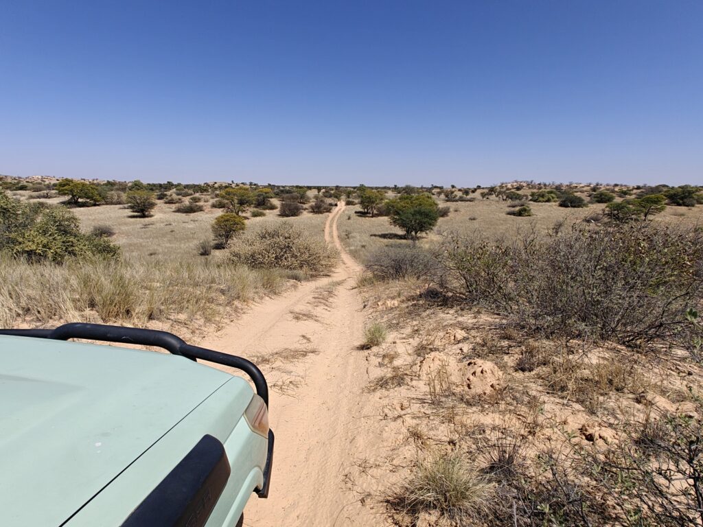
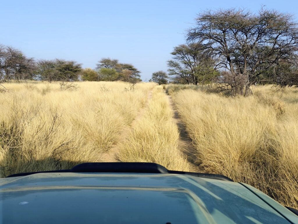
We left the KTP Mata Mata campsite and the fossilized dry riverbed of the Auob River – one of two major fossil river beds in the KTP – and traversed the rolling dunes over to the Nossob riverbed – the other major fossil river bed in the KTP (destination #2 on the map below):
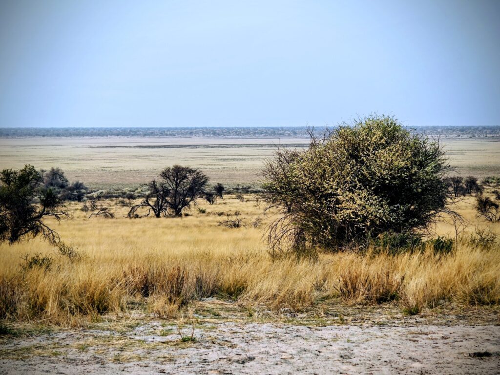
As described previously, the KTP is considered a semi-arid desert, although actually it should be considered a gradient from true desert with as little as 6 inches of precipitation per year in the southwestern part of the Park to semi-desert with as much as 13 inches in the northeastern part of the Park.
The landscape has three distinct environments that can be readily distinguished by landform, vegetation and wildlife. These include: (1) the fossilized dry riverbeds of the Auob and Nossob Rivers, which only have surface water and “flow” a little in scattered places once or twice every 100 years under the current climate – so not really a “river” anymore by current standards, hence the reference to “fossilized” river; (2) salt clay pans of varying sizes, some expansive and others very small and scattered about, with the biggest pans in the northeastern part of the Park in Botswana; and (3) rolling dunes, which constitute the vast majority of the area. I should note that although the riverbeds typically have no surface water, apparently there is still plenty of sub-surface or ground water in these riverbeds to support the tree growth – and the tourist camps!
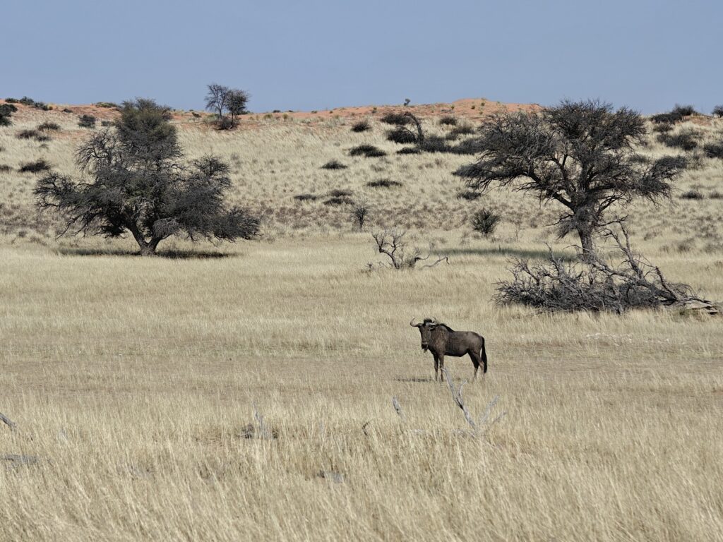
The vegetation varies from bare ground (which increases in coverage during the drought years) to grassland (which varies opposite the bare ground, and in wet years, such as 2025, can be quite prolific) interspersed with bushveld (scrubby, thorny shrubs) and tree savannahs. In addition, interestingly but not surprisingly, the grasses in the dry riverbeds are more nutritious than those in the dunes, hence the wildlife is largely concentrated in the riverbeds.
In part because of where the accessible Park roads are located, but also because of where the wildlife is concentrated, almost all of the Park tourists drive up and down the riverbeds, stopping at the intermittent waterholes maintained by the Park. The downside of this Park (similar to Etosha) is that virtally ALL the visitors are constrained to a single road up and down each of the two dry riverbeds.
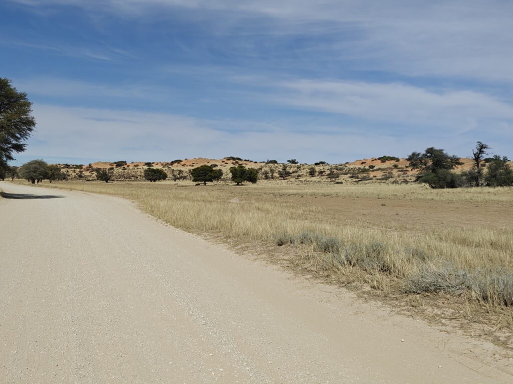
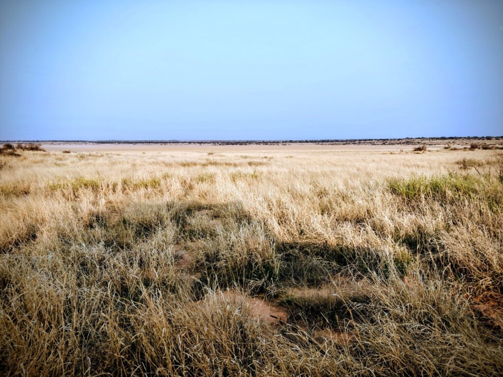
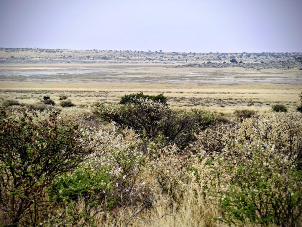
Here’s a few pictures of the riverbed and dune landscape to get you in the mood, but note that this was a year of exceptional rainfall in the summer so the grass cover and height is exceptional as well. We will be here again next year and the differences could be dramatic:
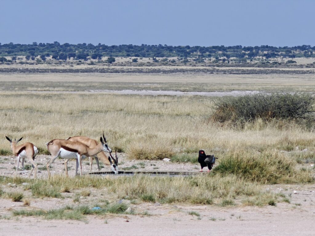
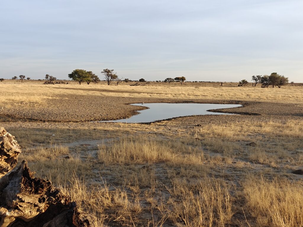
Dry riverbed and adjacent dunesVegetated dunes in the KTPVegetated dunes in KTPMisty (a.k.a. “dusty”) morning in the Nossob riverbedNossob riverbedPolentswa waterhole in the Nossob riverbed
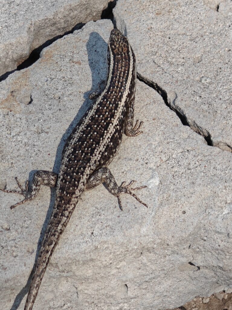
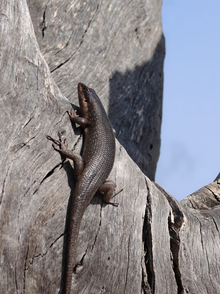
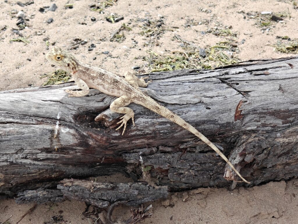
What is most surprising about the Kalahari, and the KTP specifically, is the abundance of wildlife in this semi-desert landscape. In addition to the concentration of large mammals in the dry riverbeds and more ostriches than can be counted, the ground is alive with desert mice running every which way and that, skinks and lizards everywhere, ground squirrels and mongoose running all over the place, sociable weavers in the thousands making picnicking near nesting colonies a real challenge, turtle doves galore especially at the waterholes, various raptors on every other tree it seems, and owls everywhere. So far, in our brief visit, we managed to see lions, cheetahs and African wild cats on multiple occasions, and on one morning we saw both bat-eared fox and the elusive cape fox, and of course black-back jackals everywhere!
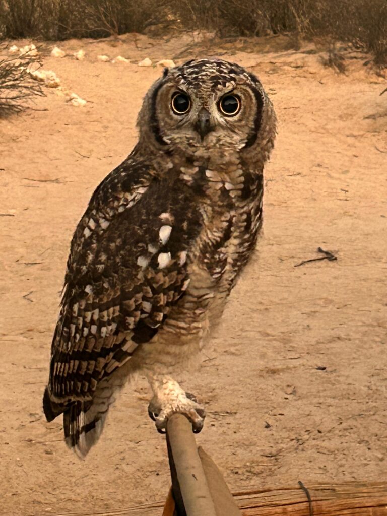
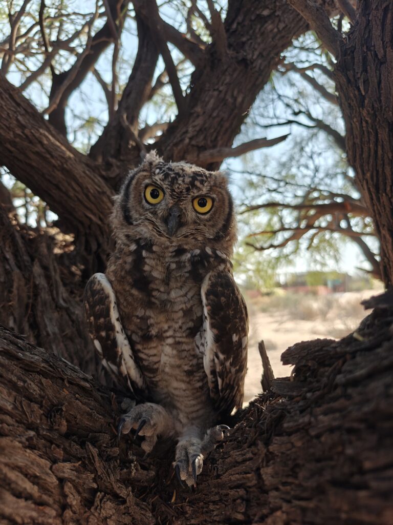
Our first two nights in the Nossob River valley were spent at the main Nossob restcamp (#2 on the map) and we did both day and night drives. The campsite was pretty nice, all things considered, even if we had relatively close neighbors. The coolest thing about the campsite was the spotted eagle owls flying all over the place, including our campsite, and even landing on our camp chairs. Who ever heard of eagle owls as camp pests?
Nossob restcampSpotted eagle owl camp guest at our Nossob campsite
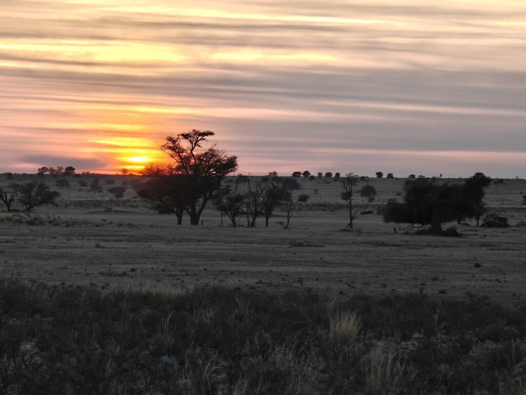
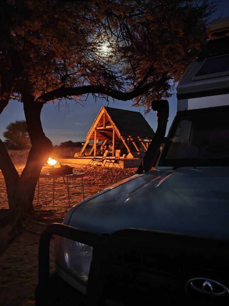
After two nights at the Nossob restcamp, we drove north up the Nossob River to a campsite called Polentswa (#3 on the map) in Botswana, which was a spectacular site. There were only 3 well-spaced campsites and each had a magnificant view out over the vast grassland savannah and riverbed. We stayed in two different campsites at Polentswa. Gorgeous sunrises and sunsets, starlit skies, few people, lots of wildlife nearby, and lions roaring outside of the campsite at night – doesn’t get much better (unless you are Rick perhaps, in which case the latter might not be desired anymore, ha)! Here’s some pics:
Polentswa campsite #1Polentswa campsite #2Polentswa sunrisePolentswa sunsetPolentswa campiste #2 by firelight after sunset
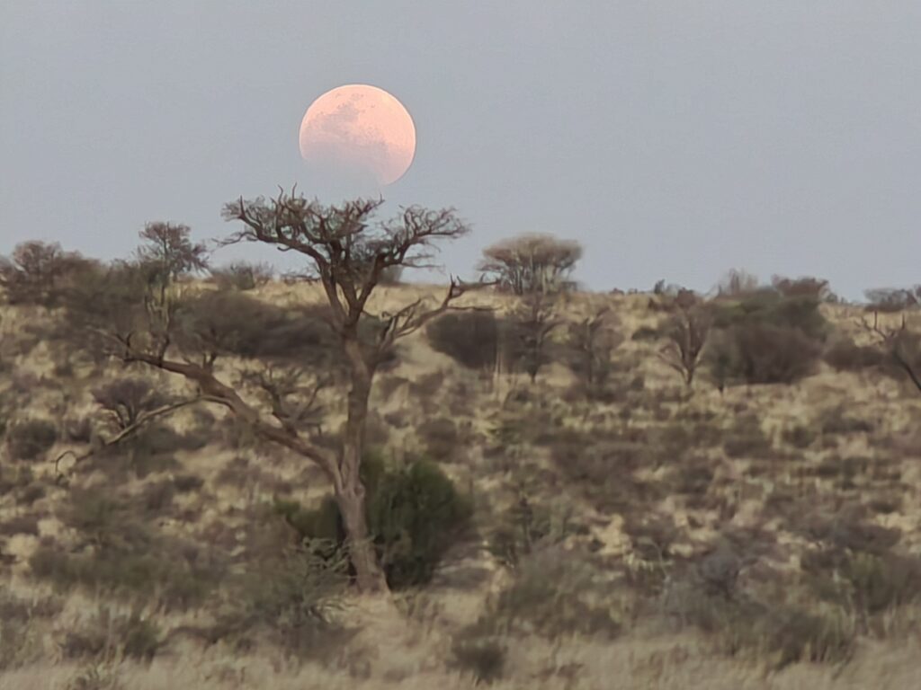
Our fourth night in the Nossob River valley was back at the main Nossob restcamp (#4 on the map), only this time we went Full Monty and stayed in a riverfront chalet with a front row view of the lighted waterhole. Hard to believe you are in the middle of the Kalahari desert and the KTP when you are sitting on your deck, with wine in hand, overlooking a waterhole 100 feet away, with a blood moon rising and total luna eclipse unfolding. Here’s a few pics to make you jealous:
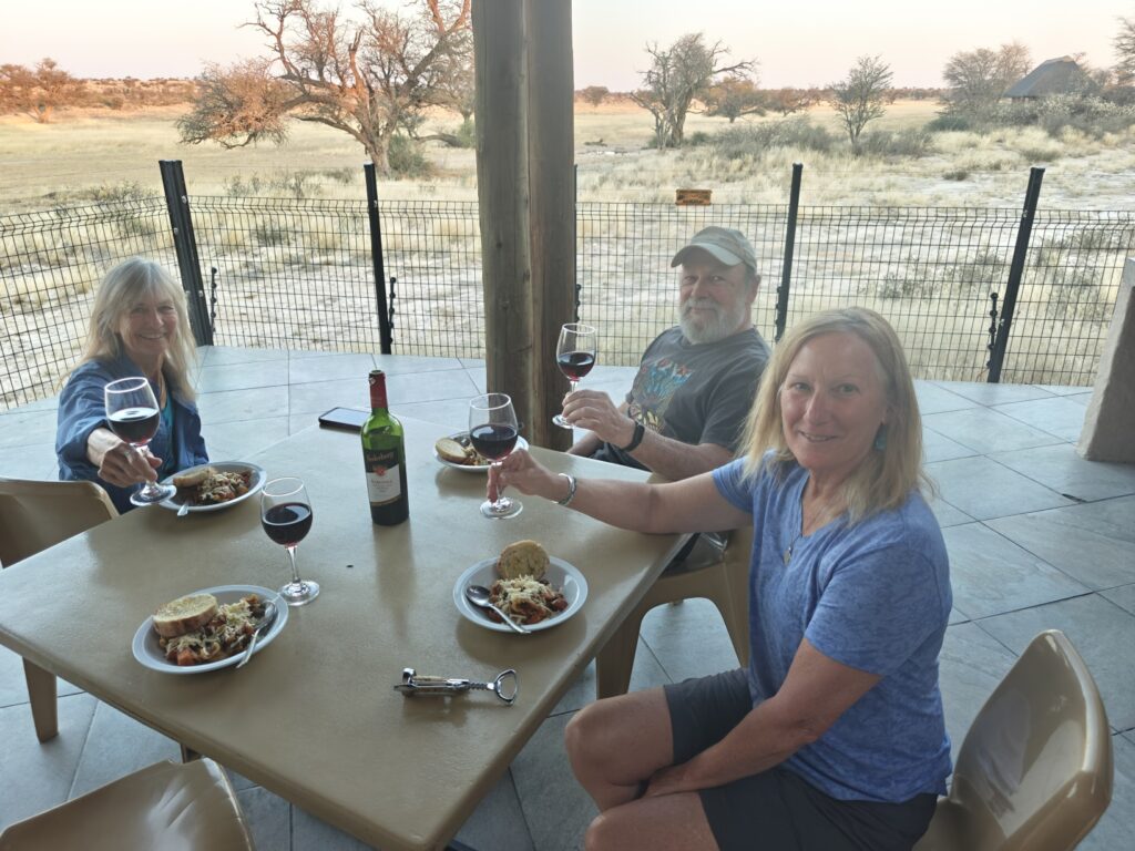
Nossob restcamp riverfront chaletDrinks from our deck overlooking the waterhole from our Nossob riverfront chaletDinner on our Nossob riverfront chalet eating Steve’s mother’s favorite Italian pasta fazoole dish (which Nancy prepared)Blood moon rising from our Nossob riverfront chalet, with luna eclipse just starting
There were too many wildlife sightings and encounters to describe them all, so I will only describe the ultimate one. This was a bucket list item for me and one that I have been waiting 25 years for: a cheetah chase and kill! That’s right, not just cheetah sightings, which you may recall we had in the Auob River on two occasions and I have had elsewhere on a few occasions, but an actual chase from beginning to end, and a successful one at that! Here’s the scene:
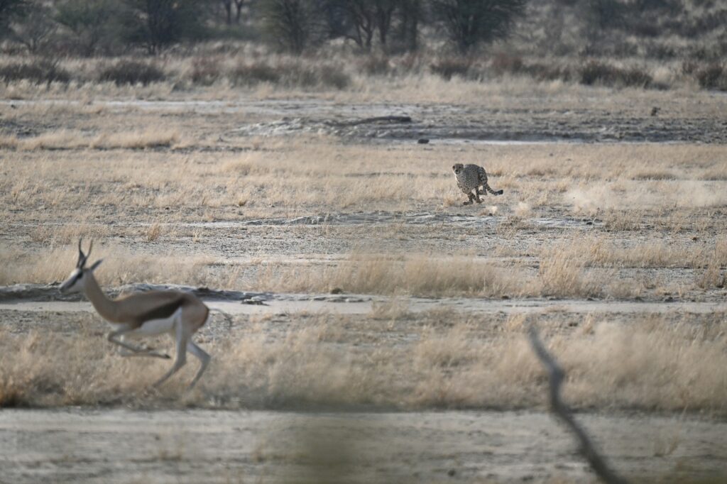
We were just leaving the Nossob restcamp in the morning, a bit latter than most people, which turned out to be fortuitous on this day, and I noticed two springbok sprinting at lightning speed down the riverbed on the opposite side. I couln’t believe the speed of the spingbok – I had never seen them run even close to this fast – they were flying. The only thing that could cause this was a cheetah chasing them. Sure enough, an adult female cheetah was close behind and moving with blazing speed, but the springbok had too much of a headstart and the cheetah quickly tired and gave up the chase and turned into the grassland fringe of the riverbed. Shortly, she returned to the riverbed and plopped down in plain sight to us to recover from the chase. Then, about 50 yards upriver, we noticed movement and spotted 3 cheetah cubs, perhaps 1-year olds, waiting and watching mamma at work – hopefully learning the art of hunting springbok. As the cubs slowly made their way closer to mom, close enough to watch her but not interfere with her, mom rose up with intent on trying again with 3 unsuspecting springbok in the opposite direction. How those springbok didn’t notice the cheetah chasing their cousins moments before, we will never know, but they made the ultimate mistake of not being more vigilant. I should also note, that we were the only ones watching this event unfold – a truly personal and intimate experience with one of the greatest predators in the animal kingdom!
We could see momma cheetah getting ready for the chase, her eyes absolutely fixated on the springbok, as she rose up, took a few careful steps in the direction of the springbok, and then burst into action. She went from standing still to blazing speed in an instant. I have never witnessed such amazing acceleration. The 3 sprinbok took off at full speed away from the charging killer. Within a couple of seconds the cheetah was rapidly gaining on the springbok, and as they went around a corner, we briefly lost sight of both the attacker and its prey, but a cloud of dust gave away the ultimate ending to the chase. We quickly moved up around the corner to see the cheetah on her victim and the 3 cubs approaching excitedly. The whole chase and kill took all of about 6-7 seconds, but I tell you it was perhaps the most exciting 6-7 seconds of my wildlife career! The following video tells the rest of the story, but here’s a couple of Steve Destefano pictures of the cheetah chase first:
Cheetah chasing springbokCheetah in flight (note dust clouds behind) in dazzling display of blazing speed and acceleration
KTP Nossob River video (13 minutes), including a full 6+ minutes of the cheetah encounter!
OK, we are off to the KTP wilderness for 8 nights!
Photo Gallery:
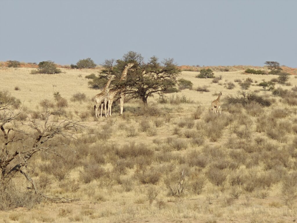
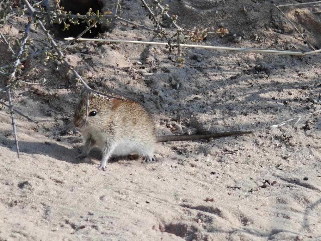
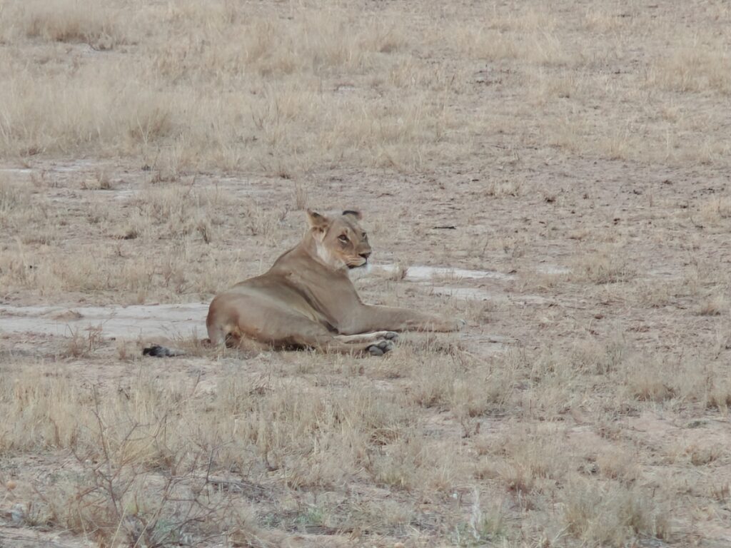
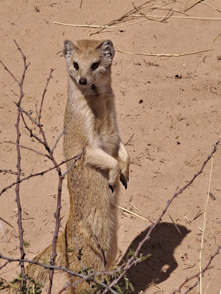
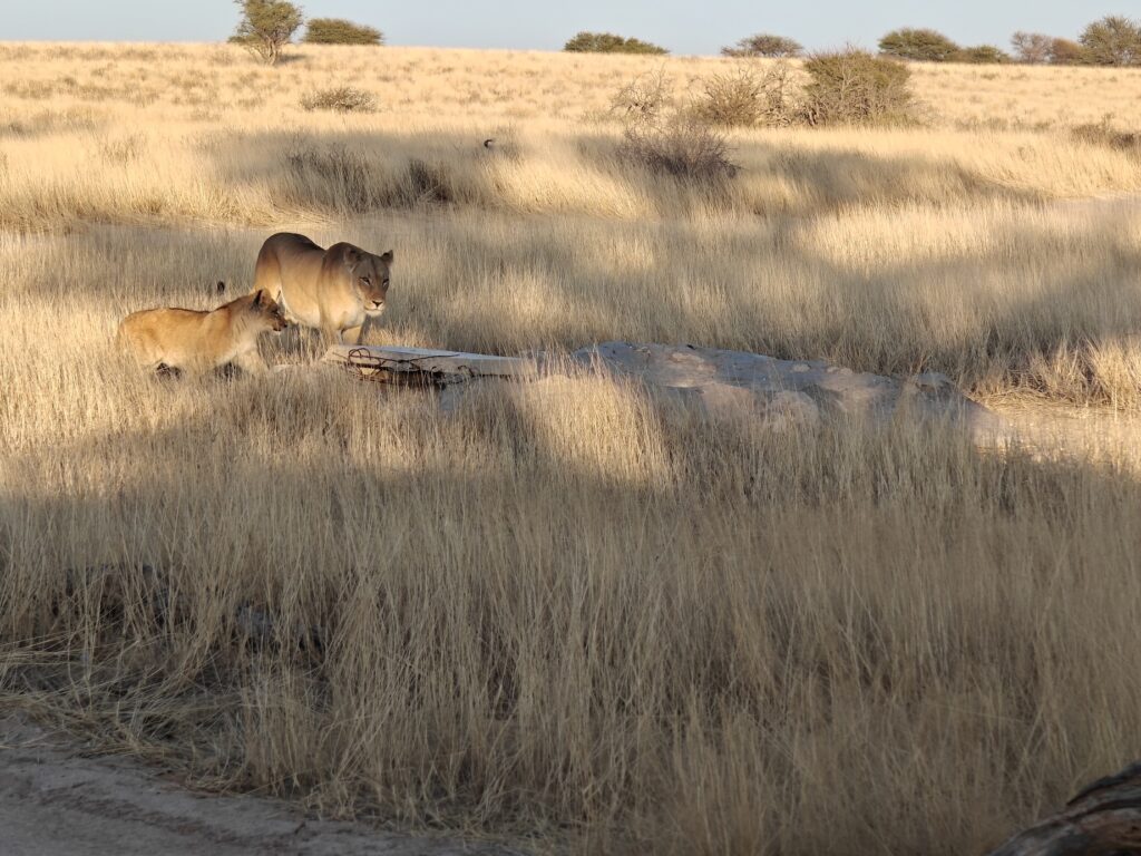
A beautiful cape fox (photo by Steve DeStefano)Classic giraffe scene (momma, teenage daughter and baby)Kalahari tree skinkKalahari 4-lined mouseFledgling spotted eagle owlLioness at Nossob restcamp waterholeLions resting along the Nossob River roadLion resting along the Nossob River roadYellow mongoose camp visitorLioness and cub at Polentswa waterholdUnidentified Kalahari lizardJust a classic waterhole scene (gemsbok, wildebeest, springbok, ostrich)
We made it to the Kgalagadi Transfrontier Park (KTP), the anticipated highlight of this year’s journey. The KTP is a place I have been hearing about from other overlanders for 3 years and having been chomping at the bit to visit.
After a brief one-night stand at a nice private campsite called Die Skuur outside of Mariental, located halfway between Sesrium and the KTP, we completed the rather delightful drive to the KTP on a combination of asphalt and nice gravel surface. I only mention this because I didn’t have to curse once about the road conditions the entire drive, much to Nancy’s delight and relief!
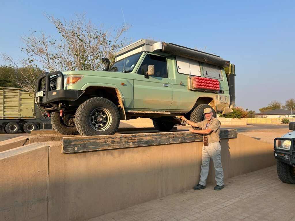
Prior to leaving Mariental, we managed a carwash that featured a serious undercarriage power wash to remove the caked on and solidified mud we picked up in Walvis Bay. And how much do you think a 1 hour car wash of this type cost? 5 bucks! That’s right, although we tipped heavily.
Green Dragon gets a badly needed undercarraige wash
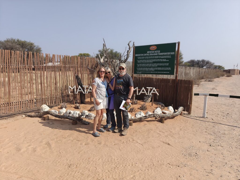
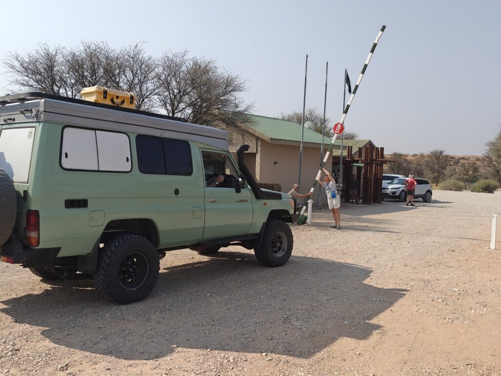
We left Namibia – with some reluctance – breezed through the border post and entered the KTP and South Africa through the Mata Mata gate – the only entrance to the KTP from Namibia. Nancy even opened the gate to let us into the KTP:
Entering the KTP at lastNancy let’s us out of Namibia and into South Africa and the KTP
The KTP, as it is generally referred to locally, is a transfrontier park in the Kalhari Desert, which you may recall from previous year’s posts, is a large semiarid sandy savanna in southern Africa covering 350,000 sq mi, including much of Botswana as well as parts of Namibia and South Africa. In the local native Tswana tounge, the name “Kalahari” means “the great thirst” and the Kgalagadi, which occupies a portion of the Kalahari, means “a waterless place” – because there is no permanent surface water.
The KTP was created by combining the Kalahari Gemsbok National Park in South Africa, created in 1931, with the Gemsbok National Park in Botswana, created in 2000, and together they encompass 15,000 square miles. The two Parks are combined into one management area to allow the wildlife to move freely between the two countries – wildlife without borders – and to facilitate management of the greater Kalahari ecosystem.
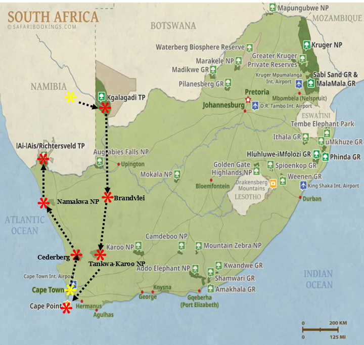
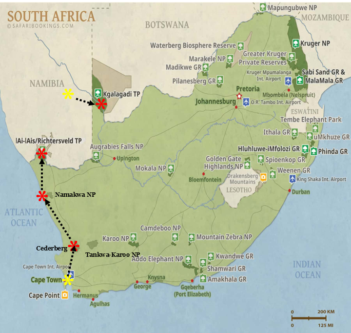
Our visit to the KTP this year extends over 18 nights – that’s right, 18 nights. Why so long, you might ask? Because this is a vast area and to fully experience the KTP in all its geography and subtleties, and to have time to observe ALL of the characteristic wildlife with liesure, and to be able to fully immerse ouselves in the sublime environment of the Kalahari – takes time. Here’s a map of the KTP with some annotations to help explain our trip. The numbers on the map correspond to the sequence of our movements through the Park:
Mata Mata (2 nights)
Nossob (2 nights)
Polentswa (2 nights)
Nossob (1 night)
Bosobogolo pan(2 nights)
Mbuasehube pan (2 nights)
Mpayathutlwa pan (2 nights)
Kiding pan (1 night)
Musemane (1 night)
Nossob (1 nights)
Twee Rivieren (2 nights)
Because our journey through the KTP is so long, I am not going to cover it in one massive post at the end of our visit – my usual mode of posting. Rather, I am going to break it up into several posts, WiFi permiting. Note, for the Botswana wilderness portion of the trip (#5-9), we will be totally disconnected from the world (and that means no WiFi), so do’t expect to hear from me for a week or so during that portion of the trip.
For this post, let’s focus on our first stop for two nights at Mata Mata (#1) and wildlife drives along the Aoub River valley. I can’t begin to cover all the wonderful wildlife sightings and encounters, so I will mostly let the pictures and composite video do the talking. One of the main highlights of these two days included a couple of different sightings of cheeetah, but some of the smaller, less notable widlife species produced some amazing encounters as well. Hope you enjoy!
Here’s the composite video for those that like (or need) action:
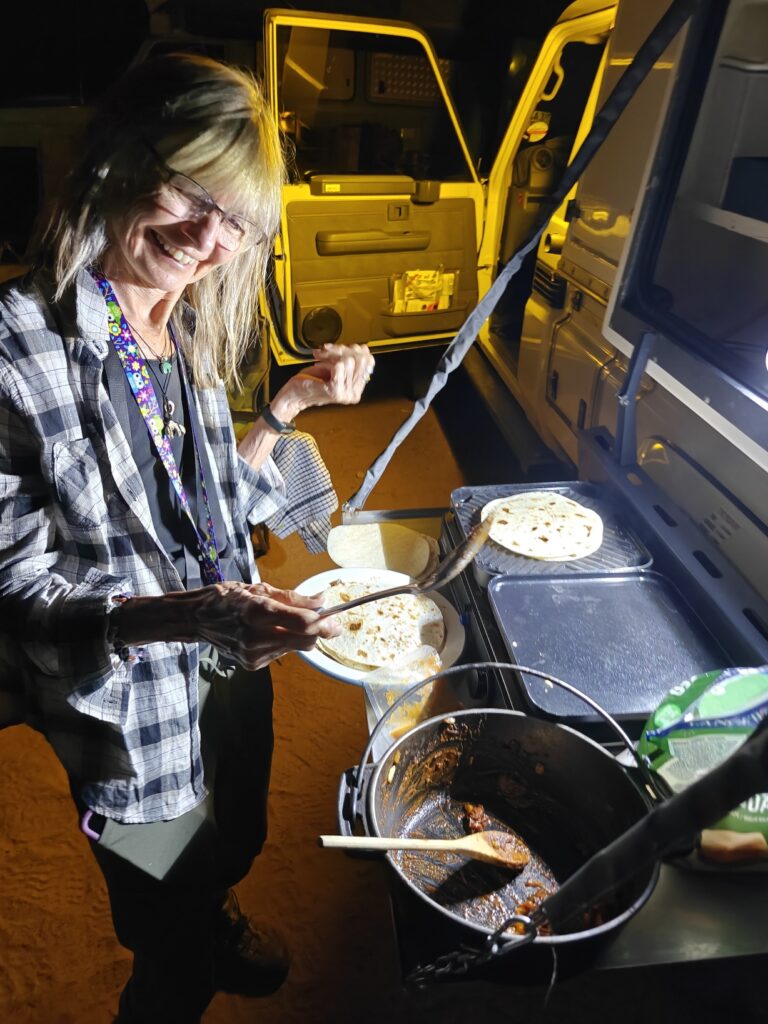
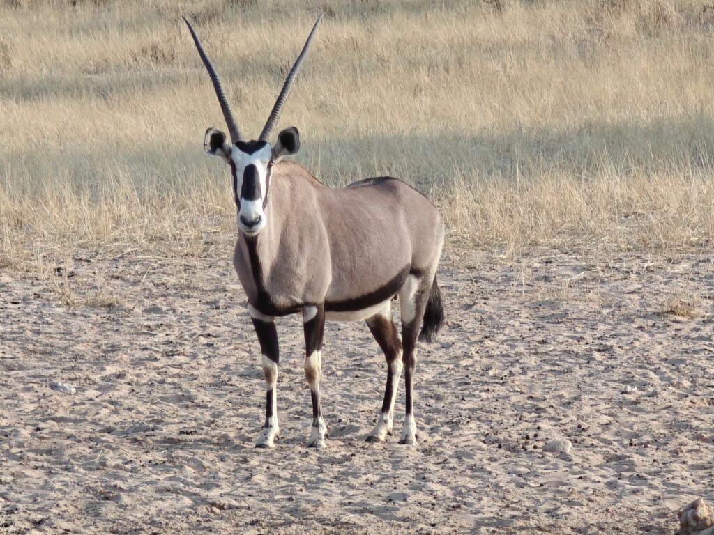
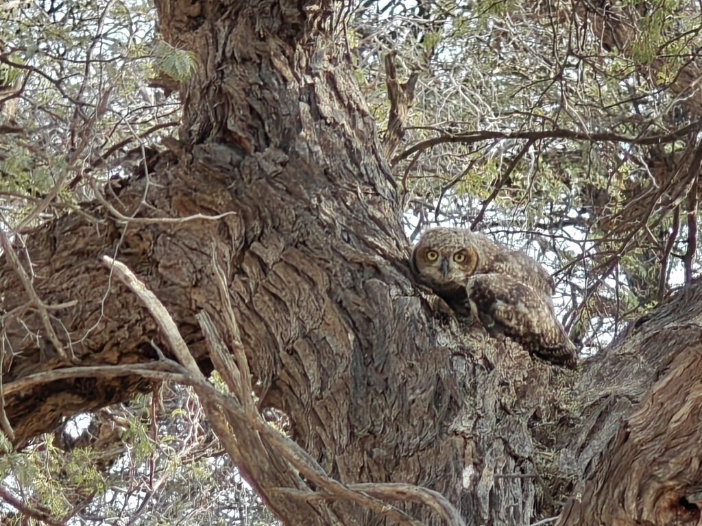
Ki makes some spicy fajitas for dinnerKTP’s iconic species, the Gemsbok (or Oryx)Common KTP resident, the Cape CobraMy favorite picture so far, a nestling Spotted Eagle OwlTypical scene in the Aoub River valleyKTP’s most awesome species, the Cheetah
Our next stop is the Nossob Rest Camp, located roughly in the middle of the Park (#2). Hope to see you there!
After leaving Walvis Bay, we headed inland to the Naukluft Mountains for a couple nights en route to the famous Sossusvlei salt pan and great sand sea.
The Naukluft Mountains form the eastern part of the Namib-Naukluft National Park. The Mountains were originally designated as the Naukluft Mountain Zebra Park to protect the Hartmann’s mountain zebra, but it was folded into the Namib-Naukluft National Park in 1979.
The Naukluft Mountains were formed by a complex serious of geological processes that I won’t try to summarize, other than to say that the current result is a beautiful array of geological formations, as hopefully my pictures and video below will show.
Our first night was actually spent outside the Park at the base of the Naukluft Mountains at the Bushman’s Desert lodge and campsite, the same place I camped a few weeks back when en route to Windhoek to meet Nancy, only you may recall that I camped in an exclusive bush site. This time, however, we went Full Monty and camped at the main camp with flush toilets, kitchen, etc. Here’s what the surrounding landscape and delightfull campsite looked like:
En route from Walvis BayEn route from Walvis BayCrossing the Tropic of Capricorn en route from Walvis BayEn route from Walvis BayBushman’s Desert campsite from the hilltopBushman’s Desert campsiteSteve making grilled cheese, onion and chutney sandwichesBushman’s Desert campsite landscapeA quiver tree of gals at Bushman’s Desert campsiteEn route to Sossusvlei
One of the highlights of this segment of our trip was a guided visit to a cheetah sanctuary in Solitaire a short distance from our campsite. A guide took the four of us in an open-air safari vehicle into a 48 hectare enclosure that serves as home to 4 sibling cheetahs, including two sisters and two brothers. Their mother was caught killing goats on a private farm and her leg was broken. She was brought to the Sanctuary and died shortly after, but not before giving birth to these 4 siblings. Unfortunately, without their mother to teach them the ways of the world (i.e., what is food and what they are food for) it was impossible to release them back into the wild, where they would assuredly die. Thus, they remain in the enclosure, but in a semi-wild state. We absolutely loved being so close to these magnificant animals. Here’s a few pictures to wet your appetite, but watch the video if you really want to see them:
Our second night was spent inside the Park at the Naukluft Park campsite. I failed to take a picture of our campsite, but it was nicely situated along a streambed with pooled water at the base of a rock cliff and overhanging trees for awesome shade. Nancy and I did a nice 10 km hike on the Olive trail that took us up to the top of the escarpment and then down a long and narrow canyon with steep walls on either side, reminiscent of some of our slot canyons in the Colorado Plateau. Rather than post a bunch of pictures, I have a 2 minute slide show for your entertainment. I should also say that a highlight of the hike, other than the spectacular mountain scenery, was spotting a small group of Hartman’s Mountain Zebra high up on the plateau, but well out of range for a photo.
Here’s a short (1.5 minute) video of Nancy and I using a chain attached to the canyon wall to pass by a drop-off pool in Olive Canyon on our Naukluft Mountains hike.
After reluctantly leaving our desert campsite at Rock Arch, we headed to the coast and Walvis Bay for a couple of nights at an apartment and a full-day guided trip down the coast to Sandwich Bay:
We spent two nights in Walvis Bay at Windbeggars in an efficiency apartment located one block from the Bay and on the southern edge of town. It was quite a contrast from our previous desert hilltop campsite. The only thing in common was that they were both perched up high, one on a rocky hill, the other on the second floor of the building.
The main reason for coming to Walvis Bay was to see the coast, in stark contrast to the desert we just came from, pick up some new birds for Steve and Ki, and take a full-day guided safari down the coast to Sandwich Bay. But in the meantime, we learned that Walvis Bay is the only Port in Namibia and all overseas exports go through it. One interesting factoid about Walvis Bay is that it is home to the largest saltworks in the southern hemisphere, which is a major export product for the country and includes sending salt to the U.S. The table salt you are using right now might have come from this very spot. Here’s a shot of the saltworks, that involves pumping salt water from the “lagoon” into basins and then letting the water evaporate over 6-8 months, afterwhich they are left with 15-20 cm of harvestable pure salt, which they bag for truck transport to neighboring countries or put on ships for overseas export. Here’s a picture of a portion of the saltworks:
Walvis Bay saltworks
We also learned, and observed first hand, that they also mine lots of Uranium in the surrounding desert – there are 5 mines in the immediate area – and ship all of the ore to China, who, by the way, is gradually taking over, at least economically, large parts of Africa.
Sandwich Bay (or Sandwich harbour) is accessible only by 4×4 and involves traversing beach and dunes for 60 km to get there. The Bay is included within the Namib-Naukluft National Park and is designated as a RAMSAR site for the expansive shallow saltwater lagoon (that was formerly freshwater). In case you don’t recall, RAMSAR is an international treaty signed in 1971 for the protection of wetlands of international significance. The RAMSAR list currently includes over 2,500 sites across the globe, including 5 in Namibia.
Based on the descriptions of Sandwich Bay and the tours, we fully expected the tour would be focused on seeing wildlife in Sandwich Bay lagoon. Well, it turned out to be much more about the desert dune landscape – which was very welcome – but even more about the wild ride up and down the dunes at break-neck speeds, racing up a steep dune and going over the lip of the dune without being able to see the drop off before descending, or rather falling off, what felt like near vertical faces (which in reality clearly didn’t exceed the angle of repose of perhaps 35-40%). It was quite a thrilling ride that many of you (yes, I am referring to you Caitlin) would have enjoyed immensely, especially the adrenaline junkies, but others might scoff at. But rest assured that the next wind wipes away the dune tracks so the impact on the physical environment is rather negligible. Here’s a few pics of the dunes and beach drive, but there is also a little video footage (see below):
Entrance to Namib-Naukluft National Park en route to Sandwich BayBeach rode en route to Sandwich BayThere is water in the desert (beneath the surface as indicated by this patch of vegetation)Driving the dunes en route to Sandwich BayNamib dunesCrazy dune formations en route to Sandwich BayDriving the beach en route to Sandwich BaySandwich Bay from atop the dunesSandwich Bay from the shore
The biggest surprise was seeing the wildlife making a living in the rear dunes supporting sparse vegetation. This included gemsbok (oryx), springbok, ostrich, and black-back jackal. We also had a wonderful encounter with a Cape fur seal on the beach (see video footage). Here’s a few pics of the critters:
Springbok in the dunesGemsbok in the dunesCaspian terns in Sandwich BayBlack-backed jackal on the beach
Here’s a short video of a cool fur seal giving himself a sand bath on the beach and some beach and dune driving:
After our brief visit to the Naukluft Mountains, we headed east to the true desert of the Namib and the famous Sossusvlei salt pan and Namib Sand Sea.
Sossusvlei is perhaps the most iconic place in Namibia, and one of the top few tourist destinations – for very good reason! Sossusvlei is one of those salt pan formations that I have talked about on multiple occasions in this blog, formed by ephemeral flooding of the Tsauchab River and the accumlation of salts in the clay topsoil, although water from the River rarely reaches the pans today. The Pan itself, however, is not the real star of this Park in my opinion, but rather it is the striking towering red dunes, purported to be some of the highest in the world, that captures the imagination. And it’s not just one pan, but several, including the famous Deadvlei Pan with its ancient, fossilized trees. The skeleton trees in Deadvlei died around 900 years ago when the climate changed and the river bed shifted course, leaving the pans dried up most of the time, except for the ephemeral seasonal rains. Because of the exceptionally dry climate, the skeleton trees have persisted for 9 centuries, thwarting any attempts to decompose them.
Much to our great surprise and delight, our Park campsite was rather OK, or as our resident PolyAnna (yes, I am referring to Ki) exclaimed, “it was awesome; we had a site on the edge of the campground, no really close neighbors, lots of animal tracks right in our campsite, and two big piles of gemsbok poop right in our site, what more could we ask for”. Sherry, rest assured that Ki is a suitable substitute for you in this regard. Here’s a pic:
Our Sesrium campsite
We had a couple of epic days in the dunes. The highlight of the first day was climbing “Big Daddy” dune, said to be the tallest dune in the Sossusvlei area at ~1066 feet above the Pan, and overlooking Deadvlei Pan. Of course, we shared the climb with several dozen other tourists also seeking the view from the top, but it was well worth the exertion and sharing the views. And the run down the slope of the dune was truly exhilarating, despite the 5 pounds of sand that we collected in our shoes. The skeleton trees, or “fossilized” trees as they refer to them here, of Deadvlei Pan were also quite beautiful, more so had we been there during the early morning hours and the sun angle low to cast shadows (perhaps next year Mark and Kirsten!).
The highlight of the second day was a hike up “Big Mamma” dune overlooking Sossusvlei itself. Big Mamma is “only” ~656 feet above the Pan, but what was epic about this hike was the strenuous “trail” breaking climb up the long crested ridge to the top – much more strenuous than climbing all the way to the top of Big Daddy on other’s footprints – and the ultimate solitude of being atop the dune by ourselves for the duration. It was the highlight of the visit for us to be sure.
We also did a short hike in Sesrium Canyon in the headwaters of the Tsauchaub River, which to our surprise was a slot canyon carved through hundred(s) of feet on conglomerate material – essentially compressed mud and rounded cobbles of varying sizes all packed together in layers of varying thicknesses. It was easy to imagine a river flowing through the canyon and depositing material for eons after eons.
OK, for your visual entertainment I have created a slide show of our wonderings AND a composite video. Take your pick, or if you are really committed, watch both. Hope you enjoy.
Here’s the slide show. Note, for you serious wildlife biologists, the dune beetle in the slide is a Tenebrionid beetle (Tok-Tokkies) and the grasshopper-looking insect is, well, a grasshopper:
Here’s the video composite. Note, I switched from landscape to portait mode in the middle of filming in Sessrium Canyon at the end of the video and I could not figure out how to merge the landscape and portrait segments, so you’ll have to turn your head on its side to watch the last couple of minutes. Sorry for the neck bending, but lesson learned – send me your hospital bill if :
We are off to the Khalagadi Transfrontier Park (KTP) for an extended safari through this part of the Khalahari Desert. Don’t panic if you don’t hear from me for several days at a time, as we will be very remote at times and without cell service.
After leaving Daan Vijoen Wildlife Reserve outside of Windhoek, we headed west and camped for a night in the Namib-Naukluft National Park en route to Walvis Bay on the coast:
Ordinarily I might not post a blog entry for a one-night stand en route to a destination, but our campsite was so awesome that I decided to. We camped at a remote and exclusive desert campsite called Rock Arch in the Namib-Naukluft National Park about 30 km on a 4×4 track off the main route to Swakopmund on the coast (n.orth of Walvis Bay). This was desert camping at its finest, and Ki was especially at home and delighted being the old desert rat that she is, owing to her days researching pronghorn antelope in southern Arizona.
The Namib-Naukluft National Park is located in western Namibia and ecompasses over 19,000 square miles of the Namib desert, which is purportedly the oldest desert on Earth. The Namib extends from the Atlantic Ocean east to the Great Escarpment that runs down and around the southern part of Africa, mostly in South Africa. You may recall from last year my visit to the Drakensberg escarpment on the northeast coast of South Africa. The Drakensberg is part of the same Great Escarpment that wraps around South Africa. The Namib is a true desert, with an average of only 4 inches of precipitation per year, which comes in the form of coastal fog that warms and falls as rain. More on the spectacular dunes in the Namib in a subsequent post.
The Namib-Naukluft Park is one of the largest wildlife parks in all of Africa. The orgins of the Park date to 1907, but there have been several substantial additions over time. The Park now runs 370 miles north to south along the coast and, thanks to an addition in 1979, it includes 1,000 miles of Atlantic Ocean coastal waters as a marine reserve. This is a really big Park; we have nothing in the States to compare in terms of size.
Ok, back to my original justification for this post – a one-night stand to a surprisingly awesome desert campsite. Our campsite was remote, private and desert camping at its finest. Our site was perched on the top of a rocky outcrop (or kopje, or koppie) perhaps only 50 feet above the plains, but enough to afford us spectacular views of the surrounding desert. There was a grotto to sit under for shade with seating and a really nice loo below the koppie. I will let the photos do the rest of the talking.
Driving into the Namib desertQuiver tree in the Namib desert near our Rock Arch campsiteSociable weaver nestHeading to Rock Arch campsiteOur hilltop Rock Arch campsiteOur Rock Arch campsiteSteve and Ki’s rigOur Rock Arch campsiteOur Rock Arch campsite looking through the archOur drop-toilet loo below our Rock Arch campsiteKevin in the grottoNancy holding up the archNancy in the grottoKi in the grottoNancy, Ki and Steve in the grottoSunset through the arch at our Rock Arch campsiteSunrise from our Rock Arch campsite
Off to Walvis Bay and a trip to Sandwich Bay. See you there!