August 11-12: Maputo National Park

I finally made it to my last destination Park in Mozambique, Maputo National Park, which covers 400 square miles on the southeastern coast of Mozambique bordering South Africa and Eswatini.

The Park was originally established as a hunting concession in 1932, and then in 1960 is was proclaimed a Reserve to protect a small population of coastal elephants resident in the area, and then in 2009 the Ponta do Ouro Partial Marine Reserve was declared to help protect a variety of marine species, including dugongs and sea turtles, and then finally in 2021 the two Reserves were combined into Maputo National Park.

In 2000, it also became part of a huge Transfrontier Conservation Area encompassing well over two million acres that includes national parks from all three bordering countries. Note, don’t picture this Transfrontier Park as a single contiguous protected Park, but rather as a set of Parks connected together by a matrix of lands in which there are concerted conservation efforts to protect wildlife, but these are mostly inhabited lands that are quite heavily used by humans. So, some of this is really just lines on a map and a way to attract international funding for projects, rather than truly protected lands, but I suppose it’s better than the alternative of completely unconstrained human land use in the matrix.

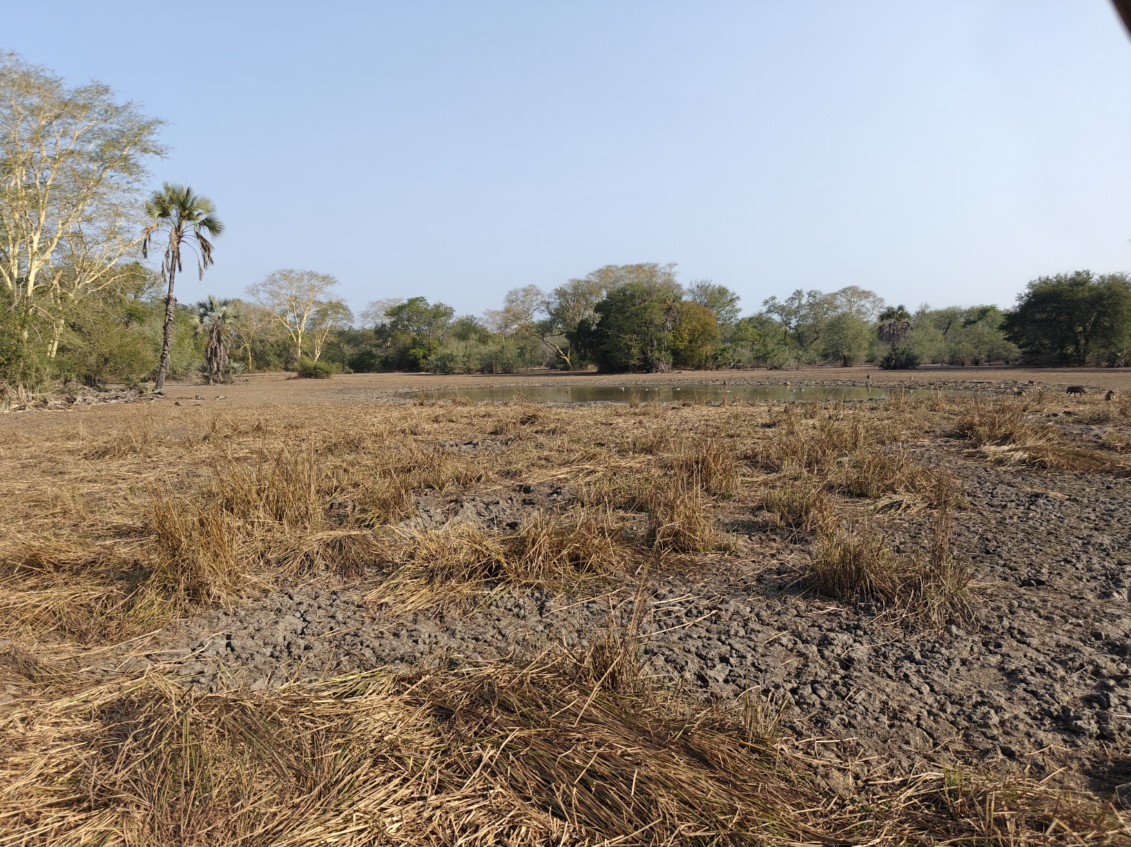
Maputo National Park is a “forest meets the sea” Park, similar to Saadani National Park in Tanzania, if you recall. However, Maputo is unique in that it is entirely comprised of ancient sand dunes and is surprisingly diverse given the rather homogenous soils; it includes several large freshwater lakes, extensive freshwater wetlands, dry and wet grasslands, grassland savannah, sand thicket and forest (or dune scrub forest), swamp forests, mangrove forests along the coastline, and extensive beach and tidal mudflats. Truly, this Park has an amazing diversity of environments for existing entirely on ancient sand dunes. The entire Park and all the varied environments listed above occur on ancient dunes created from millions of years of sea level rise and fall. Thus, the landscape is a series of rolling hills (former dunes) formed of deep sand and covered with dry grassland, savannah or dense forest thickets, with large inter-dunal basins between that either support lakes, marsh embedded within wet grasslands and the occasional swamp, and this extends 25-30 km inland from the coast. I haven’t visited any Park like it. Here are a few shots of the landscape:

Dry grassland
Dry grassland and savannah (recenty burned)
Sand (dune) thicket
Freshwater lake
Coastal dunes and each at Ponta Membene

Maputo has had the nearly identical history of all the Parks and Reserves throughout Mozambique and Malawi. All of the wildlife was wiped out during the civil war and afterwards from poaching, except for a few animals and a small remnant elephant population. Unfortunately, the white rhino population was wiped out in the 1980’s along with most other species. In 2010, the Reserve started reintroducing the large mammal fauna and by 2021 had reintroduced over 5,000 animals encompassing over a dozen species, including several antelope species as well as some of the big cats, such as cheetah, leopard, and serval. The elephant population has grown to 400 and it is now even being used a source of animals for relocation to other Parks and Reserves. Along with the recovery of the large mammal fauna, the Park has revitalized tourism in the Park, including updating several facilities. The Park returns 20% of the tourism revenue to the local communities as compensation and to encourage their engagement in and endorsement of the Park. Based on what I saw, the Park is doing a great job. The roads are signed well and the campgrounds have first rate facilities. There are animals to be seen, albeit with some difficulty, and a decent number of tourists. Overall, I rate this Park as a great one to visit, not only because of the unique and diverse environments and fauna, but also because of the top-notch facilities. I think in another 10-20 years the wildlife populations will be large enough that wildlife drives will be very productive as well.

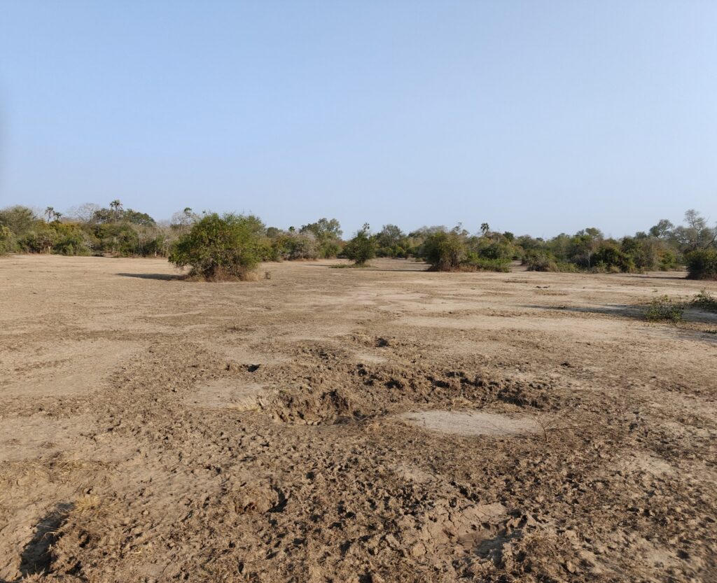
For my first night, I drove about 25 km on sand track, much of it soft and deep, through the middle of the Park out to the beach to a lodge and campground called Ponta Membene. The Green Dragon proved its worth, not only for getting me easily through all the deep sand, but also for rescuing a local vehicle that got stuck. They slowed down in the sand and stalled and couldn’t start the engine. Apparently, this engine problem was well known to the driver and his 4 or 5 accompanying friends. Anyways, I had to put the Green Dragon in low 4×4 and push the truck through the soft sand for 20 m or so to jump start his truck. I wasn’t sure Green Dragon would be able to push his smaller truck in the deep sand, but it did it with flying colors. Hooray for the Green Dragon! Here’s a few shots of the main sand track through the ancient dunes:

Maputo sand track
Maputo sand track
Maputo sand track
Maputo sand track

The beach at Ponta Mebmene was very similar to the one at Coconut Bay (if you recall; see the previous picture), with high frontal dunes and white sandy beach as far as you could see. The difference was that here there were a handful of other people on the beach. However, I did manage to get in a short snorkle, but the surf was too rough and there was no underwater reef, so it was unproductive. My campsite, however, was top-notch. I was nestled under the dense dune forest thicket and I had my own kitchen area, hot shower and toilet facility – all clean and modern. Oh, and there was a camp tender that would do anything I wanted, including building a campfire. This is living!

My campsite at Ponta Mabene

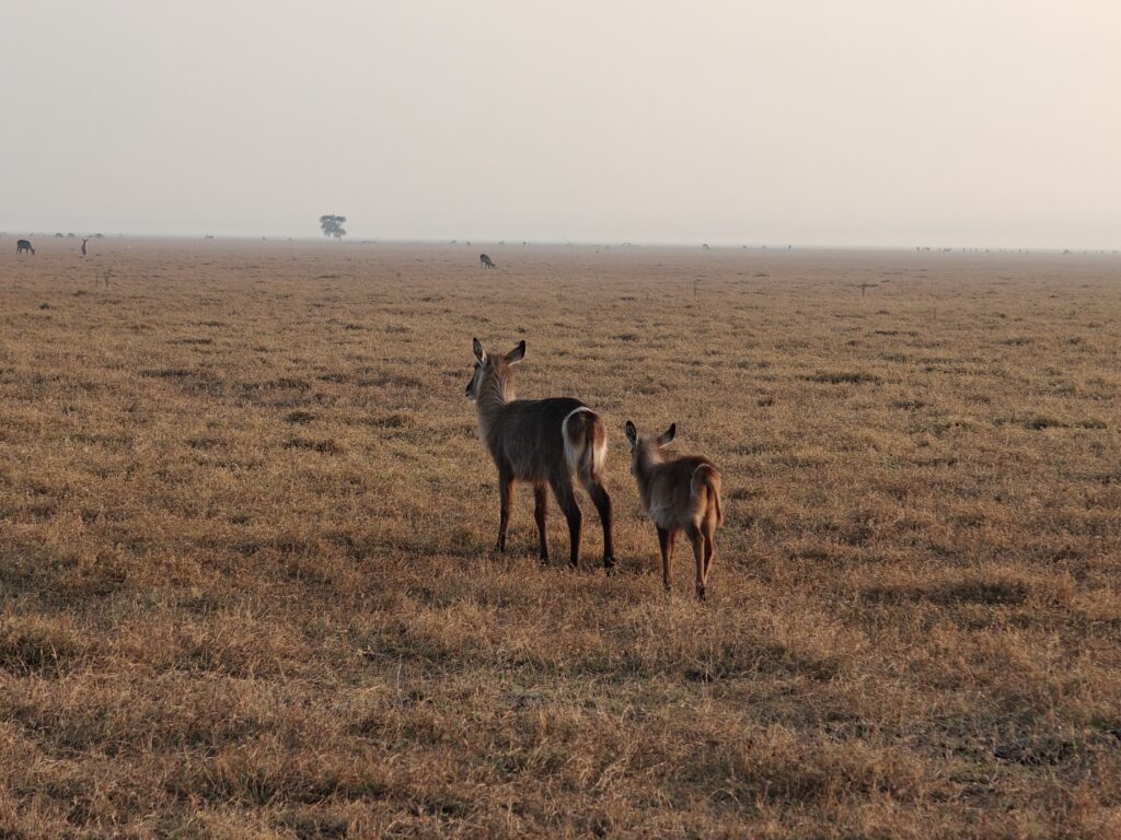
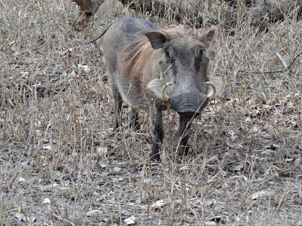
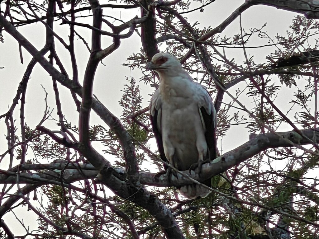
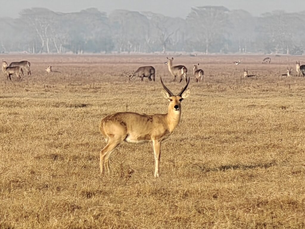
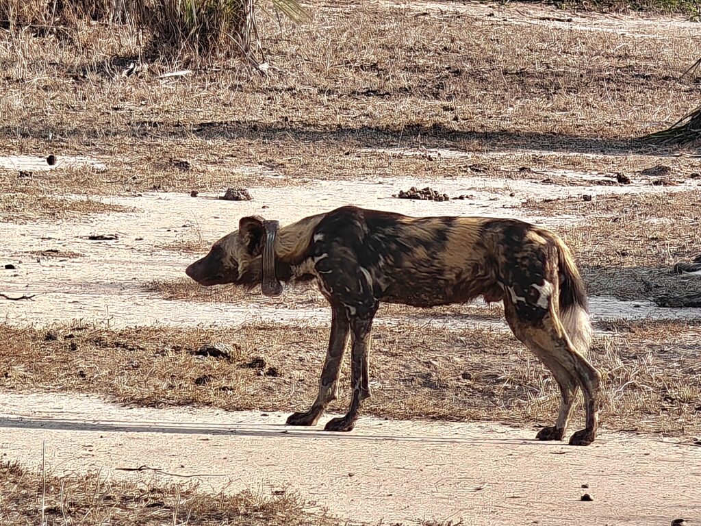
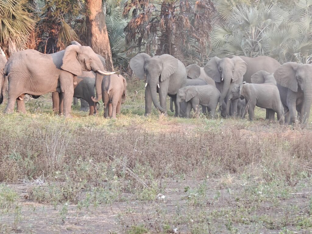
In Maputo, I drove a lot without seeing much wildlife, but I also had an awesome drive one morning through dry grassland and savannah on rolling hills to a small lake and saw lots of blue wildebeest, plains zebra, common reedbuck, waterbuck, steenbok, common duiker and hippos, and a single side-stripped jackal, not to mention lots of different bird species. I had the entire drive to myself and, as a result, I believe it was of my favorite drives of all time. I took a lot of video footage of the drive and some of the wildlife, so check out the composite video if you get excited to want to take a virtual safari with me. Here’s a few shots to wet your appetite:

Little egret
Steenbok
Common reedbuck (male)
Blue wildebeest
Black-necked heron
The lake at the end of my drive
Common duiker (playing hide and seek)

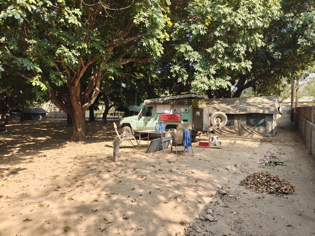
For my second night, after my amazing morning drive (noted above), I headed to a backcountry campsite overlooking a small lake named Nela. The campsite was quite nice; it included nice shade trees for the Green Dragon and a rather nice, but primitive, kitchen facility, along with a shower stall and toilet. No water though, so I had to use my own water for everything. There was also a nice campfire ring under a nice shade tree overlooking the water where I spent the afternoon.

My intended campsite at Lake Nela
My campsite view at Lake Nela

After the mid-day siesta, I made a huge pot of stir fry vegies with pasta and a curry sauce. Here’s a picture of the stir fry. Can you name all the vegies in this dish?

Stir fry medley

Just when I was finishing cooking and enjoying the serenity of the site and getting ready for a quiet evening with the animal sounds, guess who camerolling into camp? Yes, that’s right, a convey of South Africans – classic style. Eight (yes, I said 8) vehicles in this convoy all rigged out for extended camping. Apparently, they booked this campsite a while back. When I arrived at the Park they booked me and told me no one else would be there. TIA! Anyways, this little site was designed for maybe 4 vehicles, perhaps 5 max, but not 8. Not only that, but these were South Africans in a convoy, and they set up massive camps and make a lot of noise – I have camped next to them before! They weren’t going anywhere and there was no way I was going stay in this urban mess, so I packed up and headed to my next scheduled campsite at Xinguti. I arrived at dusk and only 1 of 8 sites were occupied – nice! This campground was identical to the one at Ponta Membene (i.e., identical layout and facilities) except without a lodge connected to it. It was next to a large lake but surprisingly the sites didn’t have a view of the lake or easy access to the shore. Poor design in my opinion. Why have a campground at a lake if you can’t really see the lake very well or easily access it?

My campsite at Xinguti

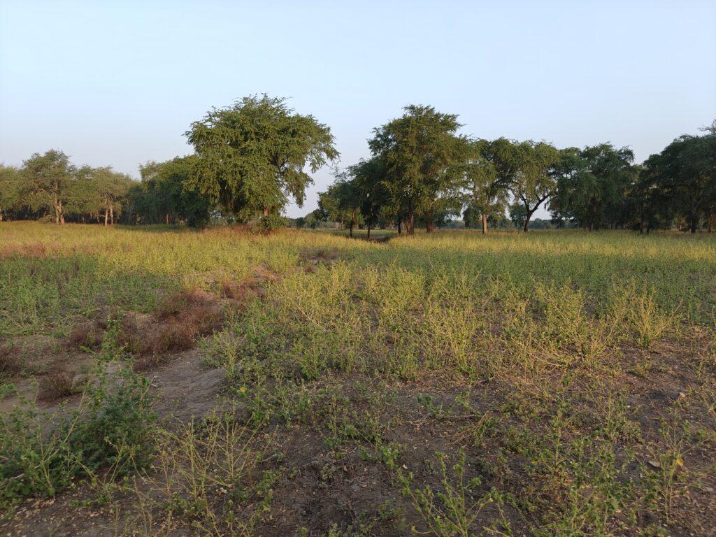
Next morning, I took another wildlife drive on one of the off-the-beaten track routes back to the main entrance gate. Again, it was a delightful drive with a diversity of habitats, including dense thickets, wet grasslands and marshes, dry grassland and savannah. I didn’t see as much wildlife on this drive as the previous day, other than water birds. I believe this was likely due to the condition of the grasslands. This grassland hadn’t been burned in some time so the grasses were taller and less palatable then the fresh shoots of the recently burned grasslands of the previous area. Burning does an important job of revitalizing the grasslands and producing highly nutritious forage for the grazing animals, and I suspect the majority of the grazing animals simply move around with the better forage conditions. Nevertheless, I still saw lots of wildebeest and zebra, along with several antelope species, and a few giraffe. Again, I had the entire drive to myself. I suspect that the vast majority of visitors to the Park simply take the main dirt track out to the coast and beach, as I did on my first day. Most come for the deserted beaches I think, not the wildlife drives, which worked to my benefit. Here’s a few shots from this drive:

Crested guineafowl
Nyala (male)
Blue wildebeest
Southern giraffe (male)

WARNING, below is a link to a very long video made for the most dedicated followers. I really enjoyed this Park for the reasons mentioned above, so I took a lot of video footage. In particular, for both of the wildlife drives I described above, in this video I will take you on a virtual safari with me from the driver’s seat. Hope you enjoy.

Maputo National Park composite (44 minutes)

Ok, since I voluntarily displaced myself from the backcountry campsite at Lake Nela and moved to Xinguti for my second night, rather than return to Xinguti for my planned third night (since there was nothing spectacular about this site), I exited the Park and spent the night at a lodge/campground in Ponta do Ouro, the southern most point in Mozambique on the coast and next to the border. Nothing to report about this one-night stand other than to say this place is clearly a vacation spot for tourists seeking beach and marine sports, as every other building is a lodge of some sort, so I am off to South Africa. It may be a while before I can post again because I’m not sure where I will be able to get a new sim card. So, see you when I see you.

New Species:

  1. Natal red duiker
  2. Rufous-naped lark
  3. Eurasian moorhen
  4. Red-capped robin-chat
  5. White-backed duck

August 9-10: En Route Down the Coast

Not much to report as I am just incrementing my way down the coast en route to my final destination in Mozambique, Maputo National Park, but that will be the focus of my next post after my visit. For now, just to keep my journal continuous, I will give you a quick report on my last two nights. From Inhassaro, just north of Vilanculos shown on the map below, I headed several hours south to Coconut Bay just south of Inhambane shown on the map below, and then on to the seaside village of Macaneta just north of Maputo shown on the map below

Coconut Bay was another huge compound of campsites and cottages set back behind the frontal dunes, so no ocean view from the campsite, but rather a short hike through the dunes to the beach. Fortunately, I was the only guest, so I had the place to myself except the staff. I was originally going to stay a second night, but a huge wedding party was coming in the following day so I bailed. The campsite was rather atypical. As you can see here, you park your camper vehical under a big shed. I suppose most people come to the beach during their summer hot, wet season, and the sheds are probably a way of providing campers shelter from the rain. I suppose that would be nice under rainy conditions, but for me it felt less like camping. Anyways, not my favorite of camping sites, which was another reason to bail after one night:

My campsite at Coconut Bay

The best thing about this place was the Bay itself. As I was the only guest, except for a few local fishmen, I had this amazing beach to myself. Talk about deserted sub-tropical beaches! I even got in a short snorkle behind the natural rock jetty shown in this photo, despite the winds and white-caps everywhere else. It wasn’t the greatest of snorkling locations – some reef fish and a few corals – but it was nice to get in the water regardless:

My snorkle site at Coconut Bay

Also of note for the birders, I had a spotted eagle owl hooting in the tree next to my campsite during the early evening. I managed a poor photo, but I am putting in here for Phil (and you other birders) as proof:

Spotted eagle owl

And sunrise over the Indian Ocean is always a delight:

Sunrise at Coconut Bay

After leaving Coconut Bay, I kept heading south down the coast and randomly ended up in the small oceanside village of Macaneta just north of Maputo, and landed at Pisane Lodge, one of the several oceanside lodges/campgrounds. Nothing special or to my liking at this place – fancy lodge and campround with resstaurant, bar, pool and all the amenities – except that it had a big screen TV and I was in time to watch the US womens soccer defeat Brazil for the gold medal! Funny thing was that Nancy was watching the game with Phil and Mary and we were Whatsapping messages back forth about the game in real time as it was being played – isn’t technology amazing. Here’s my unexciting campsite:

My campsite at Pisane Lodge

Here’s a short 2-minute video of my campsite at Coconut Bay and of the Bay itself; there was nothing worth videoing at Pisane Lodge:

Coconut Bay video (2 minutes)

Ok, I’m off to my final destination in Mozambique, Maputo National Park. See you there.

August 6-8: To the Coast or Bust

After leaving Gorongosa National Park, I headed south to the coast, stopping en route for a night at Rio de Gorongosa private game reserve and then on to the coast at Inhasarro and then south along the coast to Vilanculos. Note, the map below doesn’t show my actual route, as I had that big detour to Tete after leaving Malawi and then two additional one-night stopovers before getting to Vilanculos, which is shown as the destination in this map, but it suffices to show the basic travel plan within Mozambique.

My first night was spent at a random spot en route to the coast. I had originally planned to drive all the way to the coast but after battling mine-fields on the main north-south national highway(!) for several hours, I decided enough was enough. I know I keep complaining about the roads, but you can’t image just how bad they really are and it’s all I can think about when on these terrible roads. It’s so bad that you simply can’t take your eye off the surface to enjoy the surrounding scenery – not that there was much in this part of the country. In this case, I was driving on a major national highway (N1) that had probably 100 km of potholes distributed intermittantly over 250 km of highway, with holes several inches to two feet deep, and so many of them that it was impossible to drive around them. I had no choice but to come to an almost complete stop and gently drop in and out of them. It was truly driving hell on Earth. SO, what should have taken a couple hours on a decent road surface took 3 times that.

As I was cursing the government for allowing such a disgrace in their national infrastructure, I came upon signs for a lodge/campground that looked promising. So, I abandoned the highway for some much needed R&R. It turns out that this lodge/camp called Rio Gorongosa is a private ranch of 15,000 hectares (soon to double in size) owned by a rich South African who purchased the land from the government (actually, a 99 year lease) back in 2012 to create a game ranch for himself. After purchasing the lease, he then purchased and transported from South Africa 100 African buffalo and some number of greater kudo and sable antelope (can you imagine the cost of that?), and then had the ranch fenced and allowed the populations to grow. He flies to and from the ranch in one of his two helicopters. He will start killing big trophy animals this year and will invite wealthy big game hunters from anywhere to pay him to come and shoot one of these majestic animals. This is classic South African. South Africa is filled with huge private white-owned game farms/ranches all for the purpose of growing big animals for the trophy hunt. Apparently, some of these types have looked to poorer neighboring countries to purchase land for their sport. I can’t abide this practice!

Anyways, I had a nice afternoon sitting by the gentle Gorongosa River and then camped for the night. I had the entire ranch to myself, with only the ranch manager/shef and another staff helper around. It only cost $6 USD. Not a bad stopover all things considered:

My afternoon siesta spot on the Gorongosa River
My campsite at Rio Gorongosa

Next morning I headed on to the coast and found on iOverlander a somewhat remote, off-the-beaten-path, beachside lodge/campground called Vista de Bazaruto just south of the village of Inhassoro. This involved several kilometers of driving on sand track behind the frontal dunes (picture below), but I later learned that I could have driven the harder sand on the beach for a much easier and quicker drive.

Sand track through dunes to my campsite at Vista de Bazaruto

Again, as with most of these off-the-beaten path places, I was the only guest. This was a delightful place with beautifully kept grounds and facilities, despite having major damage to the grounds and buildings from the major cyclone that hit here in March. I had a gorgeous beachside setting for the Green Dragon with full outdoor kitchen and toilet facilities, and a nice covered pergola to boot. Here’s what my Green Dragon site looked like:

The I following night I moved 4 hours south down the coast to another delightful beachside campground in the small village of Morrungulo and the lodge of the same name. This lodge and campground was quite different from the previous few. The lodge reception, restaurant, bar, pool, and, yes, minature golf course (although it looked not much used, if ever) sit high up on a hill overlooking the bay and the beachside cottages and campground. The compound is huge, with something on the order of 17 large beachside cottages and numerous smaller bandas and something like 45 campsites, both beachside and behind. Apparently they can get up to 450 guests when every cottage and campsite is full which happens during their summer – 95% are South Africans on holiday. Fortunately, I chose a quite time of year to visit, as there are only a handful of other guests in the entire compound. This place would be a zoo when there are 450 guests running around. I, of course, chose a beachside campsite under dense shade trees, grassy understory and very nice ablutions – including hot showers! This was truly a wonderful campsite setting – Nancy, you would have loved this site! This was also another classic white sand, palm-lined, Mozambiqe beach with almost no one on it. Incredible. Oh ya, and it cost only $5 USD! Even though I had a leftover dinner that needed to be eaten, I splurged and got fish and chips for dinner at the restaurant – I just couldn’t resist! And did I say that after my beach run, dip in the ocean, and hot shower, I sat in my campsite in the shade next to the beach and watched humpback whales courting in the waters just off shore – mainly raising the pectoral fin straight up in the air and then turning and slapping it against the water? I understand that this is a male courtship display, and I could see a big whale doing this over and over near a smaller whale, which was probably a female being courted. These whales come 5,000 km from their feeding grounds in the antarctic to mate (for next year’s births), give birth, and nurse their newborns before making the return trip south.

Here’s a not-too-exciting composite video of my last two campsites, along with a bit of flute playing to make it more interesting. Regarding the latter, I was playing my flute while sitting under the pergola at sunset at the Vista de Bazaruto site and the owners came out and wanted to hear me play and learn something about the native American flute, and he videoed a bit of it to share with his kids. Anyways, he shared with me and I am shamefully passing it on to you in the composite video:

Mozambique south coast composite (7 minutes)

Ok, I’m off further down the coast to another beachsite lodge and campground, and with a little luck a day of snorkling on an off-shore reef. See you there!

New Species:

  1. Black and white shrike-flycatcher
  2. Southern black flycatcher

August 3-5: Gorongosa National Park

After my one-night stand at Mwabvi “Wildlife Reserve” (note, wildlife reserve is in quotes because there wasn’t much of a reserve or wildlife), I headed south to the southern tip of Malawi and across the border into Mozambique. Here’s a map showing my intended route out of Malawi, with an en route stopover somewhere on the way to Gorongosa National Park. But TIA had other plans!

The crossing was very quick and simple as, once again, I was the only one crossing this remote, little used border post. But why so little used, I wondered? The map showed this to be a direct route south across the Zambezi River and on to Gorongosa National Park, my next destination. One of the border post staff that spoke some broken English indicated that I might not be able to drive through, but there seemed to be some conflicting information and advise amongst the border staff, and both my Garmin Navigator and Google Maps showed the direct route and directed me to go that way. After two hours drive on dirt track past small villages I ended up at the Zambezi River, only to find out that indeed there was no longer any bridge for vehicles, just a railway crossing, and the car ferry had broken some time ago and was rusting on the river bank. OK, what to do? There was a route east across the Shire River and then turning south back down to the highway heading on to Gorongosa – Great! No such luck, because This Is Africa (TIA) afterall. The bridge over the Shire was washed away some time ago and that boat ferry was also out of business, with no immediate plans to fix it and resume business. Options? Turn back to Malawi and drive all the way back to Mulanje (the site of my backpack trip) and across the eastern border post, and then make my way south again. Not a terrible option, except I would have to retrace my steps for probably 6 hours or so and cross two borders, one back into Malawi and another back out of Malawi, with each crossing taking some time and costing some money. Not something I could look forward to.

My final option was to drive 300 km on a dirt/gravel track – a major secondary road – west along the Zambezi all the way to the relatively big city of Tete, cross the big river there, and then head back east 250 km to Gorongosa, but on on tarmack after Tete. Just as I was leaving the Zambezi to start the grueling drive to Tete, a young man hailed me and with body language – since he spoke no English, indeed almost no one in the rural parts of Mozambique speak any English – convinced me that his friend had a boat that could ferry me and the Green Dragon across the Zambezi. I loaded him into the Green Dragon and we headed back to the River. It turned out that his “friend” did indeed have a boat, but it was a 20 foot wooden monohull (very much Dhow like) that he wanted to strap planks across the gunnels and have me drive on in a perpendicular orientation to the keel. My front and rear wheels would probably have been either sitting on the gunnels or may have extended beyond the gunnels. Can you picture this? He could, and tried to show me a picture of having done it, but neither he or his 10 buddies hovering around us could show me a picture. Needlesstosay, I opted out of that option and took the long and tortuous two-day drive out to Tete on rough native surface, across the river, and back on intermittantly pothole-ridden tarmack . Big-rig trucks trying to avoid bad potholes or passing other trucks on blind curves almost ran me off the road 3 times. Two days of TIA madness! Aren’t you glad you are enjoying this from a comfortable couch?

Gorongosa National Park, established as a game reserve in 1920 and later in 1960 declared a national park and covering 1,500 square miles, is located at the southern end of the Great African Rift Valley. The park comprises the valley floor and parts of surrounding plateaus and rivers originating on nearby Mount Gorongosa (6,112 ft) that drain into Lake Urema – a large lake in the middle of the Park, and includes a mixture of woodlands, savannahs and extensive floodplain grasslands. The Park doesn’t have the appearance and the feel of the rift valley settings in Kenya and Tanzania, as there are no dramatic escarpments to be seen, at least from the part of the Park I visited. Here are a few shots of the landscape as seen on my walking and driving safaris. Note, Gorongosa NP doesn’t allow self-drive safaris yet for a variety of reasons, mostly due to the aggressive elephants that haven’t habituated to humans yet after many years of persecution during the civil war (but this is changing with each new generation of elephants), so I had to go on guided safaris with other visitors (one birding walk, one morning drive and two afternoon drives).

Seasonal pan (water hole)
Seasonal pan (now dry)
Floodplain palm forest
Floodplain savannah
Floodplain grasslands (and waterbuck)

Gorongosa National Park is yet another story of a southeast African Park that lost an estimated 95% of its large wildlife due to rampant poaching and the bloody civil war (1977-1992). After the civil war, the authorities recognized the opportunity for ecotourism based on wildlife conservation and started concerted efforts to restore the wildlife and ecology of the Park, very similar to what we saw in Malawi at Liwonde and Majete. Progress was slow at first, This Is Africa after all, but in 2008, the Government of Mozambique and the US-based Carr Foundation formed the “Gorongosa Project”, a 20-year Public-Private Partnership for the joint management of the Park and for human development in the communities near the Park, and they began a rehabilitation and reintroduction program to bring back many of the large mammal species that were lost. Of particular note has been the successful reintroduction of wild dogs (or African wolves as they are called here) in 2018 (now a population of 200 or so and enough that they are now supplying dogs for reintroductions to other Parks and Reserves), and in just the past few years they successfully reintroduced leopards (although still only a half dozen or so animals and rarely seen). The cheetah reintroduction has thus far failed. Of the 4 animals released, one died trying to kill a waterbuck, 2 others were poached for their skins and the lone surviving individual just disappeared. Hopefully they will try again becuase the habitat is certainly there for these cats. Time will tell, but along with the recovering lion population, it looks promising for the large cats and other predators since the populations of antelope species have rebounded providing the essential food source for these top predators.

Here are a few shots of some of the wildlife I observed, but I wasn’t able to capture the massive (i.e., many thousands) numbers of waterbuck I observed in the woodland savannahs and floodplain grasslands.

The ubiquitous warthog
Palm-nut vulture (for Phil)
Common reedbuck (male)
Oribi (male)
Wild dog (note GPS collar)
Elephants (matriarchal unit)

I camped at the main lodge and campsite in the Park called Chitengo. The setting was very Kruger-like. Chitengo is essentially a city comprised of a conference center, airstrip, dozens of bungalows and many dozens of tents of different luxuries, pool, restaurant, activities center, and a sprawling staff housing compound. The campground was an enclosed area with dozens of platform tents. I parked the Green Dragon in one of a few sites for vehicles between the tents. Note, there were aalmost no private vehicles here as most people either fly in or get picked up at the nearby town. The most, if not only, redeeming feature of the campground was the dense canopy of shade trees – and they did have a hot shower too. Not my kind of camping but I had no other choice. Here’s a photo of my campsite:

My Gorongosa (Chitengo) campsite

Here’s my composite video of my visit to Gorongosa National Park:

Gorongosa National Park composite (8 minutes)

New Species:

  1. Lizard buzzard
  2. Common scimitarbill
  3. Gray-headed bushshrike
  4. Dark-backed weaver
  5. Stierling’s wren-warbler
  6. Terrestrial brownbul
  7. Little sparrowhawk
  8. Yellow-throated bush sparrow
  9. African penduline tit
  10. Red-faced crombec
  11. African skimmer
  12. Square-tailed nightjar

Welcome to Mozambique

Although I am re-entering the country of Mozambique for the second time on my African overland journey, the first entry was a brief pass-through the northwestern corner en route to Malawi, so I delayed my welcome overview to this second and longer visit. Again, as with the other countries I have visited, it is worth sharing a few factoids about this country to put things in better context and to educate myself (and you, if needed) a little about this corner of the world. Here is what I learned from my research.

  • As you can see in the map above, Mozambique is bordered by the Indian Ocean to the east, Tanzania to the north, Malawi and Zambia to the northwest, Zimbabwe to the west, and Eswatini and South Africa to the southwest between the latitudes 11-27 degrees south, which in terms of distance from the equator is the southern hemisphere equivalent to most of central America in the northern hemisphere.
  • Roughly 3 times the size of Colorado, New Mexico, and Utah combined.
  • Roughly 34 million people, compared to ~332 million in the U.S..
  • Portuguese is the official languages, but only about half the people speak it; the remainder speak a variety more than 40 tribal languages.
  • Government is described as a unitary dominant-party semi-presidential republic under an authoritarian government, with both a president and prime minister appointed by the president, an elected legislative assembly, and a judiciary, so in many ways similar to the US form of government, but with more power invested in the president – unless Trump gets elected and has his way!
  • Currency is the Metical.
  • Major exports include aluminum, coal (in the form of briquettes), coke, and natural gas (particularly liquid nitrogen gas).
  • Like most of the region, it was occupied by humans for probably 10,000 years until it was “colonized” by the Bantu people in the 5th century from west Africa. The Kingdom of Mutapa Empire or “Wene we Mutapa” (Shona) was a medieval kingdom (approx. 1450-1629) which stretched between the Zambezi and Limpopo rivers of what is now the modern states of Zimbabwe and Mozambique. Its founders were culturally and politically related to the Shona kingdom of Great Zimbabwe. The empire was mostly peaceful and built their wealth through trade. Imports included such luxury goods as silk, ceramics and glassware. Exports included cotton cloth, gold, copper, salt and silver. Trade was centrally regulated, with weights and measures controlled by the court. The Mutapa also regulated “the volume of local produce on the international market” to maintain “a favorable balance of trade.” Because the Mutapa had access to gold, they were able to buy livestock and luxury goods like beads. They mostly traded with the Portuguese, who had a growing presence on the coasts of Africa. To protect their trade network and growing economy, the Mutapa relied on a well-trained military force to maintain the security of the empire.
  • Suffered the sad, but typical, European colonization history. The Portuguese were the first Europeans to explore and colonize Mozambique between 1500-1700. After that, the Portuguese continued to rule, but their rule was continually challenged by the Arabs, mostly from Oman, through the mid-twentieth century. Eventually, the native people rebelled against the Portuguese in a sporadic war that eventually, by 1975, ousted the Portuguese and left control of the country in the hands of a communist regime supported by Russia and China. Soon after, however, between 1975-1992 a prolonged bloody civil war ensued between the communists in rule and the capitalist reform party, resulting in over a million people killed. The civil war ended in 1993 and a democratic government was created that has remained in place to the present. Like most East African countries, it should be noted that Mozambique was heavily involved in the East African slave trade under the rule of the Portuguese and Arabs. Although slavery was legally abolished in Mozambique at the end of the 19th century, the chartered Portuguese companies enacted a forced labor policy and supplied cheap—often forced—African labor to the mines and plantations of the nearby British colonies and South Africa.
  • Remains one of the poorest and under-developed countries in Arica.
  • In 2013, the last rhinos in Mozambique were killed by poachers making them extinct in the country. Additionally, Mozambican poachers regularly cross into Kruger National Park in South Africa to kill rhinos.
  • Roughly half the population is under 15 years in age. Bodes well as a potential work force but without better education it means dire poverty in the future.
  • Bearing the brunt of unprecedentedly fierce cyclones in recent years. Climate scientists are not in doubt that the warming climate played a significant part in creating these mega-storms which the Mozambicans had never ever experienced before. In 2019, torrential rains and flash floods caught many people by surprise and more than 1,000 people died as a consequence. Mozambique will bear the brunt of the climactic changes that come with global warming. The sad truth is that the people who have contributed the least to the climate crisis are the ones who will suffer the most from it.
  • Fossil fuels have now been discovered off the northern coast of Mozambique and big oil companies are now scrambling to secure rights to extract gas (LNG, liquid natural gas) there to make a pretty penny. The projects are still in the exploration phase, but already thousands of people are being forcibly relocated. Important habitats like the Quirimbas National Park, a UNESCO biosphere reserve that includes areas of pristine coral reefs, mangroves, and seagrass beds are under severe threat. Ironically, extracting gas from these deposits to help the economy will also serve to accelerate and exacerbate the climate change crisis that is so adversely affecting them.
  • Has ~30% of its total land area devoted to national parks, reserves and wildlife management areas. This is truly impressive and hopefully the wildlife populations and ecology of these areas can be recovered and sustained after being decimated by is the countries long civil war. But at the same time, don’t let this impressive figure impress you too much, because we saw at Mwabivi, some of the Reserves are little more than a line on the map. If this 30% was all managed like Majete and Mwonde, then this would indeed be impressive and bode well for the future of wildlife in this corner of Africa.