May 18: Welcome to Kruger

WARNING – this post is a long one as I have a lot to report on given it’s my first day in Kruger National Park.

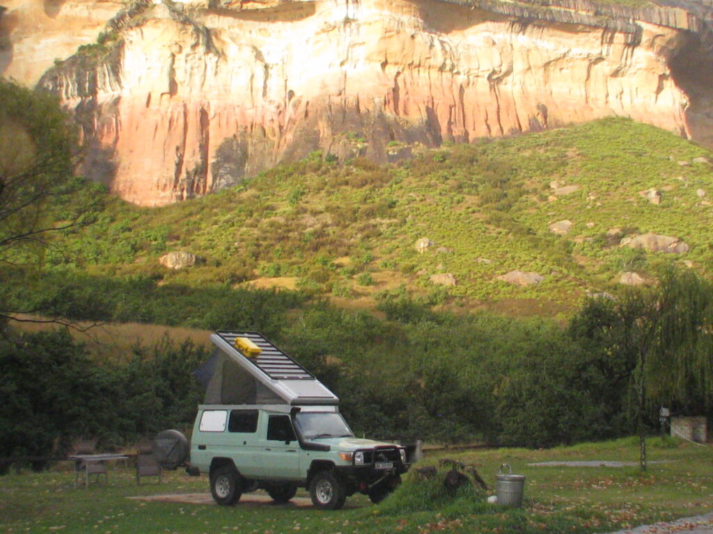
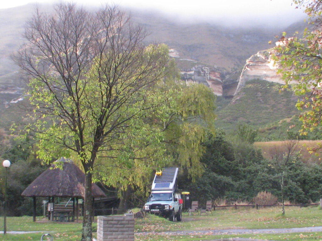
By the way, I finally was able to upload the videos of the Green Dragon in case you are interested – see the Vehicle page on this website.

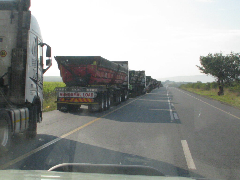
Before introducing Kruger and showing you some fun wildlife observations, I want to share one unrelated observation. The southeastern entrance to Kruger where I was entering the Park is very close to the Mozambique border. Due to the inefficiency of the border post, the coal trucks on the South African side of the border on the major highway I was traveling on were backed up in a line that extended at least 10 miles, I kid you not. At the pace they were moving it would take several days, at least, for a truck to get across the border. Why they are moving all this coal via truck and not train, when there is a track along this route, is beyond me. Fortunately, I was able to simply skirt around the procession and proceed on my way.

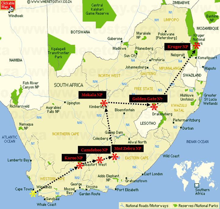
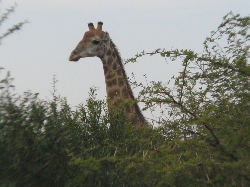
Ok, let’s introduce the iconic Kruger National Park, the flagship Park of South Africa located in the northeastern corner of the country bordering Mozambique and Zimbabwe. Kruger NP (7,576 sq mi), established in 1926, is both the 1st national park established in South Africa as well as the largest in the country, and the 6th largest national park across the entire continent of Africa. The Park is elongated north to south – extending 220 miles from north to south along the western slopes of the narrow Lubombo Mountain chain which forms the border with Mozambique and running 40 miles from east to west, on average, along its length. As a consequence of Kruger’s latitudinal and elevational gradients and varied soils derived from mostly igneous (of volcanic origin) materials, the Park supports a wide range of ecosystems and varied habitats for an exceptional array of wildlife. Kruger is an important stronghold for several of Africa’s most iconic large mammals, including supporting more than half the world’s remaining white rhinos, along with substantial populations of giraffes, buffaloes, elephants, black rhinos, leopards, cheetahs, African wild dogs and, of course, lions.

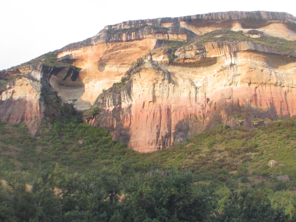
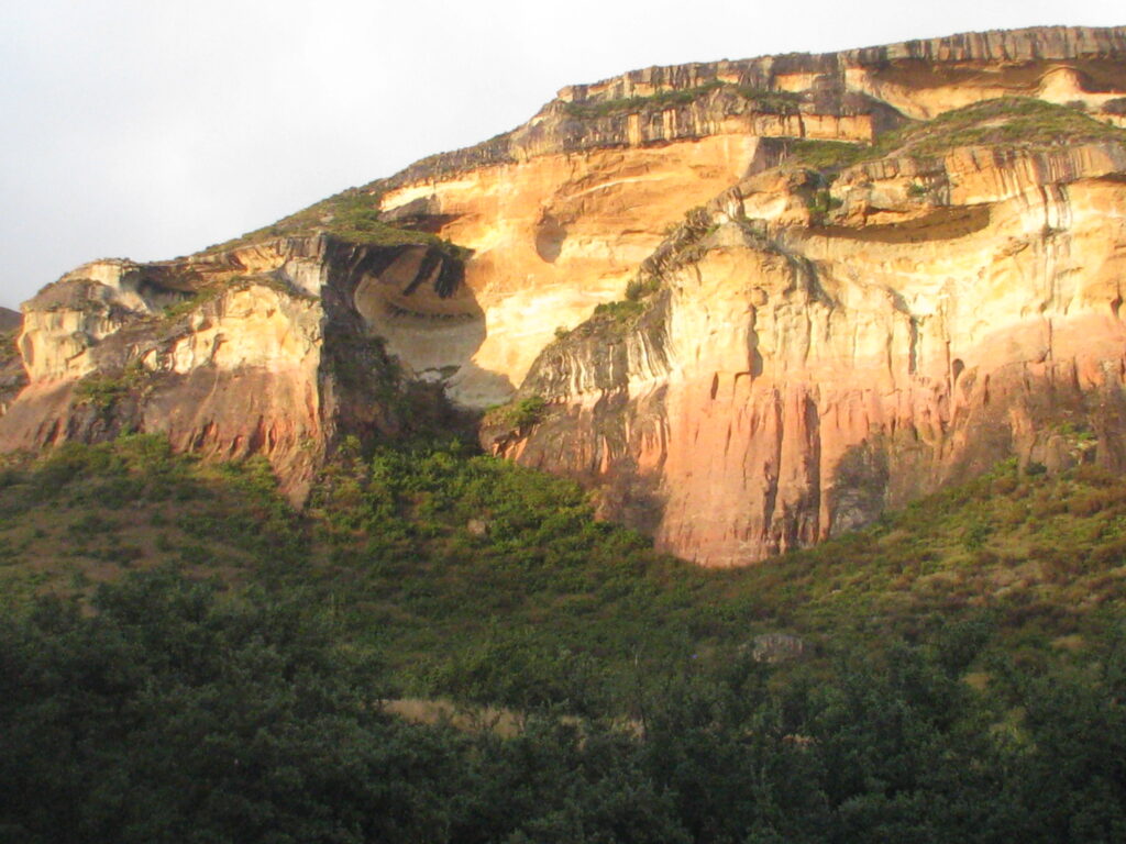
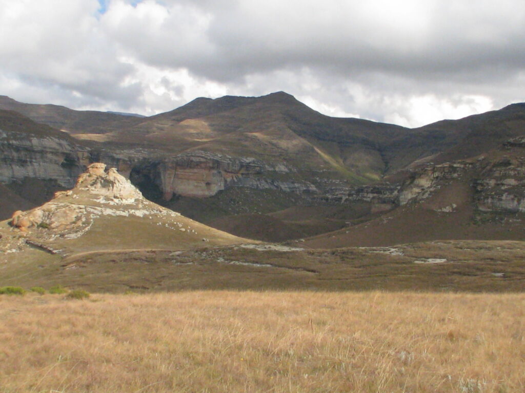
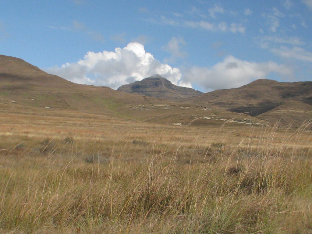
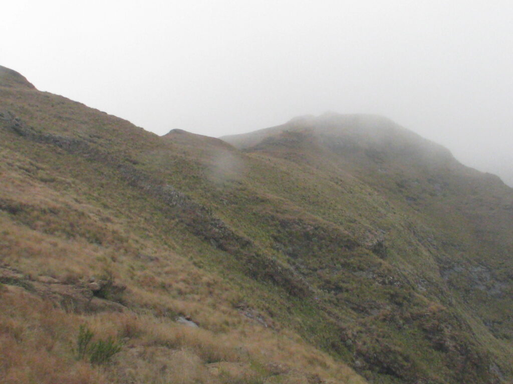
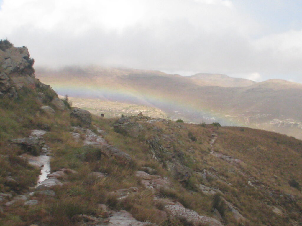
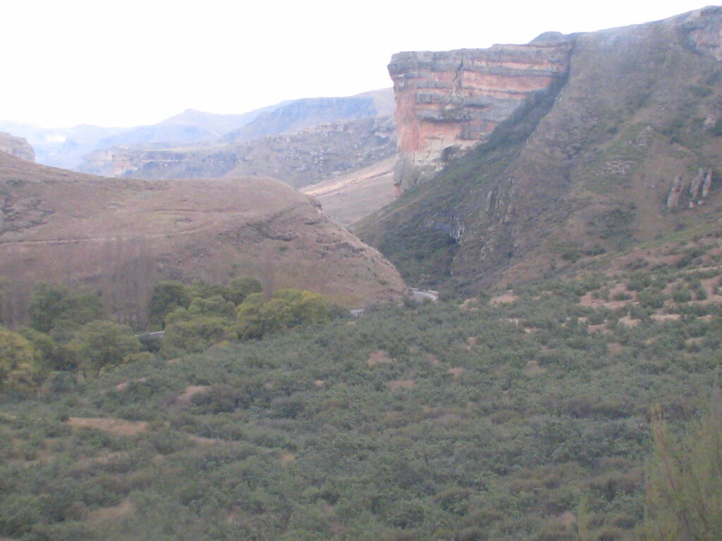
My first public campsite in Kruger is Skukuza, located in the southern section of the Park along the banks of the perennial Sabie River. The landscape surrounding this section of the Park is highly varied. To the east are the low, arid rhyolite hills of the Lebombo Mountains. The soils of the Lebombo are shallow and stony, and as this is one of the driest parts of Kruger, it is dominated by drought-resistant plants.

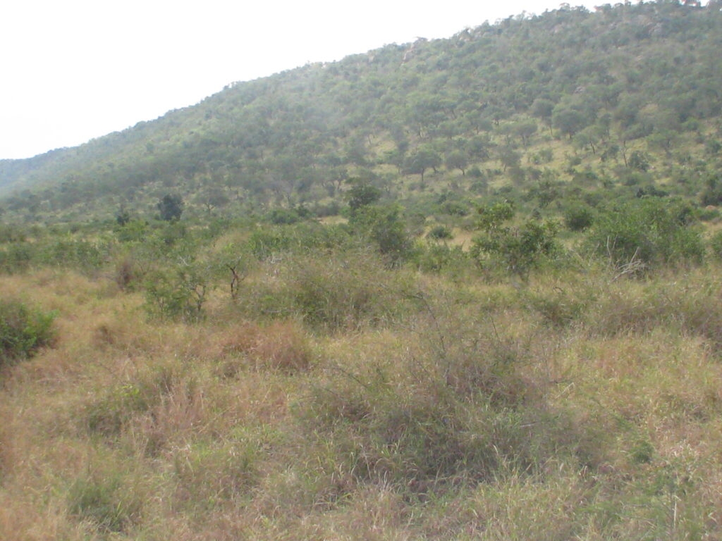
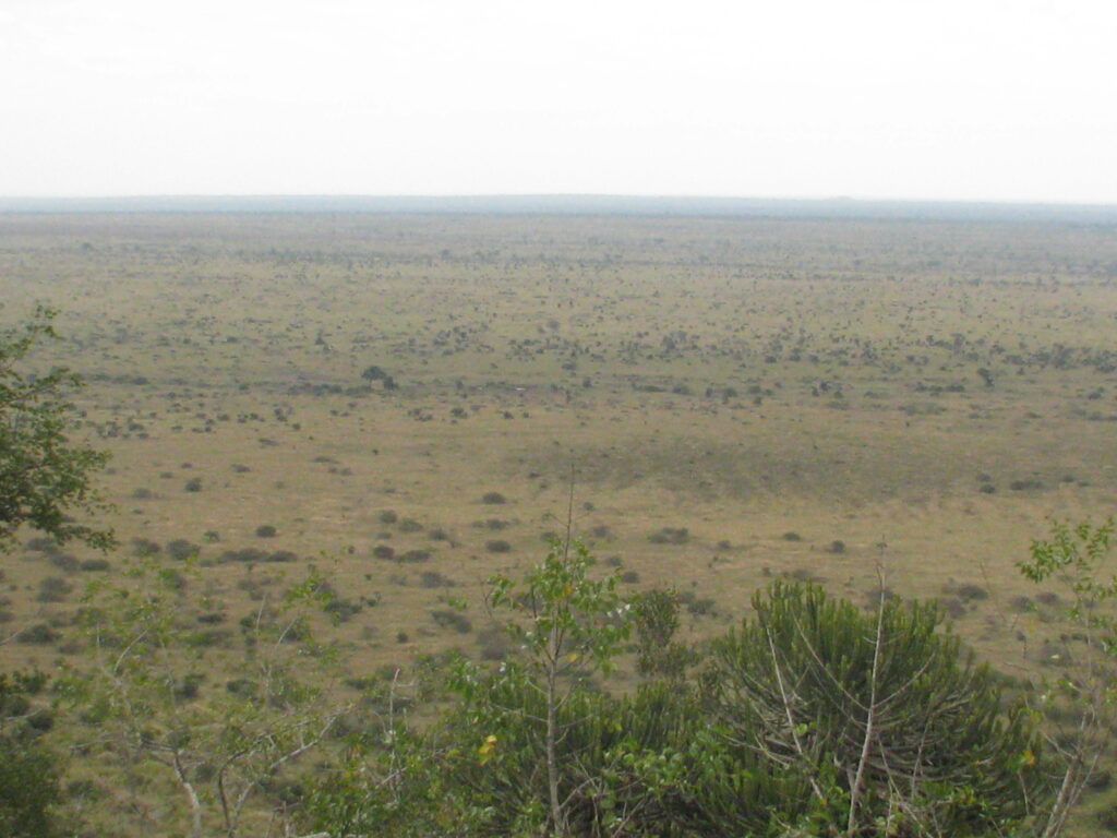
Lying west of the Lebombo hills is a rather vast open savannah grassland on basalt soils (dark, fine-grained igneous rock rich in magnesium and iron derived from extrusive molten lava). These savannah grasslands contain scattered acacia trees and form the classic picture of the African savannah.

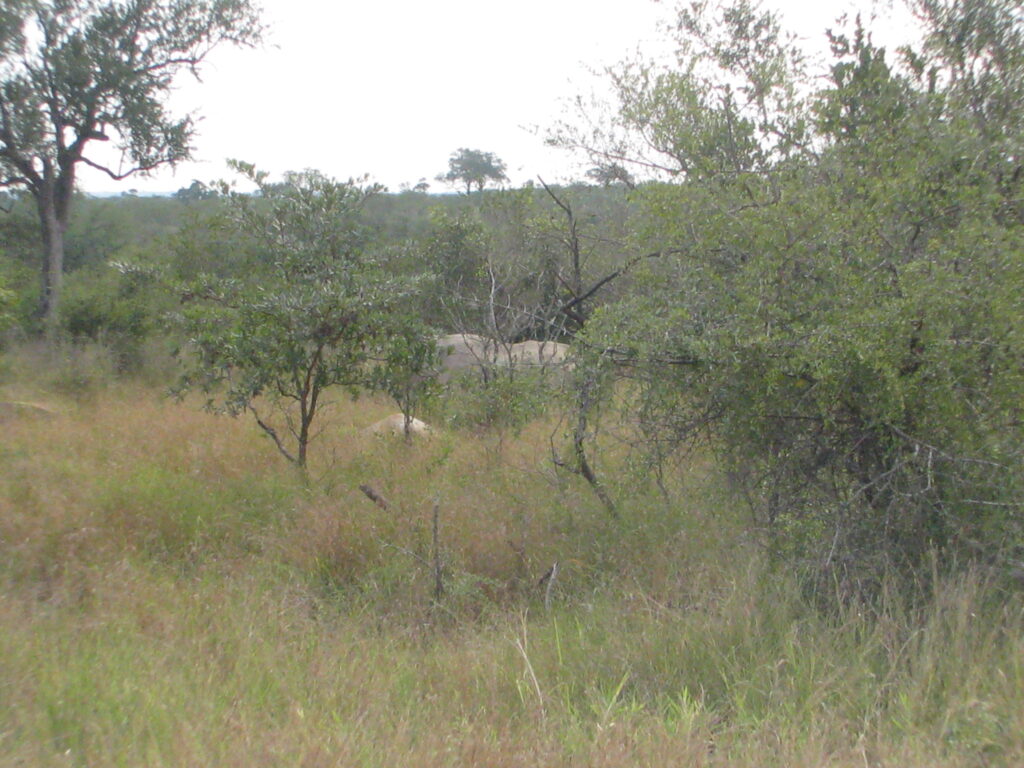
Further to the west in the vicinity of my campsite at Skukuza are areas of mixed thorn thickets and marula woodlands on granite soils (lighter, coarse-grained igneous rock rich in quartz and feldspar, also derived from extrusive molten lava).

The marula tree is worth describing in more detail, as it is important for its commercial and wildlife uses, and it is an important member of what is referred to as miombo woodlands, which are the most extensive tropical seasonal woodland and dry forest formation in Africa. Miombo is found throughout west, central and east Africa and extends southward just barely into South Africa. Marula is a medium-sized deciduous fruit-bearing tree, indigenous to the miombo woodlands of Southern Africa, and it has a beautiful spreading crown.

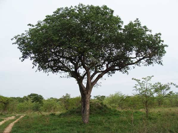
Some cool facts about the Marula tree: The marula fruit is used to make a beer and liqueur, and is used in fruit juice blends – it is sky-high in Vitamin C. In addition, the extracted nut oil is similar in its properties to olive oil, highly nutritious and exceptionally stable, with the additional benefit of having powerful antioxidant properties, and it is used as an ingredient in cosmetics (e.g., moisturizers). Locals believe it is known as “The Marriage Tree” in Zulu culture, as it is believed that those who marry beneath its branches will enjoy vigour and fertility all their days. And of course, the fruit is eaten by many wildlife species and is a favorite of elephants. Interestingly, elephants damage the trees by eating the bark and can even kill the trees by girdling, but at the same time are an important disperser of the seeds which they spread in their dung.

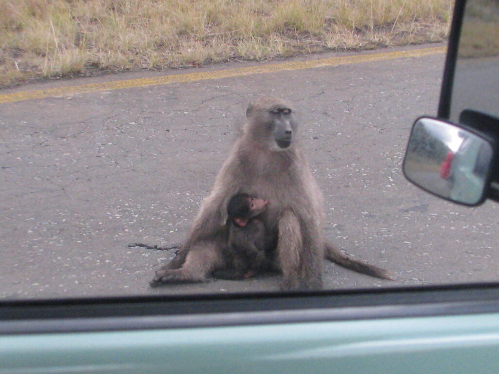
Ok, that’s enough on the environment of Kruger south, let’s see some wildlife. Here are some anecdotal wildlife observations from today:

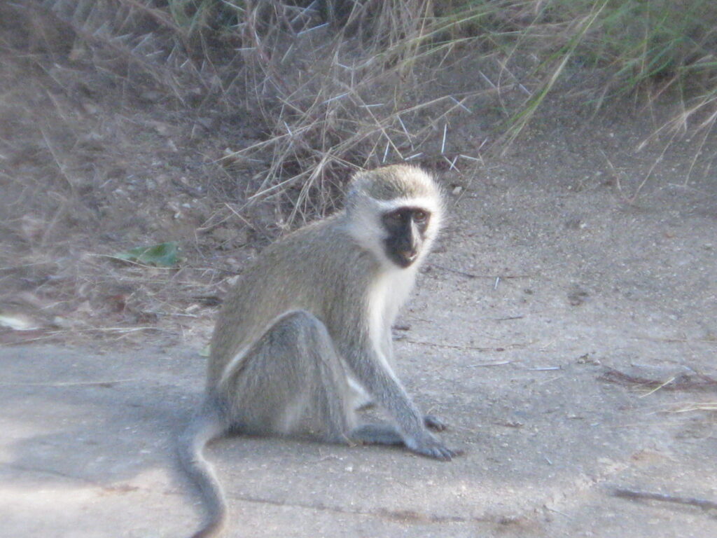
Peek-a-boo, I see you!

Do you see the Rhino in the bushes?

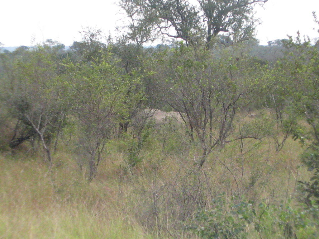
Whoops, it’s just a rock!

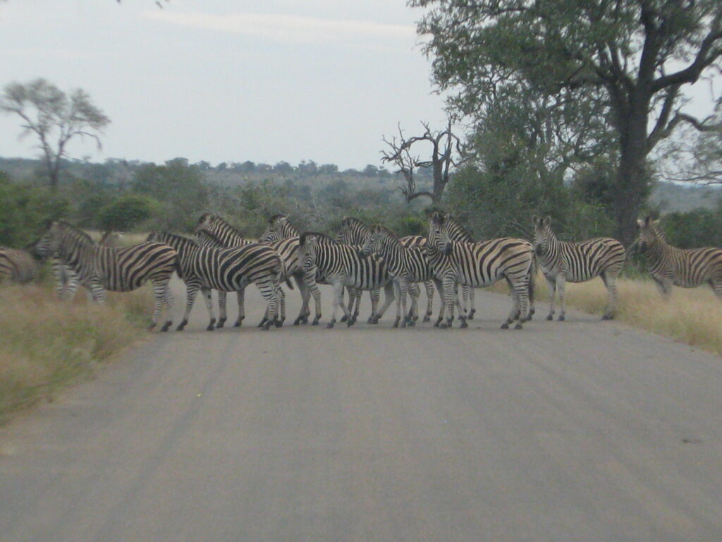
Let’s all cross in an orderly fasion please:

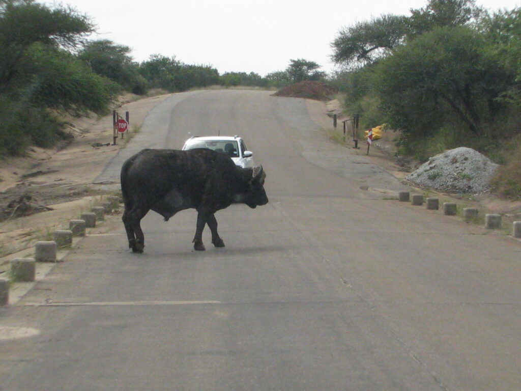
Watch out for that bison crossing the road – I mean Cape Buffalo!

Shake that booty!

Tuppens for the poor?

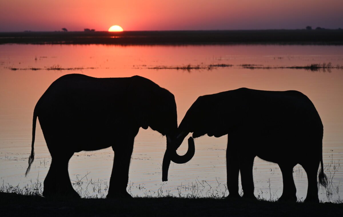
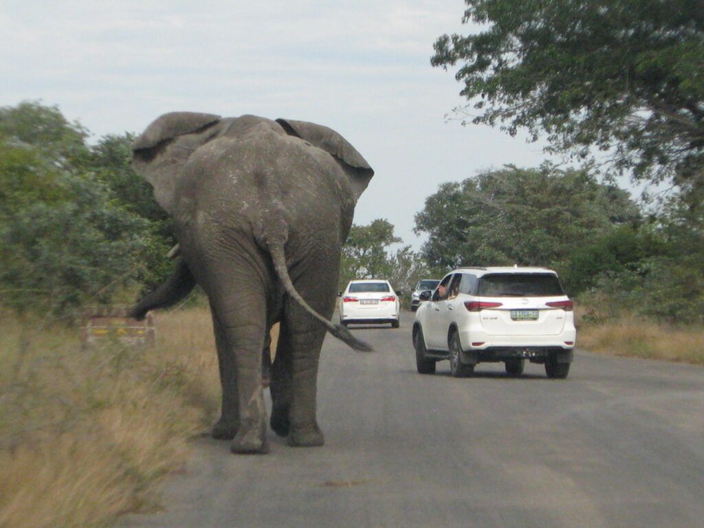
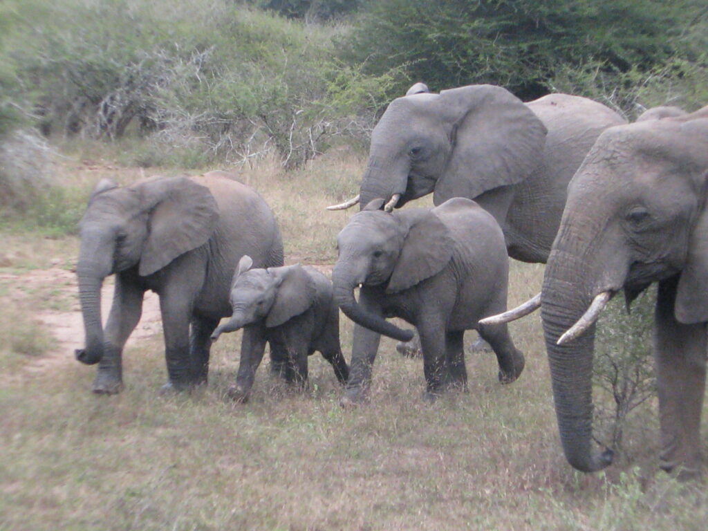
Skylar are you watching: “mommy elephant, big girl elephant, little girl elephant, and baby elephant”

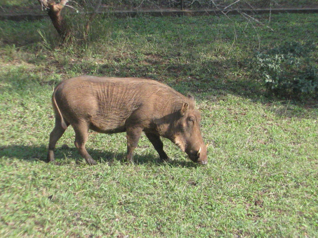
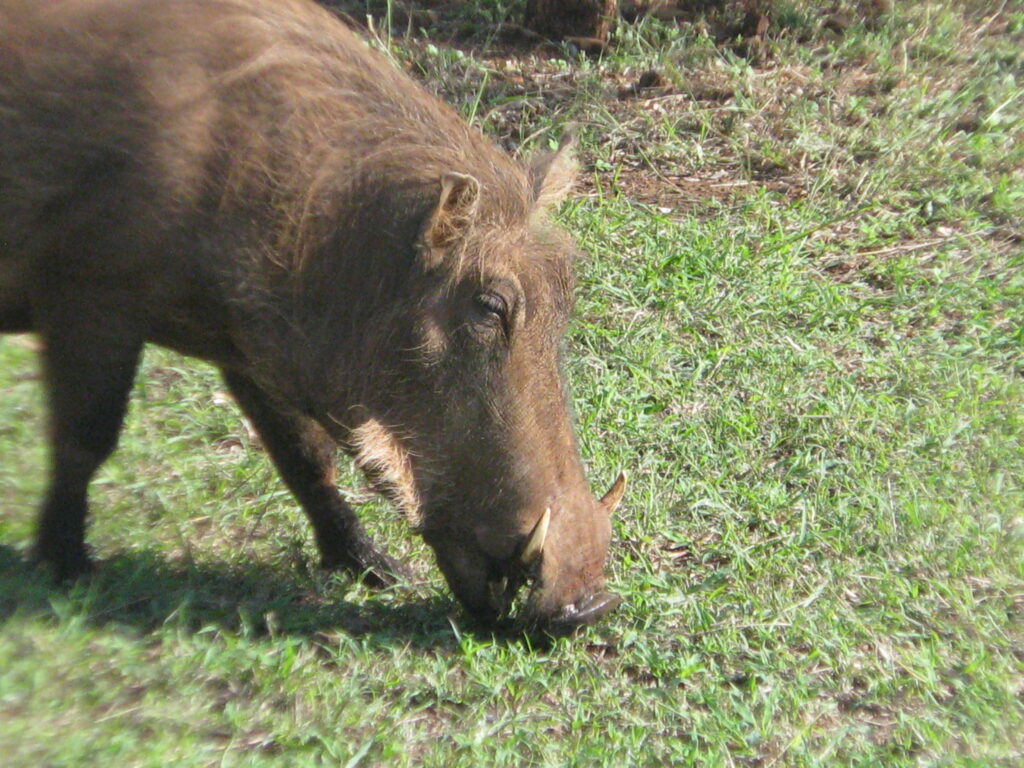
And last but not least, the species of the day – this one’s for you Sherry – is the warthog. Now how could you not love and admire this pig. They eat just about anything and everything, they live in just about any habitat in sub-saharan Africa, they run around in little matriarcal groups called “sounders” – and with their tails held high, they like to roll around in the mud to keep cool, they can burst at speeds of up to 30 mph to escape predators, and they can use their formidable tusks to defend themselves against predators such as lions, leopards and hyena’s.

Time for bed. Goodnight all!

May 17: Daily Life

Before delving in the topic of daily life, I want to share a revelation I had today while driving. You recall the roads from hell on the 4 hour bypass from hell yesterday, well, today I had an epiphony regarding the road maintenance issue (or lack thereof) in South Africa after passing yet another of these road signs:

Instead of actually fixing the potholes, let’s just put up a sign warning drivers of upcoming potholes. Brilliant! Why didn’t I think of that? The government bureaucrat that came up with this strategy was probably promoted to head of the Department of Transportation for saving the government millions on road maintenance. No one can say they aren’t doing something about the issue. Do you think we should propose this in the States?

OK, now on to business. I have had a few requests to share more of the practical aspects of my daily life on the road with the Green Dragon, so here’s a few tidbits – but not too much, lest most readers will fall asleep and miss the species of the day.

You will recall from yesterday’s post that I got to my private little lakeside campsite in the dark and thus wasn’t able to show you my setup. First, here is what I woke up to:

After listening to my morning serenade from the local avifauna – what a way to wake up – I took a few shots of my campsite as promised:

Note, that building beside the Green Dragon is a restroom and hot shower, along with a little outdoor kitchen. My typical breakfast is a bowl of oatmeal with mixed nuts and dried fruit (usually raisins) – it’s super heart healthy and quick to prepare! However, on occasion I go Full Monty and prepare a scrumptious meal. Today, in my cast iron cookpot on my diesel (yes, diesel) cook stove I started with some olive oil, then put in a chopped yellow potatoe, then a chopped sweet potatoe and yellow onion, with a little tamari and salt and pepper, followed by a chopped green peppper and tomatoe, and topped with a few slices of vegan (yeah, I know) cheese. Here’s the preparation and final result:

Delicous! And I have enough for tomorrow as well. So, don’t think I am starving myself or eating simple quick meals. I spare nothing when it comes to good food when I am camping.

I really hated to leave my private lakeside campsite for $3 a night, but given yesterdays travel experience I thought it wise to drive most of the way to Kruger National Park today so that I can for sure get to my first Kruger campsite tomorrow with time to spare. I don’t have landscape pictures of the drive because it was pretty much Iowa again, with the addition of a big coal mine or two. So we can sum up the landscape as Corn, Cows and Coal (CCC). The one thing I will share as an adendum to my previous post on the “shanty towns” is that today I didn’t see any of these camps. Instead, I saw a few townships with government housing – for the “black” South Africans I assume – that are a vast improvement over the camps I saw in the Cape Provinces:

My campsite tonight is another little hidden gem that I discovered on iOverlander that puts me about an hour or two drive from my entrance to Kruger National Park in the middle of macademia nut county – acres and acres of macademia trees and a huge processing factory just across the river from here. If you eat macademia nuts, there’s a very good chance this is where they were grown. These hidden sites are truly amazing. You drive down a bumpy dirt road that looks like it’s going nowhere and then you go through a locked gate and, Shazam, you enter a new world. This place turns out to be a really nice lodge with riverside chalets or cabins, restaurant for the guests, and a Park-like area for campers like me. As you can see from the photo below, the camping area is a pleasant grassy patch with nice shade trees. And, get this, I have my own private ablution facility with the full works, including hot shower. All this for roughly $13!

There is just one other couple camping here so it is quite serene.

It’s time for species of the day. This morning at my private lakeside campsite on the hillside above my camp there were a few Blesbok, so I can count this as the species of the day. However, I managed to get a better photo at Mountain Zebra National Park so that’s the picture I will share below. I chose this species in part because they are pretty cool looking, but also because I probably won’t see them again as their range is quite small and restricted to the east-central plains of South Africa. This is one of the antelop species whose range has been severly reduced to the few National Parks and some game farms. This is a rather large antelope – think elk size – with a very distinctive and striking color pattern that makes them rather easy to spot. They feed primarily on grasses so you find them almost exclusively in the open grasslands and they usually occur in small herds of a few to a couple dozen, although in the winter they can come together in much larger herds. I saw plenty of these guys at Mountain Zebra and Golden Gate Highlands National Parks.

Next stop, Kruger National Park.

May 16: TIA madness!

Not too much to report today other than I had a real TIA (“This is Africa”) day today, and here’s why. After a wonderful stay at Golden Gate Highlands National Park, I hit the road to get halfway to my next destination – the famous Kruger National Park. What started out as an absolutely gorgeous day with an expected drive time of about 5-6 hours and arrival at my chosen iOverlander campsite on the shores of Lake Chrissiesmeer turned out to be an 11 hour drive with arrival to my campsite after dark – which I really hate!

With the start of the trip, all was going well. Leaving the Park, I drove through Maluti-Drakensberg mountains during an awesome sunrise on the rocks and outcrops, and then began a long haul northeasterly across the rolling hills of the northeastern part of the Free State province and the southwestern part of the Mpumalanga province. This part of the country can be summed up in two words: corn & cattle, with the former dominating the landscape. If it weren’t for the not-so-flat terrain I could easily have thought I was driving across Iowa. Then, just when I was about 2 hours from my destination there was an unannounced road block. Turns out the town up ahead was protesting something (don’t know what) and had blocked the road and were not letting anyone through. Note, this was a fairly significant highway and long-haul route for truckers, so there were dozens of them stopped on the roadway. My navigation system could not handle this at all and would not, could not, direct me to an alternate route. So, I did the next best thing and spoke to a police officer who directed me to take this dirt road for 10 km, and then turn right, and when you get to ?? turn left, and then at the ?? sign turn right, and follow that for xx km until you see ?? You get the point! To my good (turns out perhaps not so good) fortune, another native in a small transit truck was trying to get to the same place (or the nearby town) and he too spoke to the police officer and decided to go for it. He was super nice and asked if I wanted to follow, so I did.

After a few kilometes on this dirt road we ran into this, and I thought this might turn out to be an interesting little bypass adventure a way to see the “real Africa”:

After 10 km more of dirt road that turn out to be muddy (which messed up my beautiful car wash I just had done a few hours earlier) we hit a paved road and all was looking good, except that we were now headed in exactly the opposite direction of my destination. Have faith I told myself. Of course, to reinforce my doubts, my navigation systems (two of them no less!) were screaming at me to turn around, and they kept on screaming at me every couple of minutes until I could turn them off. However, it took me an hour or two to turn them off because I was fully occupied trying to keep up with my South African guide and I literally couldn’t take my hands off the wheel or my eyes off the road. Why, you might ask. Well, imagine what a road would look like after being cluster bombed. That’s what this “highway” was like. Potholes all over the place. And these were foot-deep potholes, not your average American pothole. Driving was essentially an obstacle course, and at speed too so as to keep up with my guide. This went on for perhaps 2 hours – but I continued to have faith in my native savior believe it or not. This was not the worst of it. When we finally did turn onto a new road and the tarmak appeared to be in good shape, we would pick up speed and be cruising along when suddenly, without warning, there would be a massive pothole. I can’t tell you how many times I swore during these random potholle episodes, but let’s just say I am glad Skylar wasn’t in the car.

Eventually, 11 hours later, I did make it to my destination, but after dark. Fortunately, there is a happy ending to this story. Remember, this campsite is not on any real map per se, but instead is listed on my iOverlander App. Have faith in the App I always tell myself, and it hasn’t disappointed yet. Driving down a dirt road several kilometers I turned into what looked like a driveway to a farm, but eventually I came to a gate with a house off a little in the distance. To my good fortune the owner came out and opened the electronic gate remotely. I drove through and got the green light to continue down this farmyard track towards the lake, which I did. I eventually got to a “keepers” house who welcomed me to, yes, an actual campsite. After paying about 3 USD for a night stay (yes, that’s 3 US dollars) she got on her ATV and led me across a field and down a track to an incredible lake-side camping spot with full ablution facilities (that’s restroom, kitchen sink, shower, etc.). And to top it off, I am the only one here – jackpot. So, there is reward at the end of the rainbow!

I’ll show you the campsite tomorrow when it is light. Goodnight!

May 15: Golden Gate Highlands National Park

As per my previous post, I arrived at my destination Park last night. I spent today exploring Golden Gate Highlands National Park, located near the town of Bethlehem and on the northern edge of the embedded country of Lesotho. Golden Gate NP (130 sq mi), established in 1963 to protect the sandstone shelters that once served as shelters for the indigenous San people (a.k.a. “Bushman”), lies in the rolling foothills on the northern end of the Maluti-Drakensberg Mountains. The landscape consists mainly of wooded ravines, gullies and highland grasslands (or grassland veld as they call it). The park’s most notable features are its golden, ochre, and orange-hued, deeply eroded sandstone cliffs and outcrops that shine golden-yellow in the setting sun, from which the Park derives its name. I did my best to capture this scene in the following photos:

Although the rock cliffs and outcrops are the flagship features of the Park, the Park is actually most important for its conservation of high elevation grassland veld. As this series of photos depict, the mountains and valleys are covered by grassland, with something like 40 different grass species making up the mix. It is truly remarkable to see grasslands extend from the valley bottom up over the tallest mountains, some of which climb over 10,000 ft in elevation.

Another notable feature of the Park is the numerous caves and shelters displaying San rock paintings, which I was not able to see. The San were popularized, you might recall, in the movie “The Gods Must be Crazy”. The San are part of a larger ethnic group of herders (Khoi) and hunter-gatherers (San) in southern Africa known as Khoisan, which as recently as 22,000 years ago apparently constituted the largest group of humans on earth. Unfortunately, like most indigenous groups in Africa and elsewhere, the Khoisan were dispossesed of land and gradually displaced and/or assimilated by more “advanced” cultures – in this case, first by the southward immigration of Bantu-speaking agriculturalists around 2,000 years ago, and eventually by European colonists, primarily Dutch (known as the Boers) beginning in the mid 17th century and finally the British who took over from the Dutch in the early 19th century after a bloody war (known as the Boer war). As with many indigenous peoples, small pox decimated the Khoisan and Bantu after contact with European colonists, and many local populations were exterminated or enslaved by the technologically more advanced European colonists. Interestingly, following the end of Apartheid in 1994, the term “Khoisan” has gradually come to be used as a self-designation by ethnic South Africans as representing the “first nations” of South Africa vis-a-vis the ruling Bantu majority, and there has been an uprising of “Khoisan activism” in recent years, with ardent calls to restore ancestral land claims. I wish them the best of luck in their uphill endeavor.

The Park is also notable as one of the last refuges in all of Africa of the rare bearded vulture (also known as the lammergeier and ossifrage) and the southern bald ibis, as well as the rare oribi (a small, slender species of antelope). Alas, I did not see any of these species today despite my efforts, but these was not surprising given how rare they are and the time of year – regardless, it’s nice to know they are here. I just have to show you a picture of the head of the bearded vulture that I borrowed from the internet – so cool:

My public campsite is Glen Reenen rest camp in the Park. It’s a pretty awesome setting as I hope these photos capture:

I know this post is getting long, but I have to share some details and photos of the 4 hour hike I did this morning becuase it was challenging and rewarding on many levels. Basically I climbed 3,000 ft up above the escarpment to the high ridge above the campsite and then traversed the ridge for a couple of miles and then descended to below the escarpment and traverse the base of it back to the beginning. I started in beautiful sunny weather with a few broken clouds but by the time I got above the escarpment the wind was howling and I was engulfed in rain clouds. Visibility was very poor at times, but then it would break a little and I would get spectacular views only to be socked in again a minute later. I was the only person on the trail – sublime! Here are some shots of the hike that make it look more tame than it actually was – honest. Note, the first picture shows the central part of the ridge I traversed way up above the campsite:

OK, enough is enough, it’s time for, you guessed it, species of the day. Today I am dedicating this choice to my granddaughter Skylar, and she will know why is just a second. The species is the Chacma Baboon, which most will be somewhat familiar with. While these guys can be a real nuisance around the campsite – stealing anything not tied down or that weighs less than about 50 pounds, edible or not – they have a remarkable social structure. They usually live in troops that vary is size, but usually have dozens of individuals, including a dominant male, several subordinate males, lots of females and young ones. And it is to this last item that I bring your attention Skylar. The picture below is of a mommy and baby! Indeed, this little guy couldn’t be more than a few days old. Mom was so intent on letting her little baby nurse that she wouldn’t even move off the road, forcing me and other vehicles to skirt around her. Now that’s a nurturing mommy!

Hope you liked that one Skylar. Tomorrow, on the road again. Cheers.

May 14: Happy Mother’s Day!

First and foremost, happy mother’s day to all you mothers out there!

Second, today was a rather grueling long haul day driving from Mountain Zebra National Park 9 hours (argh) northeast up to Golden Gate Highlands National Park. As depicted in the map above, my original plan was to go to Mokala National Park for a couple of nights on the way to Golden Gate, but since I spent a few more days in Cape Town than originally expected, I had to cut out Mokala – bummer. Anyways, I am going to save my overview of this Park until tomorrow after I have seen the Park and am able to share photos and stories, etc. For now, let me share a few observations, photos and sounds of the day.

Shortly after leaving Mountain Zebra National Park heading in a northeast direction I left the Eastern Cape Province and entered the Freestate Province and started encountering immense cattle and sheep ranches – albeit with very few head of livestock. Nothing like the intensive livestock densities we see on similar productive grasslands in the states. Based on the fencing, these ranches must be ’10s’ of thousands of acres each, if not more – and I can ony imaging how these vast land holdings were acquired from the indigenous peoples back during the great trek north from Cape Town by the pioneer white dutch-descendent “voortrekkers” as they were called, or the Brittish settlers who came along behind them. The landscape was nothing spectacular, just vast grass-covered plains and scattered hills:

As I headed northeast further into the Free State, land productivity apparently increased and I started seeing vast fields of mostly corn, but some sorghum (I think) as well, and increasing homesites. I could have easily been driving through Iowa had I not seen the mountains in the distance:

OK, enough of the somewhat boring landscape from today. The species of the species of the day is the Springbok which I have seen a plenty. Despite their abundance and ubiquity in southern Africa they are nonetheless a very cool species – and beautiful too! As you can see from the picture I took below, they in some ways resemble our North American pronghorn antelope. Like the pronghorn, the springbok is also an antelope of the semi-desert environment and can survive for very long periods without drinking any water. Instead, it can derive much of its water needs from the food it eats when surface water is not available. Consequently, it occupies habitats that are much too dry for many of the other antelope species that we will encounter. This species likes open expanses of grassland and perhaps some scattered shrubs, but you don’t find them when the shrub cover gets too great or in woodlands because they would too easily fall prey to leapords and lions. Instead, a major predator they have to be on the look for in their preferred open country is the cheetah – the fast land animal on Earth. I often see springbok in small groups of bachelors but other times I see large herds of 20-50 or more containing adults and young. The young ones especially love to “play” by chasing each other around, and both the young and adults like to “pronk”, or run and jump in the air with arched back and stiff legs. They are really fun to watch!

OK, here is the mystery sound for today that I just recorded while lying in my roof-top bed in the public campsite at Golden Gate Highlands National Park. Can you guess what it is?

mystery sounds

Well, if you guessed Coyote you are not far from the mark. This is the call of the Black-backed jackal, which is close to being the ecological counterpart of the Coyote here in Africa. Here is a picture I stole from the internet so that you can see what the critter looks like:

Until next time, sleep tight and don’t let the jackals bite!

May 12-13: On to Mountain Zebra

My next stop after leaving Karoo National Park was going to be Camdeboo National Park, but when I arrived it was totally socked in with clouds, and the forecast was for likely rain over the next few days. The primary attraction and why I planned to visit the Park is its huge dolerite pillars, some of which are 120 meters high, located in the “Valley of Desolation”. Note, dolerite is an igneous rock (i.e., rock initially molten and injected as a fluid into older sedimentary rocks); thus, it stands in stark contrast to the surrounding layered sedimentary rocks. The Valley of Desolation is purported to be quite spectacular. However, the weather would have prevented me from seeing anything so I opted to continue on – major bummer!

On my way to my next destination, I continued travelling across the Great Karoo for several hours. One of the things I find fascination about the natural world are ecological convergences; that is, ecological systems and/or environments that evolve over time to be very similar in terms of their physical environment and their flora and fauna, despite being geographically isolated. In these convergent ecosystems, the plant and animal speciers are totally different yet perform the same or very similar ecological functions. I mention this because driving across the Karoo reminds me in so many ways of driving through parts of western North America. There are extensive semi-arid plains that go on for as far as the eye can see, reminding me of the non-irrigated western great plains – I could easly believe I was driving through parts of Nebraska or Kansas, as shown here:

These plains are regularly broken up by grass and shrub-covered hills, mesa-like landforms and mountains proper, reminding me of parts of the inner mountain west – I could easily believe I was driving through parts of Idaho or Utah, as these photos depict:

One of the biggest surprises for me regarding this part of South Africa is that I came with the preconceived notion that most of this part of the country was populated (by humans, that is) and in some form of productive agriculture, whether that be cultivated or pastoral land use. Instead, this landscape (the Karoo, that is) is almost completed unpopulated and wild, even though it is almost entirely private land. I belive what I am looking at are immense ranches (mostly just a few sheep herds, as I have not seen a single cow!!!) and game farms – places where people pay big bucks to go shoot big game animals. If you like wild places with “big sky”, this is clearly a place to visit. After some consideration, I believe the answer lies in the climate, as this area receives less than 20 inches of precipitation a year, which is generally the minimum for cultivation. There is a 20 inch precipitation line that runs north to south that essentially demarcates the western States (Western Cape and North Cape) from the agricultural eastern States (Eastern Cape, Freestate, KwaZulu-Natal).

One last observation on the landscape. The Karoo is vast, as I have said, and once had a relatively abundant megafauna (those large beasts) – albeit at much lower densities than elsewhere – which were largely eliminated by hunting. Today, the megafuana (essentiall all mammals larger than, say, a deer) are almost entirely restricted to the few national parks and game farms (where they are raised as game for hunters). So, the few national parks, such as Karoo, Camdeboo and Mountain Zebra are relics where nature still rules, noting that in these parks several of the larger species (rhino, lion, cheetah, etc.) had to be reintroduced since they had been erradicated. It’s a sad story of human overexploitation not too dissimilar to what was done in North America. These Parks are real lifelines for several of these species.

My destination was Mountain Zebra National Park, located near the town of Cradock. Mountain Zebra NP (110 sq. mi.), established in 1937, is on the eastern edge of the Great Karoo ecosystem; consequently, the vegetation is similar – dominated by grasslands and shrublands, although open- and closed-woodlands are common here in the valley bottoms and prominent rock outcroppings are distinctive as well. Indeed, this area on the eastern side of the Karoo gets a bit more precipitation so the vegetation is more productive. I took the Green Dragon out for a drive through most of the Park, including some 4×4 roads that had mud and some steep rocky/ledgy hill climbs – the Green Dragon performed like a “rock star’. Here is a whole series of pictures that show both the landscape and the drive:

The most notable feature of the Park, and its namesake, is that it is home to the very rare and endangered mountain zebra (I posted a picture of one in my previous post), which will serve as our species of the day. A few decades ago fewer than 20 individuals of this zebra species existed, but since then their numbers have recovered; currently there are more than 350 in the Park and upwards of 5,000 total in the wild. The mountain zebra is distinguished from its more common cousin, the Burchell’s zebra of the plains, by the narrow black and white stripes that extend right down to the hooves (whereas in the Burchell’s the stripes fade down the legs), the grid-iron black and white pattern on the rump, the clear white belly (the stripes do not join under the belly, whereas in the Burchell’s they do), and the longer, more donkey-like ears. In addition, mountain zebras do not aggregate into large herds like plains zebras; instead, they form small family groups consisting of a single stallion and one to five mares, together with their recent offspring. So far, I have been lucky enough to see Mountain Zebra now in three different Parks: Table Mountain (Cape Peninsular), Karoo, and now Mountain Zebra National Park.

OK, for those of you that have read this far (yikes) here are a few observations for you to figure out. First, what critter do you think made this cool dwelling (note, the opening diameter is perhaps 8-10 inches):

Pretty cool little hut, hey. Whoever did it, was a pretty good sculptor as they cared this entrance and tunnel down into an underground sanctuary with their bare hands. You wildlifers, did you guess it? Right, an Aardvark! Unfortunately, you have to out at night to see this guys as they are strictly noctural.

OK, last trivia question. What made this sound?

Mystery sounds

Wildlifers, did you guess it? Sounds a lot like someone we have in North America. It’s a close relative: the Blue Crane! I saw two groups of 4-5 individuals on my drive today and one of the groups had one individual calling and I was able to capture it – yeah!

OK, sory for such a long posting but as you can see I had a lot to say! Next stop, Golden Gate Highlands National Park – and let’s hope it’s not raining all day and night like it has been here.

May 11: Karoo National Park

As mentioned previously, my first National Park after leaving Cape Town is Karoo National Park, located just west of the town of Beaufort West. Karoo NP (297 sq. mi.), established in 1979, is part of the Great Karoo ecosystem, the largest distinct ecosystem in South Africa. It is a vast and unforgiving landscape, yet still home to a fascinating diversity of life, all having adapted to survive in harsh semi-desert conditions. Unfortunately, most of the wildlife that once roamed the Karoo have been eradicated, but the Park is a relatively small area where this unique environment and its animals are protected and persist. This semi-desert area is a sanctuary for herds of springbok, oryx (gemsbok), mountain zebra, buffalo, red hartebeest, black rhinoceros, eland, kudu, klipspringer, bat-eared foxes, black-backed jackal, ostriches, and lions – I saw most of these species today on my drive. It also has the greatest number of tortoise species of any park in the world – five in total! Most of vegetation consists of montane grasslands at the highest elevations where is gets the most precipitation, grading into grassy shrublands and dwarf shrublands at the lower elevations where the precipitation is very low and uncertain, and the occasional riparian thicket along the drainage bottoms – think Sonoran Desert of the American Southwest minus the saguaro cacti and you get a pretty good picture of the environment, as the following pictures try to depict:

My campsite is the public rest camp in the Park. As campsites go, it’s nothing to rave about. I have a small patch of ground surrounded on three sides by thornbushes, but very much within earshot of the other campsites. Modern showers, laundry, kitchen, power hookups, water spickets at every site, etc.. You get the picture. A fairly modern, full amenites campsite. Not the kind of “bush” camping I prefer, but there is no “wild” camping in the South African parks. As an aside, I had some free time this afternoon at my campsite, so I took the opportunity to make a video of the Green Dragon in all its glory . You can check out the vehicle page on this site if you want to see the Dragon in full regalia.

I took a “game” drive today (note, even though it is not really about seeing “game”, which technically refers to hunted species, the locals still refer to these wildlife drives as game drives, so I will go local too) and didn’t see a sole (human, that is) for 5 hours, and then saw maybe 5 vehicles during my last couple of hours. That made for an awesome wildlife viewing exerience that I won’t always have at other more popular safari parks. I saw lots of cool species, including two different species of zebra (mountain zebra and plains zebra) and several different antelope species (gemsbok, springbok, red hartebeest, lesser kudu, mountain reedbuck, and klipspringer) and a dozen or so new bird species. Here are some not-so-great photos I took today of some of these species (note, I have a crappy little camera without a big telephoto lens, so it’s hard for me to get good close-up pictures in focus):

M0untan Zebra
Gemsbok (oryx)
Red hartebeest
Lesser kudu
Springbok (and Gemsbok in back)
Klipspringer (male, note the pointy horns)
Klipspringer (female, had to include this because she is so cute)

My favorite was a stop at a small out-of-the-way little water hole down a 4×4 road, where I sat for perhaps an hour and watched one new bird species after another come to the hole for a drink. Even had a close up of a small grey mongoose on the prowl at the water hole. My camera is not sufficient for photographing birds (except for the occasional ostrich), so I have no bird pictures of my own to share. For you wildlifers out there, especially those that like to list species seen, I created a wildlife species page on this site where I will keep a running list of species seen on this trip. However, for the broader audience, I am going to simply highlight a single cool species I see each day I am in the field.

My species of the day is the Ludwig’s Bustard. This a large cursorial bird adapted for running more than flying. Think chicken-size bird but very long legs and long neck, which they use to run down and catch lizzards, small snakes, rodents and insects of all types. The males also have a throat pouch that they inflate in a spectacular display while strutting around amidst other males in what is called a Lek, all to attract females for the prize of mating. I saw pair of these magnificant birds but wasn’t able to get a photo so I am shamelessly going to borrow a photo off the internet for your benefit:

Ludwig’s bustart (@Albert Froneman)

May 10: On the Road Again

Today was a driving day between the Cape Region and the Great Karoo. I wanted to share a few thoughts and mostly photos to show you what the landscape looks like, before I delve into the Karoo in more detail tomorrow. Leaving my quaint campsite in the vineyard just north of Cape Town I drove through many more miles of valley-filled vineyards nestled in some pretty rugged and rocky mountains. Here a couple of pictures depicing the scene:

If you love wines, wow, this is the place to go. I have never seen so many acres of vineyards – they simply go on an on in the valleys. I am sure this rivals, or perhaps exceeds, the NAPA valley in California. However, the mountain valley setting is more spectacular in my opinion. Sean, if you were here I don’t think we would have made it very far today and probably would be saying the same a week from now.

Now, I dont’ want to suggest that everything is idyllic in wine country, because there is a “dark” side to all of this. We all know that apartheid is officially over in South Africa, but that is more of a political reality than a practial one. Yes, the SA government is now run predominantly by the majority black Africans, but the reality is that the white South Africans still run almost all of the major businesses while the black South Africans provide the manual labor. This is certainly true in wine country. All the vineyards and major businesses appear to be white owned and run, but it looks to me like most of the labor is done by very poor black South Africans. There is a definite economic class divide, rather a grand canyon, between the white professional class and the black laborers. This is very evident in the residential settings. The white community mostly lives in modern houses, often in gated communities, while the black laborers live outside of town (and in some places reasonably hidden from view) in what can best be described as “slums” or “shanty towns”, or in more politically correct terms ,”informal settlements” and “squatter camps”, as depicted here:

Most of the area’s that have white settlements, such as the valley’s with vineyards, have one of these “slum” camps nearby for the laborers. Note, I wasn’t able to photgraph these very well because, quite honestly, I felt awkward and more than a bit embarassed driving my big rig stopping to photograph these camps with the many onlookers. So, you will have to trust that the picture above was repeated many times.

Back to a more postive note! Leaving wine country and heading north, I traveled through several vineyard-filled mountain valleys on some pretty “fun” mountain roads, as shown here:

Gussy would have “enjoyed” this drive – ha! Gradually, as I drove north the landscape got drier and drier, as evidenced by the semi-arid desert vegetation and almost complete lack of human habitation, and I transitioned into what is called the Great Karoo ecosystem on my way to Karoo National Park. But I don’t want to spoil you with a description of the Karoo just yet, so you will have to tune in again tomorrow after I spend a day exploring the Park!

May 9: On the Road

After 4 days of running from shop to shop trying to get my vehicle alignment problem solved, I have finally left Cape Town and am on the road north to the Great Karoo ecosystem and Karoo National Park – and points north. More on that to come. For now, suffice it to say that the Green Dragon is in good working condition and ready for the long haul – vehicle buffs can ask me about the details later. Cape Town really is a beautiful city situated in a spectacular landscape setting, but after driving in city rush hour 4 times over the past few days I am happy to be leaving the city for the bush.

I left Cape Town mid afternoon so I couldn’t make it all the way to Karoo National Park; instead I made it into the vineyard hill country outside of Cape Town to the north. This landsape consists of beautiful rolling hills covered in thousands of acres of vineyards backed up against some rugged and rocky mountains – the combination makes for a beautify setting, as shown here:

Most of the vineyards are estates with housing, processing buildings, tracks and tracks of vineyards, and very imposing entrance gates with guards. Here is one of the very less imposing gates that I was able to quickly pull off the road in time to photograph:

I decided to stop for the night at a more or less randoly selected campsite en route to the Great Karoo that I selected from my iOverlander app. Turns out I found a nice little gem of a site (Leef’n Biki) situated on a vineyard in the Jonkershoek Valley outside of the town of Stellenbosch – which is famous for its wine making. There are only 4 sites, but I am the only one here so it’s peace and quiet for me tonight. As you can see in the photo below, it’s just a grassy patch with some trees next to a pond, but it’s surrounded by vineyards and high mountains. Here is my little camp spot:

I did say “peace and quiet”, didn’t I? Well, here is another mystery audio short of my “peace and quiet” tonight:

mystery sounds

Any quesses you wildlifers? There are two dominant sounds/species. The loudest sound coming from a single individual is a Red-knobbed Coot that looks just like our north American coot . The background chorus of “clicking” sounds are a whole pile of Clicking Stream Frogs. Not a bad background chorus to play my flute to – which I did! Bill, wish you were here as I could have really used that guitar accompanyment.

Next stop, the Great Karoo! Not sure if I will have cell service or no, so it may be a few days until you hear fro me. No Rick, I have not been eaten by lions; although there are lions in the Karoo.

May 6-8: Taking Care of Business

First, a shout out of thanks to those of you that have replied to my previous posts. It’s great to hear from you; it gives me a sense of satisfaction knowing that I am not just writing this blog to hear myself talk to myself.

My arrival to Cape Town late on May 4th initiated what I thought would be a couple days of frenzied activity on my part to get ready for my overland trip, including getting a South African sim card for my mobile hotspot so that I can communicate with the world while in SA (you are the beneficiaries), going to the ATM and getting lots of Rand for my expenses while in SA, getting acquainted with my “Green Dragon” and all its features (which you can read all about on the Vehicle page of this site), shopping for some additional desired camping supplies (such as a nice reclining camp chair for the hours spent in camp relaxing during the middle of most days – nothing like a comfortable camp chair for this purpose), and stocking up on household supplies and groceries.

Now, I did tell you what it means to say “it’s Africa”, didn’t I? Well, if not, it means, expect that everything – even the simplest things sometimes – will likely take a little (or a lot) longer. I experienced my first “Africa” hurdle shortly after arriving and meeting up with my Green Dragon. After driving it briefly I quickly realized that it is badly in need oif a frontend alignment and wheel balance — can’t drive the distance I am going to drive with a bad alignment. Well, my Green Dragon is an older vehicle (2012) and it’s seen a few rugged miles, so it is not too surprising that an alignment and balance would be needed. After 1 shop tried and failed to complete the alignment, claiming the adjusting bolts were “frozen”, another shop gave up before even trying, another sent me to yet another shop, who sent me yet to another shop, who said they could do it but because it was 1 hour from the early 2 pm closing time on Saturday, that I would have to come back Monday morning for the job. So, what should have been a couple hours in the morning on Saturday turned into a full day of running around and getting essentially nowhere, and now a “forced” stay in Cape Town of another day (or two or three if things go the way they could go – read on to see the outcome). So, as my son said in his reply to a previous post, “Hakuna Matata”. No worries, just relax and enjoy where you are.

With that being said, I did just that. As I write this post, I am lying comfortably atop my Green Dragon in the pop-up roof tent on the coast of Cape Point on the breathtaking penninsula outside of Cape Town listening to the following:

Mystery sounds

Can you guess what it is? You guessed it, nesting African penguins in the bushes right beside my vehicle. The young nestlings are whining constantly (for food I suspect) in a high pitched wine that sounds like, well, baby puppies whining or whimpering. I can’t seem to capture the audio of the nestlings with my voice recorder or I would share. Periodically the adults, who must be guarding them closely, chime in with a duet of wonderfully varied coos, gurgles and brays that quickly rises to a crescendo and then trails off slowly, with the whole chorus lasting just a few seconds – as you heard above. The closest sound that comes to mine to me is braying donkeys. What does it sound like to you? Imagine this on a backdrop of gentle waves crashing, more like caressing, the rocky shoreline below, which isn’t audible in this recording – sublime! Don’t you wish you were here? Here is a picture of my overnight parking/sleeping spot at the end of an ocean-front street – yes, iOverlander listed it as an undesignated camping spot and there were no signs to say otherwise, so what the hell.

Green Dragon overnight Cape Point

Here is the bush to the left of the vehicle (not visible in phote above) and the entrance to the penguin nest.

Penguin nest site

You know you are not in Kansas anymore when you come across a road sign like the following:

Penguin crossing sign

The next day was Sunday, so nothing could be done except enjoy the Cape. So, I took a drive down and around Cape Point and the Cape of Good Hope, which are part of Table Mountain National Park that occupy the mountain highlands and tip of the Cape penninsular. Most of the coastline and lower hills above are developed but still quite beautiful as in the following pictures:

Hiked out to Cape of Good Hope which is almost the southern tip of Africa (not quite, as there is another cape to the east that jutts south a little farther). Beautiful scrub-dominated mountainous headlands as shown here:

Came across some of these guys (gals actually) up close and personal in the scrublands just above the bluffs in the picture above of Cape of Good Hope (not what I was expecting to see in this landscape, but fun nonetheless):

OK, there is more to the neverending Green Dragon story that is still in progress as of now – which is Monday night, but I am running out of battery and want to get something posted, so stay tuned for what I hope to be a final wrap up on the vehicle issue tomorr. Cheers!