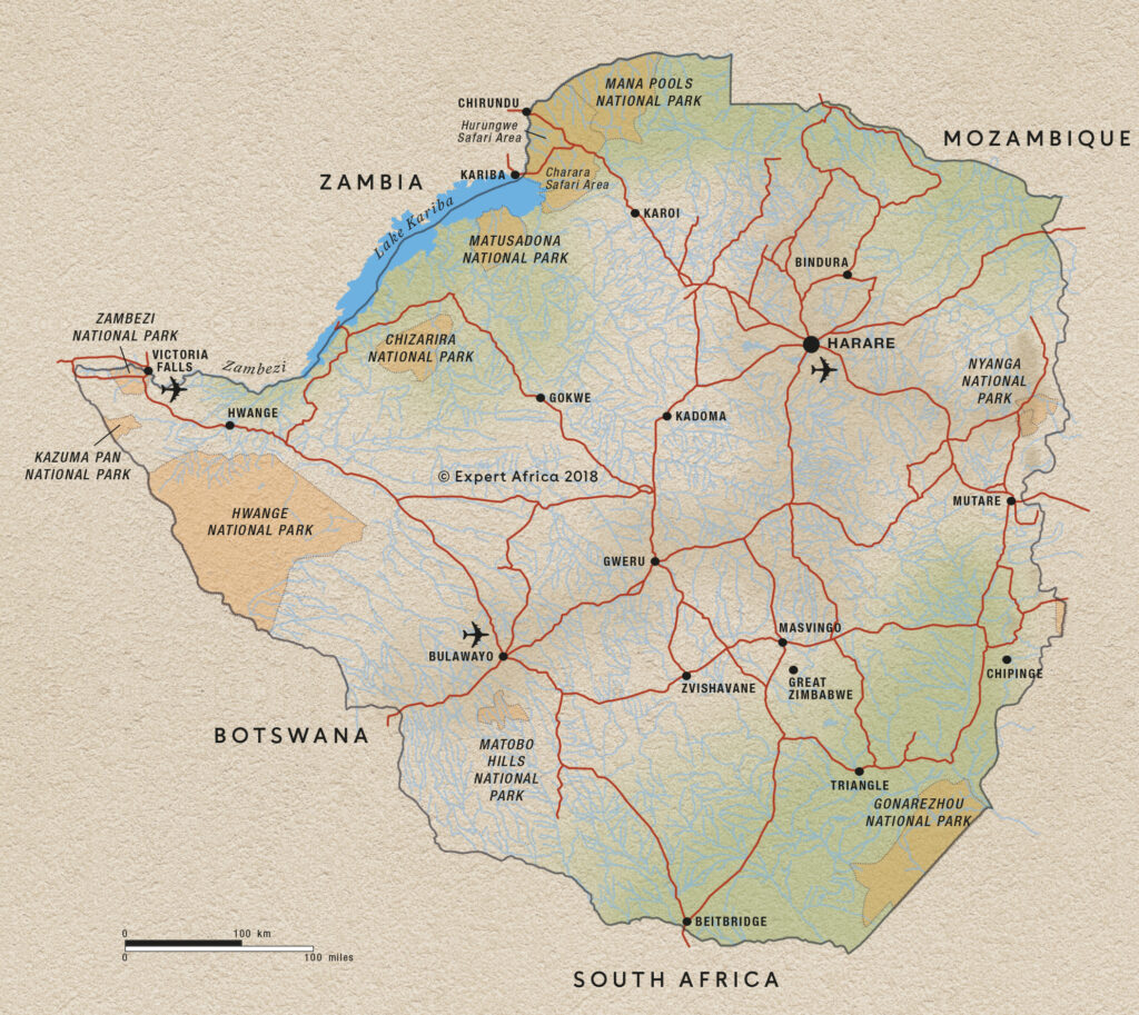
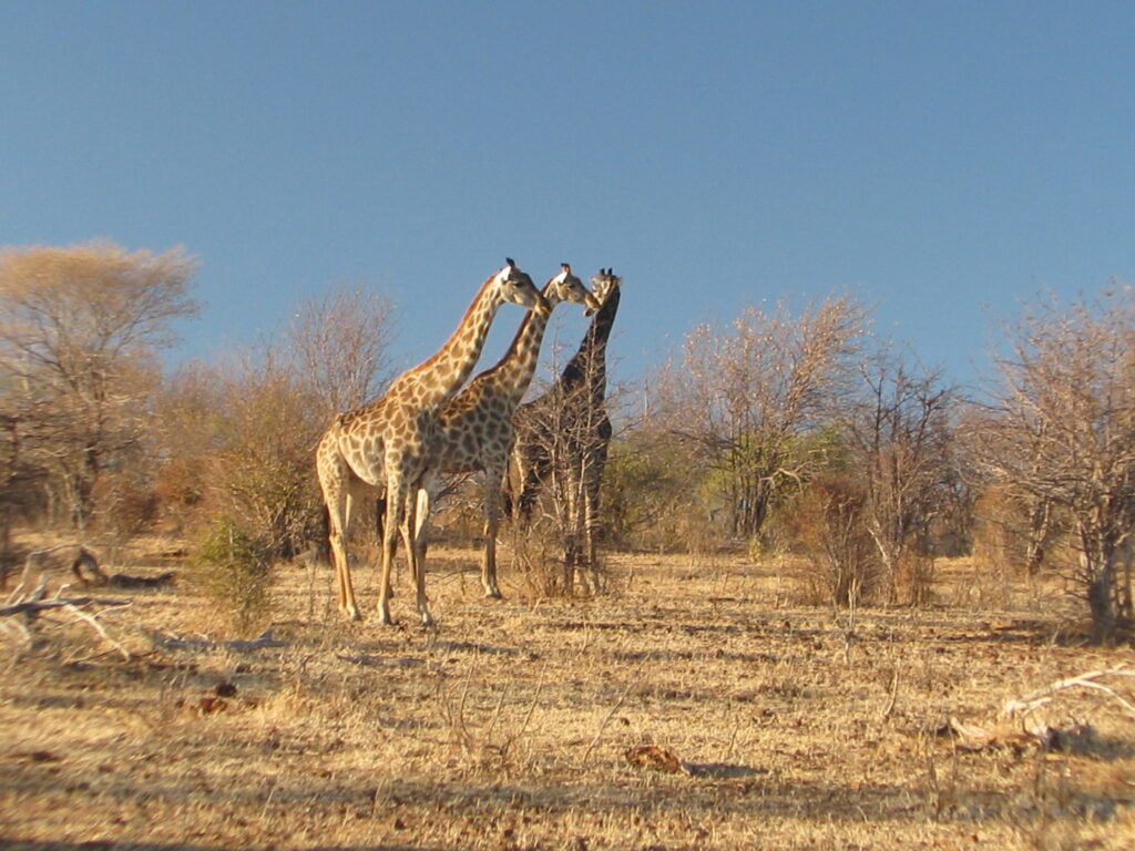
Into the unknown no longer! After leaving Chizarira and the amazing cliff-top camping on the edge of the Zambezi River valley escarpment and the Mucheni River gorge, we decided to go to the other extreme and spend time on the shores of Lake Kariba in Matusadona National Park, which just so happened to be more or less on the way to our next destination Park, Mana Pools National Park.
Our original plan was to backtrack west past Binga to the port town Mlibizi at the western end of Lake Kariba, spend a couple of nights R&R, and then catch the 22-hour long overnight ferry to the eastern end of the Lake to the town of Kariba. However, we were unable to book a spot on the ferry because of vehicle height limitations (i.e., the 3 slots for vehicles exceeding 2 meters in height were already reserved), so we instead kept on driving east from Chizarira on the so-called “back road”, which was reported to be a long and tortuous drive on a terrible road. However, much to our surprise and delight, the road was in pretty good shape, with only a few minor rough spots. Moreover, for 7 hours of driving we only saw 4 other vehicles, 3 of which were trucks hauling goods, and these were all near the beginning of the day’s drive. Thus, for probably 6 hours or so we saw no other vehicles, even though there were a fair number of pedestrians from the local villages scattered along the way. We had one river to ford en route, since the bridge was long since washed out. We had a small audience during our crossing, probably because they had rarely seen other vehicles on this road, let alone someone ford the river. Turned out the river bottom was solid sand and the Green Dragon cruised across as if it was an insult to the vehicle’s ego. Here’s a photo of the crossing point:
River crossing on way to Matusadona National Park
We detoured off the main through road (which ends on the main highway that leads to Mana Pools and elsewhere) to go to Matusadona National Park on the shores of Lake Kariba. The Park is the first in Zimbabwe to fall under the African Parks mandate, which is a partnership between the National Parks of the resident country (Zimparks in this case) and this NGO. African Parks has helped “rescue” several Parks throughout Africa. Essentially, at the request of the resident government, African Parks comes in an takes over management of the Park and dramatically improves pretty much everything from road infrastructure to tourism facilities, such as first-class campsite accommodations, and the general administration of the Park. African Parks took over management of Matusadona in 2019 with a 20-year agreement and the improvements are already obvious to us.
Proclaimed a National Park in 1975, Matusadona (1,470 km2) was once a conservation stronghold for African elephant and black rhino, and a sought-after tourism destination. But over the years, financial resources slowly diminished and poor management impacted the parks’ wildlife. Limited road networks and manpower left some areas entirely unpatrolled resulting in rampant poaching which virtually eliminated the black rhino population and severely reduced the elephant population. As with Chizarira, the widlife populations are just now starting to recover. As an example, a recent survey counted over 2,100 hippos along the Park’s lakeshore, up from a mere 250 in the 1980’s.
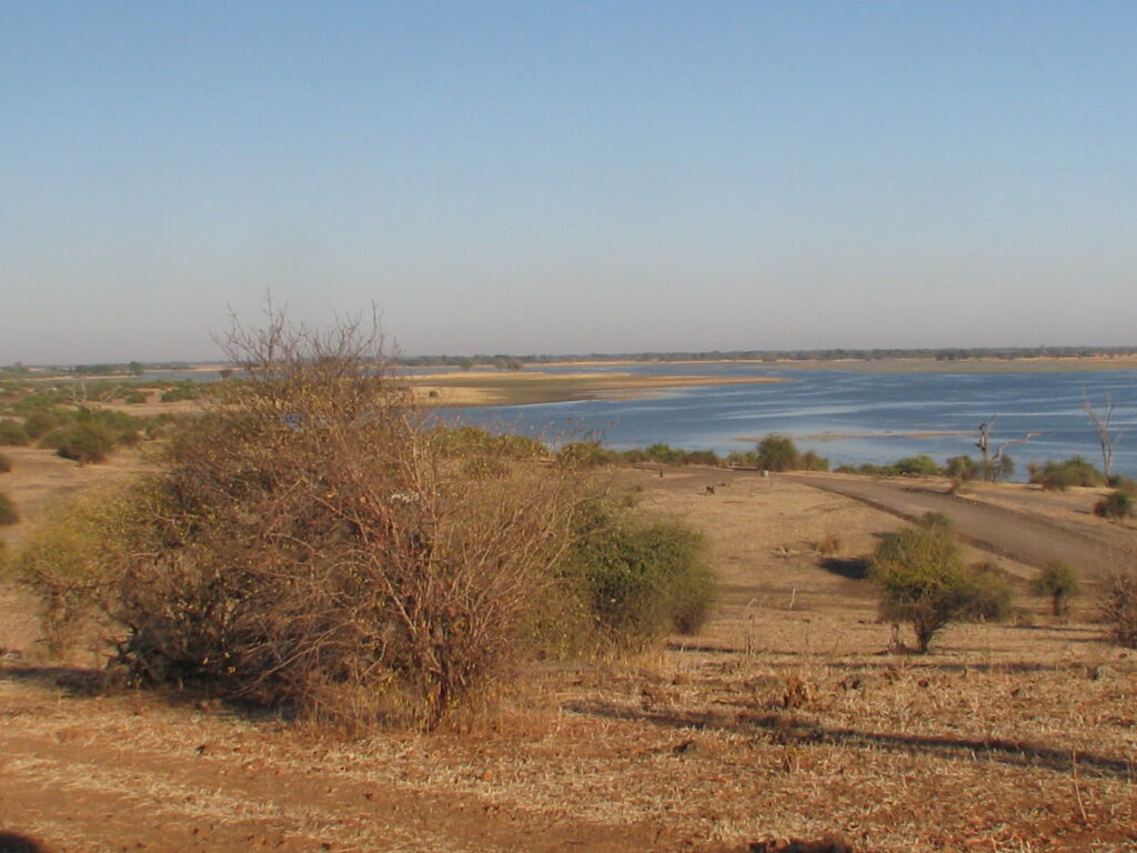
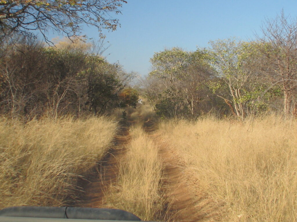
This remote and rugged Park gets its name from the rolling Matusadona hills that form part of its water-rich landscape. The Park is flanked by Lake Kariba to the north, the peaks of the Matusadona hills to the south, and two perennial rivers, the Ume and the Sanyati, to the east and west. Driving here, we passed down through the Matusadona hills on a very windy road that coursed up and down across countless streambeds, most of which were dry this time of year. Much of the mountainous inland portion of the Park is dominated by mopane woodland, but the hills descend to flatland near the shores of the lake with mixed woodland species. One of the iconic features of the Lake is the kilometer-wide “drowned forest” comprised of the trees that died when the lake was filled but still remain today, even after more than 50 years, as standing dead trees or snags. Here are a couple photos of the Park:
Matusadona HillsThe “drowned forest” on the shores of Lake Kariba
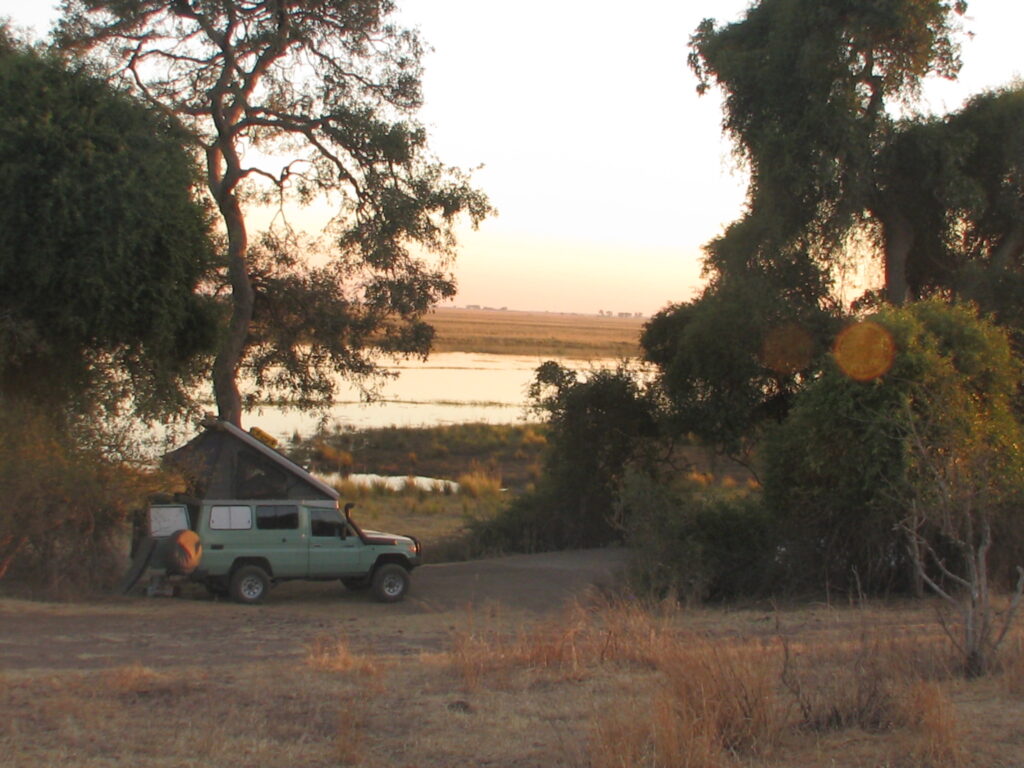
For Nancy and I, the highlight of the Park was the spectacular public campsite situated out on a peninsular with huge shade trees, modern ablution facilities (including hot showers!), uninterrupted views of sunrise and sunset across the Lake, hippos serenading us all evening and morning, and much more. Here are a few photos:
Matusadona campsiteMatusadona campsiteMatusadona campsiteMatusadona campsiteMatusadona campsite at sunsetMatusadona sunset from campsite
A perpetual breeze off the lake combined with perfect temperatures kept the environment most comfortable. We felt little need to abandon our serene campsite setting for drives on the Park’s few roads, so we spent an afternoon and all of one full day relaxing and enjoying the spectacular setting, and adding several new bird species to the list. Of course, the evenings were spent around a campfire, with countless stars in the sky, Venus so bright that it was reflecting off the surface of the lake, and a little musical entertainment by yours truly. Here is a short snippet of my evening campfire serenade to Matusadona and Lake Kariba:
Instead of another long and slow drive to another unknown stop en route to Mana Pools, we opted to spend the money on a barge ferry that was returning to Kariba after delivering supplies to the Park and had room to accommodate a vehicle. Six hours of dusty driving or 6 hours relaxing on the barge while birding and brunching? The choice was a no-brainer. Here’s a 6-minute video of our Lake Kariba barge/ferry journey:
After our ferry journey, we ended up staying in a campground just outside of Kariba within a strange lakeside association that is a combination of residential homes, rental chalets, restaurant/bar and this campground. Rather than search for a more secluded setting, we opted to settle here for the night and take advantage of the restaurant, To our surprise, we had a very large hippo grazing on the grasses in our campground after we returned from the restaurant, and prior to dinner there were zebras grazing in between the buildings – strange place or should I say strange animals.
We are off to Mana Pools National Park. See you there!
After a brief safari respite on the shores of Lake Kariba, we headed to the remote and rarely visited Chizarira National Park, located in northern Zimbabwe south of Lake Kariba. Chizarira NP (770 sq. mi.), established in 1975, is the 3rd largest national park in Zimbabwe and is situated on the Zambezi escarpment, which falls steeply some 2,000 feet to the Zambezi River valley floor and offers magnificent views towards Lake Kariba, 25 miles to the north. Rivers such as the Mucheni and Lwizikululu have cut almost sheer gorges in the escarpment, making for some spectacular scenery, as you will see if you watch the video below.
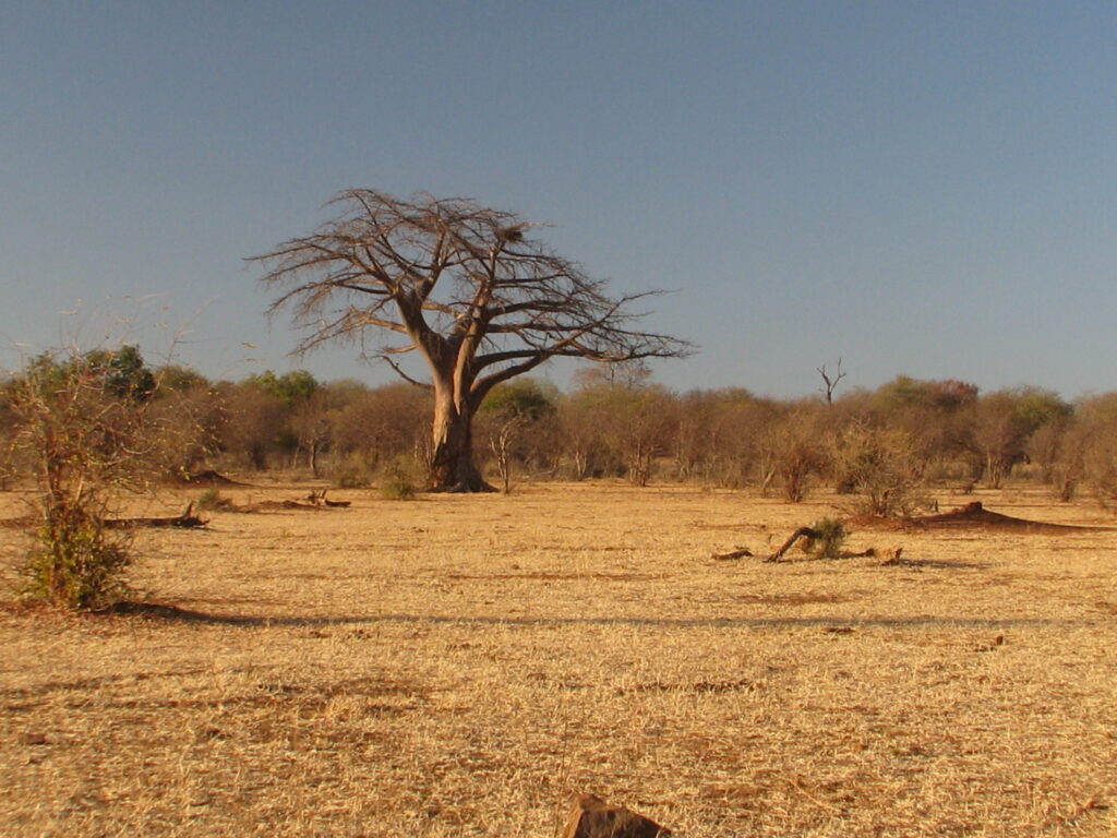
The landscape in this Park is dramatically different from that of Hwange. The landscape here is craggy near the escarpment, intensely incised by spectacular gorges and awesome gulches, with lush vegetation found in the impenetrable valleys because of natural springs. Grading south away from the escarpment are hills and valleys puncuated with drainages constituting the headwaters of the rivers that cut through the escarpment. Here are some photos showing the varied landscape:
Mucheni River gorgeChizarira gorgeChizarira landscapeChizarira landscapeChizarira landscapeChizarira landscape
As you may have noticed in the photos above, owing to the Park’s history, the landscape is rather heavily forested today, albeit with mostly young trees. Specifically, it appears that prior to independence in 1980 much of the Park was burned regularly with high severity fires (perhaps for many hundreds of years by the natives), and this was especially true during the war of independence between 1965-1980. Consequently, while miambo woodland dominated land cover near the escarpment, it quickly gave way to a mosaic of mopane woodland and open grassland savannah. Indeed, much of the Park was open grassland savannah. After independence there was almost no management of the Park and thus very little prescribed burning took place. Consequently, much of what was open grassland regenerated to dense woodland, which dominates the landscape today. Recently, the Park resumed burning with an aggressive acreage target every year, but they are burning with too low an intensity so that at best only a couple percent of the small woody stems are getting killed. Unless they start burning at much higher severity they will never recover the open grassland savannah they presumably want. Of course, one must ask whether they should seek to create an environment – open grassland savannah – that is not what nature wants to create. Nature wants this to be a rather dense woodland I think. Ah, the challenges of managing a landscape with such a complex ecological and anthropogenic history in the current socio-political context. I’m glad I am sort of retired! Here are some photos of the post-burn landscape:
Chizarira NP is arguably Zimbabwe’s most remote wilderness area. Unfortunately, the remoteness and low visitation of this Park, including the lack of lodges and safari operators, has meant increased risk from poachers in recent years and many wildlife populations have seriously suffered as a consequence. Accordingly, we saw very little wildlife on the few accessible drives in the Park. A partnership betweent the Park and an NGO called National Parks Rescue has mostly put a stop on the poaching, so they say, but it has only been 5 years since the anti-poaching effort began so the wildlife populations have not yet recovered, so most of the big game species are sparse and hard to find.
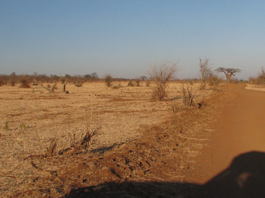
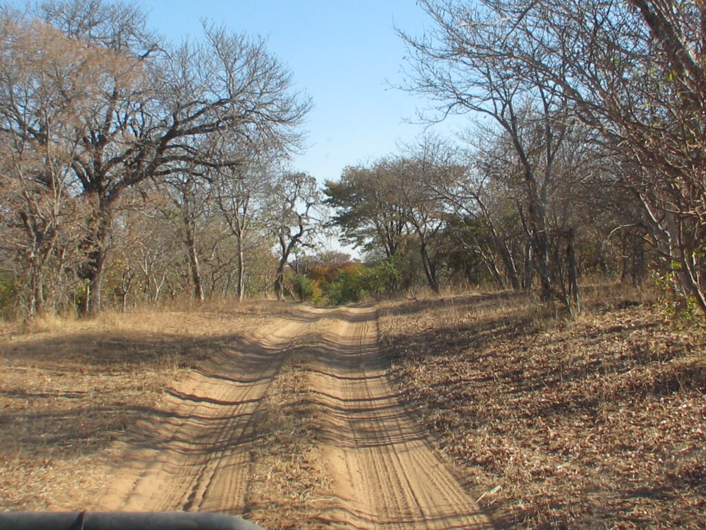
There are very few roads in the Park and most of them have apparently not been maintained since they were built, and thus they are essentially no longer drivable. Consequently, we had to content ourselves with driving the few accessible roads, which occupied us for the first couple of days. One of the so-called accessible roads even challenged the Green Dragon a little – but only a little! I actually had to put the troopie in 4×4 low for the first time to cross a gulch. Another so-called drivable road along the escarpment to a spectacular veiwpoint was just barely drivable, with numerous bolders strewn across the “track” and downed logs, some of which we had to remove to pass, as depicted in these photos:
Crossing a gulch in Chizarira (steep entry into and out of gulch not visible here)Clearing logs from one of the so-called accessible roads in ChizariraOne of the so-called accessible roads in Chizarira (do you see a road?)One of the so-called accessible roads in Chizarira (do you see a road?)
Nevertheless, the remoteness and low visitation are the very things that attracted us to this Park. In fact, on our first day and night in the Park, we were the only visitors! Yes, that right, we had 770 sq. miles of Park entirely to ourselves for a day, except for the Park staff of course (of which there were quite a few for some unknown reason given the lack of facilities and tourism). On day two another self-drive party arrived, so it started to get crowded. Needless-to-say, on our drives through the Park we saw nobody, except for a 3-person team of researchers studying lion and elephant in the Park. Of course, most visitors with any sanity would not have tried to drive a couple of the roads we drove, so perhaps it is no surprise that we didn’t run into the one or two other visitors to the Park.
Our campsite was called Mucheni View and was situated right on the edge of the escarpment at the mouth of the Mucheni River gorge. The video below will do the talking I hope, but just let me say that Nancy said that this was in her top 3 favorite campsites of all time – that’s saying something! Unbelievable view, no bugs, perfect temperatures day and night, nice facilities (i.e., ablutions, gazebo, brai, water) – what more can you ask for?
Chizarira Mucheni View campsiteChizarira Mucheni View campsiteNancy enjoying the view from our Mucheni View campsite
One of the greatest things about our campsite in Chizarira was the night sky. We are talking seriously dark sky as there is literally no light pollution for hundreds of miles and the arid climate this time of year makes for superb night sky viewing. The Milky Way never was more visible and spectacular in its display. Here is a nice photo Nancy captured of just after sunset with our campfire in the foreground and the escarpment in the background:
Here is a short composite video of our campsite and the escarpment:
OK, we are on to an unknown destination, as we have 3 days and nights to kill before going on to Mana Pools National Park, where we have reservations. Into the unknown we go! We’ll see you on the other side, hopefully!
Photo Gallery:
Just a really beautiful tree in ChizariraChizarira escarpment looking eastLilac-breasted rollerBaobab and CandelabraWaterbuck
After leaving Hwange National Park, we headed to the town of Binga on the shore of Lake Kariba for a little relaxation by the lake and resupply before heading to our next national park (sorry, no map for this one). Lake Kariba is the world’s largest artificial lake and reservoir by volume. Lake Kariba lies along the border between Zambia and Zimbabwe. It was filled between 1958 and 1963 following the completion of the Kariba Dam at its northeastern end, flooding the Kariba Gorge on the Zambezi River. The lake runs 129 miles long and averages 25 miles wide. A number of fish species have been introduced to the lake, notably the sardine-like kapenta (transported from Lake Tanganyika), which now supports a thriving commercial fishery. Kapenta, in turn, now support a thriving game fishery, particularly tigerfish, which was among the indigenous species of the Zambezi river system.
We had a nice stay in Binga at the Masumu River Lodge. Contrary to my pre-trip internet research, it turned out that the lodge no longer accommodates self-contained campers, like us, but we talked the manager into letting us camp on site anyways – since there was nobody else at the lodge. The lodge is situated on a prominent rocky headland protruding out into one of the bays of Lake Kariba in a spectacular setting. The restaurant/bar/lounge area is built into the rocks of the headland with beautiful matching stonework. Nancy and I took advantage of the outdoor lounge area both days during our stay, especially since we had the place to ourselves. We also treated ourself to a local fish (freshly caught from the lake) fish-and-chips dinner – which was private as we were the only guests. Correct that, we actually had abundant guests the entire time, but they were of the rock hyrax kind, as shown below. Our campsite was situated down the hill a few hundred feet from the restaurant/bar/lounge in a nice shaddy lawn area and next to one of the chalets that we were able to use for ablutions. Here are a few photos of our stay:
Our Binga Masumu River Lodge campsiteBinga Masumu River Lodge verandaRock hyrax attendant (one of many- at Binga Masumu River LodgeSunset on the veranda at Binga Masumu River Lodge Sunset at Binga Masumu River Lodge
Otherwise, there is not much to report about our brief stay in Binga. We made the trip into town from the lodge and got the Green Dragon washed, stocked up on some food, mostly produce, supplies, refueled and visited a local women’s collaborative craft shop, where Nancy purchased a couple of baskets made by the local women. Here is a photo of a woman weaving what will become a table.
Basket weaver at Binga Women’s Craft Center
I hate to end on a bad note, but in fairness to the spirit of this travel blog, I must report that the road to Binga from the main highway between Victoria Falls and Bulawayo was deplorable for much of the way. It was ostensibly tarmak, but in reality only the center 8 feet of the roadway had some asphalt on it, albeit with more potholes than asphalt, and the verges (sides) where rough sand and gravel, much of which was corregated. Needless-to-say, it was not a very pleasant drive. What I can’t comprehend is why they would lay, at most, a 1-inch thick layer of asphalt and expect it to last more than a few years, and then walk away from the road without any attempt at maintenance. I guess money, or the lack of it, and politics are the likely reasons. As the manager of the Binga lodge put it: there’s the 1st world, the 3rd world (what happened to the 2nd world?), and then there’s Zimbabwe – the “lost” world. Here’s proof of my rant:
The “beautuiful” road to Binga
OK, we are off to the remote and rugged Chizarira National Park. See you there.
Ulendo means “going on safari” in the Chichewa language, one of the native languages in the region.
WARNING, this post is a long one (and the videos are long too) because after leaving Victoria Falls, Nancy and I headed to Hwange National Park, located just south of Victoria Falls, for 6 nights and 7 days.
Hwange NP (5,657 sq. mi.), established in 1961, is Zimbabwe’s largest reserve. Most of the Park is said to be underlain by Kalahari sands, as it is situated on the eastern edge of the Kalahari Desert; however, we found the area we visited to have none of the deep, soft sands of Botswana’s Kalahari. Instead, we drove on mostly hard sands (and, unfortunately, corregated at times) interspersed with rocky soils, past rocky outcrops (or “Kopies”), and over genuine hills. The terrain was in fact highly variable, giving it an aesthetic appeal. The vegetation too was highly variable, ranging from open grassy plains (called a “Vlei” here) and depressional pans (often with water holes) to woodlands of varying compositions and canopy cover – although the vast majority of the area would be classified as mopane woodland because the mopane tree, in either shrub or tree form was the dominant tree species. Here are some shots of the varying landscape:
Beautiful tree in HwangeMopane woodlandRocky outcrop (or “Koppie”) in HwangeMopane woodland in HwangeGrassland savannah in Hwange
Hwange NP was our last stop in the Kalahari. The Park has an interesting history. It was never suitable for agriculture due to the sandy soils so it was never developed as such. Instead, it was used primarily as a hunting ground for big game hunters; thus, by the end of the 19th century the large mammals were almost completely exterminated from the area, with the elephant population declining to as few as 1,000. Eventually, in 1928 it was designated as a wildlife reserve (and then a National Park either in 1949 or 1961, depending on the source) in hopes of rebuilding game populations, and over time the populations slowly rebounded. Elephant populations increased dramatically and have had numbers even exceeding 45,000 during recent times, with devastating effects on the vegetation. The Park has periodically tried to reduce the elephant population through controlled hunts, but the damage to the Park’s natural vegetation is persistent.
The biggest limiting factor on wildlife populations in the Park is water and in Hwange most of the available water comes in the form of “pans”. Pans comprise one of the natural wonders of Southern Arica, and we have discussed them in previous posts. In Hwange, most of the natural pans are depressions 60-100 feet in diameter that fill with water during the rainy season and hold water long after the rains end. They reach a depth of up to 3 feet of water after the rains, but then gradually dry out over time as the dry season progresses. Most are bone dry well before the end of the dry season. Interestingly, the pans have been created by termites and other wildlife. The termites who build mounds bring salts such as lime to the surface. The salts attract wild animals, especially elephants and other large mammals who have a particular craving for it. By eating the termite heaps the animals obtain the salts, and through their physical activity they form hollows in the ground that collects rainwater. The hollows are constantly expanding as animals eat the lime-flavored soil, drink the water, and carry the mud away on their hides.
In recognition of the critical role of pans to the wildlife populations, the Park has created another 60 or so artificial pans to supplement the natural ones, largely by daming the natural drainages associated with the original pans to collect and store the rainwaters during the rainy season and thus prolong their “life”. In addition, many of the artificial pans have their water supply supplemented by solar-powered groundwater pumps to ensure an adequate water supply to the pan throughout the dry season, as the animals have come to depend on these water sources. Note, as you will see in the photos and video below, these artificial pans with dams are really more like small reservoirs than water holes, and some of them are quite large – on the order of several acres. Much of the wildlife viewing in this Park centers around these natural and artificial pans. Here are a few shots of some pans ranging from small natural ones to larger artificial ones to show you the variety:
Pan in HwangePan (with elephants) in HwangePan in HwangePan in HwangePan in HwangePan in Hwange
Our first camp in Hwange was in the northern section of the Park known as Sinamatella at the exclusive Deteema Hide campsite, where we stayed 2 nights. I will let the composite video do most of the talking about this site and our experience there, but suffice it to say it was sublime. Instead, I want to describe our auditory experience on the first night at Deteema since I wasn’t able to capture it digitally with my crappy tablet microphone, and it was a truly memorable experience for us.
Try to imagine the following: Nancy and I are tucked into our cozy sleeping bag atop the Green Dragon. The sun has gone down and the full moon has not yet come up, so its almost pitch black. It’s rather quiet at first, until the black-backed jackels herald the start of the night’s activites with a choatic ruckus of yips and yelps – their signal to the gang to muster for the night’s foray. Just after the jackel’s “call to arms” fades away, the local hippos signal confirmation of the onset of the night’s activities by blasting out a few grunts and snorts (imagine the sound of a whale surfacing and exhalling through their blow hole and you are pretty close to what the hippo sounds like when they want to make a statement by forceably exhalling through their nostrils), followed by their characteristic “laughter” – one of the sounds of wild Africa that always stirs the imagination – just what are they saying to each other or are they actually laughing at us land-bound terrestrials? In due time, we hear the non-stop chopping of the grass just outside our boma perhaps 20 feet away – no doubt by the hippos that have come out of the water to graze on the adjoining grasslands. The sound of them grazing so close is hard to ignore when you’re trying to get to sleep. Imagine a fat-man’s eating competition where they each have their head in a plate of pasta chomping away at it like a front-end loader – open mouth, push forward, bite, chew, swallow, and repeat, as fast as you can in repetitive machine-like fashion. This is what hippos grazing sound like. It sounds like they are in a race to consume as much as possible and as fast as possible – and perhaps they are given the body mass they need to maintain. While this background grass mowing is going on close by, the water starts to stir and splash. An elephant herd has arrived at the pan and are at the water’s edge, walking through the shallow water and splashing with their trunks. Even though its a fair distance away – probably 100 feet or more – the movement of elephants through the water is deafening. Imagine walking through 1 foot of water dragging your feet as fast as you can. Now amplify that sound 100 fold and you get some idea of the sound the elephants are creating. And then, without warning, an elephant trumpets explosively and the sound waves reverberate through our bodies. Imagine standing at a railroad crossing when an approaching train blows it whistle; this is what the trumpet of an elephant at close quarters feels like. Add to this a few scream-like barks and a couple of deafening, nerve-tingling elephant roars (that put a lion’s roar to shame) that shake the entire vehicle. While this cacophany is underway, 2 male lions start roaring, one perhaps less than 100 feet away and the other across the pan a few hundred feet away. The duo begin, one slightly before the other, with low grunts (or roars), increasing in tempo, pitch and volume until they reach a cresendo and then begin to fade away – the whole thing lasting perhaps 20-30 seconds. Just then, a spotted hyena laughs close by just outside the gate of our boma, as if to mock the lions and dare them to chase. A few minutes later, we hear the sound of marching elephants leaving the pan on their way back to the woodlands to feed. As they pass by the boma they are silhouetted in the now-risen full moon, and one or more of them give a deep belly rumble to communicate their retreat from the pan. As we fall asleep atop the Green Dragon, we revel in the sureal nature of the auditory experience we just had. The only word for it is sublime!
Here is a composite video of our experience at Deteema Hide, which in addition to showing you the site itself is almost exclusively about elephants. SO, if you are tired of seeing elephants and listening to me bable on about elephants, then you may want to skip this video. However, if, like us, you love elephants, then strap in and enjoy the video:
For our last and 3rd night in the Sinamatella area we moved campsites to the exclusive Shumba Hide site. The campsite itself is situated back from the pan a 100 yards or so and, unfortunately, without a view of the pan itself. However, the campsite was nicely shaded by several large ebony trees that were a delight to sit under during the mid-day sun, and we had functioning flush toilets, a water tap and warm showers to boot. The latter was obtained by building a fire in the heater behind the shower block and waiting for the water to warm up, but there was a camp tender do that for us so we just had to sit back and wait for the warm water to arrive – sweet. In case you are wondering about this hot water on demand system, here is a photo of the fireplace heater behind the shower:
Hot water on demand for shower
In addition to building a fire for the water heater, the camp tender also brought firewood and built a campfire for us in the evening. Such pampering was more than we expected or, in truth, wanted or needed, but this is how most of the campsites are set up to run in this Park so you just go with the flow. Here are a couple of photos of the campsite:
Hwange Shumba (“Simba”) Pan campsiteHwange Shumba (“Simba”) Pan campsiteHwange Shumba (“Simba”) Pan campsite siesta
Although we saw very little wildlife at Shumba pan, we did have one excting encounter after dark. While we were preparing dinner a lion starting roaring somewhere away from our site, but it could have been a couple hundred meters or a kilometer away as it can be really difficult to judge distance with a roaring lion. No worries, clearly a safe distance from us. A few minutes later, he roared again, this time clearly much closer to our site. Still no worries as it wasn’t like he was at the gate. A few minutes later, he roared again, and this time he was quite close. It was now clear that he was heading our way en route to the water hole and would likely pass right by us. No worries, we are inside a fenced-in campsite – of course the fence was only about 4 feet tall and broken in many places and thus not an obstacle to a determined lion. No worries, because at this time the camp tender walked down to our site from his abode and shut the gate – little good that did with the low and broken fence everywhere else, but at least it signaled to the lion “visitors not wanted”. While we quietly ate dinner, we kept a look-out for the lion who would almost certainly be passing by any moment, but it was quite dark and thus we could’nt see past the fence. Then, suddenly, this:
Yes, that’s right, a roar from the dirt track just outside the fence on the backside of the ablution block perhaps 50 feet away – loud enough to rattle our bones (note, the audio recording doesn’t do justice to the sound of this lion). A few minutes later we heard him roar again down at the pan. Somehow, we never did see him even though he passed by so close to us, but in our defense it was quite dark as the moon had not yet risen. The following morning, based on his paw prints in the dirt track, I confirmed that he walked right passed us to the pan and then returned the same way later on after we had fallen asleep. We decided to rename this pan from Shumba Pan to Simba Pan.
After one night stay at Simba Pan, we headed to the Park’s Main Camp area and the Jambili exclusive campsite for a 3-night stay. Instead of taking the main track to Jambili, we decided to take a secondary road that would be just about as long but keep us off the main track, which we learned immediately after leaving Simba Pan was highly corregated and thus very unpleasant driving. Moreover, we learned that it was apparently asphalted some years ago, but was now in such a state of disrepair that in sections the asphalt was entirely gone – leaving only the corregations, and in other sections is was a mine-field of potholes. We figured that some years ago they got some money from somewhere and paved this section with a single 1-inch layer of asphalt and then did absolutely zero maintenance for the next 20-plus years. The end result was a road worse off than if they had never paved it. Anyways, we were keen to get off this main road. On the Park tourist map it showed a secondary road that would get us there in about the same distance but keep us off the main road, so off we went with high hopes. The road started good – no corregation and nice hard sand. It gradually closed in and it became clear that no one had driven it for a very long time as there was no evidence of tire tracks to be found. However, the road right-away was clearly visible and every so often we did see what looked like two tracks, so we forged on. Eventually, the “road” became a single-track elephant path, but we pushed on because this is what the Green Dragon was made for, right? We pushed through the encroaching brush on either side and rolled over the elephant potholes with relative ease. Eventually, however, the corridor in the vegetation was no longer discernable and the Green Dragon was getting squeezed on both sides and from underneath. So, we reluctantly gave up and retraced our path to the main road and suffered the corregation until the next secondary road, which turned out to be in great shape and got us to our campsite in good time. Moral of the story: don’t trust the Park maps! Nevertheless, it was the kind of overlanding Africa adventure that I love! Here is a photo of the road/sand track before and after it turned into a single-track elephant trail:
Hwange road to Jambili at the start of the “road”Hwange road to Jambili turned into a single-track elephant trail
Our Jambili campsite was, in truth, somewhat of another let-down after our spectacular Deteema campsite. The site was situated in the trees well away from the pan and on the other side of the main road with no views whatsoever. However, we did have nice shade trees and functioning ablutions as well as a very nice young camp tender, as before. Here’s our campsite:
Hwange Jambili Pan campsite (shower block in background)Hwange Jambili Pan campsite tender Ezra
As with the Simba campsite, the highlight of Jambili on our first night, or morning I should say, was yet another encounter with the king of the savannah. Shortly after dawn, while we were preparing breakfast, we heard 2 lions roaring from the edge of the pan near our campsite. Moments later, we heard them again, this time even closer, and then, a few minutes later, this:
Yup, that was one of the males roaring from the end of our foot path that led out to the pan, the very same one we walked (not drove) on 3 times the previous evening to see whether there was any activity on the pan. One of the lions was roaring right where we were standing the previous evening! At one point, he even turned and looked down the path right at us. In retrospect, we probably shouldn’t have been walking out to the pan from the campsite – but how else are we going to win a Darwin award?
For the next 2 full days we drove the roads around the Main Camp area of the Park, making roughly a 140 km loop drive beginning and ending at our Jambili campsite on the first day and then a much shorter drive on the second day. Once again, we had some phenomenal wildlife encounters on our drives, especially with elephants and lions. I will let the composite video below do the talking, but as before, if you like elephants and lions, strap in and enjoy the long show; otherwise, have a nice day. Note, if you are tired of watching elephants, unlike us, and just want to see lions up close and very personal (i.e., mating), then you can jump to the last 5 minutes of the video)
That’s a wrap for Hwange; see you in Binga if you stay with us.
Photo Gallery:
Spotted hyenaElephant family (mom and two generations of young)Elephant close upGiraffe (sisters)Baboon (mothers with babies enjoying morning sun)Arrow-marked bablerBurchell’s zebraRock hyrax (“dassie”)
After sadly saying goodbye to Mark and Kirsten (Argh!), Nancy and I headed just upriver from Victoria Falls to Zambezi National Park and our exclusive riverside camp (no map included because it is right next to Victoria Falls). Zambezi NP (216 sq. mi.), established in 1979, is a relatively small national park that was split off from Victoria Falls National Park and is, of course, centered on the riverfront along the Zambezi. The River itself this time of year is still in a receding flood stage from the preceding rainy season so the banks are nearly full and the river has multiple channels with lots of tree and shrub islands, and sloughs. Here are a couple of photos to give you a sense of this mighty river:
Zambezi River secondary channelZambezi River
The landscape here is diverse in terms of terrain and vegetation. The riparian zone along the river’s edge supports a variety of large trees that quickly gives way as you move inland to mopane woodland that in places hosts a variety of tree and shrub species, including scattered baobabs on the drier sites, and gets hilly as you climb a low escarpment. Here are some photos to help you visualize the landscape:
Riparian trees along the Zambezi riverfrontLone baobab tree in the woodland with Zambezi River behindBaobob trees on a hillDriving the mopane woodland in the uplandsA hilltop view of the mopane woodland with escarpment in the background
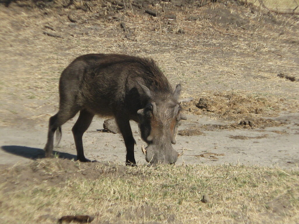
Although the Park purports to have lots of wildlife, we found there to be very few animals. Perhaps we were just unlucky, but we didn’t see many animals on our drives. We had a few giraffe, a couple of elephants, a single herd of buffalo, a few kudu and the everpresent impala and warthogs, but mostly we just saw lots of baboons. While the wildlife viewing wasn’t the greatest, the riverfront setting for our campsite was truly delightful. We had perfect temperatures, a wonderful breeze coming off the river and spectacular sunrises and sunsets, so who’s to complain. Here’s a few shots of our delightful campsite setting:
Campsite on the Zambezi RiverSunrise on the Zambezi River from our campsiteSunset on the Zambezi River from near our campsite
Our campsite was what they call an “exclusive” campsite, meaning that it is a private campsite in the bush. The plus side of these exclusive sites is the total privacy and solitude. The downside of these exclusive sites is that they have almost no facilities, so you must be a self-contained camper (i.e., supply your own water, table, etc.). The one facility they do provide is a “drop” toilet, but check out the one they provided at our site:
Not only is it like 2 feet wide on the interior (barely enough for me to squeeze inside), it is pitch black, has roosting bats and all their guano deposits, spiders and probably snakes, and who knows what else inside since you can’t see a damn thing. Who in their right mind would enter and use this toilet? Not us, that’s for sure! So, we had to resort to our own constructed pit toilet (i.e., we dug a hole in the ground for a squat-type toilet). So, exclusive sites aren’t for everybody.
Here’s a very short composite video of a couple of wildlife encounters (elephant and giraffe) and a sunset goodbye:
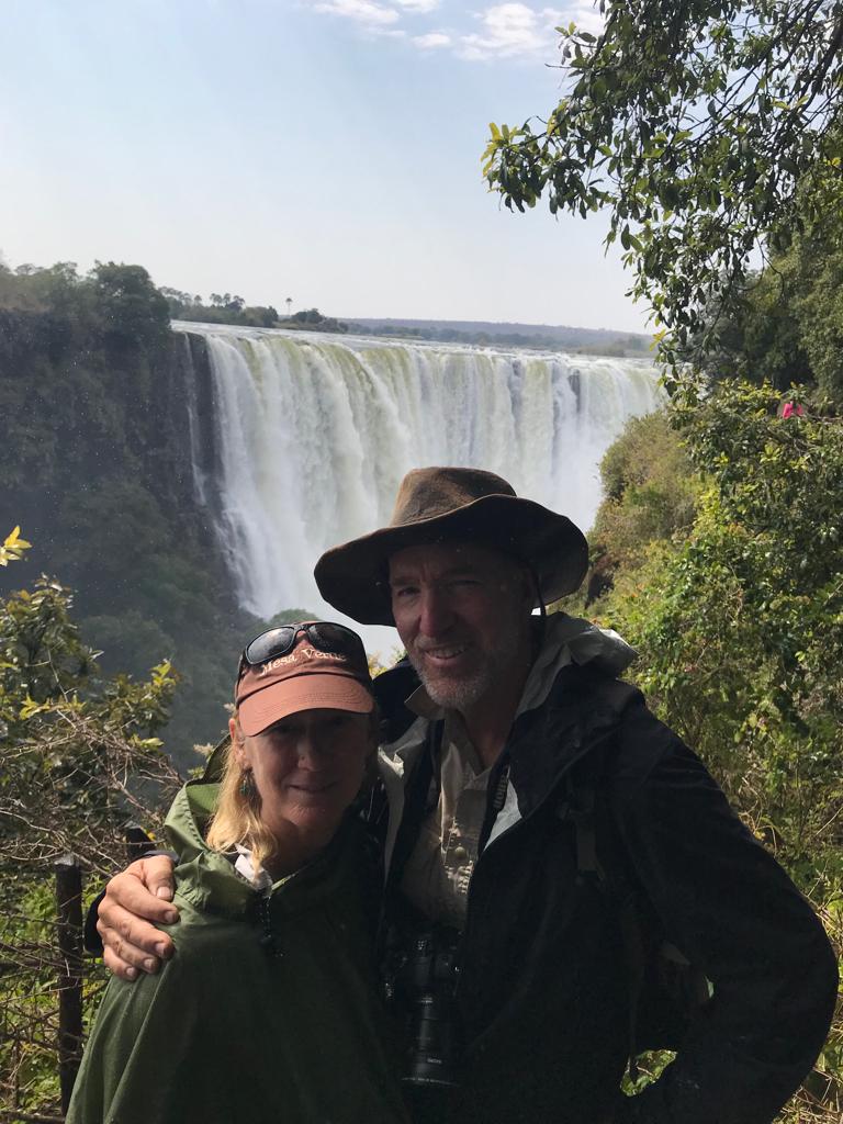
Our first stop in Zimbabwe is Victoria Falls, one the world’s 3 largest waterfalls, depending on the criteria used, containing the largest continuous sheet of falling water and extending in total just over 1 mile wide – making it one of the Seven Natural Wonders of the World. In the wet season, the spray from Victoria Falls can rise more than 1,200 feet above the falls and can be seen from up to 30 miles away. The falls vary in height from 233 to 360 ft. What makes the falls particularly spectacular, to me at least, is that the waters fall into a narrow slot gorge along a fault line that extends the length of the falls and then exists through a relatively narrow gap. Thus, you can view the falls from the opposite side of the slot gorge and be surprisingly close to the falling sheet of water – which has its pluses and minuses. On the plus side, it feels like you can almost reach out and touch the falling sheet of water. On the negative side, you are so close to the falls and the spray that not only do you get soaked, but the falls can be partly or mostly hidden from view in the spray. Here is a couple of shots of us on the walk thru the narrow strip of rainforest (due to the spra) to view the Falls:
Nancy and Kevin on the trail at Victoria FallsMark, Kirsten and Nancy on the trail at Victoria Falls
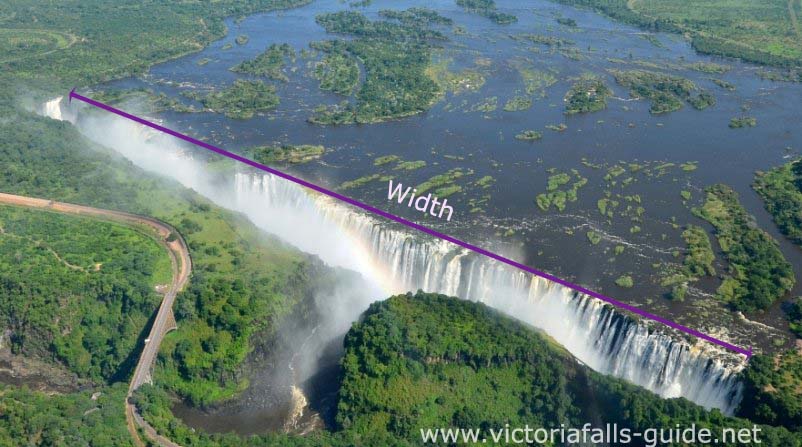
For the action lovers, here is a video of the falls from our visit (note, there is minimal narration as I could not be heard over the roar of the falls most of the time, but know that as the video progresses we are moving across the face of the falls from west to east on the Zimbabwean side of the falls, which extends about halfway across the width of the Falls):
Victoria Falls is situated on the Zambezi River – the “Great River” in the language of the Tonga people – which is the fourth-longest river in Africa, the longest east-flowing river in Africa and the largest flowing into the Indian Ocean from Africa, and has a watershed that is about half the size of the Nile River watershed. Here’s what the falls look like from the air (again, borrowed from the internet), so that you can see what an amazing natural wonder this really is. Note, we walked on the face opposing the Falls from the leftmost or western end of the Falls to the midway point where the River exists the slot:
We camped right in the middle of town at the N1 Lodge and Campsite. It was a surprisingly nice setting with a grassy lawn, lots of overhead shade trees, fantastic ablution facility, a pool and sushi bar on site only a stone’s throw away – which we took advantage of – and all within sight and earshot of the town’s hub of arts and crafts shops, not to mention the local brewery right across the street that was like a magnet to Mark. While Mark was drawn to the brewery, I was drawn to the street marimba group that performed daily for donations and invited tourists like me to join in on a marimba:
It turned out that Mark and Kirsten’s last full day with us was also their 32nd anniversary. Congratulations Mook and Kirsten! For their celebratory dinner, we went to a community-based and centered restaurant named “The Dusty Road” located in the oldest township of Victoria Falls housing a mojority of the local residents. Here’s the happy couple:
Anniversary dinner at The Dusty Road in Victoria Falls
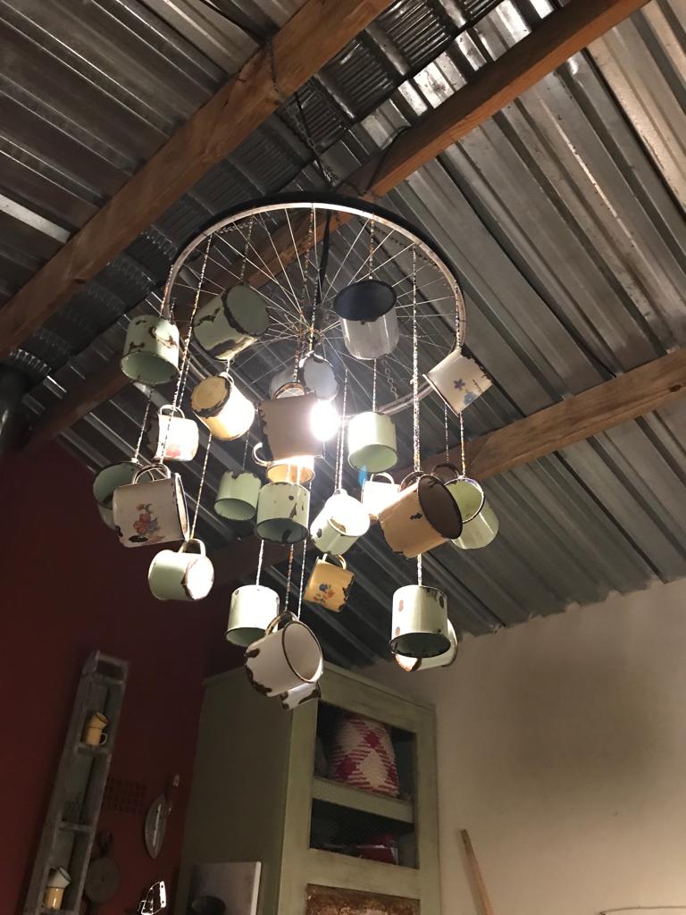
The restaurant was only recently openned by a white Zimbabwean women that grew up in country but travelled and worked as a cook all over the world, and eventually returned to her homeland and ended up settling here in Victoria Falls to open this restaurant. It is a unique restaurant. The venue is like an extended home that is constructed in part out of recycled materials of all kinds, many of which are very clever and ingenious creations, like that shown here:
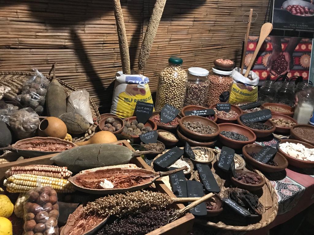
The food is all based on traditional native foods, mostly made from native plants. They show you all the native plants, seeds, etc. that are used in their dishes and give a little background on them. Here is a sampling of the grains and seeds used in the meals:
All the cooking is done in traditional style by local black Zimbabweans. All the food was excellent. At the end of our meal we had a surprise visit by a group of local kids who sang and performed for us, as shown here in this snippet of their performance, which was endearing:
Unfortunately, Victoria Falls was the end of the line for Mark and Kirsten and so we had to bid them a sad goodbye as they headed back to Nairobi and then immediately on to Oregon for a month:
So long Mook and Kirsten, it was great to share Botswana and VicFalls with you.
Nancy and I are on our own for the first time and we are off to Zambezi National Park. See you there!
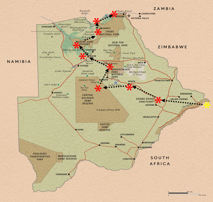
Our 3rd country on this overland trip is Zimbabwe, and once again, it is worth sharing a few factoids about this country to put things in better context and to educate myself (and you, if needed) a little about this corner of the world.
As you can see in the map above, Zimbabwe is a land-locked country bordering South Africa, Botswana, Zambia and Mozambique, centered on the Tropic of Capricorn located between the latitudes 16.5-22 degrees south, which in terms of distance from the equator is the southern hemisphere equivalent to, say, Haiti and Hawaii in the northern hemisphere.
Slightly larger than Montana.
Roughly 15 million people, compared to ~332 million in the U.S..
16 official languages (yikes!), which is the most in the world, but the majority of black Zimbabweans speak Shona (70%) or Ndebele (20%), while English is the first language of white Zimbabweans and is used in government and business and as the main medium of instruction in schools.
Government is a presidential republic, which includes executive, legislative and judicial branches with a structure similar to South Africa that I described previously, except that the president exerts almost total control over the three branches through appointments. Note, since Robert Mugabe lost his 30-year presidency and almost dictatorial rule of the country in 2017, the government has been in turmoil and the distribution of powers unstable – so who knows what the future holds.
Official currency is the Zimbabwe Dollar, but almost all transactions can be conducted in US Dollars and is the preferred currency on the street and with businesses.
Major exports include gold and other minerals (platinum, nickel and iron) and tobacco. Diamonds were discovered in Marange, eastern Zimbabwe, in 2006, but their production is steeped in massive human rights violations.
Less than 1% of the population identifies as belonging to indigenous groups, including the Tshawa and Doma, although the government does not recognize them.
Like most African countries, Zimbabwe suffered oppressive European colonization, beginning in the sixteenth century, when Portuguese colonials ventured inland from Mozambique and attacked the Kingdom of Mutapa, which then controlled an area roughly equivalent to eastern Zimbabwe and western Mozambique. Portuguese influence over Mutapa endured for about two centuries before fading away during the 1690s and early-1700s). During the year of 1685, French Huguenots emigrated to modern-day Zimbabwe (and adjoining countries) and co-existed with the indigenous people. During the 1880s and 1890s, the British South Africa Company initiated colonization by Whites, backed by a royal charter from Queen Victoria, and by 1895 the company ruled over the domain they named “Southern Rhodesia” (the area of modern-day Zimbabwe) after its founder, Cecil Rhodes. The company charter expired in 1923 and the area became a self-governing British colony until 1965 when the white minority declared independence from Britain to avoid having black majority rule. Finally, in 1980 the country was one of the last African states to gain independence from Britain after a 15-year long Civil War – and was renamed Zimbabwe.
Has the second highest concentration of elephants in Africa!
Has ~27% of its total land area devoted to national parks, reserves and wildlife management areas – pretty impressive for a country struggling with economic development!
As I leave behind Botswana, in the spirit of this “travel blog” and to be consistent with my post on driving South Africa, I want to share with you a few observations of Botswana from behind the wheel.
On a trip like this, especially given the time I have spent touring, shopping and getting things fixed, it is easy to end up with a lot of observations on traveling in country. Again, these are things that don’t really matter that much other than the fact that they occupy the inquisitive mind while on the road. I want to share a few of these ponderings with you just for fun, and especially for those considering a similar road trip.
#1. Road hazards. One of the most challenging things about driving the roads in Botswana is the many and varied road hazards. South Africa had the abundant and often hidden deep potholes that can destroy the vehicle of the unattentive driver, but Botswana had animals of all kinds on the roadways that can torment the unsuspecting driver. Worse among these were the donkeys, who stand on the edge of the road with their head or butt protruding out into the road ,or sometimes they are just standing in the middle of the road like statues oblivious to their mortality. You can literally drive past them at speed inches from their heads without them showning any signs of recognition of their potential doom. It is quite unnerving as a driver, because you are never really sure whether they will suddenly decide to move a bit as you drive past. And in case you are wondering, using the horn on the vehicle has absolutely no affect whatsoever, nor, as I discovered, does yelling profanities at them out the window as you navigate past them.
Second on the list of offenders would have to be the cows that usually cross the road in herds of dozens to hundreds at seemingly random places and at random times. One second they are grazing on the road edge and then suddenly one decides to cross the road and the others dutifully follow – again, oblivious to the oncoming vehicles. SO, when you spot cows up ahead on the road it behooves you to slow down and be ready on the brake – defensive driving at its most.
Third on the list of offenders would have to be goats, which exist in great numbers and are often crossing the roads. However, in contrast to their mammalian brethren that have larger brains, goats seem particularly intelligent when it comes to road crossing protocols. They usually look both ways before crossing and will pause when they see an approaching vehicle. SO, trust in your goats, but NOT their brethren.
Last on the list of offenders would have to be elephants; not so much on the highways, but on the dirt track game drive roads. Needlesstosay, it can be startling to round the corner on a track and out of the bushes steps a 2-7 ton elephant, tusks and all. And you better be prepared to brake and reverse if it happens to be a mother with a baby at her side or, worse yet, a baby on the other side of the road. Hitting an elephant would be perhaps the worse thing in the world. Not only would you destroy your vehicle but you would injure one of the great creatures on this planet. SO, if you you going to drive in Botswana, especially if inside the Parks, beware of elephants at all times.
#2. Sand, sand and more sand! Botswana is almost entirely underlain by the sands of the Kalahari, which can be as much as several hundred feet deep. So, it is rather obvious and not unexpected that you would be driving on sand a lot of the time. What is not so obvious, however, is the highly variable sand conditions. One minute you are cruising along on a fairly hard-packed sand and then suddenly you hit a patch of soft, deep sand and the vehicle groans and moans at the suddenness of the change in surface friction. Driving on soft sand, and especially variable sand, takes some experience. The keys are to keep your mementum at all times, keep up your engine RPMs, and, if you have to downshift, do it quickly and early before you actually need to downshift. If you master this, driving the Kalahari sands can actuallly be quite fun.
#3. Purchasing supplies. On an extended overland trip such as mine, it is inevitable that you will need to resupply and ocassionally purchase vehicle repair items. One of the most mind-blowing inefficiencies in consumer purchasing of all times is what you have to go through to purchase a item from a building supply/hardware/auto supply store, or any such store. To purchase, say, a nut and bolt from a hardware store, here is what you must endure. First, you must get help from an agent in the section of the store that has the item you are looking for. Note, you cannot seek help from any other agent in the store as they each have their assigned section and apparently there are strict rules for not violating the territory of the other agents with the same store. Next, the agent must fill out a request form for the item you want to go along with the item itself. Then you must take the form and item to another counter agent who prepares an invoice for the item. Then you take the invoice and item to the cashier who accepts payment and types up and prints a receipt for the item. Then you must show the receipt and item to a security guard at the door who carefully reviews the receipt and compares it to the item purchased and signs the receipt, even counting the individual nuts and bolts, before you can leave the facility. Then you must show the receipt and item to a guard at the outer gate, who also carefully reviews the receipt and item and signs the receipt, before you can actually leave the premises with your item – a nut an bolt! Now, I am not an economist or efficiency expert, but this seems a bit inefficient economically speaking. Perhaps this is why there are so few customers in these places of business and why these businesses don’t stay in business very long. However, this is the way ALL the businesses in Botswana conduct their retail business. Is this paranoid redundant security simply a works program to employ more people? Is it entirely motivated by paranoia over theft by the employees and/or customers? This I ponder, but cannot explain.
#4. Where are all the people? One of the notable things about Botswana is the comparative lack of people. Botswana only has a population of a couple million people spread out over a huge area, so I guess it is not too surprising that you don’t see many people except in the few villages and cities. Most of the driving in Botswana, at least outside the larger eastern cities of Gaborone and Francistown, is through vast uninhabited or very sparsely inhabitated landscapes. In part, this is because almost a third of the country is protected in Parks and Reserves, but it is also because the arid Kalahari landscape just can’t support high densities of humans. SO, if you like to be around people and developed places so that places of convenience and comfort are always close by, Botswana is probably not the place for you. On the other hand, if you like to drive through landscapes where you can spend more time looking off the road than at the road, then Botswana is an ideal place for you.
#5. Batswana friendliness. There aren’t that many Batswanans compared to other countries, but they are the friendliest people you could ever meet. Despite living in poverty, for many of them anyways, they always have a welcoming smile on their face and always seem pleased to meet you or just say hi. I haven’t met a Batswanan that wasn’t friendly and eager to welcome me. This is true for all the service people in the stores, camps, etc., as might be expected, but also for just random strangers passing on the street. And the children always have a big smile on their faces with bright white teeth – I’m so jealous. At no time do you ever feel threatened, unwanted, or resented because of our lucky draw in life. SO, don’t ever consider not coming to Botswana for fear or concern for your well being. They will certainly welcome you with open arms.
Overall, I really do love being “behind the wheel” in Botswana!
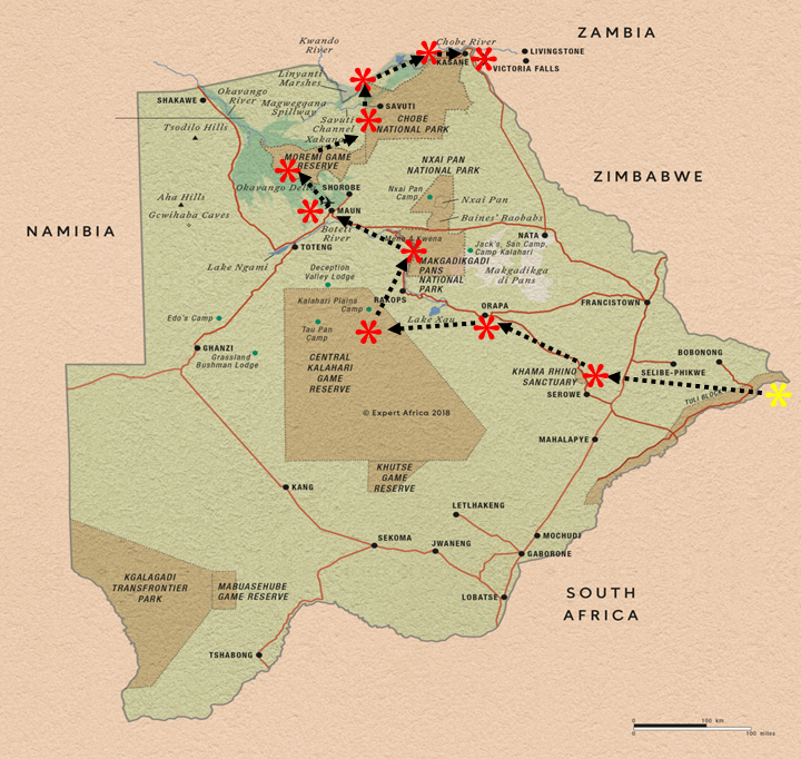
Our last stop in Botswana was the town of Kasane located on the Chobe River in the northeast corner of Botswana and the border with Namibia, Zambia and Zimbabwe (the only place in the world where 4 countries touch) and, of course, adjacent to Chobe National Park’s Serondela area. Kasane is the largest town in northern Botswana with a population of about 10,000 and is the countries northern gateway to Chobe NP and visits to Victoria Falls in neighboring Zimbabwe. Kasane is pretty much a safari gateway town as essentially all businesses and people are tied either directly or indirectly to the safari business. Here’s what Kasane looks like from the air, borrowed from the internet (thank you very much).
Kasane Botswana
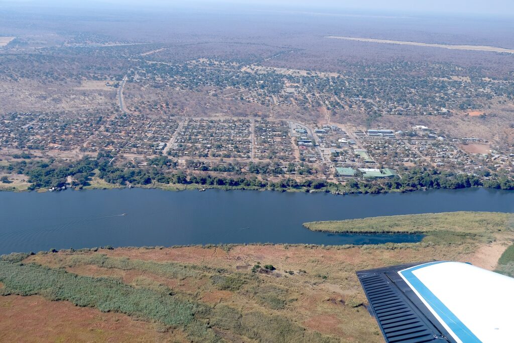
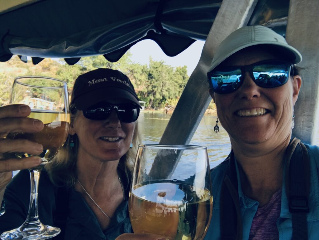
Kasane was a brief stop for a little R&R for us at Chobe River Cottages and an opportunity to resupply and get some minor vehicle issues taken care of. We did do a sunset boat ride on the Chobe, along with hundreds of other tourists. It was relaxing and it was nice to see hippo and elephant herds with babies up close in the water and marsh, but otherwise there is nothing else exciting to report. Here are a couple of photos from the sunset cruise:
Nancy and Kirsten enjoying a glass of wine on the sunset cruiseNancy and Kevin sunset silhouette
One From the Wildside:
“Can anyone please direct me to the savannah?”
Next stop, Zimbabwe and Victoria Falls. See you there!
Our last stop in Chobe National Park was Serondela, or Chobe riverfront, located in the extreme Northeast of the park along the Chobe River and across the border from Namibia’s Caprivi Strip.
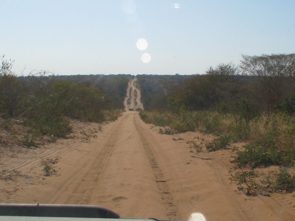
Getting to the Chobe riverfront involved driving over 100 km on a sand track road (hopefully you watched the video in the last post) that deters mosts people from making it up to the Linyanti section of the Park. In case you didn’t watch that video, here is a memorable shot of the sand track road:
Sand track road between Linyanti and Chobe riverfront
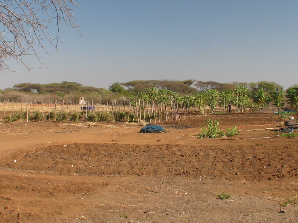
En route to the riverfront you actually leave the Park for a while and pass through a few small villages before entering back into the Park to the riverfront section. We stopped in one village “tuck” shop, as they call them (small roadside shop with a few essential and some non-essential foods and drinks), and learned of a produce farm out back. We took advantage of the opportunity to stock up on some fresh farm produce.
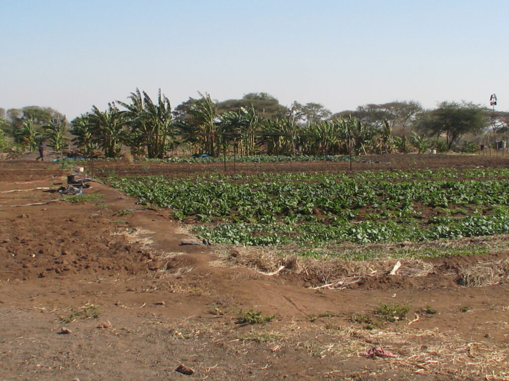
Farm-to-vehicle stopFarm-to-vehicle stop (spinach in foreground, rape in background, bananas behind)
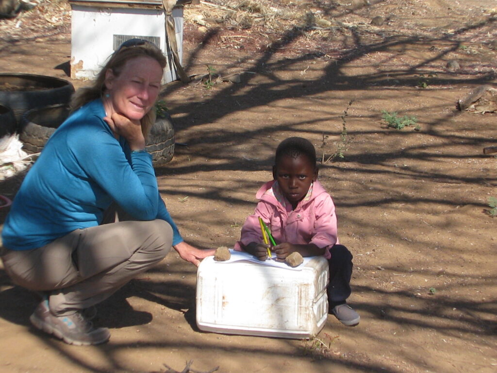
Indeed, you can’t get any fresher, as the workers went out into the garden patches and picked our vegies, including a massive head of spinach (equal to probably 4 heads in the US stores), an equally massive head of rape (like kale), a bag of small tomatoes, and a small bag of onions. How much do you think this cost? 47 Pula, which translates to a little over 2 USD. Crazy! I gave her 100 Pula, which still seemed like a rediculous bargan. Meanwhile, while the gardeners were out picking the vegies, I gave a couple of colored pencils to a small child (perhaps 4-5 years old) of one of the workers, Mark donated a sheet of art paper, and Nancy offered some coloring instruction to the young, very appreciative pupil:
Nancy and her young pupil
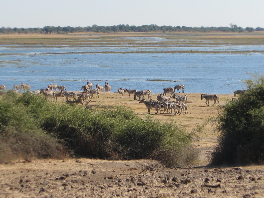
The obvious central feature of this section of the Park is the Chobe riverfront and adjacent woodlands. The Chobe River is a major watering spot for wildlife, especially in the dry season from May to October, with one of the densest wildlife concentrations in Africa, both on land and water. Being close to the town of Kasane and not far from Victoria Falls, which is situated just downstream from Kasane, this is Chobe’s most visited section. And while the high tourist density detracts from the appeal of the Chobe riverfront, even the large numbers of other safari vehicles and googling tourists can’t take away from the truly phenomenal wildlife spectacle of the Chobe riverfront during the dry season.
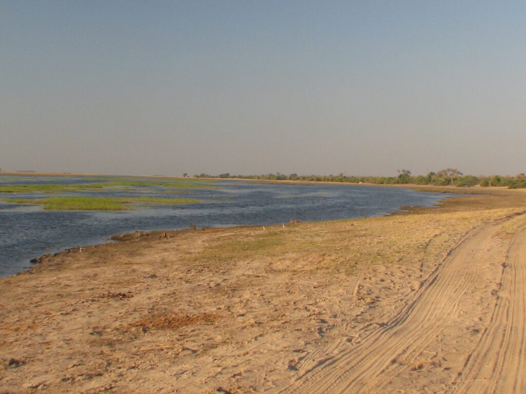
The Chobe River itself this time of year is in a receding flood stage, so the channel itself is still full and the adjacent flooplains are a mosaic of flooded side channels, pools and marshes interspersed with grasslands and the ocassional island of trees. A month from now the waters will have receded enough that only the main channel and a few of the major side channels will have water. But for our visit, it was a water wonderland, as shown here:
The Chobe riverfront isn’t all just about the River itself; rather, it is the adjacent uplands that host the large numbers of wildlife that sleep and eat on land and simply come to the river for a drink every so often. So, much of the “action” so-to-speak is in the zone immediately adjacent to the river. We spent most of our time driving up and down the River in this riverfront zone. The closer you are to the River, the more “beat down” the vegetation is from all the overbrowsing of the concentrated animals. In places it even looks like a dead zone, but believe it or not these plants will mostly bounce right back with the onset of the wet season in November. As you move farther away from the River into the uplands the woodlands take on a very different look and become much denser. It is worth noting, as I was reminded, that historically the Chobe riverfront hosted a forest of teak and ebony trees, but most of these trees were logged out years ago before the area became a national park and the high concentration of browsing animals today keeps the forest from reestablishing. Here is a series of photos to show the varied uplands and transition to “greener pastures” as you move farther away from the river:
We camped in the public campsite at Ihaha right along the riverfront. Once again, we had the usual campsite accommodations, but this time with a view over the river, as shown here:
Ihaha campsiteIhaha campsite
One of the outstanding wildlife observations we had along the riverfront was an encounter with a pair of elusive and secretive leopards that graced us with their presence on open ground and in daylight. The encounter was all to brief and a bit frenzied, but nonetheless a great sighting to see these most beautiful creatures. Here are the only 2 good shots I got of them:
Leopard (shortly after gettng a drink)Leopard (shortly after getting a drink)
The only downside to this event was the rush of safari vehicles that converged on the site out of nowhere, making it a less than private experience. It never ceases to amaze me how we are driving along, seeing either no other vehicles or the ocassional safari vehicle and then, upon the sighting of any of the big cats, out of nowhere and within a minute or two a dozen safari vehicles descend on the location. Of course, all the safari guides are in communication with each other, so as soon as any one of them spots a big cat they instantly communicate their location – I just can’t figure how they all get there so fast when they are nowhere in sight. Of course, they share these sightings with each other so that they can all almost guarantee their customers that they will see the big cats.
One of the outstanding “negative” wildlife encounters we had along the riverfront was the invasion of our camp by a troop of very nasty baboons. We left the Green Dragon in camp and went for our usual evening drive together in Mark and Kirtsten’s vehicle. Even though we had seen the baboons near our campsite before leaving, we didn’t think it a problem to leave our rooftop tent up and our drop-down table in the down position. We left no food outside or anything else that you would think could attract the baboons. We left our metal table and lounge chairs out as usual. Well, when we returned from our drive, we found that the Green Dragon had been vandalized by the baboons. They bent over the side mirrors and radio antennae, broke the wire supports for the drop-down table (they must have been jumping up and down on it to break the wires), tore up the rain fly awning of the tent, and, worst of all, shit all over everything. There was baboon shit smeared on every surface of the vehicle and the lounge chairs. It was as if they were pissed off because they couldn’t get into the vehicle to steal the food so they crapped all over it instead in an act of vengeance. Lesson learned – don’t leave anything at all out or exposed!
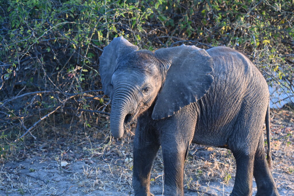
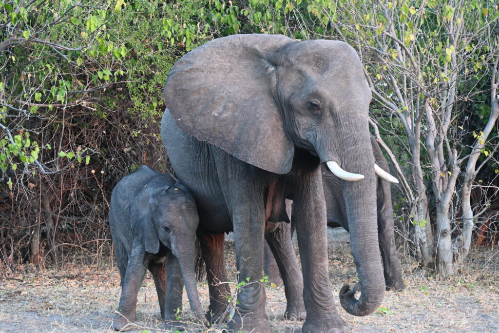
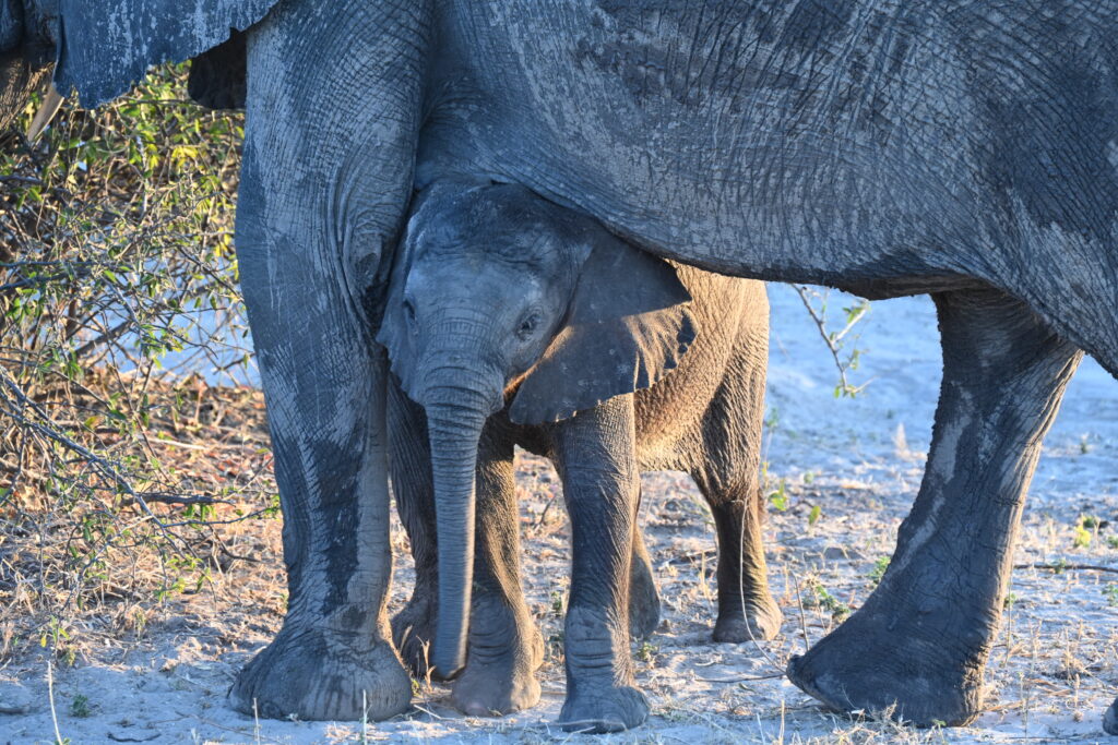
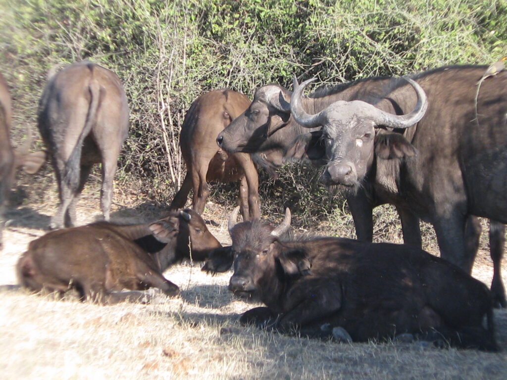
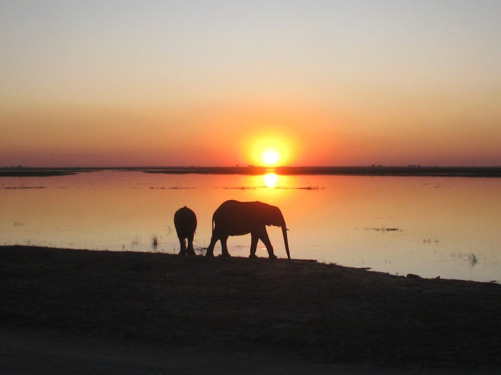
On the positive side, the Chobe riverfront has an amazing number and variety of animals. Perhaps most noteworthy was the huge number of greater Kudo and giraffes that we saw. But perhaps the most memorable wildlife observation of all was the elephant population. Along the riverfront there were dozens and dozens of elphant herds, mostly organized into matriarchal units with an amazing number of baby elephants. The “big boys”, as we would call them, were present as well but in low numbers, and we figured that they must have been kept extremely busy to produce as many babies as we saw. The photo gallery below has some of the better pictures of the wildlife, but here is the ultimate out-of-Africa shot to sum up the amazing elephant experience on the Chobe riverfront:
Chobe riverfront elephants at sunset
Here is a composite video of some of our Chobe riverfront observations. Hope you enjoy it:
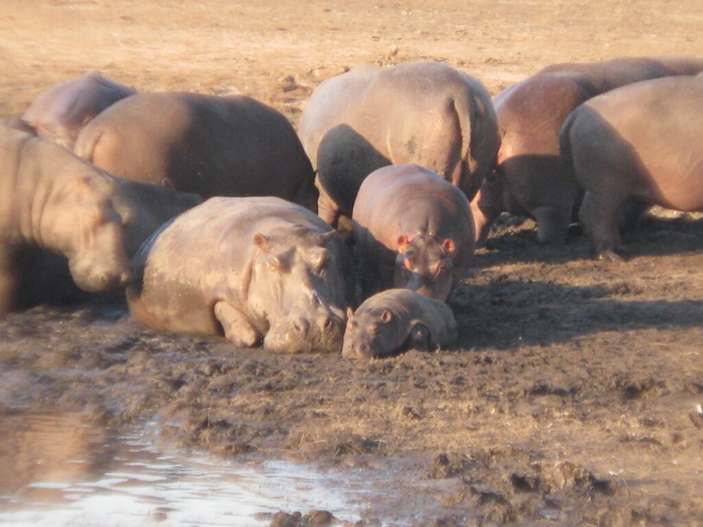
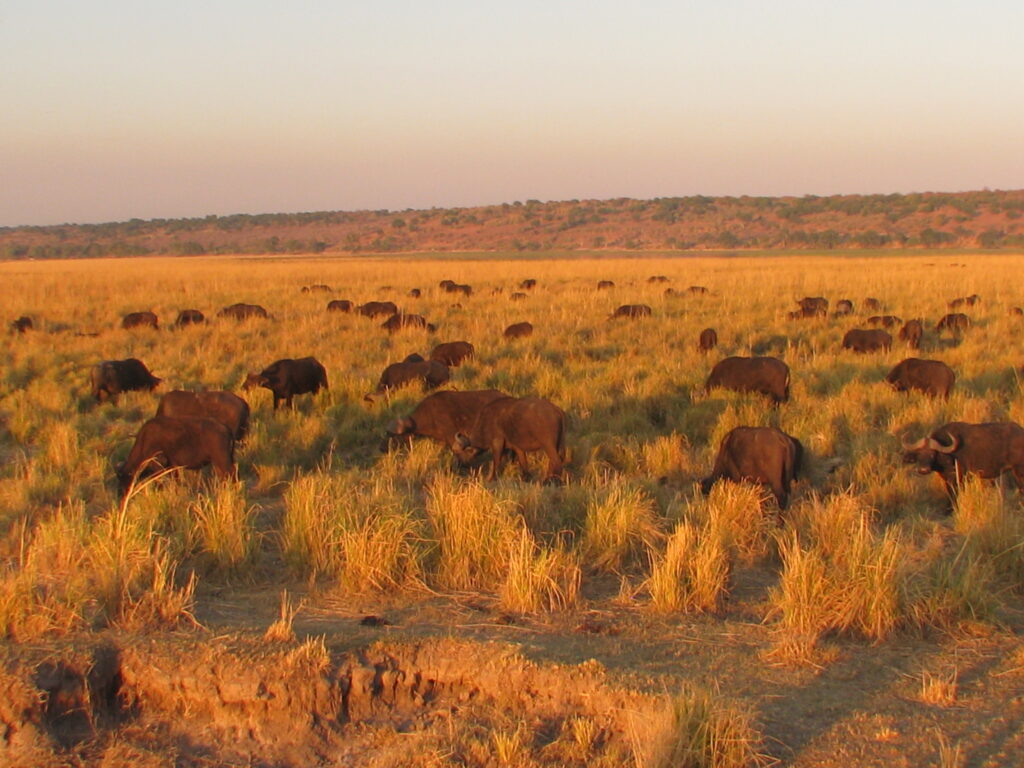
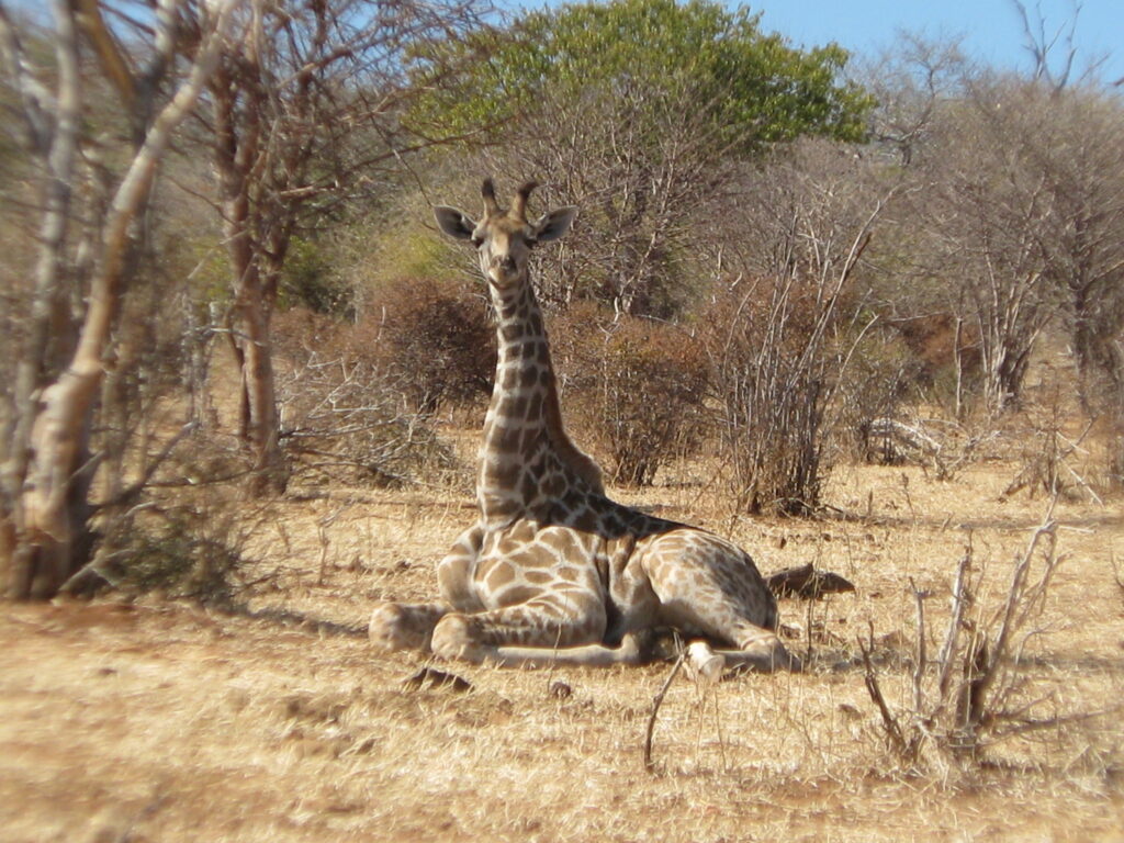
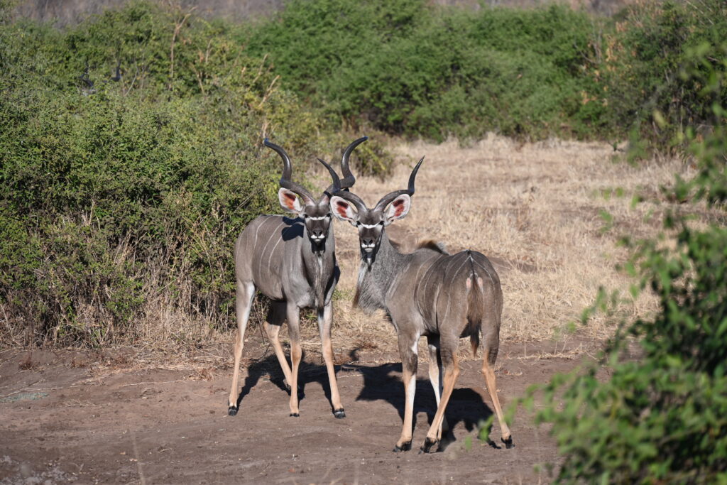
Baby elephantElephant mom and babyElephant mom and babyHippos with a very little babyHippos with a very tiny babySunset over the Chobe River marsh with cape buffalo herd feedingYoung giraffe resting on the ground (a rare sight)Greater kudu brothersCape buffalo (with baby)Giraffe (“the 3 sisters)WarthogChobe river elephant sunset